Moss

Downs, Moorland in Orkney

Scotland

Moss

Moorland by Balfour Cottage Looking north east from the fields by the A964.
Moorland by Balfour Cottage Credit: Andy Farrington

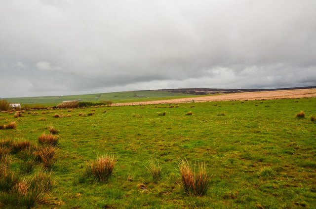
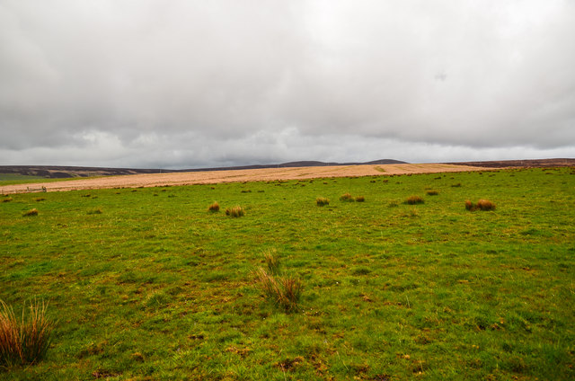
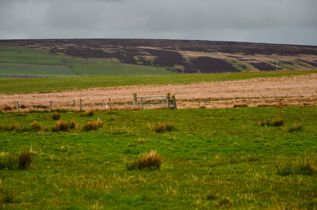
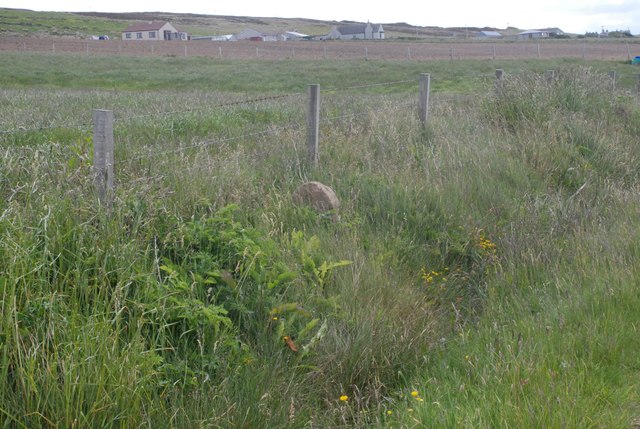
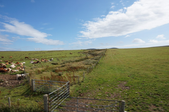
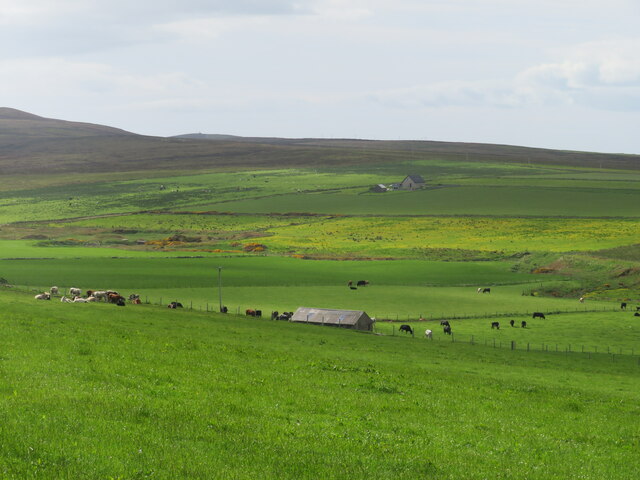
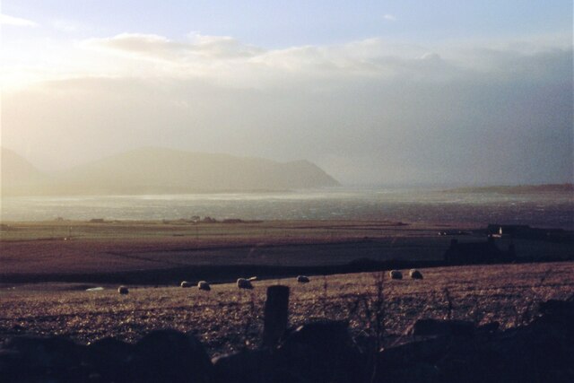
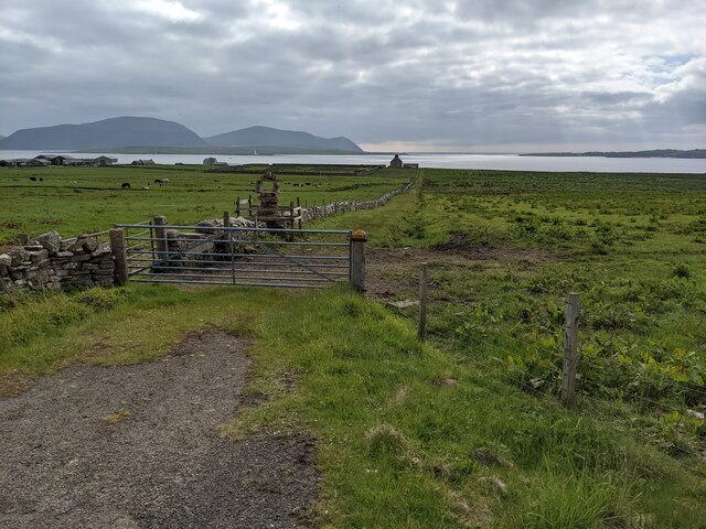
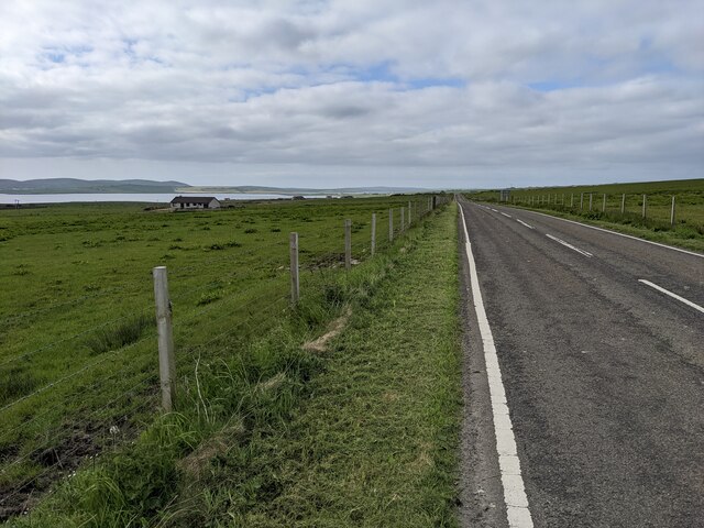
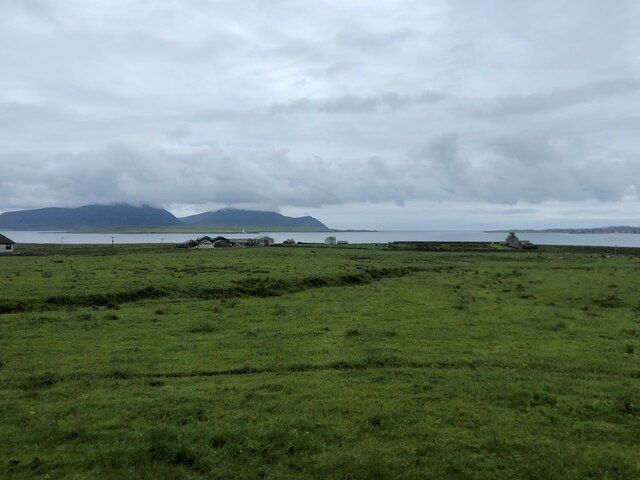
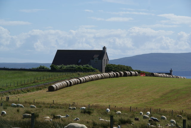
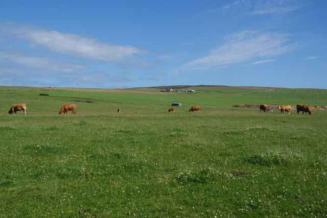
Moss, Orkney, located in the northernmost part of Scotland, is a picturesque area characterized by its stunning downs and moorlands. The landscape of Moss is dominated by vast expanses of rolling hills covered in lush green grass and heather. The area is known for its wild and untamed beauty, with its unspoiled natural surroundings attracting visitors from all over the world.

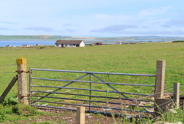
The downs of Moss offer breathtaking panoramic views of the surrounding countryside, with their gentle slopes and undulating terrain. The grassy plains are dotted with scattered rocks and boulders, adding to the area's rugged charm. The downs are home to a variety of plant and animal species, including wildflowers, birds, and small mammals, making it a paradise for nature enthusiasts and wildlife photographers.

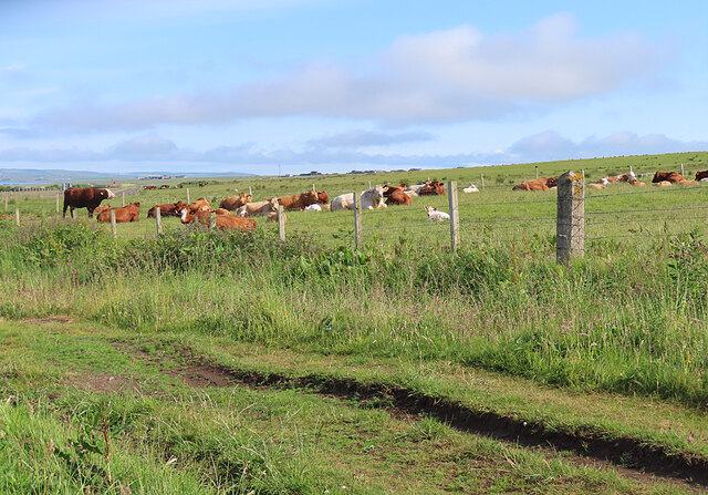
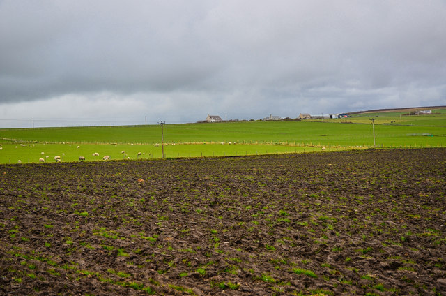
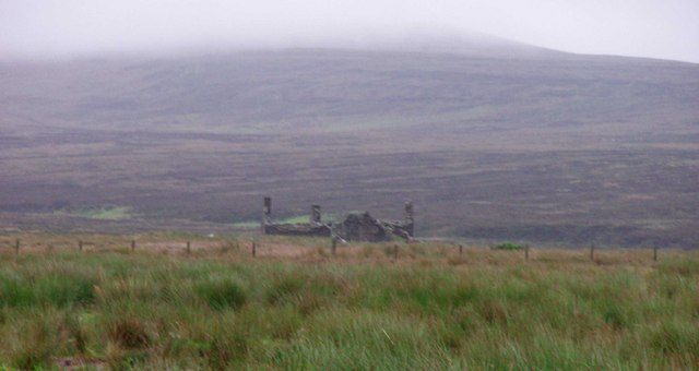
In contrast, the moorlands of Moss feature a more barren and desolate landscape, with vast stretches of open space covered in heather and peat. The moorlands are characterized by their unique ecosystem, with hardy plant species adapted to the harsh weather conditions of the region. The area is also known for its peat bogs, which have been utilized by locals for centuries for fuel and other purposes.

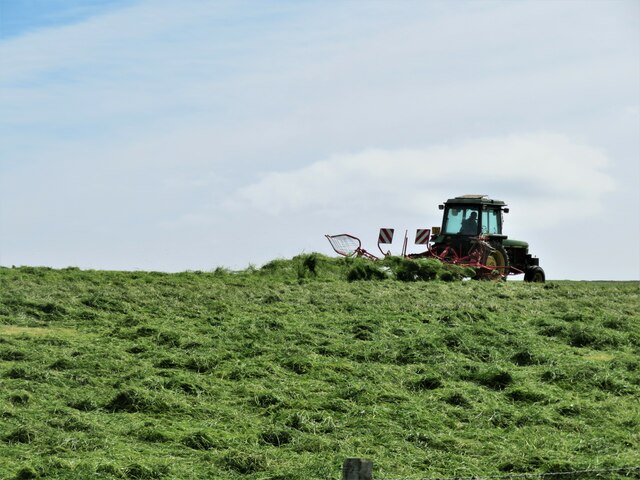
Visitors to Moss, Orkney can enjoy a range of outdoor activities, including hiking, birdwatching, and photography. The area's tranquil atmosphere and untouched beauty provide the perfect backdrop for nature lovers seeking peace and serenity. With its stunning downs and moorlands, Moss is truly a hidden gem in the Orkney Islands, offering a unique and unforgettable experience for all who venture into its enchanting landscapes.

If you have any feedback on the listing, please let us know in the comments section below.
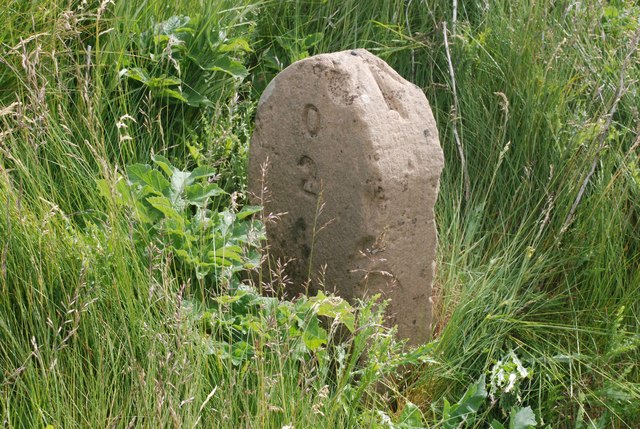
Moss Images

Images are sourced within 2km of 58.960321/-3.2061547 or Grid Reference HY3008. Thanks to Geograph Open Source API. All images are credited.

Moorland by Balfour Cottage Looking north east from the fields by the A964.
Moorland by Balfour Cottage
Looking north east from the fields by the A964.
Brown Hill Looking east across the moorland.
Brown Hill
Looking east across the moorland.
Boundary Gate To the east of Balfour Cottage on the moors.
Boundary Gate
To the east of Balfour Cottage on the moors.
Old Road Bridge of Waite to Orphir Milestone inscribe O2 (Orphir) one side and W3 (Bridge of Waithe) the other.
Old Road Bridge of Waite to Orphir
Milestone inscribe O2 (Orphir) one side and W3 (Bridge of Waithe) the other.
Milestone, Orkney - Mainland On the unclassified road between Bridge of Waithe and Orphir, near A964 junction. Orphir (O) 2. Bench mark with Bolt. Milestone Society National ID: OR_OPWA02
Milestone, Orkney - Mainland
On the unclassified road between Bridge of Waithe and Orphir, near A964 junction. Orphir (O) 2. Bench mark with Bolt. Milestone Society National ID: OR_OPWA02
Farmland to the east of A964 at Brown Hill
Hillside and dale at Ireland Looking towards the valley of the Burn of Ireland from near the road end. The OS seems rather ungenerous with yellow colouring along the road to Ireland as it is shown as a white road on the 'geograph' map, whereas my 2007 edition map correctly shows it as surfaced as far as the site of an old quarry.
Hillside and dale at Ireland
Looking towards the valley of the Burn of Ireland from near the road end. The OS seems rather ungenerous with yellow colouring along the road to Ireland as it is shown as a white road on the 'geograph' map, whereas my 2007 edition map correctly shows it as surfaced as far as the site of an old quarry.
Turning the hay crop One crop that grows well on Orkney is grass, which feeds the large numbers of beef cattle on the islands. It looks as though the tractor has a rotary tedder to turn the grass and assist with drying.
Turning the hay crop
One crop that grows well on Orkney is grass, which feeds the large numbers of beef cattle on the islands. It looks as though the tractor has a rotary tedder to turn the grass and assist with drying.
Sheep grazing at Settersquoy A blustery Hoy Sound in the distance.
Sheep grazing at Settersquoy
A blustery Hoy Sound in the distance.
Gate and sculpture The fenced area in the stone wall has a small sculpture in it. I couldn't tell whether this is ancient or more recently created.
Gate and sculpture
The fenced area in the stone wall has a small sculpture in it. I couldn't tell whether this is ancient or more recently created.
The A964 near Clestrain
Hall of Clestrain Farm Just above it on Graemsay Island is Sandside lighthouse and the mountains behind are on Hoy. Clestrain Sound separates Mainland from Graemsay
Hall of Clestrain Farm
Just above it on Graemsay Island is Sandside lighthouse and the mountains behind are on Hoy. Clestrain Sound separates Mainland from Graemsay
Cattle near Clestrain The ruts in the foreground are the course of the Scorradale road before it was diverted to make a safer road junction.
Cattle near Clestrain
The ruts in the foreground are the course of the Scorradale road before it was diverted to make a safer road junction.
Gate near Clestrain The house on the far side of the field is Karloan.
Gate near Clestrain
The house on the far side of the field is Karloan.
Stenness: postbox № KW16 11 and phone, Mill of Ireland These two red objects stand by the A964 and both probably see very little use. The postbox is a George V-reign specimen and is emptied at 12:30 on weekday and Saturday lunchtimes.
Stenness: postbox № KW16 11 and phone, Mill of Ireland
These two red objects stand by the A964 and both probably see very little use. The postbox is a George V-reign specimen and is emptied at 12:30 on weekday and Saturday lunchtimes.
Farmland by Biggings Looking across to Villasquoy and Millquoy.
Farmland by Biggings
Looking across to Villasquoy and Millquoy.
Line of bales by Villasquoy
Cows near Villasquoy The moorland rises steadily up the ridge towards Ward Hill, the highest point of Mainland.
Cows near Villasquoy
The moorland rises steadily up the ridge towards Ward Hill, the highest point of Mainland.
Show me another place!

Moss is located at Grid Ref: HY3008 (Lat: 58.960321, Lng: -3.2061547)

Unitary Authority: Orkney Islands

Police Authority: Highlands and Islands

What 3 Words

///happening.drizzly.soaps. Near Stenness, Orkney Islands

Nearby Locations

Moss

Related Wikis

Burn of Ayreland

The Burn of Ayreland (or Ireland) is a northwesterly flowing coastal stream on Mainland Orkney, Scotland, that discharges to the Clestrain Sound about...

Stines Moss

Stines Moss is an elevated bog in the southwest upland area of the Orkney Mainland, Scotland. == Prehistory and history == This moss is located a few miles...

Mill of Ayreland

The Mill of Ayreland is an historic watermill driven by water force of the Burn of Ayreland, a northwesterly flowing coastal stream within Mainland Orkney...

Hall of Clestrain

The Hall of Clestrain is a house in the parish of Orphir, Orkney, Scotland. The house was the birthplace of the explorer John Rae in 1813. Currently...

Nearby Amenities

Located within 500m of 58.960321,-3.2061547
Ford: yes
Lat/Long: 58.9617987/-3.2077558
Power: pole
Lat/Long: 58.9564227/-3.209475
Power: pole
Lat/Long: 58.9570797/-3.2105559
Power: pole
Lat/Long: 58.9577145/-3.2116073
Power: pole
Lat/Long: 58.9582664/-3.2124764
Power: pole
Lat/Long: 58.9588473/-3.2133481
Power: pole
Lat/Long: 58.9595223/-3.2142091
Power: pole
Lat/Long: 58.9602968/-3.2128304
Power: pole
Lat/Long: 58.9607366/-3.2138282
The data included in this document is from www.openstreetmap.org. The data is made available under ODbL.

Have you been to Moss?

Leave your review of Moss below (or comments, questions and feedback).