Bad na Mòine

Downs, Moorland in Aberdeenshire

Scotland

Bad na Mòine

Clach Choutsaich From some distance away, on the track in.
Clach Choutsaich Credit: Peter Aikman

Bad na Mòine, located in Aberdeenshire, Scotland, is a region characterized by its downs and moorland landscapes. Spread across a vast area, this scenic location offers a unique blend of natural beauty and rugged terrain.

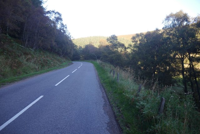
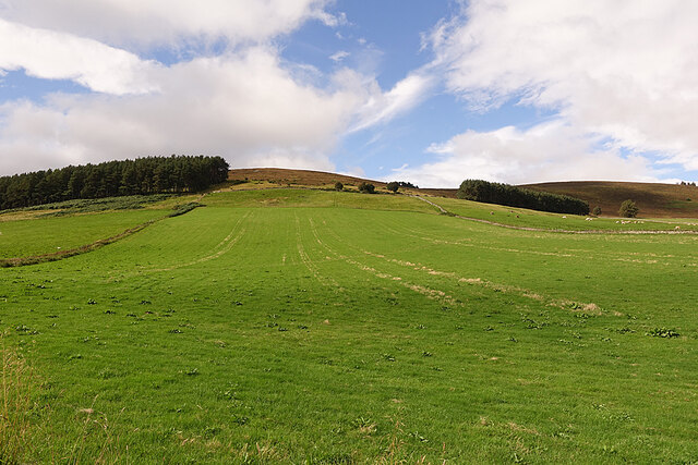
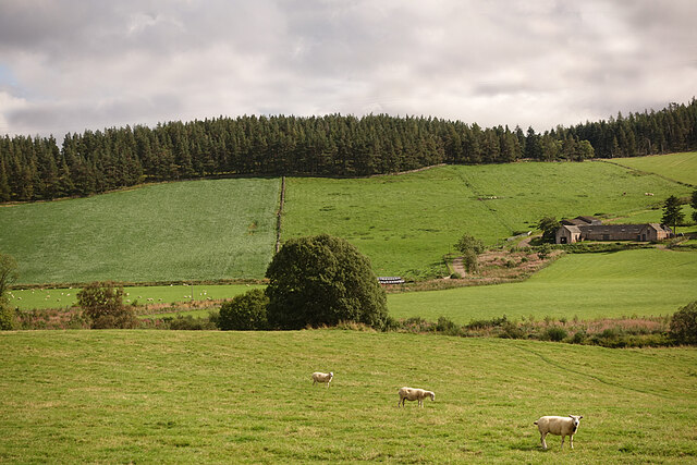
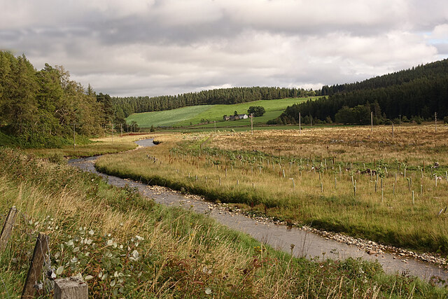
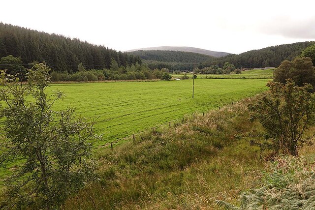
The downs of Bad na Mòine are characterized by rolling hills and gentle slopes, covered in lush green vegetation and interspersed with small streams and rivers. These downs provide a picturesque backdrop for outdoor activities such as hiking, picnicking, and nature walks. The undulating landscape also offers opportunities for birdwatching, with various species of birds making their homes in the area.

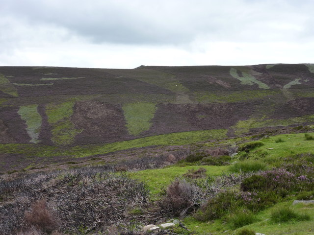
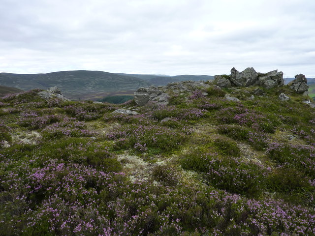
The moorland of Bad na Mòine is a distinct feature of the region, characterized by its wide expanses of open, heather-covered land. This rugged terrain is home to a rich diversity of flora and fauna, including heather, mosses, and various species of birds and small mammals. The moorland is a popular destination for nature enthusiasts, providing a serene and tranquil environment for walking, photography, and wildlife observation.

Visitors to Bad na Mòine can also explore the rich cultural and historical heritage of the region. The area is dotted with ancient archaeological sites, including standing stones and stone circles, offering a glimpse into the region's past. Additionally, there are quaint villages nearby where visitors can experience the local culture, sample traditional cuisine, and interact with the friendly locals.

In conclusion, Bad na Mòine in Aberdeenshire is a captivating destination known for its downs and moorland landscapes. With its natural beauty, diverse wildlife, and rich history, it offers visitors a truly immersive and memorable experience.

If you have any feedback on the listing, please let us know in the comments section below.

Bad na Mòine Images

Images are sourced within 2km of 57.176014/-3.1594599 or Grid Reference NJ2910. Thanks to Geograph Open Source API. All images are credited.

Clach Choutsaich From some distance away, on the track in.
Clach Choutsaich
From some distance away, on the track in.
Clach Choutsaich from the west With frost-shattered scree below it.
Clach Choutsaich from the west
With frost-shattered scree below it.
Clach Choutsaich from the east In the middle distance left is Carn Leac Saighdeir, and in the far distance you can just see Ben Avon with its tors. One of these is another Clach Choutsaich.
Clach Choutsaich from the east
In the middle distance left is Carn Leac Saighdeir, and in the far distance you can just see Ben Avon with its tors. One of these is another Clach Choutsaich.
A944, Strathdon Just east of the junction with the A939. This is quite high up, yet there are still some arable fields amongst the moors and woods.
A944, Strathdon
Just east of the junction with the A939. This is quite high up, yet there are still some arable fields amongst the moors and woods.
Road (A944) and Bridge crossing Garchory Burn Looking south-westward towards Garchory.
Road (A944) and Bridge crossing Garchory Burn
Looking south-westward towards Garchory.
Skellater House The house dates from 1727 and it is a Category A Listed building. See <span class="nowrap"><a title="http://portal.historicenvironment.scot/designation/LB16173" rel="nofollow ugc noopener" href="http://portal.historicenvironment.scot/designation/LB16173">Link</a><img style="margin-left:2px;" alt="External link" title="External link - shift click to open in new window" src="https://s1.geograph.org.uk/img/external.png" width="10" height="10"/></span> for details. It, or perhaps its grounds, appear to be undergoing another phase of renovation, judging by the container outside it and the large red earth-moving machine skulking behind the trees.
Skellater House
The house dates from 1727 and it is a Category A Listed building. See LinkExternal link for details. It, or perhaps its grounds, appear to be undergoing another phase of renovation, judging by the container outside it and the large red earth-moving machine skulking behind the trees.
Fields on Craig of Westertown Westertown, in this case, is Westertown of Skellater.
Fields on Craig of Westertown
Westertown, in this case, is Westertown of Skellater.
Farmland in Strathdon The tree stands on the bank of the River Don, which is not quite visible from here. The farm is Belniden.
Farmland in Strathdon
The tree stands on the bank of the River Don, which is not quite visible from here. The farm is Belniden.
River Don At this point the river runs fairly close to the road. It won't be long before the young trees in the plastic sheaths on the far bank completely obscure the view towards Belniden.
River Don
At this point the river runs fairly close to the road. It won't be long before the young trees in the plastic sheaths on the far bank completely obscure the view towards Belniden.
Bad na Moine The Garchory Burn makes is way across the fields here after emerging from the glen to the right. The hill at the far side is Creag Loisgte.
Bad na Moine
The Garchory Burn makes is way across the fields here after emerging from the glen to the right. The hill at the far side is Creag Loisgte.
A944 towards Strathdon
Track on the side of Sron Aonghais Heading from the Strathdon road west of Skellater House, leading to Geal Charn. Leads through an upland heather grouse moor.
Track on the side of Sron Aonghais
Heading from the Strathdon road west of Skellater House, leading to Geal Charn. Leads through an upland heather grouse moor.
Looking back to the small pine wood The track through the heather moor
Looking back to the small pine wood
The track through the heather moor
Scorched Scots pine trees above Skellater A heather burning is responsible for this. About 20% of this small pine wood is affected
Scorched Scots pine trees above Skellater
A heather burning is responsible for this. About 20% of this small pine wood is affected
One of the scots pine scorched during heather burning Among others not affected. Walking through this little wood above Skellater, one can still smell the smell of burning.
One of the scots pine scorched during heather burning
Among others not affected. Walking through this little wood above Skellater, one can still smell the smell of burning.
Chilly morning in Strathdon Looking towards Belniden.
Chilly morning in Strathdon
Looking towards Belniden.
Wintry fields below Creag Loisgte in Strathdon
Haugh Land in Strathdon A haugh is an area of flat land beside a river, the equivalent of a flood plain or water meadow in England. The farm in the distance is Colnabaichin, standing safely on higher ground, away from the risk of flooding in a spate.
Haugh Land in Strathdon
A haugh is an area of flat land beside a river, the equivalent of a flood plain or water meadow in England. The farm in the distance is Colnabaichin, standing safely on higher ground, away from the risk of flooding in a spate.
Show me another place!

Bad na Mòine is located at Grid Ref: NJ2910 (Lat: 57.176014, Lng: -3.1594599)

Unitary Authority: Aberdeenshire

Police Authority: North East

What 3 Words

///assess.wolf.hunk. Near Ballater, Aberdeenshire

Nearby Locations

Bad na Mòine

Related Wikis

Corgarff

Corgarff (Scottish Gaelic: Corr Garaidh) is a hamlet in Aberdeenshire, Scotland, in the Grampian Mountains. The nearby Corgarff Castle was used as a military...

Cock Bridge (Aberdeenshire)

Cock Bridge is a settlement in Aberdeenshire, Scotland, located in the Cairngorms National Park, on the A939 road near Corgarff and Corgarff Castle, between...
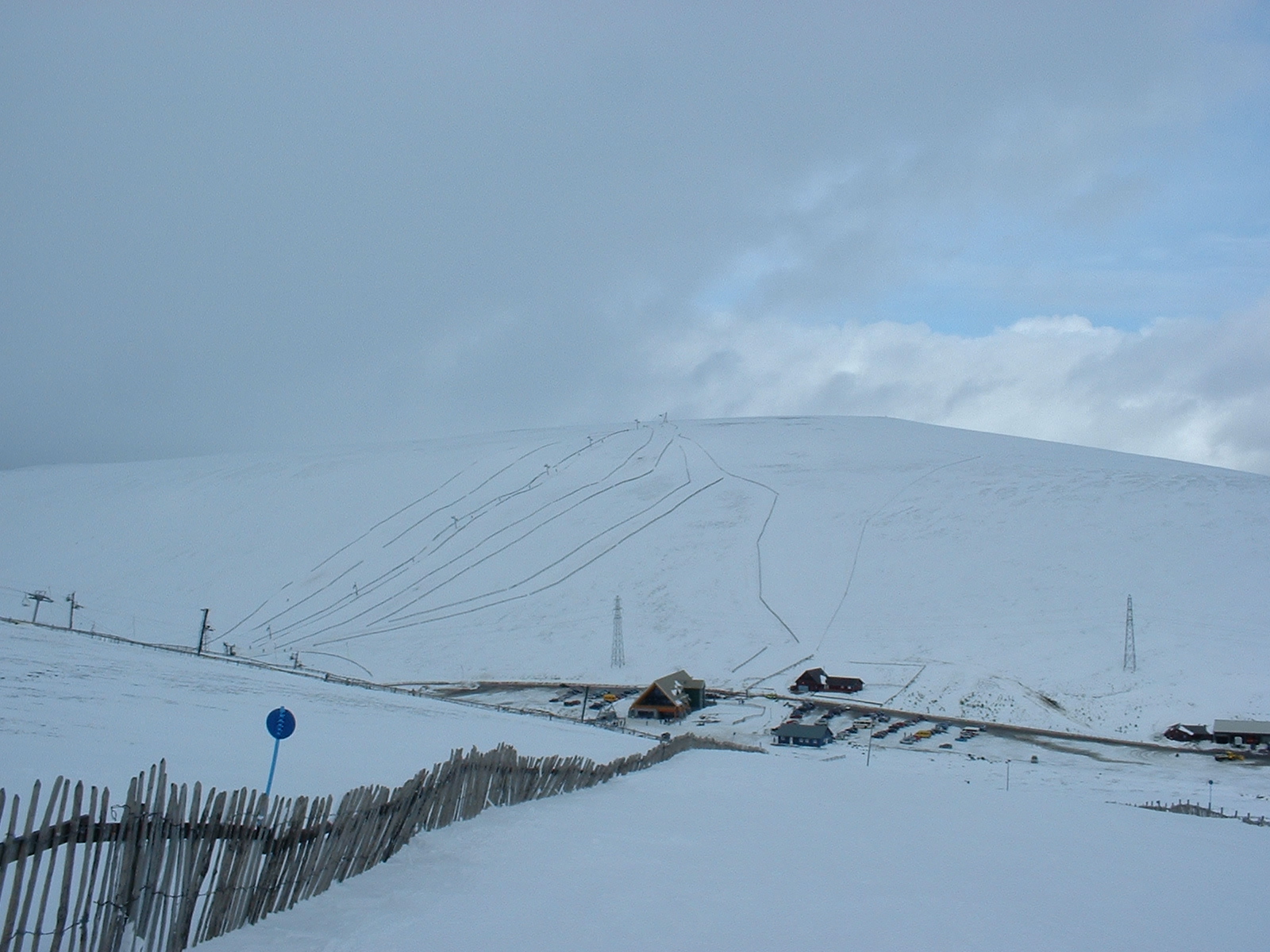
Lecht Ski Centre

The Lecht Ski Centre is an alpine ski area in the Cairngorms in the Scottish Highlands. The ski slopes are set around the mountains Beinn a' Chruinnich...

Corgarff Castle

Corgarff Castle is located slightly west of the village of Corgarff, in Aberdeenshire, north-east Scotland. It stands by the Lecht road, which crosses...

Strathdon

Strathdon (; Gaelic: Srath Dheathain) is an area in Aberdeenshire, Scotland. It is situated in the strath of the River Don, 45 miles west of Aberdeen in...

Lost, Aberdeenshire

Lost (Lòsda in Scottish Gaelic; population: less than 24; grid reference NJ349132 or on 1869 map) is a hamlet in Aberdeenshire, Scotland. It lies 40 miles...

Doune of Invernochty

The Doune of Invernochty is a 12th-century castle in the Cairngorms National Park in Scotland, of which only earthworks survive. The Royal Commission on...

Bellabeg

Bellabeg (an anglicisation of Scottish Gaelic: Am Baile Beag, 'the small farmtown') is a small roadside settlement in Strathdon, Aberdeenshire, Scotland...

Nearby Amenities

Located within 500m of 57.176014,-3.1594599
Ford: yes
Lat/Long: 57.1740948/-3.1521177
Power: pole
Lat/Long: 57.175345/-3.1515154
Power: pole
Lat/Long: 57.1750178/-3.1522619
Power: pole
Lat/Long: 57.1744583/-3.1529224
Power: pole
Lat/Long: 57.1738989/-3.1535622
Power: pole
Lat/Long: 57.173318/-3.1537996
Power: pole
Lat/Long: 57.1745376/-3.1541901
Power: pole
Lat/Long: 57.1727203/-3.1540439
Garchory
Place: locality
Lat/Long: 57.1733699/-3.1531971
The data included in this document is from www.openstreetmap.org. The data is made available under ODbL.

Have you been to Bad na Mòine?

Leave your review of Bad na Mòine below (or comments, questions and feedback).