Brownrigg Moss

Downs, Moorland in Westmorland South Lakeland

England

Brownrigg Moss

Moorland with knoll east of Calf Crag Ground east of Calf Crag with snow remnants.
Beyond and more completely snowed are Fairfield and Great Rigg.
Moorland with knoll east of Calf Crag Credit: Trevor Littlewood

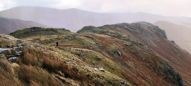
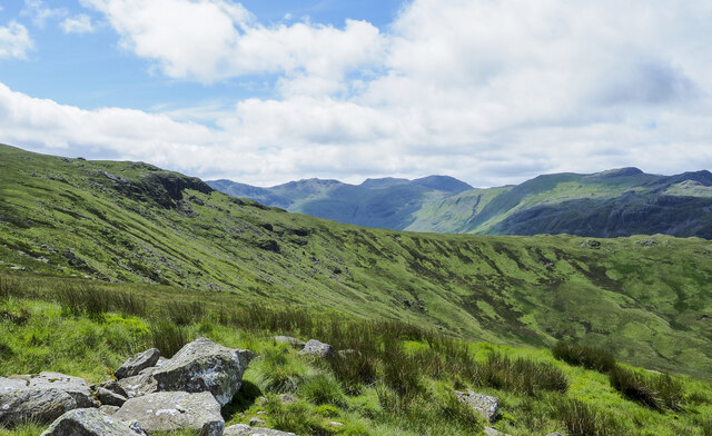
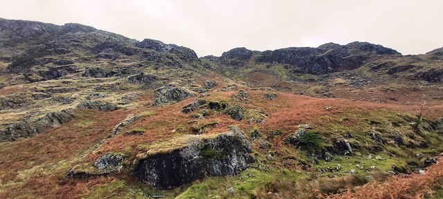
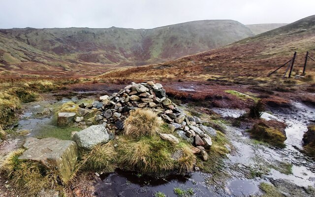
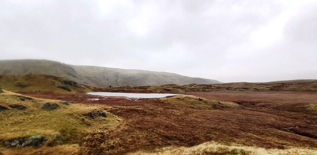
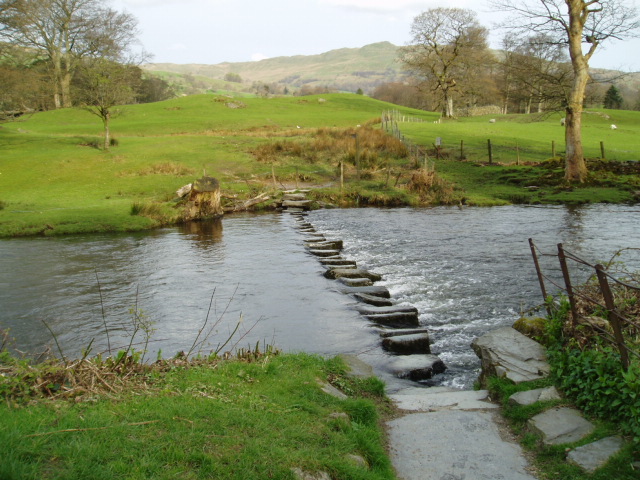
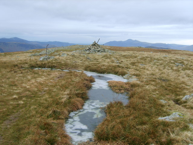
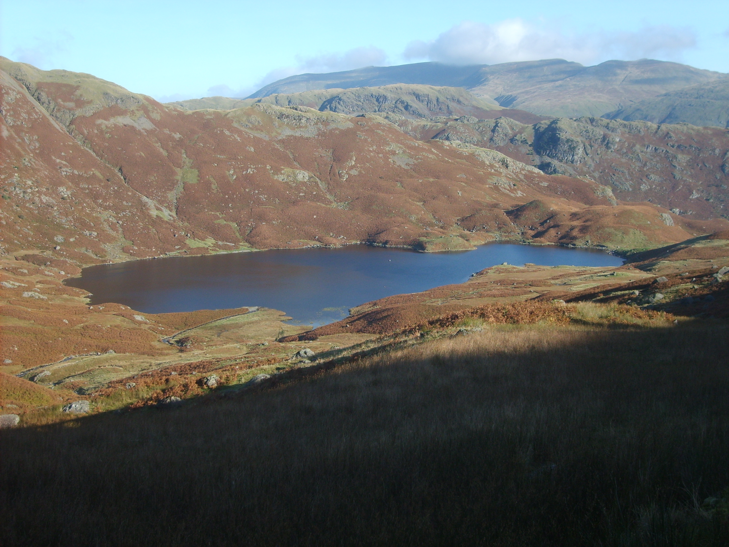
Brownrigg Moss is a vast expanse of moorland located in the county of Westmorland, England. Situated within the picturesque setting of the Westmorland Dales, the moss covers an area of approximately 500 acres and is a designated Site of Special Scientific Interest (SSSI).

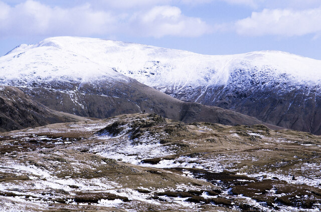
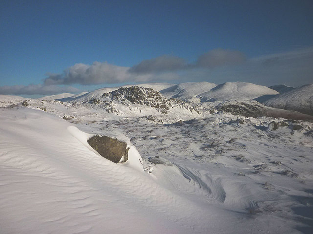
The moss is characterized by its undulating terrain, featuring a mixture of low-lying marshy areas and heather-covered hills. This diverse topography has resulted in a rich variety of plant and animal species, making it a haven for wildlife enthusiasts and nature lovers. Rare species such as the black grouse, golden plover, and curlew can often be observed in their natural habitats within the moss.

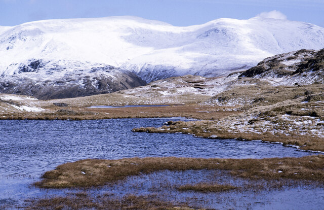
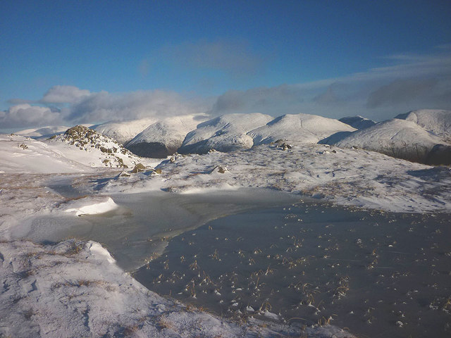
The moss is intersected by several small streams and is home to a number of small tarns, adding to its natural beauty. The surrounding landscape is predominantly rural, with scattered farms and traditional stone buildings dotting the area.

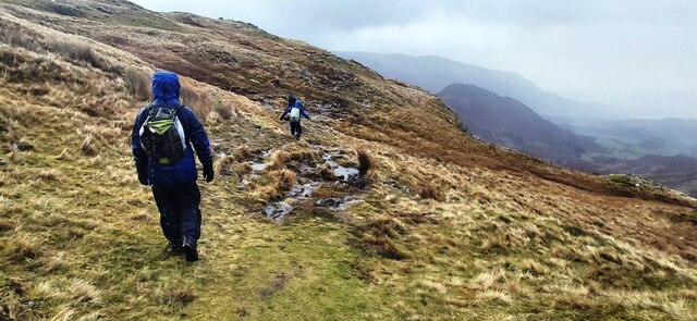
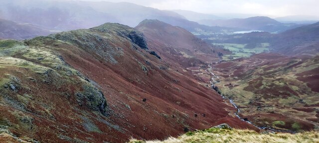
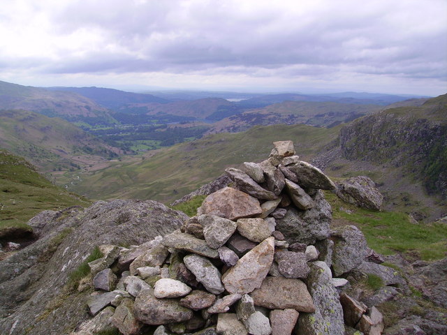
Visitors to Brownrigg Moss can enjoy various activities such as hiking, birdwatching, and photography. There are well-maintained footpaths that crisscross the moss, allowing visitors to explore its unique flora and fauna at their own pace. The moss also offers breathtaking panoramic views of the surrounding countryside, making it a popular destination for photographers and artists.

Overall, Brownrigg Moss is a stunning natural landscape that showcases the beauty and diversity of the Westmorland Dales. With its unique mix of moorland, marshes, and hills, it offers a tranquil escape from the hustle and bustle of everyday life, providing visitors with a chance to connect with nature in a truly remarkable setting.

If you have any feedback on the listing, please let us know in the comments section below.

Brownrigg Moss Images

Images are sourced within 2km of 54.484208/-3.0854288 or Grid Reference NY2910. Thanks to Geograph Open Source API. All images are credited.

Moorland with knoll east of Calf Crag Ground east of Calf Crag with snow remnants.
Beyond and more completely snowed are Fairfield and Great Rigg.
Moorland with knoll east of Calf Crag
Ground east of Calf Crag with snow remnants. Beyond and more completely snowed are Fairfield and Great Rigg.
Unnamed tarn west of Steel Fell - 2 This is the largest of a number of tarns along the broad ridge connecting Steel Fell with Calf Crag; it's unnamed on OS maps.
In the distance, Helvellyn is the massive hill to the left; Nethermost Pike and Dollywaggon Pike are the other snow-covered domes.
Unnamed tarn west of Steel Fell - 2
This is the largest of a number of tarns along the broad ridge connecting Steel Fell with Calf Crag; it's unnamed on OS maps. In the distance, Helvellyn is the massive hill to the left; Nethermost Pike and Dollywaggon Pike are the other snow-covered domes.
Footpath below Calf Crag
Moment Crag above Far Easedale
Lone Walker above Moment Crag
The view east from Belles Knot Easedale tarn is in the distance.
The view east from Belles Knot
Easedale tarn is in the distance.
Grassy slope at head of Greenup valley The rock band beyond the slope at the head of the valley is Long Crag.
Mountains of the Scafell group are seen distantly at the centre of the image.
Grassy slope at head of Greenup valley
The rock band beyond the slope at the head of the valley is Long Crag. Mountains of the Scafell group are seen distantly at the centre of the image.
Broadstone Head
Broadstone Head
Cairn at the head of Far Easedale
Tarn on Brownrigg Moss
Un-named Stream After heavy rain overnight steams are full and fast flowing. This one flows for about 1.5km before emptying into Easedale Tarn on Grasmere Common but is un-named on the Ordnance Survey map. I’m surprised, such an obvious feature.

Taken from my blog <span class="nowrap"><a title="https://fhithich.wordpress.com/2015/08/28/easedale-tarn/" rel="nofollow ugc noopener" href="https://fhithich.wordpress.com/2015/08/28/easedale-tarn/">Link</a><img style="margin-left:2px;" alt="External link" title="External link - shift click to open in new window" src="https://s1.geograph.org.uk/img/external.png" width="10" height="10"/></span>
Un-named Stream
After heavy rain overnight steams are full and fast flowing. This one flows for about 1.5km before emptying into Easedale Tarn on Grasmere Common but is un-named on the Ordnance Survey map. I’m surprised, such an obvious feature. Taken from my blog LinkExternal link
High Raise Trig Point Moments before the weather closed in. Pike o'Stickle just visible.
High Raise Trig Point
Moments before the weather closed in. Pike o'Stickle just visible.
Drifting snow, Codale head Deep snow has collected in the lee of rocks and lumpy ground and been sculpted by the wind. Most of the higher fell country has snow cover which makes progress difficult at times when it is deep and soft like this.
Drifting snow, Codale head
Deep snow has collected in the lee of rocks and lumpy ground and been sculpted by the wind. Most of the higher fell country has snow cover which makes progress difficult at times when it is deep and soft like this.
Sergeant Man Two walkers summit the small rocky peak. Beyond, are the craggy coves of Crinkle Crags.
Sergeant Man
Two walkers summit the small rocky peak. Beyond, are the craggy coves of Crinkle Crags.
Codale Tarn in winter The tarn is quite close to the popular path to Sergeant Man but sits off route and out of sight on a shelf to the north. It sees far fewer visitors than Easedale Tarn.
Codale Tarn in winter
The tarn is quite close to the popular path to Sergeant Man but sits off route and out of sight on a shelf to the north. It sees far fewer visitors than Easedale Tarn.
Frozen tarn east of Codale Head This long narrow tarn sits on an exposed shelf with an excellent view towards the Helvellyn range. It would have been a delectable place for a stop were it not for the freezing gale.
Frozen tarn east of Codale Head
This long narrow tarn sits on an exposed shelf with an excellent view towards the Helvellyn range. It would have been a delectable place for a stop were it not for the freezing gale.
Snow and rocks above Codale Tarn The rough ground north of the tarn is an interesting place to explore but deep snow was making it hard work in places today.
Snow and rocks above Codale Tarn
The rough ground north of the tarn is an interesting place to explore but deep snow was making it hard work in places today.
Old fence post near Codale Head A long-gone fence once marked a parish boundary running across the moor. A few old posts remain, embedded in rock outcrops.
Old fence post near Codale Head
A long-gone fence once marked a parish boundary running across the moor. A few old posts remain, embedded in rock outcrops.
Show me another place!

Brownrigg Moss is located at Grid Ref: NY2910 (Lat: 54.484208, Lng: -3.0854288)

Administrative County: Cumbria

District: South Lakeland

Police Authority: Cumbria

What 3 Words

///switch.butlers.press. Near Ambleside, Cumbria

Nearby Locations

Brownrigg Moss Moor Moss

Related Wikis

Calf Crag

Calf Crag is a fell in the English Lake District, on the eastern side of the High Raise massif. == Topography == The spine of the Central Fells runs on...

River Rothay

The Rothay is a spate river of the Lake District in north-west England. Its name comes from Old Norse and translates literally as the red one. This has...

Tarn Crag (Easedale)

Tarn Crag is a fell in the Central Fells of the English Lake District. Strictly the name refers only to the rock face looking down upon Easedale Tarn,...

Ullscarf

Ullscarf is a fell in the English Lake District close to the geographical centre of the Cumbrian hills. It forms part of the watershed between the Derwentwater...

Sergeant Man

Sergeant Man is a fell in the English Lake District. It is properly a secondary summit of High Raise, but is given a separate chapter by Alfred Wainwright...

Easedale Tarn

Easedale Tarn is a tarn in the centre of the English Lake District, about two miles west of the village of Grasmere. It lies in a hollow between Tarn Crag...

High Raise (Langdale)

High Raise is a fell in the Central Fells of the English Lake District, not to be confused with another High Raise situated in the Far Eastern Fells. High...

Gibson Knott

Gibson Knott is a fell in the English Lake District, an intermediate height on the ridge between Greenburn and Far Easedale in the Central Fells. ��2...

Nearby Amenities

Located within 500m of 54.484208,-3.0854288
Calf Crag
Ele: 537
Natural: peak
Wikidata: Q5019563
Wikipedia: en:Calf Crag
Lat/Long: 54.4842215/-3.0794729
Ele: 490
Natural: saddle
Lat/Long: 54.4824027/-3.0891956
Bicycle: yes
Foot: yes
Ford: yes
Horse: yes
Lat/Long: 54.4827454/-3.0915548
Bicycle: yes
Foot: yes
Ford: yes
Horse: yes
Lat/Long: 54.4834202/-3.0913342
Ford: yes
Lat/Long: 54.4843221/-3.0915605
Ford: yes
Lat/Long: 54.4844564/-3.0928843
Ford: yes
Lat/Long: 54.4843739/-3.0912451
Bicycle: yes
Foot: yes
Ford: yes
Horse: yes
Lat/Long: 54.4825866/-3.091123
The data included in this document is from www.openstreetmap.org. The data is made available under ODbL.

Have you been to Brownrigg Moss?

Leave your review of Brownrigg Moss below (or comments, questions and feedback).