Hall Green
Settlement in Lancashire South Ribble
England
Hall Green

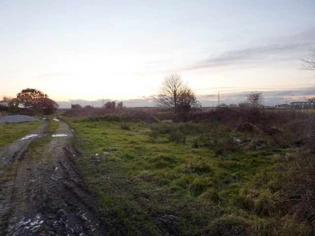
Hall Green is a small village located in the county of Lancashire, England. Situated in the borough of Chorley, it is nestled in the picturesque countryside, offering a tranquil and idyllic setting for its residents. The village is surrounded by lush green fields and rolling hills, providing breathtaking views and ample opportunities for outdoor activities.
With a population of around 500 people, Hall Green maintains a close-knit community spirit. The village is characterized by its charming cottages and traditional architecture, which adds to its quaint and timeless appeal. Despite its small size, Hall Green boasts a range of amenities to cater to the needs of its residents, including a village hall, a local pub, and a primary school.
The village is conveniently located just a short drive away from the nearby town of Chorley, providing easy access to a wider range of services and facilities. Additionally, Hall Green benefits from excellent transport links, with major roads such as the A6 and M61 nearby, making it an ideal location for commuters.
Surrounded by nature reserves and parks, Hall Green offers ample opportunities for outdoor enthusiasts. The nearby Yarrow Valley Country Park provides beautiful walking trails, fishing spots, and picnic areas. Furthermore, the village is within close proximity to the West Pennine Moors, a designated Area of Outstanding Natural Beauty, offering a wealth of stunning landscapes to explore.
Overall, Hall Green is a charming village in Lancashire that offers a peaceful and rural lifestyle, combined with easy access to nearby amenities and natural beauty.
If you have any feedback on the listing, please let us know in the comments section below.
Hall Green Images
Images are sourced within 2km of 53.718292/-2.812196 or Grid Reference SD4624. Thanks to Geograph Open Source API. All images are credited.


Hall Green is located at Grid Ref: SD4624 (Lat: 53.718292, Lng: -2.812196)
Administrative County: Lancashire
District: South Ribble
Police Authority: Lancashire
What 3 Words
///contrived.librarian.songbird. Near Tarleton, Lancashire
Nearby Locations
Related Wikis
Hoole railway station
Hoole railway station was on the West Lancashire Railway in England. It was in the civil parish of Little Hoole about a mile from the village of Much Hoole...

Longton Bridge railway station
Longton Bridge was a railway station on the West Lancashire Railway in England. It served the village of Longton. == History == The station opened as Longton...
Longton, Lancashire
Longton is a village and civil parish in the west of the borough of South Ribble, Lancashire, England. It is about 4 miles to the south west of Preston...

Walmer Bridge
Walmer Bridge is a small village in Lancashire, England. Surrounding villages are Much Hoole and Longton. == History == Walmer Bridge is first recorded...
Nearby Amenities
Located within 500m of 53.718292,-2.812196Have you been to Hall Green?
Leave your review of Hall Green below (or comments, questions and feedback).