Bagwyllydiart

Settlement in Herefordshire

England

Bagwyllydiart

Cockshoot Wood Pasture by Cockshoot Wood
Cockshoot Wood Credit: P Gaskell

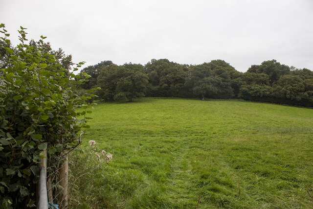
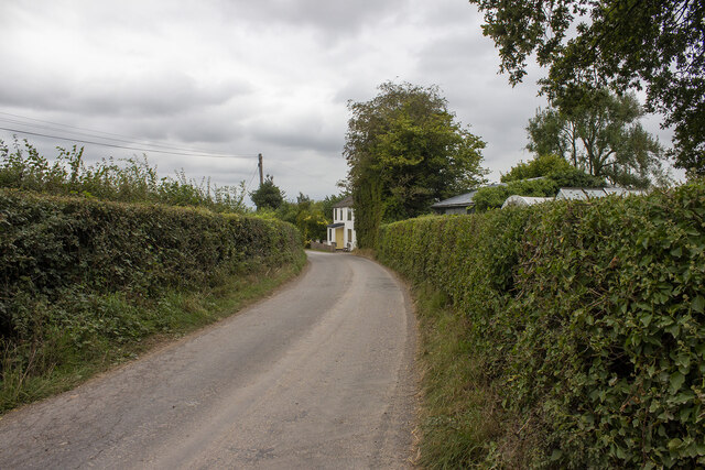
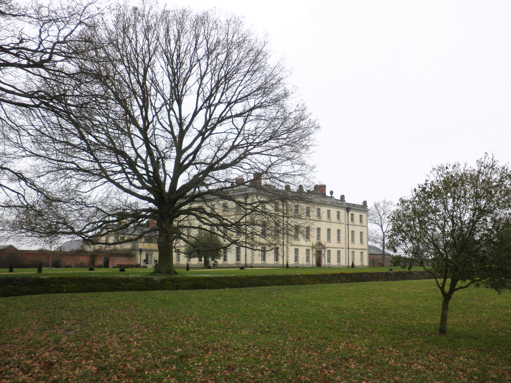
Bagwyllydiart is a small village located in the county of Herefordshire, England. Situated in the picturesque countryside, it is surrounded by rolling hills and lush green fields. The village is part of the civil parish of Ewyas Harold, nestled within the Wye Valley Area of Outstanding Natural Beauty.

Bagwyllydiart is known for its tranquil and idyllic setting, making it a popular destination for those seeking a peaceful retreat. The village is characterized by traditional stone cottages and well-maintained gardens, giving it a quaint and charming atmosphere.

The community in Bagwyllydiart is close-knit, with a population of around 200 residents. The village has a small primary school and a community hall, which serves as a hub for various social events and gatherings. The local pub, The Red Lion, is a popular meeting spot for both residents and visitors, offering a warm and friendly atmosphere.

The surrounding countryside provides ample opportunities for outdoor activities such as hiking, cycling, and horse riding. Bagwyllydiart is also located near the Offa's Dyke Path, a popular long-distance trail that follows the ancient earthwork of Offa's Dyke. This makes the village a convenient base for exploring the stunning landscapes of the Welsh Marches.

Overall, Bagwyllydiart offers a peaceful retreat in a picturesque countryside setting, making it a desirable destination for nature lovers and those seeking a slower pace of life.

If you have any feedback on the listing, please let us know in the comments section below.

Bagwyllydiart Images

Images are sourced within 2km of 51.937784/-2.8092816 or Grid Reference SO4426. Thanks to Geograph Open Source API. All images are credited.

Cockshoot Wood Pasture by Cockshoot Wood
Cockshoot Wood
Pasture by Cockshoot Wood
Hondys Farm Converted vernacular farm building at Hondys Farm
Hondys Farm
Converted vernacular farm building at Hondys Farm
Bagwyllydiart Farm Road junction at Bagwyllydiart Farm
Bagwyllydiart Farm
Road junction at Bagwyllydiart Farm
Crab's Castle Farm Vernacular and modern farm buildings at Crab's Castle Farm
Crab's Castle Farm
Vernacular and modern farm buildings at Crab's Castle Farm
Cross Llyde Road at Cross Llyde
Cross Llyde
Road at Cross Llyde
Track to Little Camdore
Grass field near Crab's Castle The Black Mountains in the distance.
Grass field near Crab's Castle
The Black Mountains in the distance.
Barley field near Crab's Castle
Burhope Farm
Burhope Farm
Camdore Farm
Camdore Farm
Wheat field near Camdore Farm Hondy Wood in the background.
Wheat field near Camdore Farm
Hondy Wood in the background.
Hedge-lined road, Cross Llyde, Herefordshire Ahead for Marlas and Kilpeck.
Hedge-lined road, Cross Llyde, Herefordshire
Ahead for Marlas and Kilpeck.
Direction signs in a hedge, Cross Llyde, Herefordshire Signs showing the way to Pontrilas, Orcop, Ross-on-Wye and Garway Hill are partly hidden by vegetation in October 2022.
Direction signs in a hedge, Cross Llyde, Herefordshire
Signs showing the way to Pontrilas, Orcop, Ross-on-Wye and Garway Hill are partly hidden by vegetation in October 2022.
Bagwyllydiart name sign, Herefordshire Welsh name in Herefordshire (England) 
several kilometres from Monmouthshire (Wales).
Bagwyllydiart name sign, Herefordshire
Welsh name in Herefordshire (England) several kilometres from Monmouthshire (Wales).
Garway Hill direction sign on a bank, Herefordshire  Near Bagwyllydiart Farm.
Garway Hill direction sign on a bank, Herefordshire
Near Bagwyllydiart Farm.
Bagwyllydiart Farm building, Herefordshire The SW part of the farm with a Welsh name in Herefordshire (England) several kilometres from Monmouthshire (Wales).
Bagwyllydiart Farm building, Herefordshire
The SW part of the farm with a Welsh name in Herefordshire (England) several kilometres from Monmouthshire (Wales).
East side of Orcop Village Hall In rural Herefordshire.
East side of Orcop Village Hall
In rural Herefordshire.
Owl banner, Orcop, Herefordshire In October 2022 the banner on Orcop Village Hall shows

OWL GOOD NEIGHBOUR COMMUNITY
LUNCH FOR EVERYONE
FIRST WEDNESDAY
OF EACH MONTH
12:30 - 15:00
Owl banner, Orcop, Herefordshire
In October 2022 the banner on Orcop Village Hall shows OWL GOOD NEIGHBOUR COMMUNITY LUNCH FOR EVERYONE FIRST WEDNESDAY OF EACH MONTH 12:30 - 15:00
Show me another place!

Bagwyllydiart is located at Grid Ref: SO4426 (Lat: 51.937784, Lng: -2.8092816)

Unitary Authority: County of Herefordshire

Police Authority: West Mercia

What 3 Words

///botanists.those.ranked. Near Grosmont, Monmouthshire

Nearby Locations

Bagwyllydiart Garway Hill

Related Wikis

Bagwyllydiart

Bagwyllydiart is a hamlet in Herefordshire, England 16 kilometres (10 mi) south west of Hereford near the Welsh border. It lies between the villages of...

Kentchurch Court

Kentchurch Court is a Grade I listed stately home 1,200 yards (1,000 m) east from the village of Kentchurch in Herefordshire, England. == History == It...

Kentchurch

Kentchurch is a small village and civil parish in Herefordshire, England. It is located some 13 miles (21 km) south-west of Hereford and 13 miles (21...

Orcop

Orcop is a village and civil parish in the county of Herefordshire, England. It lies 14 kilometres (8.7 mi) south of Hereford. It has a well-preserved...

Kilpeck Priory

Kilpeck Priory was a Benedictine priory in Kilpeck, Herefordshire, England, at grid reference SO448303.In 1134, William, son of Norman, gave the church...

Kilpeck

Kilpeck (Welsh: Llanddewi Cil Peddeg) is a village and civil parish in the county of Herefordshire, England. It is about nine miles (14 km) southwest of...

Church of St Mary and St David, Kilpeck

The Church of St Mary and St David is a Church of England parish church at Kilpeck in the English county of Herefordshire, about 5 miles from the border...

The Mynde

The Mynde is a country house in Much Dewchurch, Herefordshire. Originally built in the 15th and 16th centuries, it was remodelled in the 18th century and...

Nearby Amenities

Located within 500m of 51.937784,-2.8092816
Saddlebow Road
Naptan AtcoCode: 2090A068100
Naptan Bearing: NW
Naptan BusStopType: CUS
Naptan CommonName: Saddlebow Road
Naptan Indicator: opp junction with Saddlebow Road
Naptan Landmark: Bagwyllydiart Cottage
Naptan NaptanCode: heradgjm
Naptan Street: Saddlebow Road
Naptan Verified: no
Source: naptan_import
Lat/Long: 51.9381555/-2.8099455
Garway Road
Naptan AtcoCode: 2090A18548
Naptan Bearing: SW
Naptan BusStopType: CUS
Naptan CommonName: Garway Road
Naptan Indicator: adj
Naptan Landmark: Bagwyllidiart Cottage
Naptan NaptanCode: heragwat
Naptan Street: Garway Road
Naptan Verified: no
Source: naptan_import
Lat/Long: 51.9375717/-2.8094227
Bagwyllydiart
Place: hamlet
Wikidata: Q3784413
Lat/Long: 51.9376851/-2.8086995
Barrier: stile
Source: survey
Lat/Long: 51.9395459/-2.8088777
Power: pole
Source: bing
Lat/Long: 51.9372143/-2.8130981
Power: pole
Source: bing
Lat/Long: 51.9372937/-2.8124437
Power: pole
Source: bing
Lat/Long: 51.9373466/-2.8117973
Power: pole
Source: bing
Lat/Long: 51.9372209/-2.8106064
Power: transformer
Source: survey
Lat/Long: 51.9370043/-2.8098755
Public Transport: stop_position
Lat/Long: 51.9375789/-2.8094503
Fire Hydrant
Emergency: fire_hydrant
Fire Hydrant Type: underground
Source: survey
Lat/Long: 51.9377682/-2.8092498
Post Box
Ref: HR2 155
Royal Cypher: EIIR
Royal Cypher Wikidata: Q33102113
Source: survey
Lat/Long: 51.9377918/-2.8093819
Information: board
Source: survey
Tourism: information
Lat/Long: 51.9382346/-2.8098795
Generator Method: photovoltaic
Generator Output Electricity: yes
Generator Source: solar
Generator Type: solar_photovoltaic_panel
Power: generator
Lat/Long: 51.9378236/-2.8095549
Public Transport: stop_position
Lat/Long: 51.9381717/-2.8099184
Power: pole
Lat/Long: 51.9350182/-2.8097561
Power: pole
Lat/Long: 51.9356979/-2.8089622
Power: pole
Lat/Long: 51.9360633/-2.8085518
Power: pole
Lat/Long: 51.9364602/-2.8080931
Power: pole
Lat/Long: 51.9366388/-2.8086966
The data included in this document is from www.openstreetmap.org. The data is made available under ODbL.

Have you been to Bagwyllydiart?

Leave your review of Bagwyllydiart below (or comments, questions and feedback).