Woodland

Downs, Moorland in Lancashire South Lakeland

England

Woodland

Remains of wooden ballast bin Only a few rotten pieces of wood remain from this ballast bin beside the former Furness Railway Coniston Branch near Moss Side.  Built from old wooden railway sleepers it is difficult to place an age on this ballast bin, but it is possible it pre-dates the formation of the London Midland and Scottish Railway in 1923 who later introduced concrete bins (see photograph <a href="https://www.geograph.org.uk/photo/6797992">NY2924 : LMS Standard Concrete Ballast Bin</a>).
Positioned approximately every mile, more frequently on curved track, ballast bins were used to store small stone chippings which were used by the railway Lengthsmen to pack and adjust the railway sleepers. Using only a jack and a shovel, an experienced Lengthsman could judge exactly the right quantity of chippings to use to obtain a perfect ‘top’ to the rail and they often took great pride in the quality of their work.
The Coniston Branch closed to passengers in October 1958 and to all traffic with effect from the 30 April 1962 although the last train had run during the preceding week.  The track bed in front of the ballast bin is deep in mud and trampled by cows.
Remains of wooden ballast bin Credit: Adrian Taylor

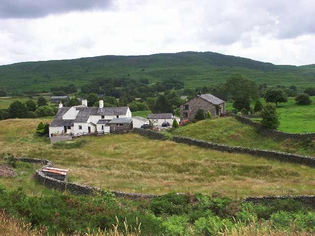
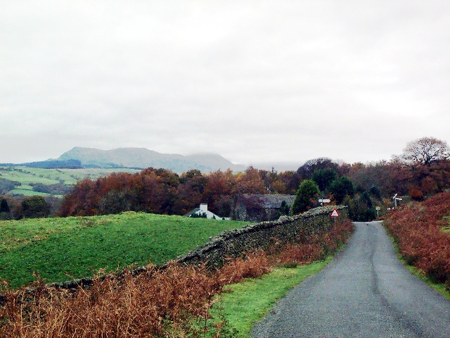
Woodland, Lancashire is a picturesque village located in the northwest of England. Situated in the county of Lancashire, it is surrounded by stunning countryside, including downs and moorland, which makes it an attractive destination for nature enthusiasts and hikers alike.

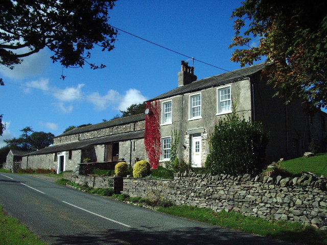
The village itself is small, with a population of around 1,000 residents. It is characterized by its charming stone houses and well-maintained gardens, giving it a quintessential English village feel. The community is close-knit, with a friendly and welcoming atmosphere that is often associated with rural villages.

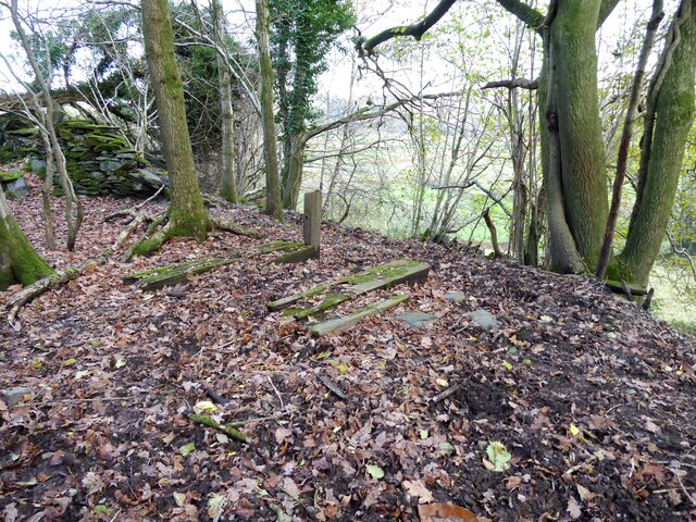
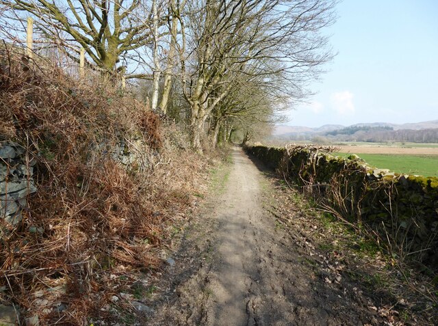
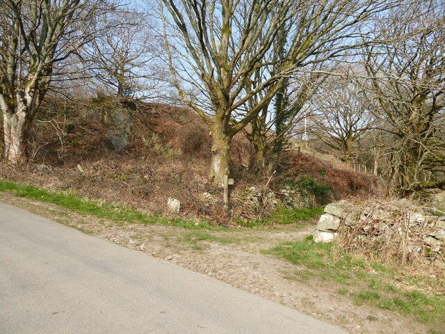
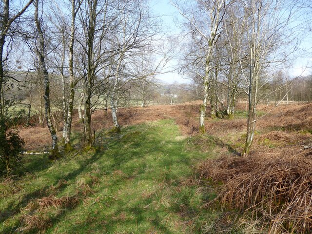
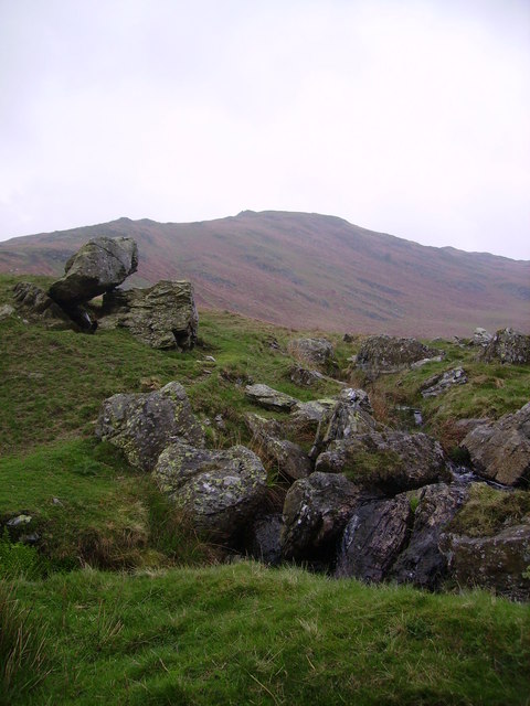
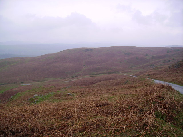
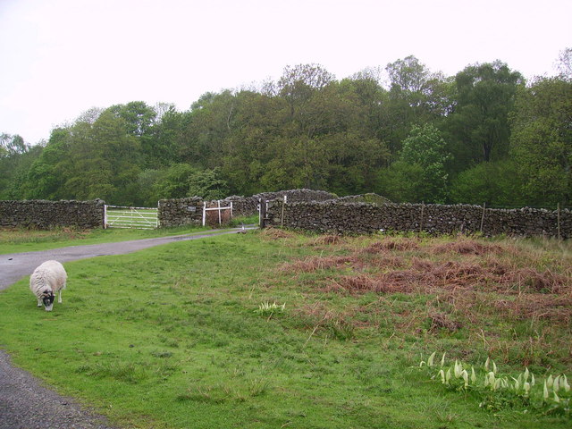
Woodland is blessed with an abundance of natural beauty. The downs surrounding the village offer breathtaking views of the rolling hills and meadows, providing a tranquil escape from the hustle and bustle of city life. Moorland areas nearby are home to a variety of wildlife, including birds, sheep, and deer, making it a popular spot for birdwatching and wildlife enthusiasts.

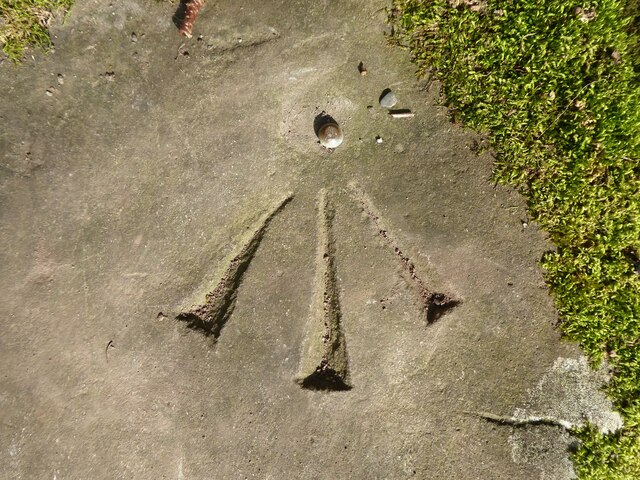
The village has a rich history, with evidence of human habitation dating back to the Roman era. Several archaeological sites, such as Roman roads and burial mounds, can be found in the area, adding to its historical significance.

Despite its small size, Woodland boasts a few amenities for its residents and visitors. There is a village pub that serves traditional English food and ale, as well as a small convenience store for everyday needs. However, for more extensive shopping and entertainment options, residents often travel to nearby towns.

Overall, Woodland, Lancashire is a charming village that offers a peaceful and idyllic lifestyle surrounded by stunning natural landscapes.

If you have any feedback on the listing, please let us know in the comments section below.
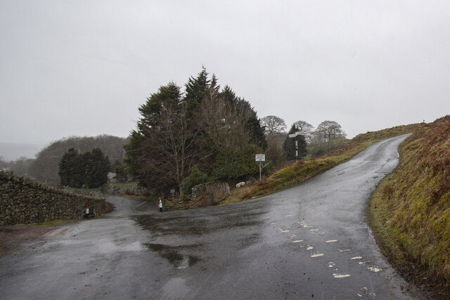
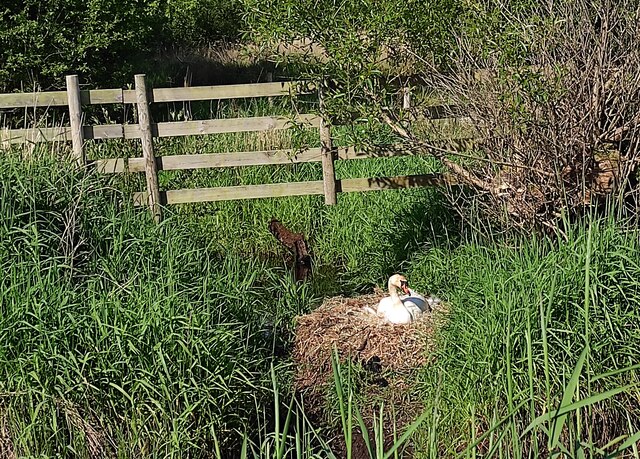
Woodland Images

Images are sourced within 2km of 54.290959/-3.1642698 or Grid Reference SD2488. Thanks to Geograph Open Source API. All images are credited.

Remains of wooden ballast bin Only a few rotten pieces of wood remain from this ballast bin beside the former Furness Railway Coniston Branch near Moss Side.  Built from old wooden railway sleepers it is difficult to place an age on this ballast bin, but it is possible it pre-dates the formation of the London Midland and Scottish Railway in 1923 who later introduced concrete bins (see photograph <a href="https://www.geograph.org.uk/photo/6797992">NY2924 : LMS Standard Concrete Ballast Bin</a>).
Positioned approximately every mile, more frequently on curved track, ballast bins were used to store small stone chippings which were used by the railway Lengthsmen to pack and adjust the railway sleepers. Using only a jack and a shovel, an experienced Lengthsman could judge exactly the right quantity of chippings to use to obtain a perfect ‘top’ to the rail and they often took great pride in the quality of their work.
The Coniston Branch closed to passengers in October 1958 and to all traffic with effect from the 30 April 1962 although the last train had run during the preceding week.  The track bed in front of the ballast bin is deep in mud and trampled by cows.
Remains of wooden ballast bin
Only a few rotten pieces of wood remain from this ballast bin beside the former Furness Railway Coniston Branch near Moss Side. Built from old wooden railway sleepers it is difficult to place an age on this ballast bin, but it is possible it pre-dates the formation of the London Midland and Scottish Railway in 1923 who later introduced concrete bins (see photograph NY2924 : LMS Standard Concrete Ballast Bin). Positioned approximately every mile, more frequently on curved track, ballast bins were used to store small stone chippings which were used by the railway Lengthsmen to pack and adjust the railway sleepers. Using only a jack and a shovel, an experienced Lengthsman could judge exactly the right quantity of chippings to use to obtain a perfect ‘top’ to the rail and they often took great pride in the quality of their work. The Coniston Branch closed to passengers in October 1958 and to all traffic with effect from the 30 April 1962 although the last train had run during the preceding week. The track bed in front of the ballast bin is deep in mud and trampled by cows.
Ordnance Survey Rivet This OS rivet can be found on the stile SE side of the road. It marks a point 15.027m above mean sea level.
Ordnance Survey Rivet
This OS rivet can be found on the stile SE side of the road. It marks a point 15.027m above mean sea level.
Ordnance Survey Rivet This OS rivet can be found on the wall east side of Woodlands Road. It marks a point 69.758m above mean sea level.
Ordnance Survey Rivet
This OS rivet can be found on the wall east side of Woodlands Road. It marks a point 69.758m above mean sea level.
Kirkby Pool
Kirkby Pool
Lane near Brookside The lane is a public footpath leading to Buttstead Wood.
Lane near Brookside
The lane is a public footpath leading to Buttstead Wood.
Stile beside Buttstead Wood The public footpath from The Hill to Woodland crosses this stile adjacent to Buttstead Wood.
There is an Ordnance Survey rivet benchmark with cut mark on the bottom stone step of the stile (detail photograph <a href="https://www.geograph.org.uk/photo/7259390">SD2389 : Benchmark, Buttstead Wood</a>).
Stile beside Buttstead Wood
The public footpath from The Hill to Woodland crosses this stile adjacent to Buttstead Wood. There is an Ordnance Survey rivet benchmark with cut mark on the bottom stone step of the stile (detail photograph SD2389 : Benchmark, Buttstead Wood).
Benchmark, Buttstead Wood Detail of the Ordnance Survey rivet benchmark with cut mark on the horizontal bottom step of a public footpath stile adjacent to Buttstead Wood.  The benchmark marks a height of 8.6076m above mean sea level (Ordnance Datum Newlyn) last verified in 1954 (location photograph <a href="https://www.geograph.org.uk/photo/7259381">SD2389 : Stile beside Buttstead Wood</a>).
Benchmark, Buttstead Wood
Detail of the Ordnance Survey rivet benchmark with cut mark on the horizontal bottom step of a public footpath stile adjacent to Buttstead Wood. The benchmark marks a height of 8.6076m above mean sea level (Ordnance Datum Newlyn) last verified in 1954 (location photograph SD2389 : Stile beside Buttstead Wood).
Lane entrance near Brookside Leading from the road near Brookside the lane leads to Buttstead Wood and carries a public footpath to Low Rosthwaite.
There is an Ordnance Survey rivet benchmark on the top of the low stone post partially hidden in the brambles to the left of the footpath signpost (photograph <a href="https://www.geograph.org.uk/photo/7260566">SD2389 : Rivet benchmark near Brookside</a>).
Lane entrance near Brookside
Leading from the road near Brookside the lane leads to Buttstead Wood and carries a public footpath to Low Rosthwaite. There is an Ordnance Survey rivet benchmark on the top of the low stone post partially hidden in the brambles to the left of the footpath signpost (photograph SD2389 : Rivet benchmark near Brookside).
Rivet benchmark near Brookside Detail of an Ordnance Survey rivet benchmark on the top of a low stone post near Brookside.  The benchmark marks a height of 11.0246m above mean sea level (Ordnance Datum Newlyn) last verified in 1972 (location photograph <a href="https://www.geograph.org.uk/photo/7260558">SD2389 : Lane entrance near Brookside</a>).
Rivet benchmark near Brookside
Detail of an Ordnance Survey rivet benchmark on the top of a low stone post near Brookside. The benchmark marks a height of 11.0246m above mean sea level (Ordnance Datum Newlyn) last verified in 1972 (location photograph SD2389 : Lane entrance near Brookside).
Woodland path near Latter Rigg
Road Junction
Road Junction
Swan on Nest by Galloper Pool On Thornthwaite Latter Rigg Moss.
Swan on Nest by Galloper Pool
On Thornthwaite Latter Rigg Moss.
Ringhouse Farm and Cottages, Lake District This is Ringhouse Farm and its associated cottages which are available for rent (google 'em for details). Ideally situated for access to the south lakes and beyond and plenty of walks from the farm if you don't feel like getting into the car.
Ringhouse Farm and Cottages, Lake District
This is Ringhouse Farm and its associated cottages which are available for rent (google 'em for details). Ideally situated for access to the south lakes and beyond and plenty of walks from the farm if you don't feel like getting into the car.
Low Heathwaite Gate Road junction at western edge of hilly moorland.
Low Heathwaite Gate
Road junction at western edge of hilly moorland.
Looking towards Blawith Knott From the fell road to Woodland
Looking towards Blawith Knott
From the fell road to Woodland
Fell Road Under Blawith Knott
Fell Road
Under Blawith Knott
Sheep Near Woodland By the entrance to Thornthwaite Farm. Cuckoo Pint (Lords and Ladies) growing on the verge.
Sheep Near Woodland
By the entrance to Thornthwaite Farm. Cuckoo Pint (Lords and Ladies) growing on the verge.
High Aulthwaite Side
Show me another place!

Woodland is located at Grid Ref: SD2488 (Lat: 54.290959, Lng: -3.1642698)

Administrative County: Cumbria

District: South Lakeland

Police Authority: Cumbria

What 3 Words

///poet.prove.decoding. Near Millom, Cumbria

Related Wikis

Woodland, Cumbria

Woodland is a dispersed hamlet within the civil parish of Kirkby Ireleth in the Furness region of Cumbria, England, and is located in the southern part...

St John the Evangelist's Church, Woodland

St John the Evangelist's Church is in the hamlet of Woodland, about 4 kilometres (2 mi) to the northeast of Broughton-in-Furness, Cumbria, England. It...

Rosthwaite, Broughton West

Rosthwaite is a settlement in the Broughton West civil parish of Westmorland and Furness, Cumbria England. It is part of the Lake District, 3 miles (4...

Woodland railway station

Woodland railway station served the hamlet of Woodland, in Lancashire, England (now in Cumbria). It was on the branch line to Coniston. == History == Authorised...

Nearby Amenities

Located within 500m of 54.290959,-3.1642698
Barrier: kissing_gate
Lat/Long: 54.2935132/-3.1645691
Source: OS_OpenData_StreetView
Lat/Long: 54.2915118/-3.1663082
Barrier: cattle_grid
Lat/Long: 54.2926105/-3.1576923
Barrier: stile
Lat/Long: 54.2935275/-3.1611004
Barrier: cattle_grid
Lat/Long: 54.2919651/-3.1569409
Woodland
Place: locality
Wikidata: Q15058964
Wikipedia: en:Woodland, Cumbria
Lat/Long: 54.2920659/-3.1584183
Ford: yes
Lat/Long: 54.2896733/-3.1702182
Barrier: stile
Lat/Long: 54.2933025/-3.1622704
Barrier: cattle_grid
Lat/Long: 54.2867424/-3.1639917
Generator Method: photovoltaic
Generator Output Electricity: yes
Generator Source: solar
Generator Type: solar_photovoltaic_panel
Power: generator
Lat/Long: 54.293479/-3.1601196
Barrier: stile
Lat/Long: 54.2933713/-3.1628351
Barrier: stile
Lat/Long: 54.28972/-3.1645614
Fountain
Covered: no
Fountain: water
Indoor: no
Lit: no
Lat/Long: 54.2869636/-3.1649054
Power: pole
Lat/Long: 54.2875345/-3.1642523
Power: pole
Lat/Long: 54.2937388/-3.1591116
Power: pole
Lat/Long: 54.2930562/-3.1590863
Power: pole
Lat/Long: 54.2923896/-3.1590433
Power: pole
Lat/Long: 54.2914164/-3.1590121
Power: pole
Lat/Long: 54.2906027/-3.1589789
Power: pole
Lat/Long: 54.2900181/-3.1589359
Power: pole
Lat/Long: 54.2896922/-3.1584166
Power: pole
Lat/Long: 54.2901742/-3.1577
Power: pole
Lat/Long: 54.2874801/-3.163204
Power: pole
Lat/Long: 54.2873741/-3.1614487
Power: pole
Lat/Long: 54.2878745/-3.1608825
Power: pole
Lat/Long: 54.2886152/-3.1600156
Power: pole
Lat/Long: 54.2891623/-3.1593791
Power: pole
Lat/Long: 54.2937274/-3.1626612
Power: pole
Lat/Long: 54.2937296/-3.1612486
Power: pole
Lat/Long: 54.293741/-3.1600303
The data included in this document is from www.openstreetmap.org. The data is made available under ODbL.

Have you been to Woodland?

Leave your review of Woodland below (or comments, questions and feedback).