Balharvie Moss

Downs, Moorland in Fife

Scotland

Balharvie Moss

West Lomond trigpoint Looking south-east with Harperleas and Ballo reservoirs in the background,
West Lomond trigpoint Credit: Becky Williamson

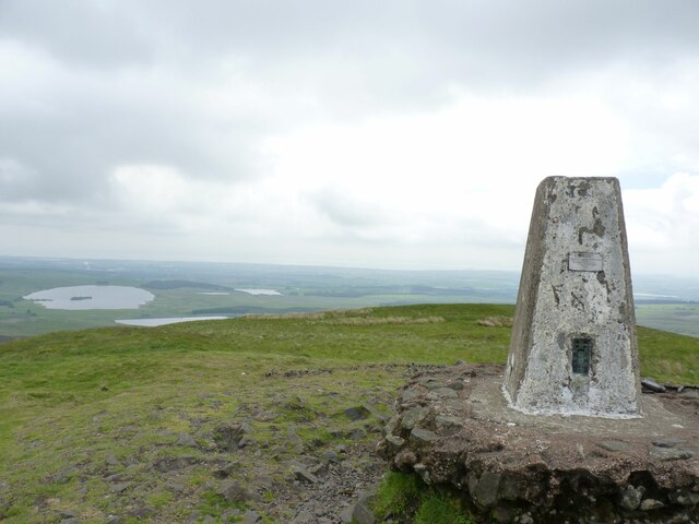
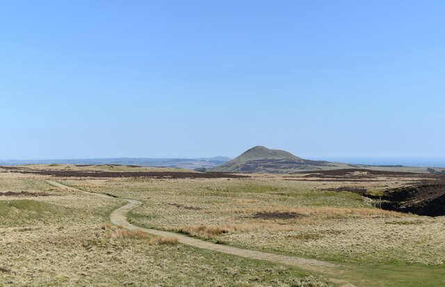
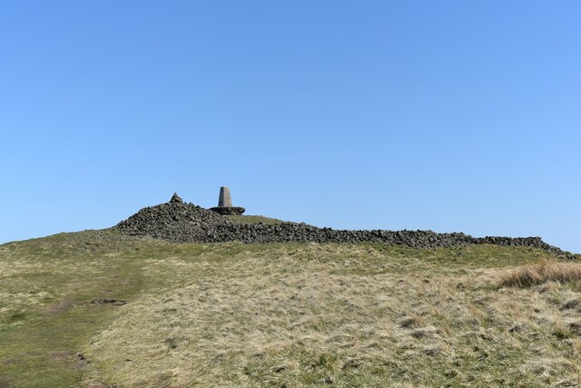
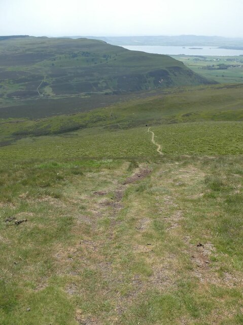
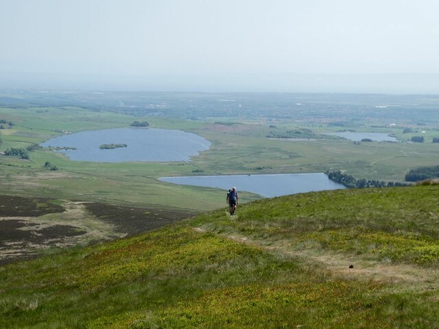
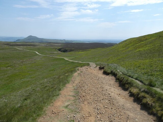
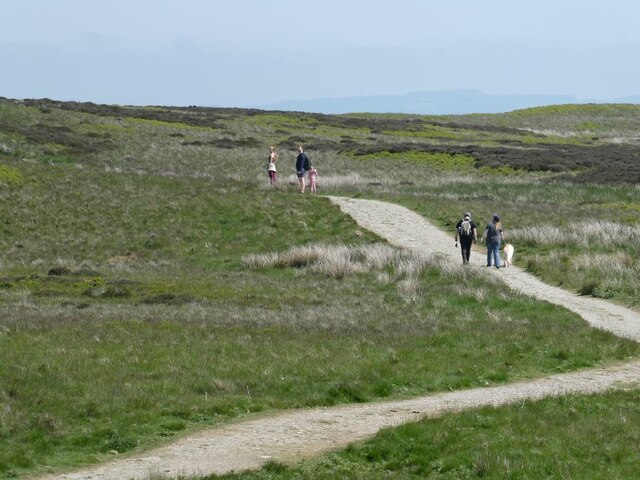
Balharvie Moss is a vast expanse of moorland located in Fife, Scotland. Covering an area of approximately 100 hectares, it is situated south of the town of Auchtermuchty and lies within the Falkland Estate. The moss is characterized by its undulating terrain, consisting of heather-covered hills, peat bogs, and small patches of woodland.

As a designated Site of Special Scientific Interest (SSSI), Balharvie Moss is renowned for its rich biodiversity. The moss supports a variety of plant species, including sphagnum moss, cotton grass, and heather, which thrive in the acidic peat soil. The area is also home to numerous species of birds, such as golden plovers, curlews, and lapwings, which nest and forage in the open moorland habitat.

Balharvie Moss plays an important role in water regulation and conservation. It acts as a natural sponge, absorbing rainfall and slowly releasing it into nearby streams and rivers. The moss also acts as a carbon sink, helping to mitigate climate change by storing carbon dioxide in its peat layers.

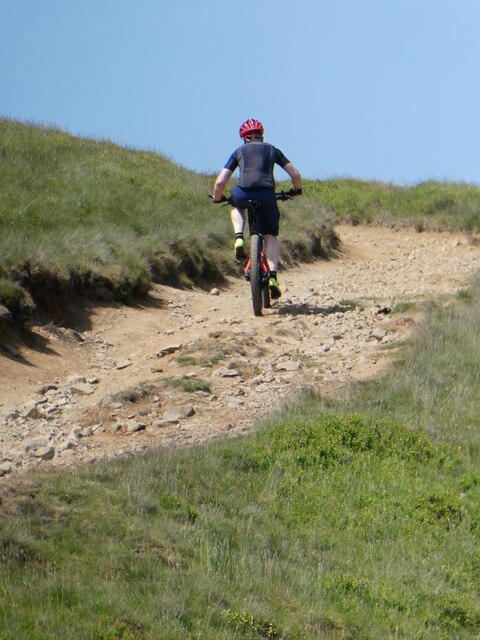
Visitors to Balharvie Moss can enjoy its tranquil and unspoiled surroundings, with several walking trails available for exploration. The moss offers breathtaking panoramic views of the surrounding countryside, making it a popular destination for nature enthusiasts, photographers, and birdwatchers.

Efforts are being made to restore and enhance the ecological value of Balharvie Moss, including measures to control invasive species and promote peatland restoration. These initiatives aim to safeguard the unique biodiversity and ecological functions of this remarkable moorland habitat for future generations.

If you have any feedback on the listing, please let us know in the comments section below.

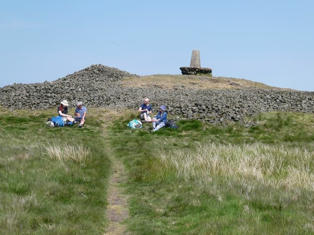
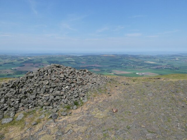
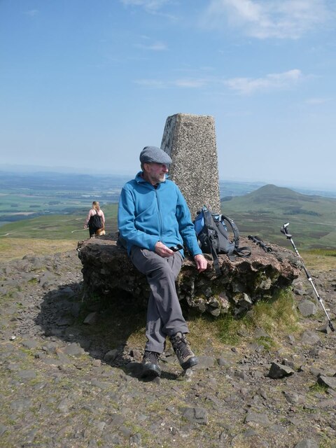
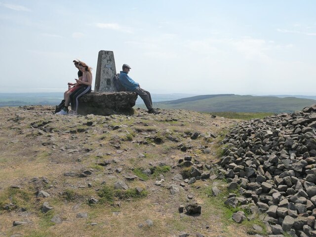
Balharvie Moss Images

Images are sourced within 2km of 56.244121/-3.2656203 or Grid Reference NO2106. Thanks to Geograph Open Source API. All images are credited.

West Lomond trigpoint Looking south-east with Harperleas and Ballo reservoirs in the background,
West Lomond trigpoint
Looking south-east with Harperleas and Ballo reservoirs in the background,
View towards East Lomond The landscape looks rather bleak but it was actually a lovely spring day.
View towards East Lomond
The landscape looks rather bleak but it was actually a lovely spring day.
Cairn and trig point, West Lomond West Lomond is the highest point in Fife, at 522 m.  Geologically, it is part of the East Fife basanitic and foiditic plugs and vents, being igneous bedrock formed between 330.9 and 272.3 million years ago during the Carboniferous and Permian periods, or in simpler terms, an extinct volcano.   According to the trigpointing.uk website, the trig point has reference number PP334 and was once a 'primary' reference point.
Cairn and trig point, West Lomond
West Lomond is the highest point in Fife, at 522 m. Geologically, it is part of the East Fife basanitic and foiditic plugs and vents, being igneous bedrock formed between 330.9 and 272.3 million years ago during the Carboniferous and Permian periods, or in simpler terms, an extinct volcano. According to the trigpointing.uk website, the trig point has reference number PP334 and was once a 'primary' reference point.
Path up the south-west side of West Lomond The summit cone of West Lomond is a steep pull-up from any direction. It is just possible to make out the figure of a walker toiling up one of the less popular approach routes. The deep cleft of Glen Vale can be seen in the middle distance with Loch Leven beyond.
Path up the south-west side of West Lomond
The summit cone of West Lomond is a steep pull-up from any direction. It is just possible to make out the figure of a walker toiling up one of the less popular approach routes. The deep cleft of Glen Vale can be seen in the middle distance with Loch Leven beyond.
West Lomond summit Wear by many feet on this popular summit has resulted in the foundations of this trig pillar which  was erected in the 1940s now being exposed by a good 50 cm.
West Lomond summit
Wear by many feet on this popular summit has resulted in the foundations of this trig pillar which was erected in the 1940s now being exposed by a good 50 cm.
Summit cairn of West Lomond With extensive, if slightly hazy, views to the north.
Summit cairn of West Lomond
With extensive, if slightly hazy, views to the north.
Summit of West Lomond Wear by many feet on this popular summit has resulted in the foundations of this trig pillar which  was erected in the 1940s now being exposed by a good 50 cm. East Lomond <a href="https://www.geograph.org.uk/gridref/NO2406">NO2406</a> can be seen in the distance.
Summit of West Lomond
Wear by many feet on this popular summit has resulted in the foundations of this trig pillar which was erected in the 1940s now being exposed by a good 50 cm. East Lomond NO2406 can be seen in the distance.
Summit of West Lomond Wear by many feet on this popular summit has resulted in the foundations of this trig pillar which  was erected in the 1940s now being exposed by a good 50 cm.
Summit of West Lomond
Wear by many feet on this popular summit has resulted in the foundations of this trig pillar which was erected in the 1940s now being exposed by a good 50 cm.
Path up the south-east side of West Lomond The summit cone of West Lomond is a steep pull-up from any direction. This shows a couple of walkers toiling up one of the less popular approach routes.  Beyond and below are Harperleas Reservoir <a href="https://www.geograph.org.uk/gridref/NT2105">NT2105</a>, Ballo Reservoir <a href="https://www.geograph.org.uk/gridref/NT2204">NT2204</a> (further away) and Holl Reservoir <a href="https://www.geograph.org.uk/gridref/NT2203">NT2203</a> (to the right).
Path up the south-east side of West Lomond
The summit cone of West Lomond is a steep pull-up from any direction. This shows a couple of walkers toiling up one of the less popular approach routes. Beyond and below are Harperleas Reservoir NT2105, Ballo Reservoir NT2204 (further away) and Holl Reservoir NT2203 (to the right).
The path down from West Lomond East Lomond <a href="https://www.geograph.org.uk/gridref/NT2406">NT2406</a> in the distance.
The path down from West Lomond
East Lomond NT2406 in the distance.
The path down from West Lomond The broad firm gravel path nearly all the way makes West Lomond a very popular location for a walk.
The path down from West Lomond
The broad firm gravel path nearly all the way makes West Lomond a very popular location for a walk.
Cyclist on West Lomond He denied having an onboard motor, but judging from the speed at which he ascended this rough path, it was hard to believe!
Cyclist on West Lomond
He denied having an onboard motor, but judging from the speed at which he ascended this rough path, it was hard to believe!
Path to West Lomond The path from Craigmead car park approaches West Lomond.
See Lomond Hills Regional Park article <a title="https://www.geograph.org.uk/article/Lomond-Hills-Regional-Park" href="https://www.geograph.org.uk/article/Lomond-Hills-Regional-Park">Link</a>
Path to West Lomond
The path from Craigmead car park approaches West Lomond. See Lomond Hills Regional Park article Link
Path to West Lomond At the bottom of the hill the path splits into three. The old path to the summit can be seen on the left of the image. It was closed for several years to allow regeneration of the vegetation and path repairs to take place. It is now open again but is steep and should really be avoided. A new path can be seen heading off to the right. It contours round the hill taking a more affable line to the summit and is now the preferred route. On its way round the hill it is joined by a path coming up from the Bunnet Stane <a href="https://www.geograph.org.uk/photo/5402625">NO1906 : Path to West Lomond</a>. There is a third path leaving this junction. It goes left, contours round the hill and heads towards a stile beyond which the path continues past the Devil's Burdens to the top of Edge Head <a href="https://www.geograph.org.uk/photo/5412398">NO1805 : Path at top of Edge Head, Lomond Hills</a>.
See Lomond Hills Regional Park article <a title="https://www.geograph.org.uk/article/Lomond-Hills-Regional-Park" href="https://www.geograph.org.uk/article/Lomond-Hills-Regional-Park">Link</a>
Path to West Lomond
At the bottom of the hill the path splits into three. The old path to the summit can be seen on the left of the image. It was closed for several years to allow regeneration of the vegetation and path repairs to take place. It is now open again but is steep and should really be avoided. A new path can be seen heading off to the right. It contours round the hill taking a more affable line to the summit and is now the preferred route. On its way round the hill it is joined by a path coming up from the Bunnet Stane NO1906 : Path to West Lomond. There is a third path leaving this junction. It goes left, contours round the hill and heads towards a stile beyond which the path continues past the Devil's Burdens to the top of Edge Head NO1805 : Path at top of Edge Head, Lomond Hills. See Lomond Hills Regional Park article Link
Path around West Lomond This is the third path which leaves the junction at the base of West Lomond <a href="https://www.geograph.org.uk/photo/5424401">NO1906 : Path to West Lomond</a>. It contours round the hill with its ultimate destination being the top of Edge Head.
See Lomond Hills Regional Park article <a title="https://www.geograph.org.uk/article/Lomond-Hills-Regional-Park" href="https://www.geograph.org.uk/article/Lomond-Hills-Regional-Park">Link</a>
Path around West Lomond
This is the third path which leaves the junction at the base of West Lomond NO1906 : Path to West Lomond. It contours round the hill with its ultimate destination being the top of Edge Head. See Lomond Hills Regional Park article Link
Path around West Lomond The third path from the junction <a href="https://www.geograph.org.uk/photo/5424426">NO1906 : Path around West Lomond</a> contours around the hill. Two reservoirs are visible in the distance - Harperleas on the left and Holl on the right.
See Lomond Hills Regional Park article <a title="https://www.geograph.org.uk/article/Lomond-Hills-Regional-Park" href="https://www.geograph.org.uk/article/Lomond-Hills-Regional-Park">Link</a>
Path around West Lomond
The third path from the junction NO1906 : Path around West Lomond contours around the hill. Two reservoirs are visible in the distance - Harperleas on the left and Holl on the right. See Lomond Hills Regional Park article Link
Path around West Lomond On its way around the hill the third path from the junction <a href="https://www.geograph.org.uk/photo/5424401">NO1906 : Path to West Lomond</a> crosses a path which comes up from Harperleas Reservoir to ascend West Lomond.
See Lomond Hills Regional Park article <a title="https://www.geograph.org.uk/article/Lomond-Hills-Regional-Park" href="https://www.geograph.org.uk/article/Lomond-Hills-Regional-Park">Link</a>
Path around West Lomond
On its way around the hill the third path from the junction NO1906 : Path to West Lomond crosses a path which comes up from Harperleas Reservoir to ascend West Lomond. See Lomond Hills Regional Park article Link
Summit of West Lomond The triangulation pillar and cairn on the top of West Lomond.
Summit of West Lomond
The triangulation pillar and cairn on the top of West Lomond.
Show me another place!

Balharvie Moss is located at Grid Ref: NO2106 (Lat: 56.244121, Lng: -3.2656203)

Unitary Authority: Fife

Police Authority: Fife

What 3 Words

///hospitals.rents.following. Near Falkland, Fife

Related Wikis

Lomond Hills

The Lomond Hills (meaning either beacon hills or bare hills), also known outside the locality as the Paps of Fife, are a range of hills in central Scotland...

West Lomond

West Lomond is the highest point in the county of Fife, Scotland and the highest peak in the Lomond Hills. Its cone-shaped summit, which is the remains...

Bunnet Stane

The Bunnet Stane (or bonnet stone) is a rock formation near the hamlet of Gateside in Fife, at the foot of West Lomond. It sits upon one of the calciferous...

Strathmiglo

Strathmiglo (Scottish Gaelic: Srath Mioglach) (Ordnance Survey grid reference NO214101) is a village and parish in Fife, Scotland on the River Eden. It...

Have you been to Balharvie Moss?

Leave your review of Balharvie Moss below (or comments, questions and feedback).