Bowness Common

Downs, Moorland in Cumberland Allerdale

England

Bowness Common

Campfield Marsh Boardwalk Campfield Marsh, on the shores of the Solway Firth, is a natural mosaic of saltmarsh, peatbogs, farmland and wet grassland. This rich area provides homes for a variety of native wildlife, including ducks and geese in the winter and breeding waders, dragonflies and peat bog plants in spring and summer.
Campfield Marsh Boardwalk Credit: Colin Kinnear

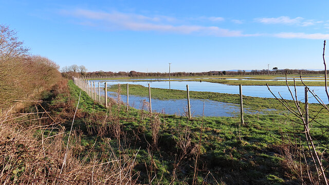
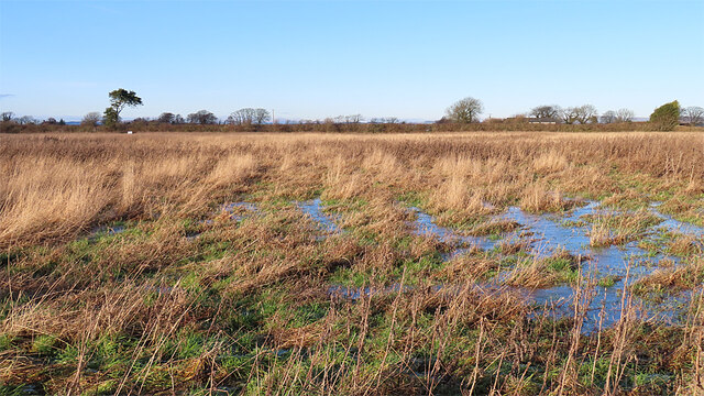
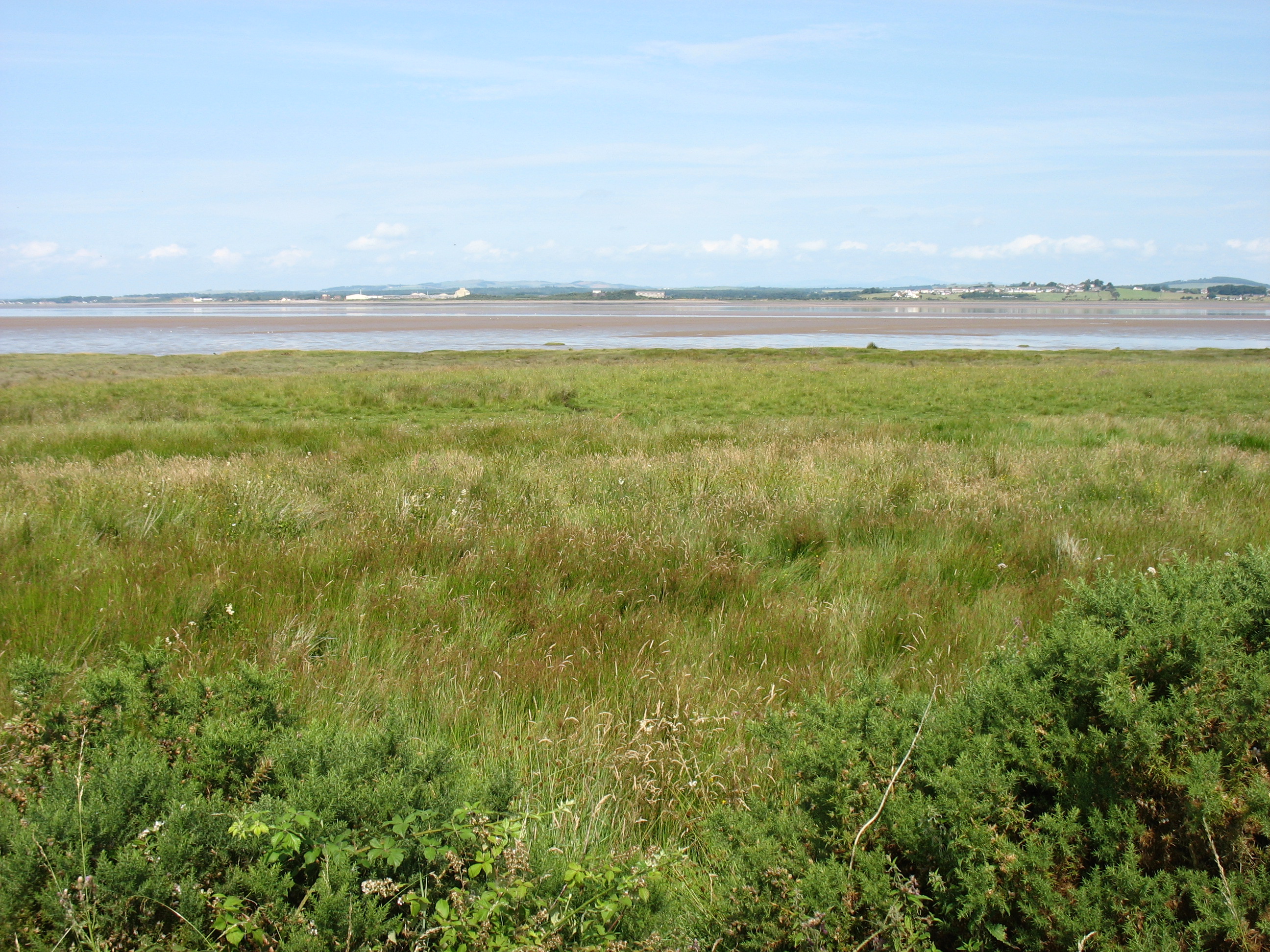
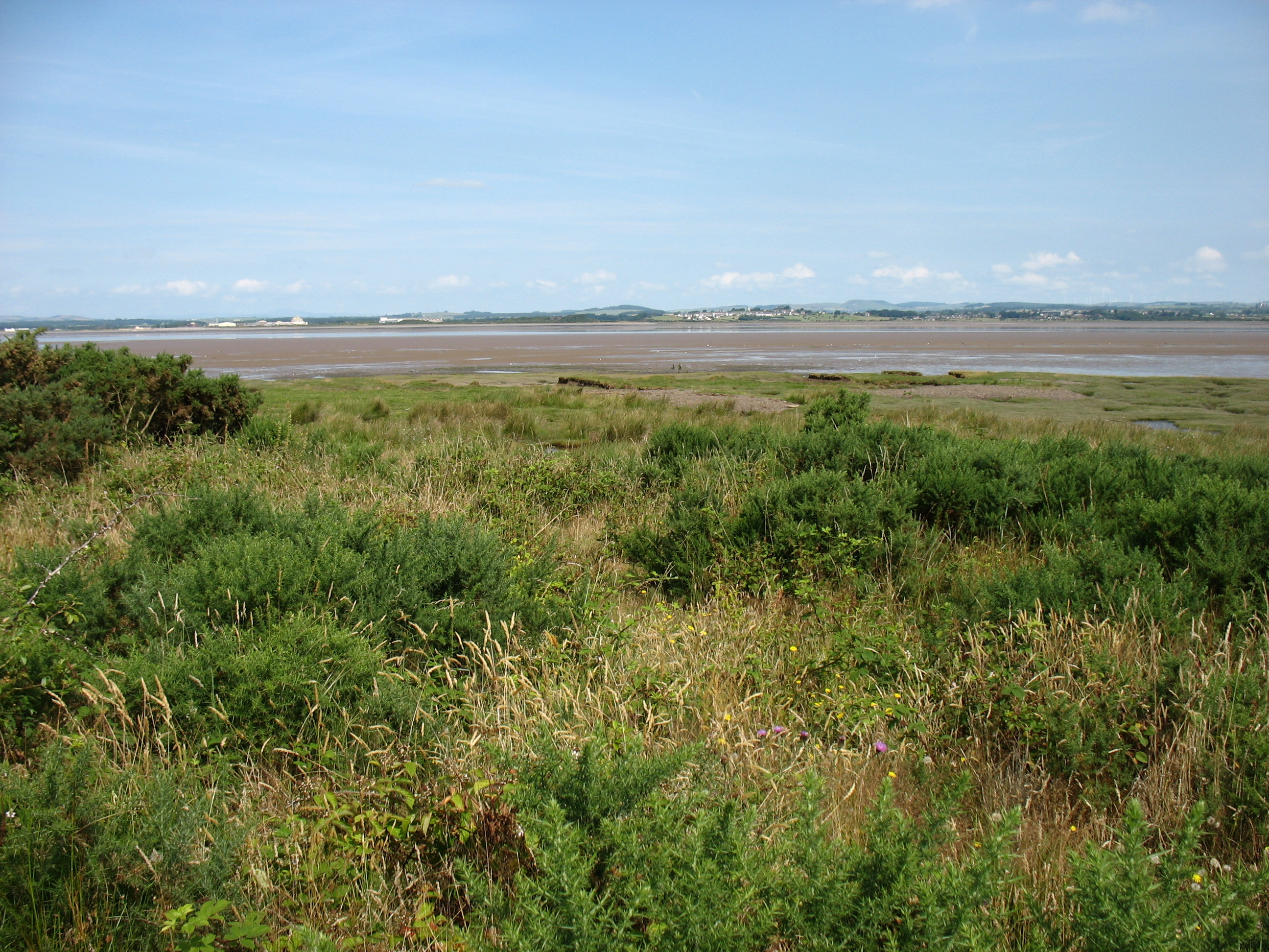
Bowness Common, located in Cumberland, England, is a vast expanse of picturesque downs and moorland that spans over a considerable area. The common is renowned for its natural beauty, captivating visitors with its diverse landscapes and unique flora and fauna.

Covering an extensive area, Bowness Common offers a variety of terrains, ranging from rolling downs to undulating moorland. The downs provide a scenic view, featuring gently sloping hills covered in lush green grass and dotted with wildflowers during the warmer months. These grassy areas are ideal for leisurely walks and picnics, offering visitors the chance to immerse themselves in the tranquility of the surroundings.

The moorland section of Bowness Common is characterized by its rugged and untamed beauty. Here, visitors can explore the vast expanses of heather-covered moors, which transform into a stunning purple carpet during late summer. The moorland is also home to a variety of wildlife, including rare bird species such as curlews and lapwings, making it a haven for birdwatchers and nature enthusiasts.

Bowness Common is a protected area, managed by conservation organizations to preserve its natural heritage. It provides a haven for a wide range of plant and animal species, including the bilberry, a small edible fruit that grows abundantly in the area. The common is also home to several species of reptiles, such as the common lizard and adder, adding to its ecological significance.

With its breathtaking landscapes and rich biodiversity, Bowness Common offers visitors a unique opportunity to connect with nature and experience the beauty of the English countryside. Whether it's a leisurely stroll across the downs or an adventurous hike through the moorland, this enchanting common is sure to leave visitors with lasting memories of its natural splendor.

If you have any feedback on the listing, please let us know in the comments section below.

Bowness Common Images

Images are sourced within 2km of 54.930346/-3.2263045 or Grid Reference NY2160. Thanks to Geograph Open Source API. All images are credited.

Campfield Marsh Boardwalk Campfield Marsh, on the shores of the Solway Firth, is a natural mosaic of saltmarsh, peatbogs, farmland and wet grassland. This rich area provides homes for a variety of native wildlife, including ducks and geese in the winter and breeding waders, dragonflies and peat bog plants in spring and summer.
Campfield Marsh Boardwalk
Campfield Marsh, on the shores of the Solway Firth, is a natural mosaic of saltmarsh, peatbogs, farmland and wet grassland. This rich area provides homes for a variety of native wildlife, including ducks and geese in the winter and breeding waders, dragonflies and peat bog plants in spring and summer.
Campfield Nature Reserve One of several areas of wetland, each surrounded by a stout fence to exclude predators.
Campfield Nature Reserve
One of several areas of wetland, each surrounded by a stout fence to exclude predators.
Campfield Nature Reserve The view of some of the ponds at the Royal Society for the Protections of Birds reserve from the large hide. This is the only hide that is weatherproof and where you can sit down while watching the birds. However the view is against the light and most of the water is obscured by rushes.
Campfield Nature Reserve
The view of some of the ponds at the Royal Society for the Protections of Birds reserve from the large hide. This is the only hide that is weatherproof and where you can sit down while watching the birds. However the view is against the light and most of the water is obscured by rushes.
Frozen Pond The long pond follows the line of one of the waymarked paths arpund the Campfield Nature Reserve.
Frozen Pond
The long pond follows the line of one of the waymarked paths arpund the Campfield Nature Reserve.
Red Route There are a red and a blue waymarked route around the Campfield Nature Reserve. This is part of the red route.
Red Route
There are a red and a blue waymarked route around the Campfield Nature Reserve. This is part of the red route.
Campfield Nature Reserve The waymarked red route is the longest in the Royal Society for the Protections of Birds reserve at Campfield. It branches off at the main hide, which is in the background in this view. Today you needed waterproof footwear for the red routes as parts of it were inundated and frozen. The fence is electrified to exclude predators.
Campfield Nature Reserve
The waymarked red route is the longest in the Royal Society for the Protections of Birds reserve at Campfield. It branches off at the main hide, which is in the background in this view. Today you needed waterproof footwear for the red routes as parts of it were inundated and frozen. The fence is electrified to exclude predators.
Path in the Nature Reserve This path is part of both the (shorter) blue and the (longer) red waymarked routes in Campfield Nature Reserve.
Path in the Nature Reserve
This path is part of both the (shorter) blue and the (longer) red waymarked routes in Campfield Nature Reserve.
Build-a-Den One of the features beside the blue and red waymarked routes in Campfield Nature Reserve.
Build-a-Den
One of the features beside the blue and red waymarked routes in Campfield Nature Reserve.
Campfield Nature Reserve A section of the waymarked paths round the reserve.
Campfield Nature Reserve
A section of the waymarked paths round the reserve.
Boggy Ground This wet area has a fine swathe of assorted grasses and Creeping Thistles which provide seed for small birds.
Boggy Ground
This wet area has a fine swathe of assorted grasses and Creeping Thistles which provide seed for small birds.
Field Entrance This field on the Royal Society for the Protection of Birds Campfield Nature Reserve is full of plants that provide seeds for small birds to feed on.
Field Entrance
This field on the Royal Society for the Protection of Birds Campfield Nature Reserve is full of plants that provide seeds for small birds to feed on.
Dead Tree The tree has presumably been drowned by the water of the pond.
Dead Tree
The tree has presumably been drowned by the water of the pond.
Entering Longcroft
Entering Longcroft
A road leading to Rogersceugh
The road to Whitrigg
The track to Rogersceugh Farm A public footpath leading to Bowness-on-Solway follows this farm access track.
The track to Rogersceugh Farm
A public footpath leading to Bowness-on-Solway follows this farm access track.
Track near Whitrigg
Track near Whitrigg
Lane north of Millrigg Farm
Show me another place!

Bowness Common is located at Grid Ref: NY2160 (Lat: 54.930346, Lng: -3.2263045)

Administrative County: Cumbria

District: Allerdale

Police Authority: Cumbria

What 3 Words

///graver.evoke.gulped. Near Annan, Dumfries & Galloway

Nearby Locations

Bowness Bowness Common

Related Wikis

Milefortlet 1

Milefortlet 1 (Biglands House) was a milefortlet of the Roman Cumbrian Coast defences. These milefortlets and intervening stone watchtowers extended from...
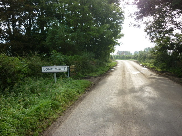
Longcroft, Cumbria

Longcroft is a small community in Cumbria, England, nestled in between Kirkbride and Anthorn. The village contains only five houses, one of which is Longcroft...

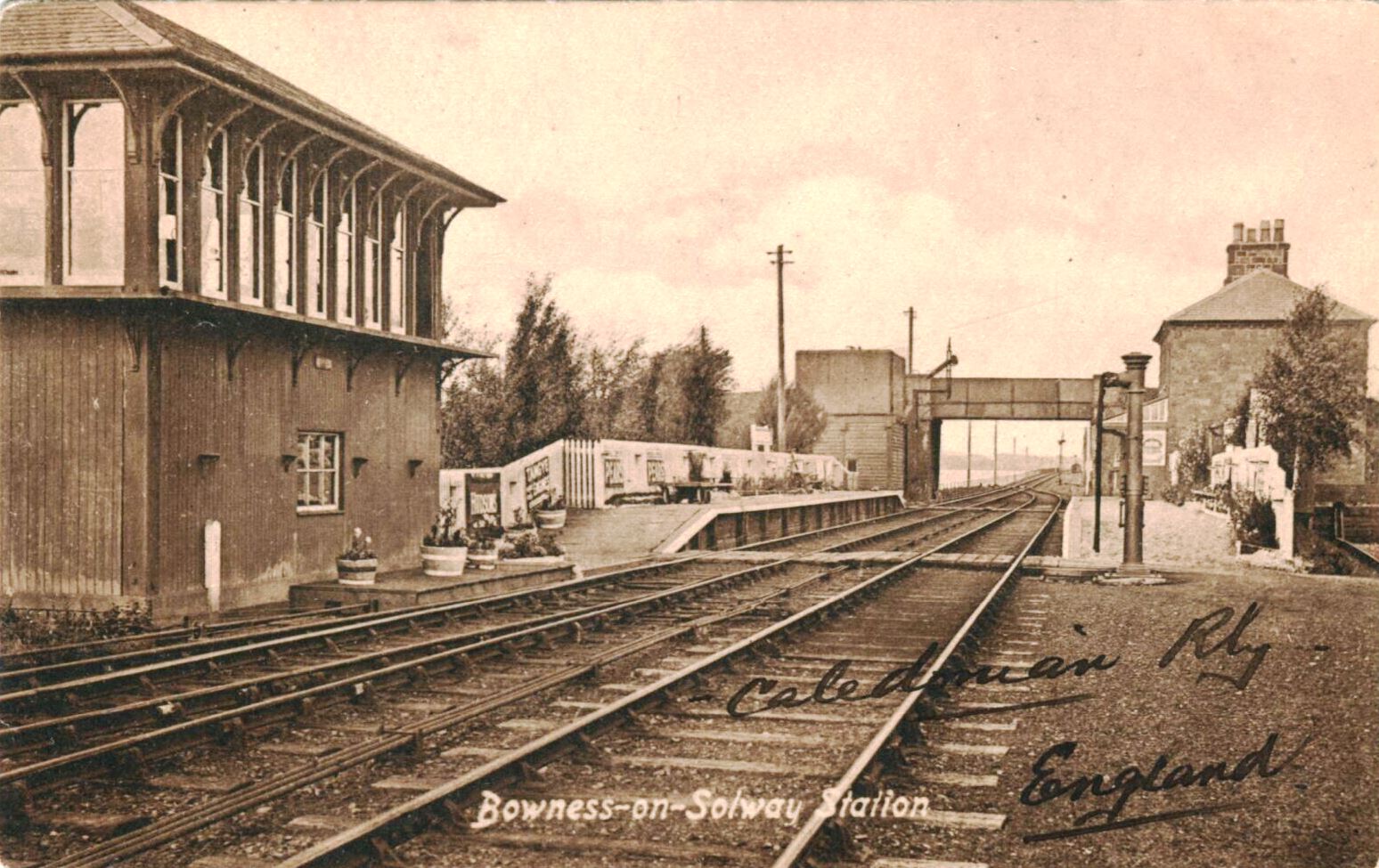
Bowness railway station

Bowness was a station which served Bowness-on-Solway, a village in Cumbria on the English side of the Solway Firth. The station opened on 8 August 1870...

Milefortlet 2

Milefortlet 2 was a Milefortlet of the Roman Cumbrian Coast defences. These milefortlets and intervening stone watchtowers extended from the western end...

Nearby Amenities

Located within 500m of 54.930346,-3.2263045
Rogersceugh
Place: locality
Lat/Long: 54.9269701/-3.2256037
Ford: yes
Lat/Long: 54.9285672/-3.2203289
Power: pole
Lat/Long: 54.9263846/-3.2253563
Power: pole
Lat/Long: 54.9259326/-3.2252596
The data included in this document is from www.openstreetmap.org. The data is made available under ODbL.

Have you been to Bowness Common?

Leave your review of Bowness Common below (or comments, questions and feedback).