Belsay Fields

Downs, Moorland in Cumberland Allerdale

England

Belsay Fields

Rough grazing on slope of Whittas Park Whittas Park is an area of roughly vegetated ground north-west from Binsey in the north-western Lake District. Binsey lies to the left side of the image with the Skiddaw group of mountains to the right.
Rough grazing on slope of Whittas Park Credit: Trevor Littlewood

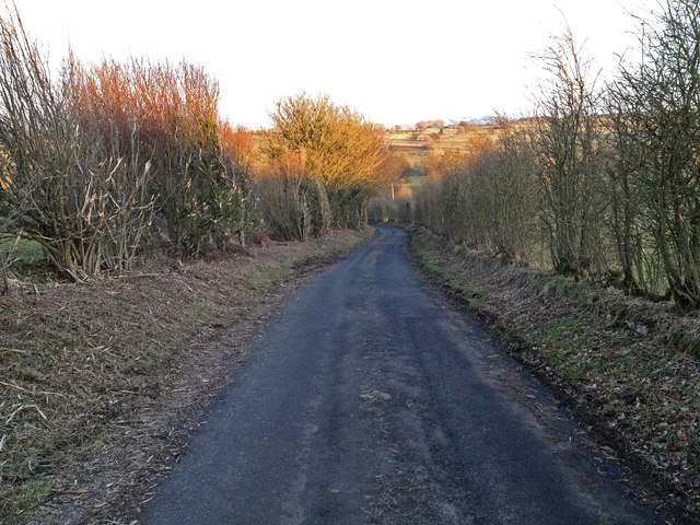
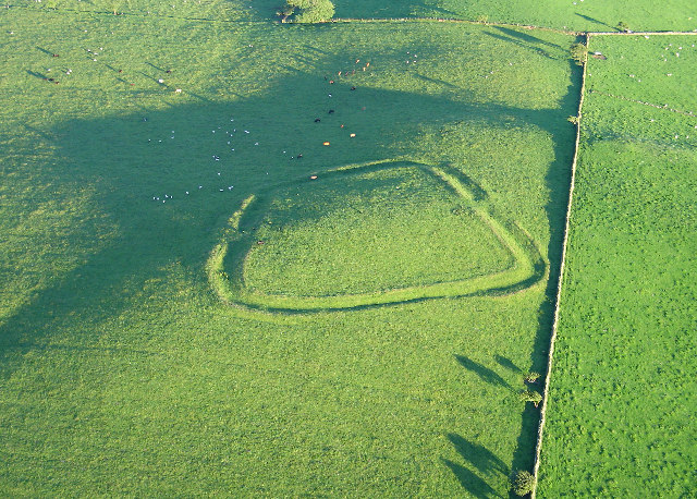
Belsay Fields, located in Cumberland, is a picturesque expanse of natural beauty encompassing downs, moorland, and rolling fields. Spread over a vast area, this landscape showcases the diverse and captivating scenery of the region. The fields are characterized by their undulating topography, with gentle slopes and occasional rocky outcrops, creating an enchanting visual spectacle.

The downs in Belsay Fields are defined by their wide, open spaces and are covered in lush grasses and wildflowers. This creates a vibrant and colorful carpet that changes with the seasons, offering a stunning display of nature's ever-changing palette. The downs are home to a variety of wildlife, including rabbits, squirrels, and an array of bird species, making it a haven for nature enthusiasts and birdwatchers.

Adjacent to the downs, the moorland in Belsay Fields adds a distinct ruggedness to the landscape. Here, heather-covered hills stretch as far as the eye can see, providing a striking contrast to the greenery of the downs. Moorland plants, such as bilberry and cotton grass, thrive in this environment, adding a touch of unique beauty to the area.

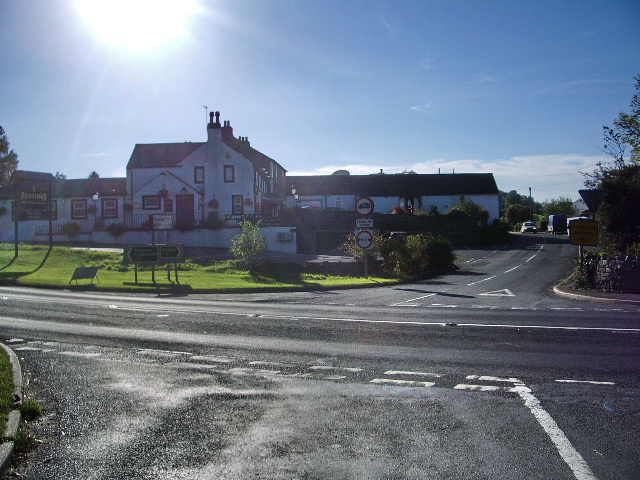
Belsay Fields invites visitors to explore its vast network of walking trails, allowing them to immerse themselves in the natural wonders of the countryside. The fields are also home to Belsay Hall, a stately home with magnificent gardens, adding historical charm to this already captivating setting.

Overall, Belsay Fields in Cumberland offers a harmonious blend of downs, moorland, and rolling fields, providing visitors with a captivating and diverse landscape to explore and enjoy.

If you have any feedback on the listing, please let us know in the comments section below.

Belsay Fields Images

Images are sourced within 2km of 54.722983/-3.2293816 or Grid Reference NY2037. Thanks to Geograph Open Source API. All images are credited.

Rough grazing on slope of Whittas Park Whittas Park is an area of roughly vegetated ground north-west from Binsey in the north-western Lake District. Binsey lies to the left side of the image with the Skiddaw group of mountains to the right.
Rough grazing on slope of Whittas Park
Whittas Park is an area of roughly vegetated ground north-west from Binsey in the north-western Lake District. Binsey lies to the left side of the image with the Skiddaw group of mountains to the right.
Farm lane near to Whitrigg The lane which is also initially a bridleway lies to the west of the small village of Whitrigg.
Farm lane near to Whitrigg
The lane which is also initially a bridleway lies to the west of the small village of Whitrigg.
Field with Binsey beyond The field lies on the west side of a minor road close to the low hill, Caer Mote.
Field with Binsey beyond
The field lies on the west side of a minor road close to the low hill, Caer Mote.
On Binsey Above Binsey's West Crag looking NW through early evening mist.
On Binsey
Above Binsey's West Crag looking NW through early evening mist.
Track to Binsey Binsey ahead.
Track to Binsey
Binsey ahead.
View of Bassenthwaite Lake Looking SSW.
View of Bassenthwaite Lake
Looking SSW.
Path descending Binsey
A farm track This track is a Right of Way and is one of the standard routes when climbing Binsey.
A farm track
This track is a Right of Way and is one of the standard routes when climbing Binsey.
West Crag, Binsey
West Crag, Binsey
The track to Binsey This track leaves the A591 near Bewaldeth and climbs gently to this gate. The hillside behind is all Access Land. There is a path, but it is not always very clear.
The track to Binsey
This track leaves the A591 near Bewaldeth and climbs gently to this gate. The hillside behind is all Access Land. There is a path, but it is not always very clear.
The track to Whitrigg
Bird House Farm
Bird House Farm
View from Binsey View from the top of Binsey
View from Binsey
View from the top of Binsey
Broken lane leading to High Ireby This lane is marked as unsuitable for vehicles at both ends.  It is no longer maintained as a road.  It is very interesting to see how rapidly nature reclaims a man made environment.  You can see it was once a fully adopted carriageway as there are drains with grids all along the edges.  It now has pot holes up to 6-7 inches deep and you would not be able to travel along it in a standard car.
Broken lane leading to High Ireby
This lane is marked as unsuitable for vehicles at both ends. It is no longer maintained as a road. It is very interesting to see how rapidly nature reclaims a man made environment. You can see it was once a fully adopted carriageway as there are drains with grids all along the edges. It now has pot holes up to 6-7 inches deep and you would not be able to travel along it in a standard car.
Footpath from Whitrigg to Torpenhow This path crosses various grazing fields and will bring you out near to Torpenhow.  The photo is taken from where the path joins the Whitrigg to Ireby road.
Footpath from Whitrigg to Torpenhow
This path crosses various grazing fields and will bring you out near to Torpenhow. The photo is taken from where the path joins the Whitrigg to Ireby road.
Road from Whitrigg to Snittlegarth or Ireby This is the single track lane from Whitrigg towards Ireby.
Road from Whitrigg to Snittlegarth or Ireby
This is the single track lane from Whitrigg towards Ireby.
View of the distant fells from the Whitrigg to Ireby road
Binsey from the Whitrigg Ireby Road Binsey is the main hill visible here.
Binsey from the Whitrigg Ireby Road
Binsey is the main hill visible here.
Show me another place!

Belsay Fields is located at Grid Ref: NY2037 (Lat: 54.722983, Lng: -3.2293816)

Administrative County: Cumbria

District: Allerdale

Police Authority: Cumbria

What 3 Words

///unguarded.panels.enacted. Near Aspatria, Cumbria

Nearby Locations

Belsay Fields

Related Wikis

Caer Mote

Caer Mote is a hill of 289 metres (948 ft) in the north of the English Lake District near Bothel, Cumbria. Its summit lies just outside the boundary of...

Binsey

Binsey is a hill on the northern edge of the Lake District in Cumbria, England. It is detached from the rest of the Lakeland hills, and thus provides a...

Bewaldeth and Snittlegarth

Bewaldeth and Snittlegarth is a civil parish in Cumbria, England, historically part of Cumberland. It lies north of Bassenthwaite Lake, in the Lake District...

Bothel, Cumbria

Bothel is a small village in Cumbria, England. Bothel was historically within Cumberland. == Location == It is situated just off the main A595 road, 18...

Ireby Old Church

Ireby Old Church is a redundant Anglican church, of which only the chancel remains. It stands in an isolated position 1 mile (2 km) to the west of the...

St Michael's Church, Torpenhow

St Michael's Church is in the civil parish of Blennerhasset and Torpenhow, Cumbria, England. It is an active Anglican church in the deanery of Derwent...

Bothel and Threapland

Bothel and Threapland is a civil parish in Cumbria, England, just outside the Lake District National Park. According to the 2001 census, it had a population...

Ireby and Uldale

Ireby and Uldale is a civil parish in the English county of Cumbria forming part of the district of Allerdale. The population, including Bewaldeth and...

Nearby Amenities

Located within 500m of 54.722983,-3.2293816
Belsay Fields
Place: locality
Lat/Long: 54.7234182/-3.2291612
The data included in this document is from www.openstreetmap.org. The data is made available under ODbL.

Have you been to Belsay Fields?

Leave your review of Belsay Fields below (or comments, questions and feedback).