Pointfaulds Moss

Downs, Moorland in Angus

Scotland

Pointfaulds Moss

V junction The right path leads up Mid Hill. The left path further into Glen Cally. The dog clearly wants to go where the deer are.
V junction Credit: Aleks Scholz

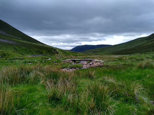
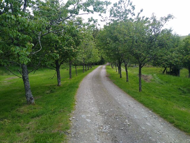
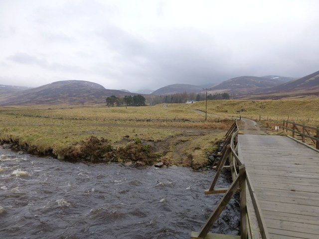
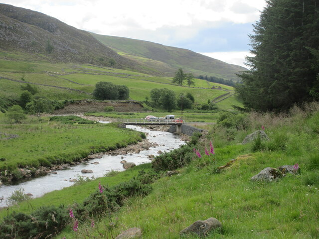
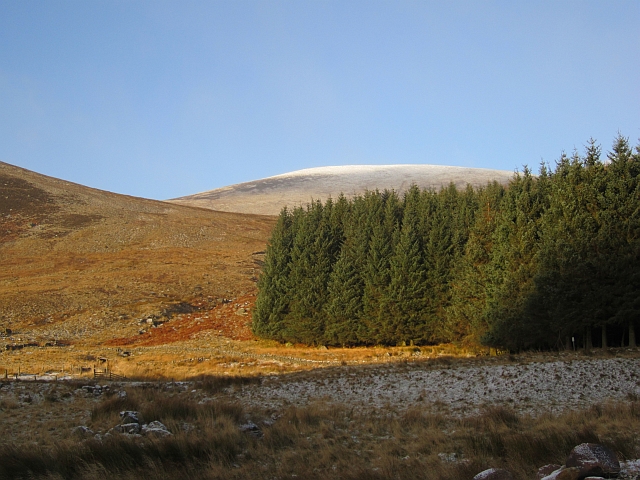
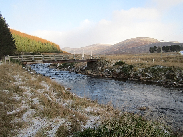
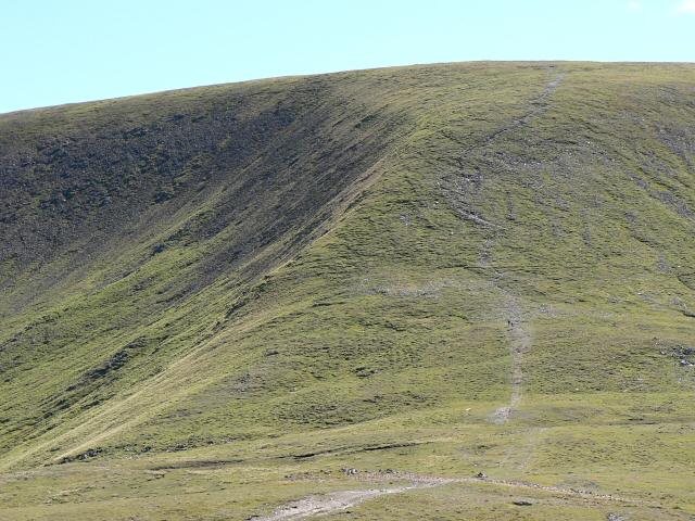
Pointfaulds Moss is a prominent feature located in Angus, Scotland. This expansive area of downs and moorland covers a vast expanse and is a significant part of the local landscape. The moss is situated within the heart of the Scottish countryside, providing a picturesque and tranquil setting for visitors.

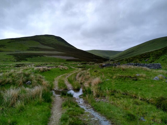
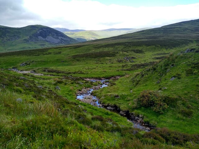
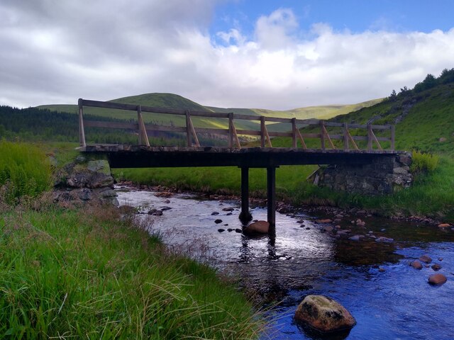
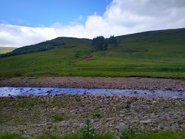
The moss is characterized by its unique ecosystem, with a diverse range of flora and fauna. The undulating terrain is covered with heather, mosses, and grasses, creating a rich and vibrant tapestry of colors throughout the year. This variety of plant life supports a wide array of wildlife, including birds, insects, and small mammals.

Pointfaulds Moss serves as an important habitat for several species of birds, such as curlews, lapwings, and red grouse, making it a popular destination for birdwatching enthusiasts. The moss is also home to various reptiles, amphibians, and insects, adding to its ecological significance.

Visitors to Pointfaulds Moss can enjoy a peaceful and immersive experience, exploring the network of walking trails that crisscross the area. These trails offer stunning views of the surrounding countryside and provide an opportunity to observe the local wildlife up close.

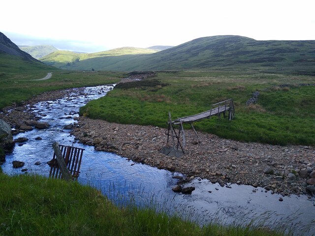
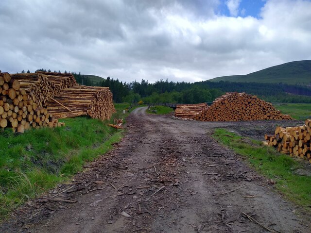
In addition to its natural beauty, Pointfaulds Moss holds historical and cultural significance. The moss has been used for centuries for grazing livestock and harvesting peat. This deep connection to the land is evident in the remnants of old peat-cutting sites that can still be found scattered throughout the moss.

Overall, Pointfaulds Moss is a captivating and diverse natural landscape that offers visitors a chance to reconnect with nature and experience the unique beauty of the Scottish countryside.

If you have any feedback on the listing, please let us know in the comments section below.

Pointfaulds Moss Images

Images are sourced within 2km of 56.830898/-3.3269446 or Grid Reference NO1971. Thanks to Geograph Open Source API. All images are credited.

V junction The right path leads up Mid Hill. The left path further into Glen Cally. The dog clearly wants to go where the deer are.
V junction
The right path leads up Mid Hill. The left path further into Glen Cally. The dog clearly wants to go where the deer are.
A look down Glen Cally The bridge crosses from one side of the stream to the other. Some ruined shielings are seen around that point.
A look down Glen Cally
The bridge crosses from one side of the stream to the other. Some ruined shielings are seen around that point.
Shielings in Glen Cally Some of the two-wheel tracks in this area actually develop quite nicely into beautiful paths. This one is a good example. Others will stay eyesores for many years.
Shielings in Glen Cally
Some of the two-wheel tracks in this area actually develop quite nicely into beautiful paths. This one is a good example. Others will stay eyesores for many years.
Beautiful burns The point where Glencally burn merges with Altvraigy burn.
Beautiful burns
The point where Glencally burn merges with Altvraigy burn.
Broken bridge My contribution to document the state of the footbridge across the Isla. It was marginally intact in 2005 (<a href="https://www.geograph.org.uk/photo/470685">NO1970 : Old footbridge over the River Isla,Dalhally</a>), intact in 2006 (<a href="https://www.geograph.org.uk/photo/165798">NO1970 : Footbridge in Glen Isla</a>), intact but decayed in 2008 (<a href="https://www.geograph.org.uk/photo/1055092">NO1970 : Footbridge in Glen Isla</a> and <a href="https://www.geograph.org.uk/photo/896581">NO1970 : Dilapidated bridge over the Isla</a>), intact but rickety in 2009 (<a href="https://www.geograph.org.uk/photo/1583619">NO1970 : Rickety Bridge</a>), still intact, but wobbly in 2012 (<a href="https://www.geograph.org.uk/photo/3105373">NO1970 : Rickety Footbridge over River Isla near Linns</a>), broken in 2020 (<a href="https://www.geograph.org.uk/photo/6803778">NO1970 : Broken bridge over the Isla</a> and <a href="https://www.geograph.org.uk/photo/6578813">NO1970 : Ruined bridge, Glen Isla</a>), and apparently still broken in 2022. The big question is of course what happened between 2012 and 2020.
Broken bridge
My contribution to document the state of the footbridge across the Isla. It was marginally intact in 2005 (NO1970 : Old footbridge over the River Isla,Dalhally), intact in 2006 (NO1970 : Footbridge in Glen Isla), intact but decayed in 2008 (NO1970 : Footbridge in Glen Isla and NO1970 : Dilapidated bridge over the Isla), intact but rickety in 2009 (NO1970 : Rickety Bridge), still intact, but wobbly in 2012 (NO1970 : Rickety Footbridge over River Isla near Linns), broken in 2020 (NO1970 : Broken bridge over the Isla and NO1970 : Ruined bridge, Glen Isla), and apparently still broken in 2022. The big question is of course what happened between 2012 and 2020.
Tree-lined path to Tulchan Lodge This is a beautiful, but private driveway that only leads to the lodge. I turned around soon after that point.
Tree-lined path to Tulchan Lodge
This is a beautiful, but private driveway that only leads to the lodge. I turned around soon after that point.
Track through timber stacks Entire tree plantations have disappeared compared to previous years in the upper parts of Glen Isla, either the trees were large enough to be harvested, or they have suffered during the storms in winter 2021-22.
Track through timber stacks
Entire tree plantations have disappeared compared to previous years in the upper parts of Glen Isla, either the trees were large enough to be harvested, or they have suffered during the storms in winter 2021-22.
Another bridge across the River Isla In the background parts of the Monega-Glas Maol ridge.
Another bridge across the River Isla
In the background parts of the Monega-Glas Maol ridge.
Across River Isla The Wester Latch burn with some old trees on the other side.
Across River Isla
The Wester Latch burn with some old trees on the other side.
Hill track above Auchavan
Track to Dalhally From the bridge at Auchavan.
The bridge has suffered, possibly from a vehicle sliding on ice?
The River Isla is in spate.
Track to Dalhally
From the bridge at Auchavan. The bridge has suffered, possibly from a vehicle sliding on ice? The River Isla is in spate.
Bridge over the River Isla Bridge crossing the River Isla near Auchavan, viewed from the north.
Bridge over the River Isla
Bridge crossing the River Isla near Auchavan, viewed from the north.
Woodland, Glen Isla A small conifer block near Auchavan, the hill is Monameanach.
Woodland, Glen Isla
A small conifer block near Auchavan, the hill is Monameanach.
Bridge at Auchavan The bridge carries a road to Dalhally.
Bridge at Auchavan
The bridge carries a road to Dalhally.
The River Isla after heavy rain Dalhally, in its shelter belt beside Glencally Burn, beyond the river.
The River Isla after heavy rain
Dalhally, in its shelter belt beside Glencally Burn, beyond the river.
'Piece time' in Upper Glen Isla
Summit slopes of Monamenach Looking into the head of Glen Isla.
Summit slopes of Monamenach
Looking into the head of Glen Isla.
Summit of Monamenach Cairn on the summit of the Corbett. The scree covered slopes of Creag Leacach can be seen in the distance.
Summit of Monamenach
Cairn on the summit of the Corbett. The scree covered slopes of Creag Leacach can be seen in the distance.
Show me another place!

Pointfaulds Moss is located at Grid Ref: NO1971 (Lat: 56.830898, Lng: -3.3269446)

Unitary Authority: Angus

Police Authority: Tayside

What 3 Words

///feasting.calibrate.attitudes. Near Inverey, Aberdeenshire

Nearby Locations

Pointfaulds Moss

Related Wikis

Loch Beanie

Loch Beanie also known as Loch Shechernich, is a small shallow freshwater loch that is located in Glen Shee in Perth and Kinross, Scotland. == Island... ==

Glas Maol

Glas Maol (Scottish Gaelic: A' Ghlas-Mheall) is a mountain in the Mounth, in the southeastern part of the Highlands of Scotland. The broad, flat summit...

Mayar (mountain)

Mayar is a mountain in the Grampians, in Angus, Scotland. It is usually climbed together with its near neighbour, Driesh. At an elevation of 928 m, it...

Caenlochan

Caenlochan (Scottish Gaelic: Cadha an Lochain) is a glen in the Grampian Mountains of Scotland. Under EU Natura 2000 legislation it is a Special Area of...

Nearby Amenities

Located within 500m of 56.830898,-3.3269446
Ford: yes
Lat/Long: 56.8347244/-3.3312427
Power: pole
Lat/Long: 56.8269391/-3.3255145
Power: pole
Lat/Long: 56.8276631/-3.3258908
Power: pole
Lat/Long: 56.8282545/-3.3262091
Power: pole
Lat/Long: 56.828961/-3.3265754
Power: pole
Lat/Long: 56.8295699/-3.3268977
Power: pole
Lat/Long: 56.8302501/-3.327256
Power: pole
Lat/Long: 56.8309072/-3.3275923
Power: pole
Lat/Long: 56.8315457/-3.3279366
Power: pole
Lat/Long: 56.832102/-3.3282329
Power: pole
Lat/Long: 56.8328609/-3.3286372
Power: pole
Lat/Long: 56.8333789/-3.329558
Power: pole
Lat/Long: 56.8338674/-3.3304468
Power: pole
Lat/Long: 56.8343722/-3.3313496
The data included in this document is from www.openstreetmap.org. The data is made available under ODbL.

Have you been to Pointfaulds Moss?

Leave your review of Pointfaulds Moss below (or comments, questions and feedback).