Hesk Fell

Downs, Moorland in Cumberland Copeland

England

Hesk Fell

Sheepfold Camp The disused sheepfold provides added shelter for the wild camper.
Sheepfold Camp Credit: Charles Leventon

Hesk Fell is a prominent peak located in the county of Cumberland, in the North West of England. Situated within the Lake District National Park, this elevated landform is part of the larger Coniston Fells range. Hesk Fell stands at an impressive height of 477 meters (1,565 feet), offering breathtaking views of the surrounding area.

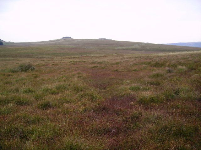
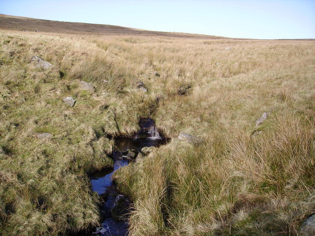
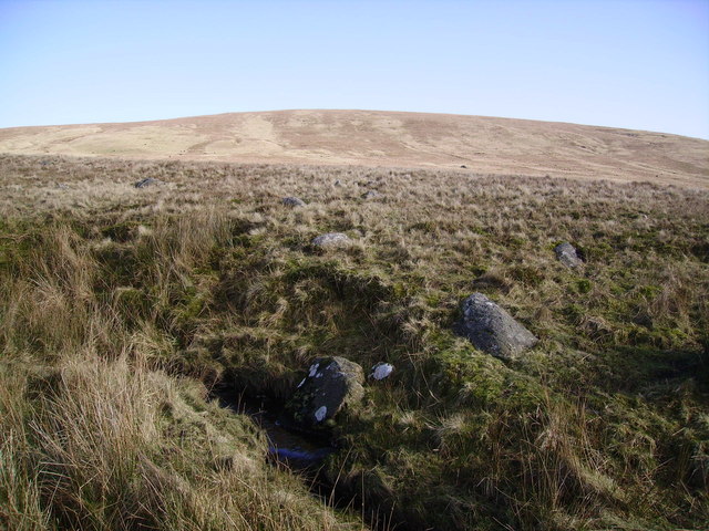
The landscape of Hesk Fell is characterized by its rolling hills, lush green meadows, and scattered rocky outcrops. The terrain is a mixture of heather moorland, providing a diverse habitat for various plant and animal species. Visitors can expect to encounter an array of wildlife, including birds such as curlews, skylarks, and buzzards, as well as native mammals like red deer and mountain hares.

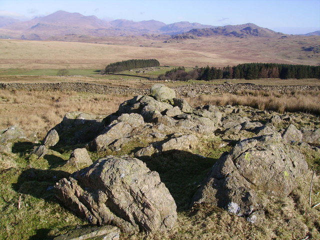
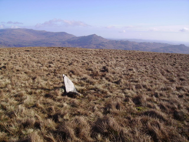
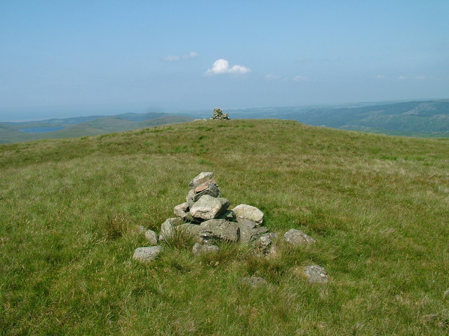
The ascent to the summit of Hesk Fell is relatively moderate, making it an accessible destination for hikers of varying abilities. Once at the top, hikers are rewarded with panoramic vistas of the nearby Coniston Water, the Irish Sea, and the iconic peaks of the Lake District, such as the Old Man of Coniston and Scafell Pike.

Hesk Fell offers a tranquil and unspoiled environment, attracting nature enthusiasts, photographers, and outdoor adventurers alike. Its remote location ensures a peaceful and serene experience, away from the hustle and bustle of urban life. Whether for a leisurely walk or a challenging hike, Hesk Fell provides an opportunity to immerse oneself in the natural beauty and rugged charm of the Cumberland countryside.

If you have any feedback on the listing, please let us know in the comments section below.

Hesk Fell Images

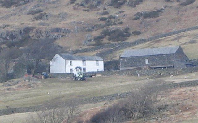
Images are sourced within 2km of 54.343511/-3.2693609 or Grid Reference SD1794. Thanks to Geograph Open Source API. All images are credited.

Sheepfold Camp The disused sheepfold provides added shelter for the wild camper.
Sheepfold Camp
The disused sheepfold provides added shelter for the wild camper.
Crosbythwaite Farm. Big sheep gathering day when this one was taken.
Crosbythwaite Farm.
Big sheep gathering day when this one was taken.
Pike Side Farm
Pike Side Farm
Stephensons Wood. As viewed from the Crosbythwaite sheep pens.
Stephensons Wood.
As viewed from the Crosbythwaite sheep pens.
Bridleway To Holehouse from the Birker fell Road. Hesk Fell in view.
Bridleway
To Holehouse from the Birker fell Road. Hesk Fell in view.
Sike Moss Birker Fell Needless to say very wet. Looking towards the Scafells.
Sike Moss Birker Fell
Needless to say very wet. Looking towards the Scafells.
Sike Moss The boggy vegetation starting to show a red tinge. Bog Myrtle widespread here.
Sike Moss
The boggy vegetation starting to show a red tinge. Bog Myrtle widespread here.
Wall Ulpha The ancient wall crosses the Birker Fell road at Winds Gate. Extensive flanks of Hesk Fell in view.
Wall Ulpha
The ancient wall crosses the Birker Fell road at Winds Gate. Extensive flanks of Hesk Fell in view.
On Ulpha Fell The wall encloses the farmland around Woodend Farm.
On Ulpha Fell
The wall encloses the farmland around Woodend Farm.
Wall, Ulpha Fell On the ascent of the grassy Hesk Fell. Scafell on the skyline.
Wall, Ulpha Fell
On the ascent of the grassy Hesk Fell. Scafell on the skyline.
Cairn , Hesk Fell All is grass on Hesk Fell's summit dome.The Cairn consists of three stones carried up by someone. Anywhere in a 100 yard radius could be the top. Heaton Cooper states that Hesk Fell is from 'Hest Fell, Fell of the Ponies.' Caw on the skyline.
Cairn , Hesk Fell
All is grass on Hesk Fell's summit dome.The Cairn consists of three stones carried up by someone. Anywhere in a 100 yard radius could be the top. Heaton Cooper states that Hesk Fell is from 'Hest Fell, Fell of the Ponies.' Caw on the skyline.
Storthes Gill In the dip between Hesk Fell and Whitfell
Storthes Gill
In the dip between Hesk Fell and Whitfell
Storthes A boggy dip between Hesk Fell and Whitfell. Several small becks and Storthes Gill eventually meet together in the square to become Holehouse Gill a tributary of the Duddon.Looking up at Hesk Fell.
Storthes
A boggy dip between Hesk Fell and Whitfell. Several small becks and Storthes Gill eventually meet together in the square to become Holehouse Gill a tributary of the Duddon.Looking up at Hesk Fell.
Summit Cairn, Yoadcastle Yoadcastle's top is craggy and a great viewpoint in all directions on the quiet fells above Devoke Water. Hesk Fell in mid shot.
Summit Cairn, Yoadcastle
Yoadcastle's top is craggy and a great viewpoint in all directions on the quiet fells above Devoke Water. Hesk Fell in mid shot.
Yoadcastle The bristly top of this small fell.
Yoadcastle
The bristly top of this small fell.
Yoadcastle The craggy south face of Yoadcastle 1610'
Yoadcastle
The craggy south face of Yoadcastle 1610'
Great Gill, Cockley Moss The eastern gridline of the square appears to be almost exactly where the Gill passes through the wall.
Great Gill, Cockley Moss
The eastern gridline of the square appears to be almost exactly where the Gill passes through the wall.
Cockley Moss Looking towards Devoke Water
Cockley Moss
Looking towards Devoke Water
Show me another place!

Hesk Fell is located at Grid Ref: SD1794 (Lat: 54.343511, Lng: -3.2693609)

Administrative County: Cumbria

District: Copeland

Police Authority: Cumbria

What 3 Words

///shelving.animal.calculate. Near Millom, Cumbria

Nearby Locations

Hesk Fell Hesk Fell

Related Wikis

Hesk Fell

Hesk Fell is a hill in the south-west of the English Lake District, between the Duddon Valley and Eskdale near Ulpha, Cumbria. It is the subject of a chapter...

Woodend, Ulpha

Woodend is situated between the Duddon Valley and the village of Ulpha and the valley of Eskdale, high up on Birker Fell, approximately 950 feet above...

Stainton Pike

Stainton Pike is a hill in the English Lake District, near Waberthwaite, Cumbria. It is the subject of a chapter of Wainwright's book The Outlying Fells...

Great Worm Crag

Great Worm Crag is a hill in south west of the English Lake District, north of Ulpha, Cumbria. It is the subject of a chapter of Wainwright's book The...

Nearby Amenities

Located within 500m of 54.343511,-3.2693609
Hesk Fell
Ele: 477
Natural: peak
Wikidata: Q5745672
Lat/Long: 54.3409241/-3.2687983
The data included in this document is from www.openstreetmap.org. The data is made available under ODbL.

Have you been to Hesk Fell?

Leave your review of Hesk Fell below (or comments, questions and feedback).