Broad Moss

Downs, Moorland in Peeblesshire

Scotland

Broad Moss

Trig Point on Pykestone Hill
Trig Point on Pykestone Hill Credit: Colin Park

Broad Moss is a picturesque area located in Peeblesshire, Scotland. It is characterized by its rolling downs and expansive moorland, offering visitors breathtaking views and a serene atmosphere. The landscape is predominantly covered in heather and grasses, creating a vibrant tapestry of colors throughout the seasons.

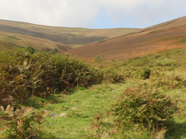
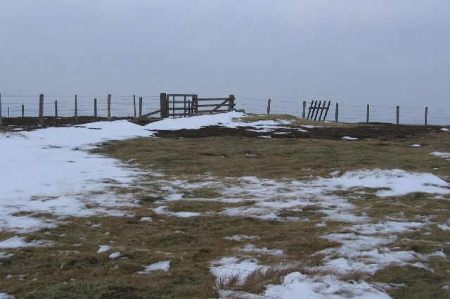
The downs in Broad Moss are gently sloping hills that provide ideal grazing land for livestock. They are often dotted with sheep, adding to the rural charm of the area. The downs offer visitors ample opportunity for leisurely walks, with well-maintained paths offering easy access to the stunning vistas.

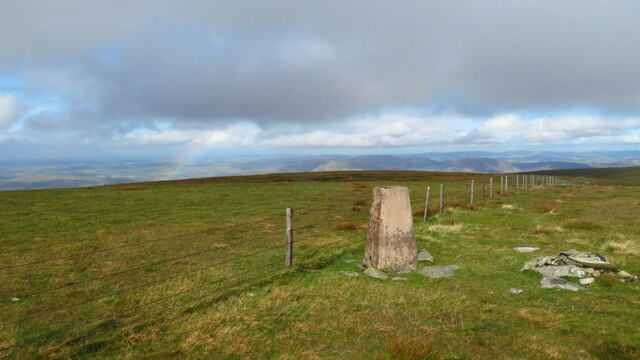
The moorland in Broad Moss is a vast expanse of open land, characterized by its heather-clad hills and peat bogs. The moorland is home to a variety of wildlife, including birds, small mammals, and insects. It is a haven for birdwatchers, with species such as curlews, grouse, and buzzards frequently spotted in the area.

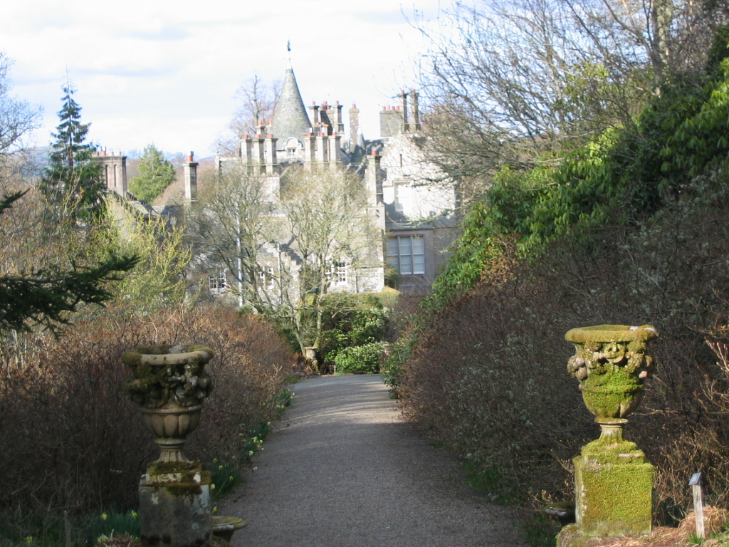
Broad Moss is also home to several historic sites, adding to its cultural significance. The ruins of Broad Moss Castle, a 16th-century fortress, stand as a testament to the area's rich history and offer a glimpse into its past.

Overall, Broad Moss is a haven for nature lovers and history enthusiasts alike. Its downs and moorland provide a stunning backdrop for outdoor activities, while its historical sites add depth and intrigue to the area. Whether exploring the landscape or immersing oneself in the local history, Broad Moss offers a truly enchanting experience.

If you have any feedback on the listing, please let us know in the comments section below.

Broad Moss Images

Images are sourced within 2km of 55.57343/-3.3129976 or Grid Reference NT1731. Thanks to Geograph Open Source API. All images are credited.

Trig Point on Pykestone Hill
Den Knowes Head High up on the northern slopes of Pykestone Hill with fine views of from left Drumelzier Law, Culter Fell, Chapelgill Hill and Tinto. A grand day out in the Borders with a nice breeze to cool off.
Den Knowes Head
High up on the northern slopes of Pykestone Hill with fine views of from left Drumelzier Law, Culter Fell, Chapelgill Hill and Tinto. A grand day out in the Borders with a nice breeze to cool off.
Head of Kirkhope Between Pikestone Hill and Grey Wether Law.
Head of Kirkhope
Between Pikestone Hill and Grey Wether Law.
Cairn on Kirkhope Rig View down Kirk Hope and the Manor.
Cairn on Kirkhope Rig
View down Kirk Hope and the Manor.
On Kirkhope Rig Views of the Manor Valley open up from the ridge, though the path marked is indistinct and the ground rough in places.
On Kirkhope Rig
Views of the Manor Valley open up from the ridge, though the path marked is indistinct and the ground rough in places.
Cairn on Kirkhope Rig The cairn is situated near the now indistinct zigzags on the path up from Kirkhope. The buildings at Langhaugh are in view above centre.
Cairn on Kirkhope Rig
The cairn is situated near the now indistinct zigzags on the path up from Kirkhope. The buildings at Langhaugh are in view above centre.
Cairn on Kirkhope Rig A zigzag path climbs the ridge nearby, so this cairn was possibly a landmark on the otherwise featureless heather slope.
Cairn on Kirkhope Rig
A zigzag path climbs the ridge nearby, so this cairn was possibly a landmark on the otherwise featureless heather slope.
Moorland, Grey Weather Law Wind stunted heather at 700m above sea level. The view is over the Manor Valley towards Blackhouse Heights.
Moorland, Grey Weather Law
Wind stunted heather at 700m above sea level. The view is over the Manor Valley towards Blackhouse Heights.
Cairn on Grey Weather Law Looking north-east from the slope of Grey Weather Law towards the Manor Valley.
Cairn on Grey Weather Law
Looking north-east from the slope of Grey Weather Law towards the Manor Valley.
Kirkhope and the Manor Valley The long dry ridge running over Pikethaw and Dollar Law is an obvious route for travel, wide open views, nowhere for evildoers to hide, yet the name given to this ancient ridgeway is the Thieves Road. Perhaps once English cattle were driven this way - or Scottish cattle the other way? 
The picture shows the eastern drop off from the ridge/plateau down to the Manor Water via the side glen of Kirkhope.  There is a good path (shown by Harveys and on the 1:25:000 Ordnance Survey map) down to Kirkhope from here.
Kirkhope and the Manor Valley
The long dry ridge running over Pikethaw and Dollar Law is an obvious route for travel, wide open views, nowhere for evildoers to hide, yet the name given to this ancient ridgeway is the Thieves Road. Perhaps once English cattle were driven this way - or Scottish cattle the other way? The picture shows the eastern drop off from the ridge/plateau down to the Manor Water via the side glen of Kirkhope. There is a good path (shown by Harveys and on the 1:25:000 Ordnance Survey map) down to Kirkhope from here.
Summit of Pykestone Hill The highest part of the northern end of the Thieves Road at 737m, Pykestone Hill continues the theme of dry crisp upland heath and easy progress. The photo was taken during the afternoon, and by now the sun had seen off the overnight snowfall. Given good cover these hills are ideal for ski touring.  The background hill is Drumelzier Law.
Summit of Pykestone Hill
The highest part of the northern end of the Thieves Road at 737m, Pykestone Hill continues the theme of dry crisp upland heath and easy progress. The photo was taken during the afternoon, and by now the sun had seen off the overnight snowfall. Given good cover these hills are ideal for ski touring. The background hill is Drumelzier Law.
The Scrape Borders hills often have interesting names.  Here is a typical Southern Upland top: Flat, ill defined and marked by a fence junction. There is often a hurdle to facilitate swapping stray sheep over.
The Scrape
Borders hills often have interesting names. Here is a typical Southern Upland top: Flat, ill defined and marked by a fence junction. There is often a hurdle to facilitate swapping stray sheep over.
Track on Den Knowes The track leads to Pykestone Hill
Track on Den Knowes
The track leads to Pykestone Hill
Den Knowes Head The track to Pykstone Hill across the plateau
Den Knowes Head
The track to Pykstone Hill across the plateau
Scrape Burn
Scrape Burn
Scawd Law top
Scawd Law top
Northey Knowe The east ridge of Pykestone Hill
Northey Knowe
The east ridge of Pykestone Hill
Berry Burn
Berry Burn
Show me another place!

Broad Moss is located at Grid Ref: NT1731 (Lat: 55.57343, Lng: -3.3129976)

Unitary Authority: The Scottish Borders

Police Authority: The Lothians and Scottish Borders

What 3 Words

///estuaries.fewest.shimmered. Near Peebles, Scottish Borders

Nearby Locations

Pykestone Hill Broad Moss

Related Wikis

Posso Tower

Posso Tower is a 16th-century tower house, about 6.0 miles (9.7 km) south and west of Peebles, Scottish Borders, Scotland, and west of Manor Water. �...

Dawyck Chapel

Dawyck Chapel, also known as Dalwick Church, is located (NGR NT 16798 34933) within the Parish of Drumelzier in the Scottish Borders area of Scotland....

Dawyck Botanic Garden

Dawyck Botanic Garden is a botanic garden and arboretum covering 25 hectares (62 acres) at Stobo on the B712, 8 miles (13 kilometres) south of Peebles...

Dawyck House

Dawyck House is a historic house at Dawyck, in the parish of Drumelzier in the former Peeblesshire, in the Scottish Borders area of Scotland. The alternative...

Bellspool

Bellspool is a village in the Scottish Borders area of Scotland, near to Drumelzier, Hopcarton and Kingledoors == See also == List of places in the Scottish...

Stobo railway station

Stobo railway station was a railway station in the Borders east of Biggar, serving the hamlet of Stobo; a rural community within the Parish of Stobo....

Drumelzier

Drumelzier (), is a village and civil parish on the B712 in the Tweed Valley in the Scottish Borders. The area of the village is extensive and includes...

Upper Tweeddale National Scenic Area

The Upper Tweeddale National Scenic Area lies in the Borders region of Scotland. It is one of 40 national scenic areas (NSA) in Scotland, which are defined...

Have you been to Broad Moss?

Leave your review of Broad Moss below (or comments, questions and feedback).