Brae of Mause

Downs, Moorland in Perthshire

Scotland

Brae of Mause

Field in the sun Field dotted with sheep in the early morning sunshine, looking north-westwards from the Bonnington Road
Field in the sun Credit: Scott Cormie

The requested URL returned error: 429 Too Many Requests

If you have any feedback on the listing, please let us know in the comments section below.

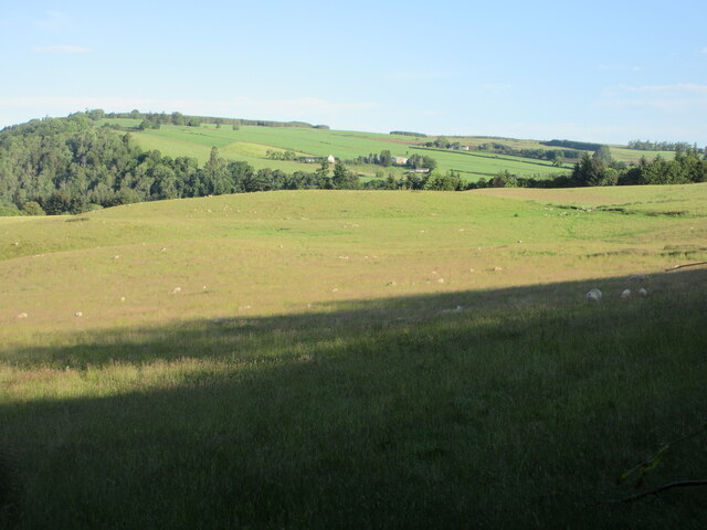
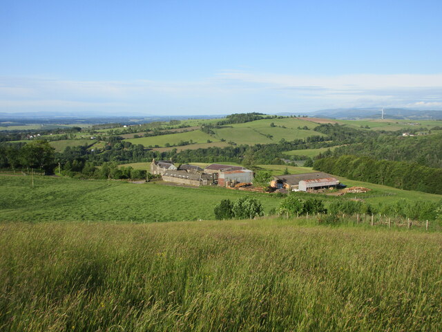
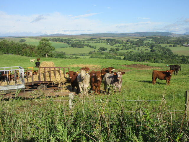
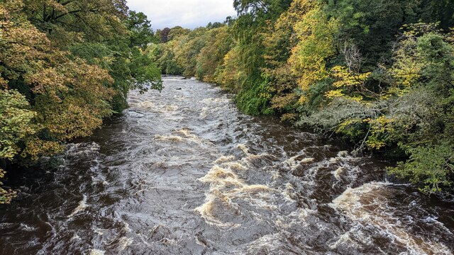
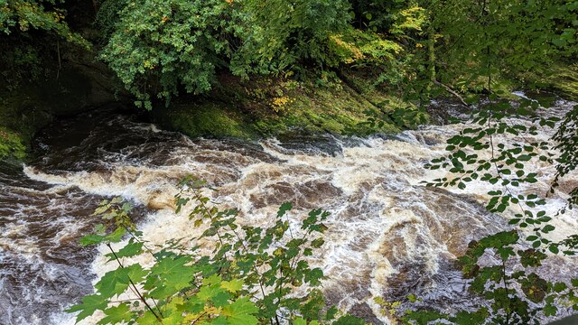
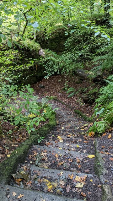
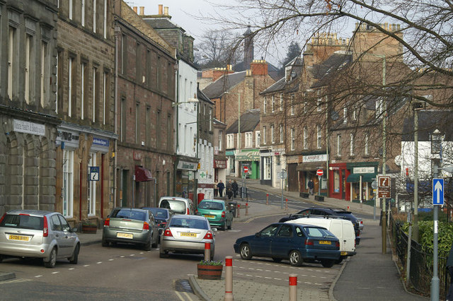
Brae of Mause Images

Images are sourced within 2km of 56.612314/-3.3551616 or Grid Reference NO1647. Thanks to Geograph Open Source API. All images are credited.

Field in the sun Field dotted with sheep in the early morning sunshine, looking north-westwards from the Bonnington Road
Field in the sun
Field dotted with sheep in the early morning sunshine, looking north-westwards from the Bonnington Road
Looking down on Bonnington Bonnington Farm from the hillside above to the north-east.
Looking down on Bonnington
Bonnington Farm from the hillside above to the north-east.
Cattle near Kynballoch Cattle at a feeder on the roadside north of Kynballoch.
Cattle near Kynballoch
Cattle at a feeder on the roadside north of Kynballoch.
Footbridge near Mill Leat, Blairgowrie
Cargill's Leap
Cargill's Leap
Footpath near Cargills Leap
Cargill's Leap The Ericht is forced through narrow passages in conglomerate rock here. The site is named after a Rattray Covenanter who escaped capture by jumping across here.
Cargill's Leap
The Ericht is forced through narrow passages in conglomerate rock here. The site is named after a Rattray Covenanter who escaped capture by jumping across here.
Cargill's Leap The Ericht is forced through narrow channels in conglomerate rock here.  The site is named after a Covenanter from Rattray who escaped capture by jumping the river here.
Cargill's Leap
The Ericht is forced through narrow channels in conglomerate rock here. The site is named after a Covenanter from Rattray who escaped capture by jumping the river here.
Keathbank Mill View across the Ericht at a surviving jute mill building, now residential.  There are numerous ruins on the Blairgowrie side of the river.
Keathbank Mill
View across the Ericht at a surviving jute mill building, now residential. There are numerous ruins on the Blairgowrie side of the river.
Path signpost, Blairgowrie No units given, but they are in miles (kilometres are also used on some signs in the locality).  Bridge of Cally remains 6 miles away for some time.
Path signpost, Blairgowrie
No units given, but they are in miles (kilometres are also used on some signs in the locality). Bridge of Cally remains 6 miles away for some time.
Ashbank Mill Ruins of a flax and jute mill on the Blairgowrie side of the Ericht. Now overgrown with trees.
Ashbank Mill
Ruins of a flax and jute mill on the Blairgowrie side of the Ericht. Now overgrown with trees.
Ashbank Mill Ruins of a flax and jute mill on the Blairgowrie side of the Ericht. Now overgrown with trees.
Ashbank Mill
Ruins of a flax and jute mill on the Blairgowrie side of the Ericht. Now overgrown with trees.
Ashbank Mill Ruins of a flax and jute mill on the Blairgowrie side of the Ericht. Now overgrown with trees.
Ashbank Mill
Ruins of a flax and jute mill on the Blairgowrie side of the Ericht. Now overgrown with trees.
Poplars, Knocky Hill above Blairgowrie on the Highland Boundary Fault. The line of poplars is very distinctive.
Poplars, Knocky
Hill above Blairgowrie on the Highland Boundary Fault. The line of poplars is very distinctive.
Pasture, Lornty Eastern side of Knockie, above Blairgowrie.
Pasture, Lornty
Eastern side of Knockie, above Blairgowrie.
View over the Ericht Looking across the Ericht towards the hills above Rattray.
View over the Ericht
Looking across the Ericht towards the hills above Rattray.
Road, Lornty The sign is a countermeasure against the sat-navs.  Good luck getting an HGV out from there, they mean it!
Road, Lornty
The sign is a countermeasure against the sat-navs. Good luck getting an HGV out from there, they mean it!
Show me another place!

Brae of Mause is located at Grid Ref: NO1647 (Lat: 56.612314, Lng: -3.3551616)

Unitary Authority: Perth and Kinross

Police Authority: Tayside

What 3 Words

///straying.dared.slam. Near Blairgowrie, Perth & Kinross

Nearby Locations

Brae of Mause

Related Wikis

Newton Castle

Newton Castle stands in its grounds near the town of Blairgowrie in Perth and Kinross, Scotland. It is a Category A listed building dating to the mid-16th...

Blairgowrie and Rattray

Blairgowrie and Rattray ( ) is a twin burgh in Perth and Kinross, Scotland. Locals refer to the town as "Blair". Blairgowrie is the larger of the two former...

Blairgowrie railway station

Blairgowrie railway station served the burgh of Blairgowrie and Rattray, Perth and Kinross, Scotland from 1855 to 1955 on the Scottish Midland Junction...

Blairgowrie Community Hospital

Blairgowrie Community Hospital is a health facility in Perth Road, Blairgowrie and Rattray, Scotland. It is managed by NHS Tayside. == History == The first...

Nearby Amenities

Located within 500m of 56.612314,-3.3551616
Power: pole
Lat/Long: 56.6162858/-3.3558948
Power: pole
Lat/Long: 56.6156066/-3.3558091
Power: pole
Lat/Long: 56.614882/-3.356247
Power: pole
Lat/Long: 56.6141766/-3.3566976
Power: pole
Lat/Long: 56.6135009/-3.3571069
Power: pole
Lat/Long: 56.6129002/-3.3569546
Power: pole
Lat/Long: 56.6122707/-3.3567706
Power: pole
Lat/Long: 56.6116709/-3.356604
Power: pole
Lat/Long: 56.6123608/-3.3542804
Power: pole
Lat/Long: 56.6120178/-3.3554563
Power: pole
Lat/Long: 56.6112944/-3.3578944
Power: pole
Lat/Long: 56.6109052/-3.3591794
Power: pole
Lat/Long: 56.6105835/-3.3590133
Power: pole
Lat/Long: 56.6099715/-3.3587063
Power: pole
Lat/Long: 56.6093519/-3.3584015
Power: pole
Lat/Long: 56.6086922/-3.3580718
The data included in this document is from www.openstreetmap.org. The data is made available under ODbL.

Have you been to Brae of Mause?

Leave your review of Brae of Mause below (or comments, questions and feedback).