Cockley Moss

Downs, Moorland in Cumberland Copeland

England

Cockley Moss

Boathouse, Devoke Water 1958 Taken on a Sunday outing from Lancaster in my father's Vauxhall Velox, which he had somehow managed to drive along the track to the boathouse. I'm standing by the car.

Compare with <a href="https://www.geograph.org.uk/photo/5692087">SD1696 : The boathouse, Devoke Water</a> taken by Karl and Ali showing the ruined boathouse in 2018.
Boathouse, Devoke Water 1958 Credit: Henry C Barton

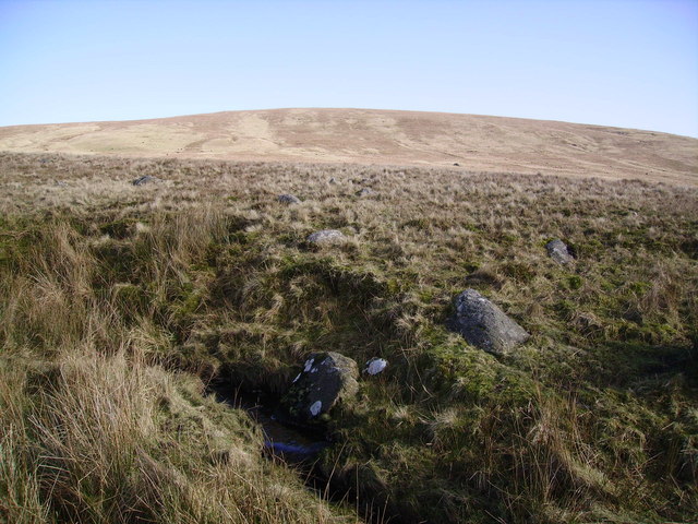
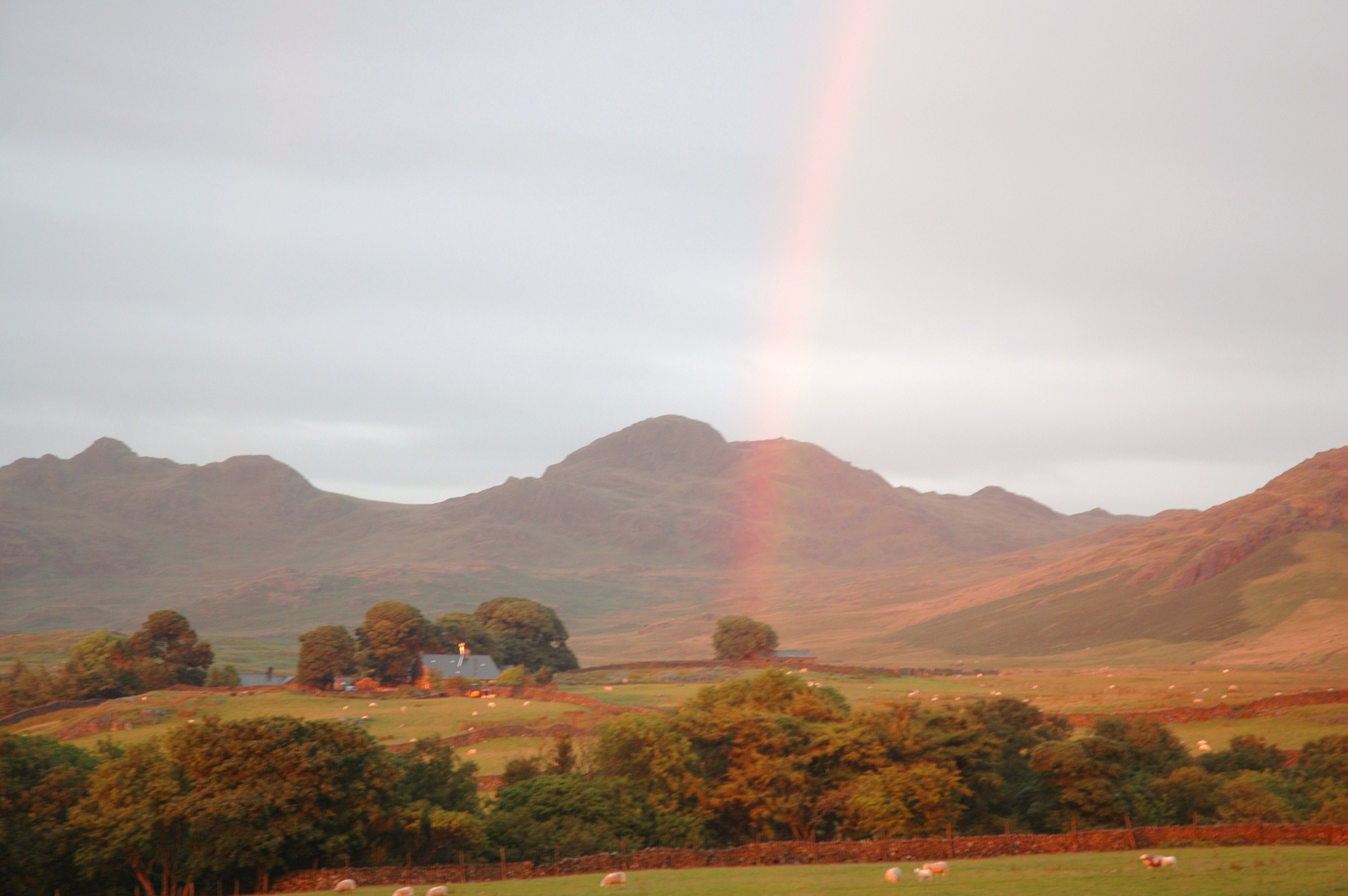
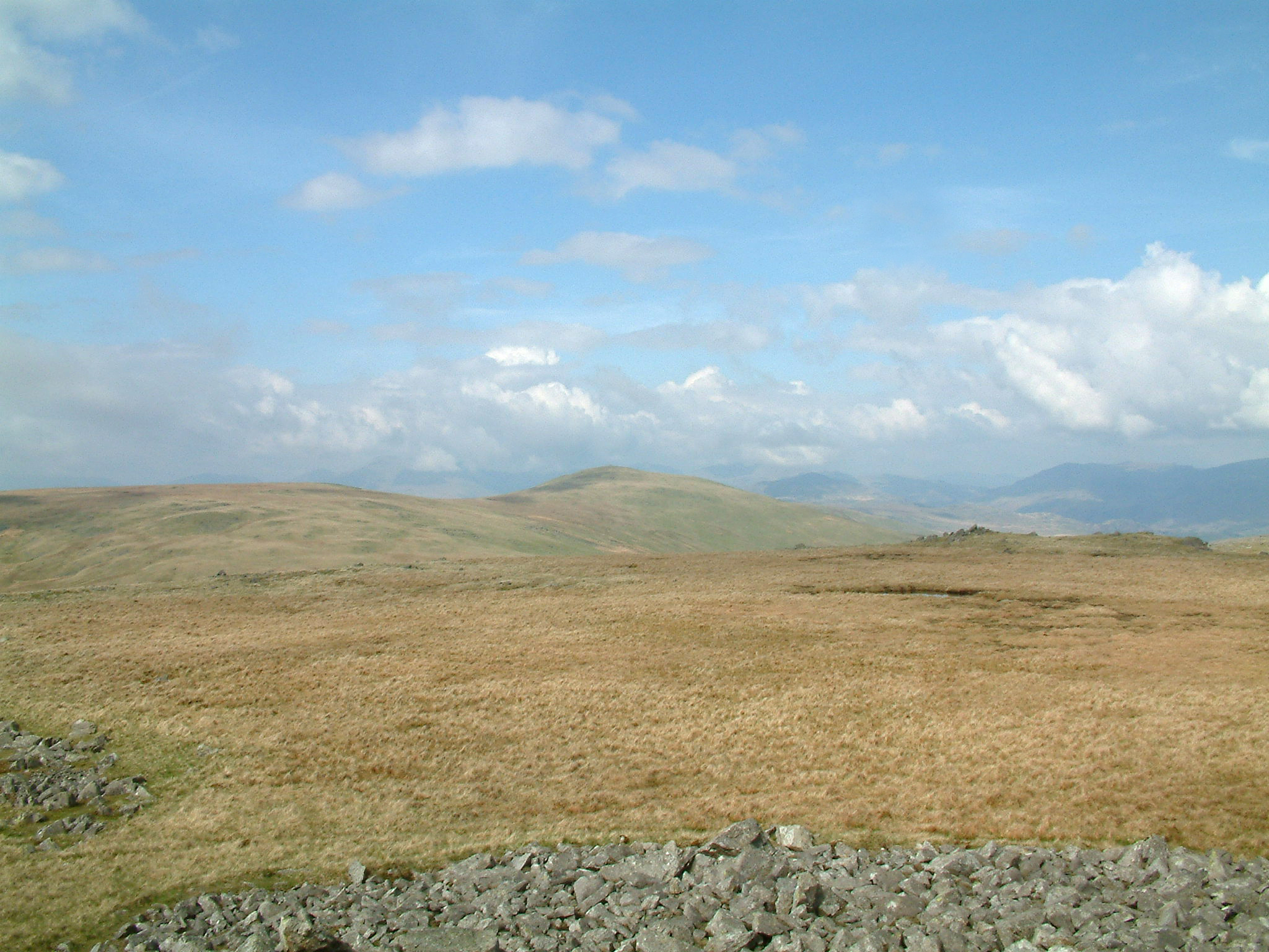
Cockley Moss, located in Cumberland, England, is a stunning area of downs and moorland that captivates visitors with its natural beauty and diverse landscape. Stretching over an expansive area, it is a haven for nature enthusiasts and outdoor adventurers alike.

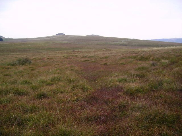
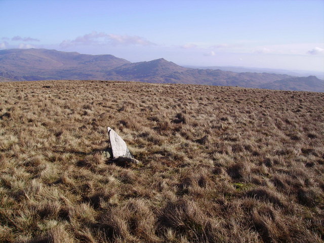
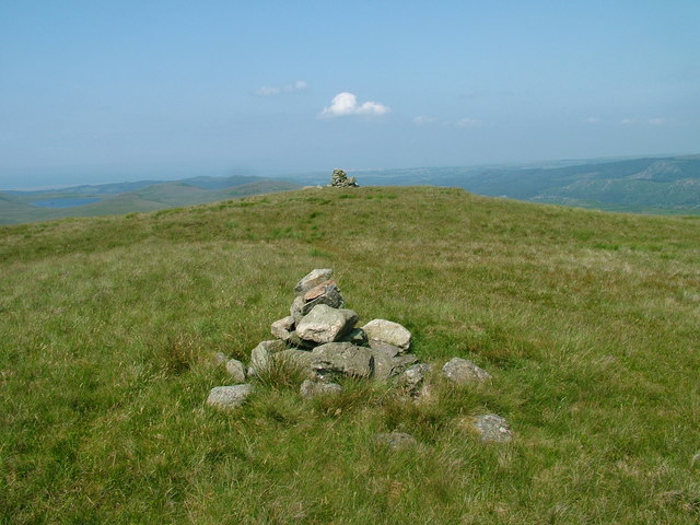
The downs of Cockley Moss offer rolling hills and expansive grasslands, providing a picturesque setting for leisurely walks and hikes. The gentle slopes and panoramic views make it an ideal spot for picnics, photography, and enjoying the tranquility of the countryside. The downs are home to a variety of plant species, including heather, gorse, and wildflowers, which add vibrant pops of color throughout the seasons.

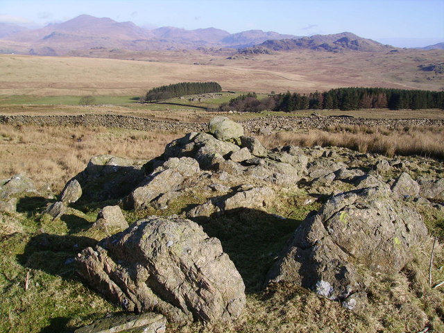
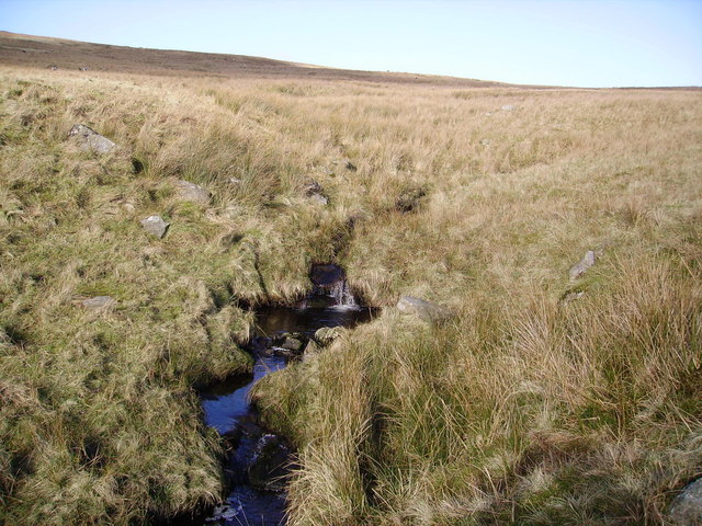
The moorland of Cockley Moss is a unique and captivating habitat, with its rugged terrain and vast stretches of open space. Visitors can explore the moorland on foot or bike, traversing its undulating hills and valleys. This wild and untamed landscape is home to a rich diversity of wildlife, including birds of prey, such as kestrels and buzzards, as well as various species of small mammals and reptiles.

Cockley Moss also boasts several walking trails and nature reserves, allowing visitors to immerse themselves in the natural wonders of the area. These reserves are carefully managed to protect the delicate ecosystems and provide habitat for rare and endangered species.

Overall, Cockley Moss offers a unique blend of downs and moorland, making it a must-visit destination for those seeking to connect with nature and explore the stunning countryside of Cumberland.

If you have any feedback on the listing, please let us know in the comments section below.

Cockley Moss Images

Images are sourced within 2km of 54.348831/-3.2822177 or Grid Reference SD1695. Thanks to Geograph Open Source API. All images are credited.

Boathouse, Devoke Water 1958 Taken on a Sunday outing from Lancaster in my father's Vauxhall Velox, which he had somehow managed to drive along the track to the boathouse. I'm standing by the car.

Compare with <a href="https://www.geograph.org.uk/photo/5692087">SD1696 : The boathouse, Devoke Water</a> taken by Karl and Ali showing the ruined boathouse in 2018.
Boathouse, Devoke Water 1958
Taken on a Sunday outing from Lancaster in my father's Vauxhall Velox, which he had somehow managed to drive along the track to the boathouse. I'm standing by the car. Compare with SD1696 : The boathouse, Devoke Water taken by Karl and Ali showing the ruined boathouse in 2018.
Boathouse on Devoke Water.
NE tip of Devoke Water. Taken from the access road.
NE tip of Devoke Water.
Taken from the access road.
Stords Hill. Stords Hill, as seen from the boathouse on Devoke Water.
Stords Hill.
Stords Hill, as seen from the boathouse on Devoke Water.
Stephensons Wood. As viewed from the Crosbythwaite sheep pens.
Stephensons Wood.
As viewed from the Crosbythwaite sheep pens.
Sike Moss Birker Fell Needless to say very wet. Looking towards the Scafells.
Sike Moss Birker Fell
Needless to say very wet. Looking towards the Scafells.
On Birker Fell Looking towards Seat How
On Birker Fell
Looking towards Seat How
Sike Moss The boggy vegetation starting to show a red tinge. Bog Myrtle widespread here.
Sike Moss
The boggy vegetation starting to show a red tinge. Bog Myrtle widespread here.
On Ulpha Fell The wall encloses the farmland around Woodend Farm.
On Ulpha Fell
The wall encloses the farmland around Woodend Farm.
Wall, Ulpha Fell On the ascent of the grassy Hesk Fell. Scafell on the skyline.
Wall, Ulpha Fell
On the ascent of the grassy Hesk Fell. Scafell on the skyline.
Cairn , Hesk Fell All is grass on Hesk Fell's summit dome.The Cairn consists of three stones carried up by someone. Anywhere in a 100 yard radius could be the top. Heaton Cooper states that Hesk Fell is from 'Hest Fell, Fell of the Ponies.' Caw on the skyline.
Cairn , Hesk Fell
All is grass on Hesk Fell's summit dome.The Cairn consists of three stones carried up by someone. Anywhere in a 100 yard radius could be the top. Heaton Cooper states that Hesk Fell is from 'Hest Fell, Fell of the Ponies.' Caw on the skyline.
Storthes Gill In the dip between Hesk Fell and Whitfell
Storthes Gill
In the dip between Hesk Fell and Whitfell
Storthes A boggy dip between Hesk Fell and Whitfell. Several small becks and Storthes Gill eventually meet together in the square to become Holehouse Gill a tributary of the Duddon.Looking up at Hesk Fell.
Storthes
A boggy dip between Hesk Fell and Whitfell. Several small becks and Storthes Gill eventually meet together in the square to become Holehouse Gill a tributary of the Duddon.Looking up at Hesk Fell.
Summit Cairn, Stainton Pike On the approach from Holehouse Tarn. Stainton Pike is an 'Outlying Wainwright' on the ridge leading from Whitfell to Devoke Water. This side of the ridge becomes craggy compared with the grassy Ulpa and Hesk fells and is littered with ancient cairns and interesting nooks and crannies.
Summit Cairn, Stainton Pike
On the approach from Holehouse Tarn. Stainton Pike is an 'Outlying Wainwright' on the ridge leading from Whitfell to Devoke Water. This side of the ridge becomes craggy compared with the grassy Ulpa and Hesk fells and is littered with ancient cairns and interesting nooks and crannies.
Summit Cairn, Yoadcastle Yoadcastle's top is craggy and a great viewpoint in all directions on the quiet fells above Devoke Water. Hesk Fell in mid shot.
Summit Cairn, Yoadcastle
Yoadcastle's top is craggy and a great viewpoint in all directions on the quiet fells above Devoke Water. Hesk Fell in mid shot.
Devoke Water The largest Tarn in the Lake District having a surface area of over Three Hundred Thousand square feet in old money.The deepest point is at about Forty Six Feet on the North side of the Tarn. According to Heaton Cooper in the Thirteenth Century it was named 'Dudockis Terne and also Fosse Terne.' The locals call it 'Duvvock Water'
Devoke Water
The largest Tarn in the Lake District having a surface area of over Three Hundred Thousand square feet in old money.The deepest point is at about Forty Six Feet on the North side of the Tarn. According to Heaton Cooper in the Thirteenth Century it was named 'Dudockis Terne and also Fosse Terne.' The locals call it 'Duvvock Water'
Devoke Water from Seat How The two storey boat house was built to house boats, a stable and room for the Gillies to cater for the needs of the toffs from Muncaster Castle. The Tarn was stocked with Trout from Italy by the Monks of Furness Abbey according to that old romantic Heaton Cooper the famous artist.
Devoke Water from Seat How
The two storey boat house was built to house boats, a stable and room for the Gillies to cater for the needs of the toffs from Muncaster Castle. The Tarn was stocked with Trout from Italy by the Monks of Furness Abbey according to that old romantic Heaton Cooper the famous artist.
Devoke Water The small island is called Watness Coy
Devoke Water
The small island is called Watness Coy
Show me another place!

Cockley Moss is located at Grid Ref: SD1695 (Lat: 54.348831, Lng: -3.2822177)

Administrative County: Cumbria

District: Copeland

Police Authority: Cumbria

What 3 Words

///shadowing.wolves.stoops. Near Seascale, Cumbria

Nearby Locations

Cockley Moss

Related Wikis

Woodend, Ulpha

Woodend is situated between the Duddon Valley and the village of Ulpha and the valley of Eskdale, high up on Birker Fell, approximately 950 feet above...

Hesk Fell

Hesk Fell is a hill in the south-west of the English Lake District, between the Duddon Valley and Eskdale near Ulpha, Cumbria. It is the subject of a chapter...

Devoke Water

Devoke Water is a small lake in the south west of the Lake District in North West England. It is the largest tarn in the Lake District, a tarn being a...

Stainton Pike

Stainton Pike is a hill in the English Lake District, near Waberthwaite, Cumbria. It is the subject of a chapter of Wainwright's book The Outlying Fells...

Birkerthwaite

Birkerthwaite is a village on Birker Fell, Eskdale, Cumbria, England. == See also == List of places in Cumbria == External links == Media related to Birkerthwaite...

Whitfell

Whitfell (or sometimes Whit Fell) is a hill of 573 metres (1,880 ft) in the southwestern part of the Lake District. It is the highest point between Black...

Great Worm Crag

Great Worm Crag is a hill in south west of the English Lake District, north of Ulpha, Cumbria. It is the subject of a chapter of Wainwright's book The...

Ulpha

Ulpha is a small village and civil parish in the Duddon Valley in the Lake District National Park in Cumbria, England. Historically in Cumberland, it forms...

Nearby Amenities

Located within 500m of 54.348831,-3.2822177
Cockley Moss
Place: locality
Lat/Long: 54.3488415/-3.283952
The data included in this document is from www.openstreetmap.org. The data is made available under ODbL.

Have you been to Cockley Moss?

Leave your review of Cockley Moss below (or comments, questions and feedback).