Badmorris

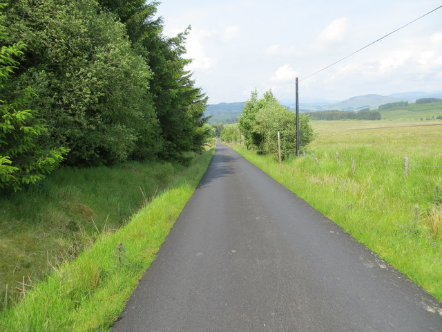
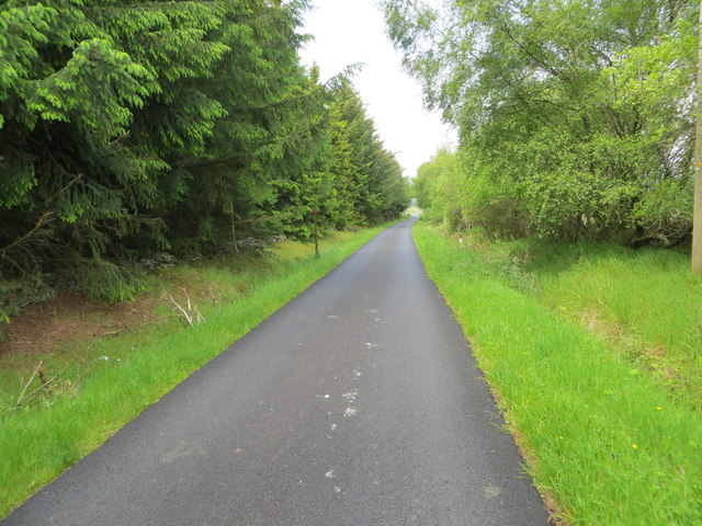
Downs, Moorland in Perthshire

Scotland

Badmorris

Entrance to turbine 5, Drumderg wind farm The Drumderg wind farm, south of (but no doubt visible from) the Cairngorms National Park, has been built on the site of an old military range. There are sixteen turbines, numbered, if you look at the site from the southwest, in lines, nearest first, then right to left in each line. This is turbine 5, at just over 380m above sea level, on the track heading to the east after the first junction of tracks. The first line of turbines, numbers 01 to 04 are in the first line and are behind the photographer. Number 05 is the most southeasterly of the second line, and the view looks away from turbines 06 to 08 in this line.
Entrance to turbine 5, Drumderg wind farm Credit: Andy Waddington

Badmorris is a small village located in the region of Perthshire, Scotland. Situated amidst picturesque downs and moorland, it offers a tranquil and scenic setting for residents and visitors alike. The village is nestled amidst rolling hills, with breathtaking views of the surrounding countryside.

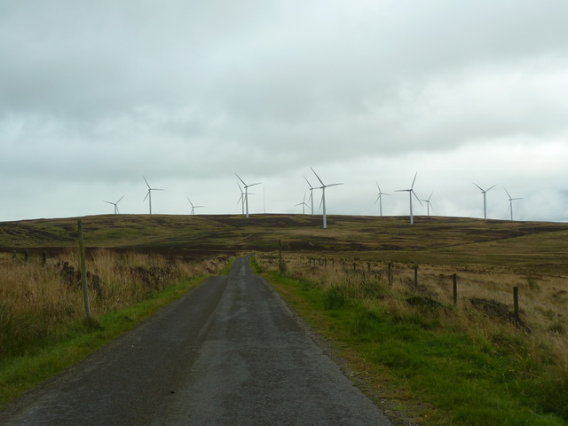
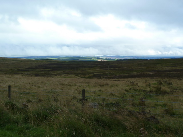
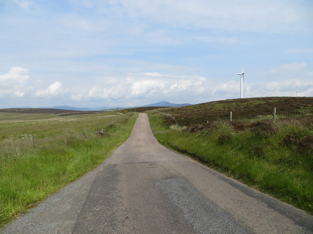
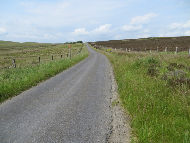
The downs and moorland in Badmorris are characterized by vast stretches of open grassland, dotted with heather, bracken, and other native vegetation. This diverse landscape provides a habitat for a variety of wildlife, including birds, rabbits, and deer. The moorland is also home to several rare plant species, making it an area of ecological significance.

The village itself is comprised of charming stone cottages and traditional buildings, contributing to its quaint and rustic atmosphere. The locals are known for their warm hospitality, welcoming visitors with open arms. The community is tight-knit, with a strong sense of pride in their village and its natural surroundings.

Outdoor enthusiasts will find plenty to do in Badmorris. The downs and moorland offer endless opportunities for walking, hiking, and birdwatching. There are also several well-maintained trails and pathways that allow visitors to explore the area and take in its beauty at their own pace.

In terms of amenities, Badmorris has a few local shops and a small pub, providing basic necessities and a place to unwind after a day of exploring. For those seeking a peaceful retreat in the heart of nature, Badmorris in Perthshire is an idyllic destination that showcases the best of Scotland's downs and moorland.

If you have any feedback on the listing, please let us know in the comments section below.

Badmorris Images

Images are sourced within 2km of 56.684745/-3.3628725 or Grid Reference NO1655. Thanks to Geograph Open Source API. All images are credited.

Entrance to turbine 5, Drumderg wind farm The Drumderg wind farm, south of (but no doubt visible from) the Cairngorms National Park, has been built on the site of an old military range. There are sixteen turbines, numbered, if you look at the site from the southwest, in lines, nearest first, then right to left in each line. This is turbine 5, at just over 380m above sea level, on the track heading to the east after the first junction of tracks. The first line of turbines, numbers 01 to 04 are in the first line and are behind the photographer. Number 05 is the most southeasterly of the second line, and the view looks away from turbines 06 to 08 in this line.
Entrance to turbine 5, Drumderg wind farm
The Drumderg wind farm, south of (but no doubt visible from) the Cairngorms National Park, has been built on the site of an old military range. There are sixteen turbines, numbered, if you look at the site from the southwest, in lines, nearest first, then right to left in each line. This is turbine 5, at just over 380m above sea level, on the track heading to the east after the first junction of tracks. The first line of turbines, numbers 01 to 04 are in the first line and are behind the photographer. Number 05 is the most southeasterly of the second line, and the view looks away from turbines 06 to 08 in this line.
Graffiti on turbine 6, Drumderg wind farm It's a huge canvas to paint on, but clearly the artist hadn't thought to bring a big ladder or other climbing aids to reach most of it. Still, it seems unusually enterprising of any spray-can vandal to reach somewhere quite this bleak and remote from a population centre though it would seem to offer a generally safe environment in terms of getting caught and reprimanded, so maybe that was its main appeal. A wide audience seems unlikely. Turbine 06 is the second in the second line of four turbines, and in this view turbines 03 and a blade of 04 are on the left, with turbines 07 and 08 to the right. This one is just shy of 400m above sea level and there are sixteen altogether, between 370 and 420m asl on this disused military range.
Graffiti on turbine 6, Drumderg wind farm
It's a huge canvas to paint on, but clearly the artist hadn't thought to bring a big ladder or other climbing aids to reach most of it. Still, it seems unusually enterprising of any spray-can vandal to reach somewhere quite this bleak and remote from a population centre though it would seem to offer a generally safe environment in terms of getting caught and reprimanded, so maybe that was its main appeal. A wide audience seems unlikely. Turbine 06 is the second in the second line of four turbines, and in this view turbines 03 and a blade of 04 are on the left, with turbines 07 and 08 to the right. This one is just shy of 400m above sea level and there are sixteen altogether, between 370 and 420m asl on this disused military range.
Track to the exit, Drumderg wind farm There are 8.3 kilometre of access tracks on the Drumderg wind farm, giving access to its sixteen turbines and a tall anemometer mast. Most are of this standard, although one stretch is not signposted for use by vehicles and is perhaps a little steeper and less frequented. The site is a former military firing range, and the turbines lie between 370 and 420m above sea level. The photo was taken from c 400m asl, on the middle track across the southwestern slopes of Drumderg and heads for the exit to the public road 1.7 km away. Visible in this view are turbines 07, 06, 05 and 01.
Track to the exit, Drumderg wind farm
There are 8.3 kilometre of access tracks on the Drumderg wind farm, giving access to its sixteen turbines and a tall anemometer mast. Most are of this standard, although one stretch is not signposted for use by vehicles and is perhaps a little steeper and less frequented. The site is a former military firing range, and the turbines lie between 370 and 420m above sea level. The photo was taken from c 400m asl, on the middle track across the southwestern slopes of Drumderg and heads for the exit to the public road 1.7 km away. Visible in this view are turbines 07, 06, 05 and 01.
Find your turbine, Drumderg wind farm Turbines 01-04 were left at the first junction within the wind farm, whilst anyone arriving at this junction will have just passed turbine 05. You could reach turbines 12 to 14 by either way at this junction, but the signs can be smaller and cheaper if you are directed to go left. Turbine 09 is at the start of the longest line of turbines, 09-14, but there is no track between 09 and the rest of that line (turbine 10 is reached by going up to turbine 11 and coming back on a short spur track). Turbines 15 and 16 are the shortest "line" of turbines, on the NE side of the hill and perhaps slightly sheltered on the lee slope in the prevailing wind. Turbines 09 (nearer, on the right) and 10 are featured in this view, generating on a SW wind bringing sleet earlier in the day and unpleasant conditions for kayaking (which is why I was wandering around a wind farm, as hardier souls took on the Black Water).
Find your turbine, Drumderg wind farm
Turbines 01-04 were left at the first junction within the wind farm, whilst anyone arriving at this junction will have just passed turbine 05. You could reach turbines 12 to 14 by either way at this junction, but the signs can be smaller and cheaper if you are directed to go left. Turbine 09 is at the start of the longest line of turbines, 09-14, but there is no track between 09 and the rest of that line (turbine 10 is reached by going up to turbine 11 and coming back on a short spur track). Turbines 15 and 16 are the shortest "line" of turbines, on the NE side of the hill and perhaps slightly sheltered on the lee slope in the prevailing wind. Turbines 09 (nearer, on the right) and 10 are featured in this view, generating on a SW wind bringing sleet earlier in the day and unpleasant conditions for kayaking (which is why I was wandering around a wind farm, as hardier souls took on the Black Water).
Straight on for Drumderg Wind Farm
View south towards Blairgowrie
Drumderg Wind Farm Houses the switch gear for transferring the power generated by the wind farm to the national grid
Drumderg Wind Farm
Houses the switch gear for transferring the power generated by the wind farm to the national grid
Road between forest and Drmbderg Wind Farm near to High Rannagulzion Looking north-westward.
Road between forest and Drmbderg Wind Farm near to High Rannagulzion
Looking north-westward.
Minor road passing between moorland and Drumderg Wind Farm Looking northward.
Minor road passing between moorland and Drumderg Wind Farm
Looking northward.
Fence enclosed minor road passing through moorland near to Badmorris Looking north-westward.
Fence enclosed minor road passing through moorland near to Badmorris
Looking north-westward.
Minor road passing between moorland and woodland near Hill of Kingseat Looking north-westward.
Minor road passing between moorland and woodland near Hill of Kingseat
Looking north-westward.
Wood-lined minor road near to Shieldrum Looking north-westward.
Wood-lined minor road near to Shieldrum
Looking north-westward.
Moors, Drumturn Looking through a verdant roadside to the rough grazing and moorland which dominates this square.
Moors, Drumturn
Looking through a verdant roadside to the rough grazing and moorland which dominates this square.
Forest of Alyth Not high ground, but probably infertile. A large area of moorland south of the high hills of the Mounth. One of many moorland or rough farmland squares in this area.
Forest of Alyth
Not high ground, but probably infertile. A large area of moorland south of the high hills of the Mounth. One of many moorland or rough farmland squares in this area.
Saebeg, Forest of Alyth Moorland, lots of it. Not high ground, but mostly under heather.
Saebeg, Forest of Alyth
Moorland, lots of it. Not high ground, but mostly under heather.
Road across the Forest of Alyth Moorland road from Alyth to Glen Shee
Road across the Forest of Alyth
Moorland road from Alyth to Glen Shee
Drumderg As well as a grouse shoot, the moor is also used for sheep farming, and now electricity generation. The photograph was taken before the exceptionally intrusive power station appeared (I was lucky, it must be one of the worst eyesores so far.)
Drumderg
As well as a grouse shoot, the moor is also used for sheep farming, and now electricity generation. The photograph was taken before the exceptionally intrusive power station appeared (I was lucky, it must be one of the worst eyesores so far.)
Cairn Gleamach with High Rannagulzion on the Horizon
Show me another place!

Badmorris is located at Grid Ref: NO1655 (Lat: 56.684745, Lng: -3.3628725)

Unitary Authority: Perth and Kinross

Police Authority: Tayside

What 3 Words

///soothing.drifters.positions. Near Blairgowrie, Perth & Kinross

Nearby Locations

Badmorris

Related Wikis

Bridge of Cally

Bridge of Cally is a small village in Kirkmichael parish, Perth and Kinross, Scotland. It sits at the junction of three glens, Glenshee, Strathardle and...

Auchinleish

Auchinleish is a village in Angus, Scotland. == References ==

River Ardle

The River Ardle (Scottish Gaelic: Abhainn Àrdail) is a tributary of the River Ericht. It runs for 10 miles (16 km) through Strathardle in Perthshire, Scotland...
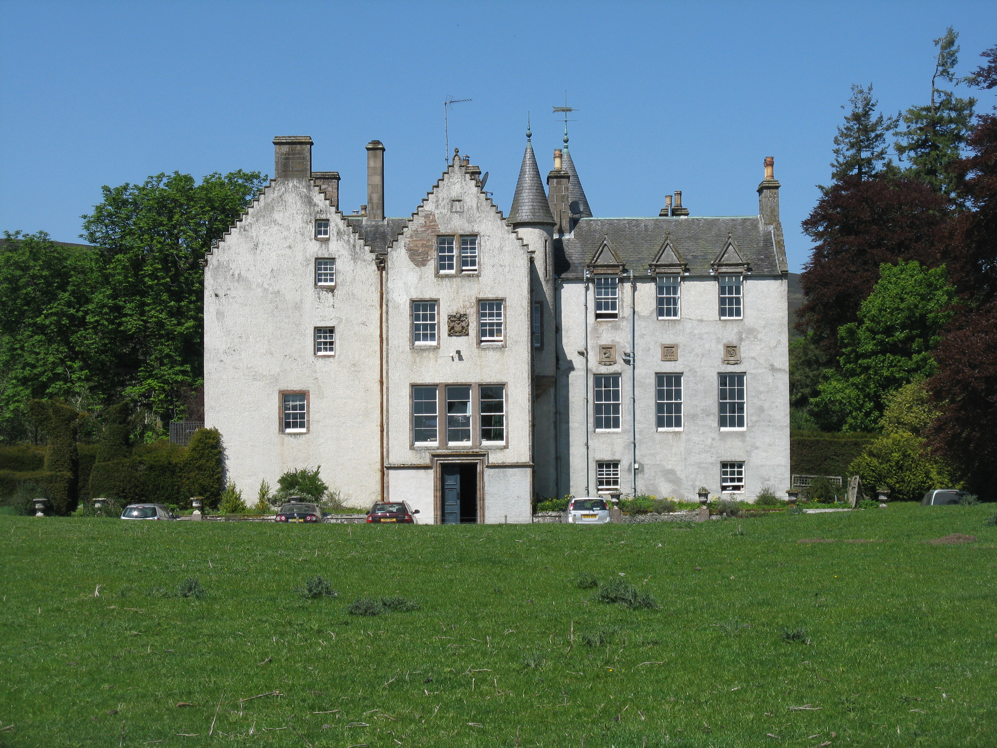
Blackcraig Castle

Blackcraig Castle is a Baronial mansion house dating from 1856 in Perthshire, Scotland, close to the towns of Ballintuim and Blairgowrie on the banks of...

Kilry Glen

Kilry Glen, in Angus, Scotland, is the glen of the Burn of Kilry, a tributary of the River Isla. It is situated west of the B954 road, approximately four...

Brewlands Bridge

Brewlands Bridge is a hamlet in Glen Isla, Angus, Scotland. It is lies situated on the River Isla, eleven miles north-west of Kirriemuir and ten miles...

Kirkton of Glenisla

Kirkton of Glenisla consists of a church and graveyard, a hotel, hall and several homes forming the largest concentration of habitation in Glenisla, Angus...

Bamff

Bamff House is the home of the Ramsays of Bamff, and is located within a 1,300-acre (5.3 km2) estate in Perthshire, Scotland. Bamff House began as a fortified...

Nearby Amenities

Located within 500m of 56.684745,-3.3628725
Power: pole
Lat/Long: 56.6810666/-3.3674036
Power: pole
Lat/Long: 56.6816801/-3.3683618
Power: pole
Lat/Long: 56.682217/-3.369209
Power: pole
Lat/Long: 56.682793/-3.3701181
The data included in this document is from www.openstreetmap.org. The data is made available under ODbL.

Have you been to Badmorris?

Leave your review of Badmorris below (or comments, questions and feedback).