Reidh Mòr

Downs, Moorland in Caithness

Scotland

Reidh Mòr

Ford on Loop Burn, Caithness The ford lies on a path which runs between the A9 and Loch Ruard.  The remains of a footbridge can be seen on either side of the burn.
Ford on Loop Burn, Caithness Credit: Claire Pegrum

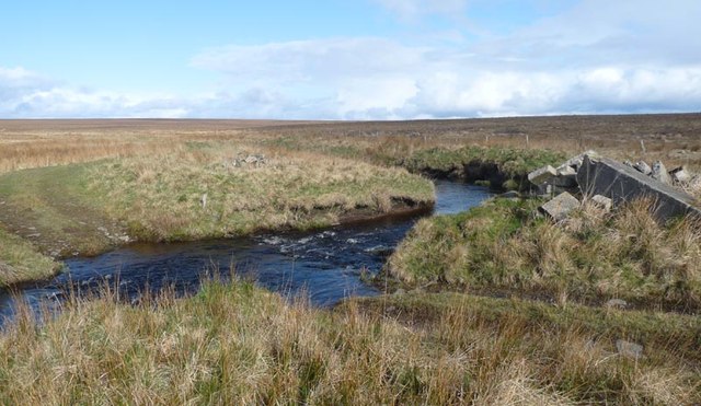
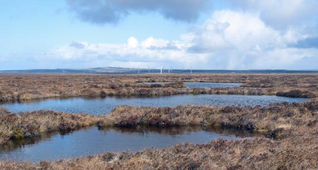
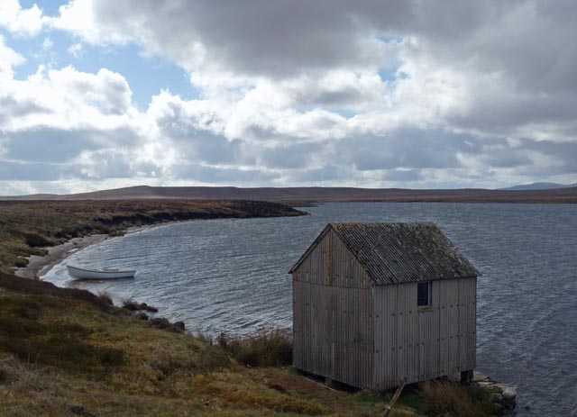
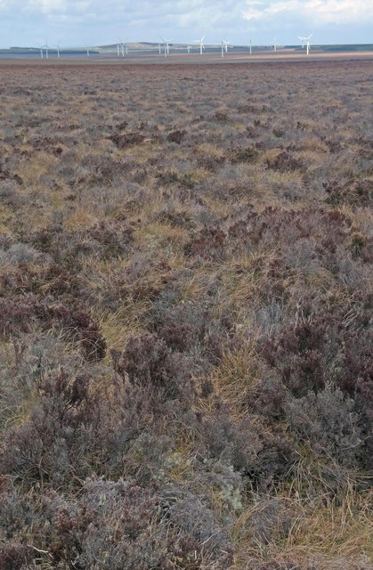
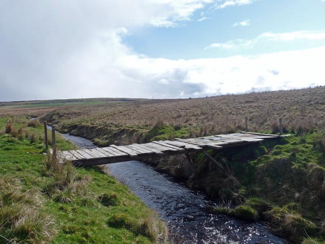
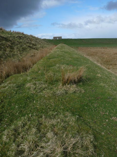
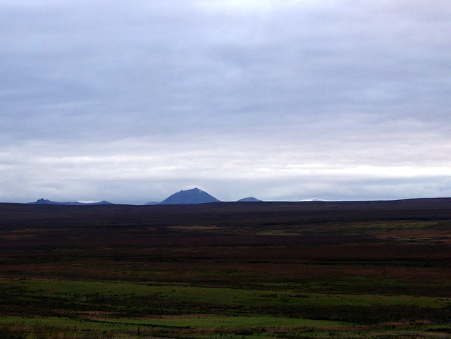
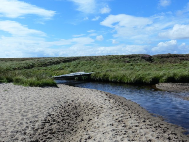
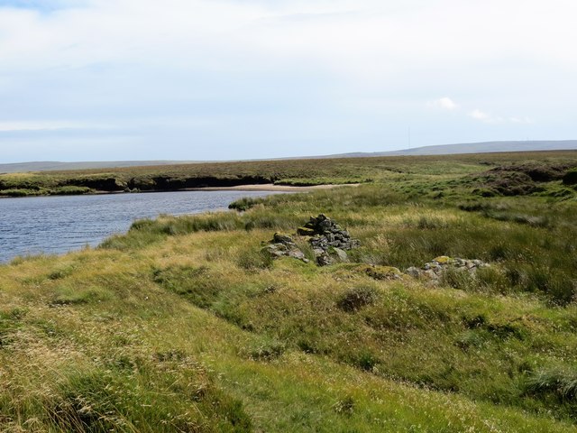
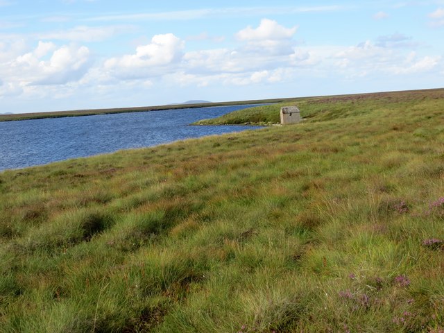
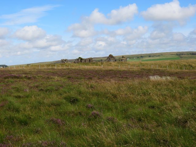
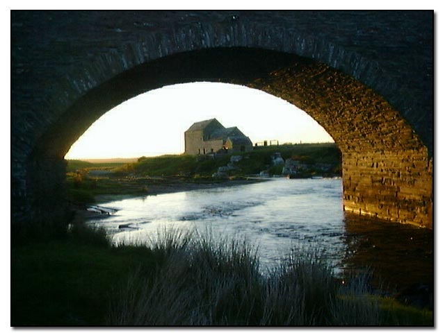
Reidh Mòr, located in Caithness, Scotland, is a vast expanse of downs and moorland that stretches over an area of approximately 20 square miles. The landscape of Reidh Mòr is characterized by rolling hills, open grasslands, and heather-covered moors, offering a stunning and undisturbed natural beauty.

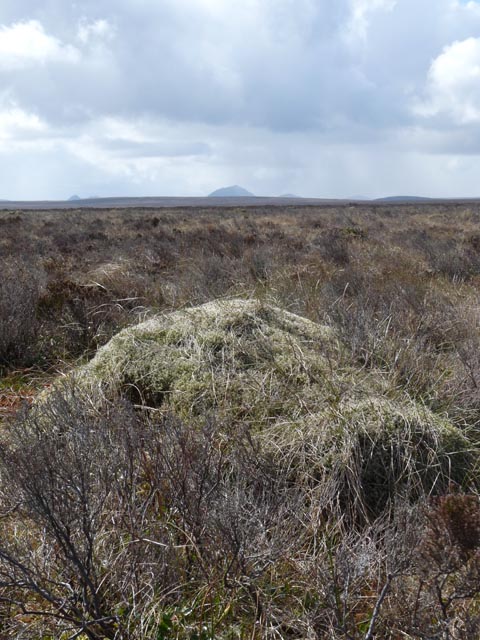
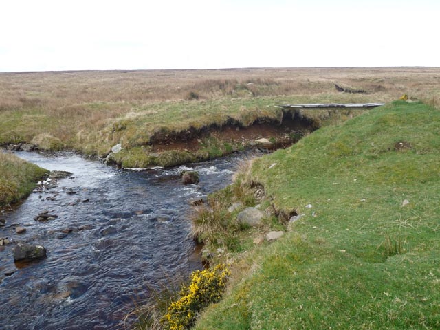
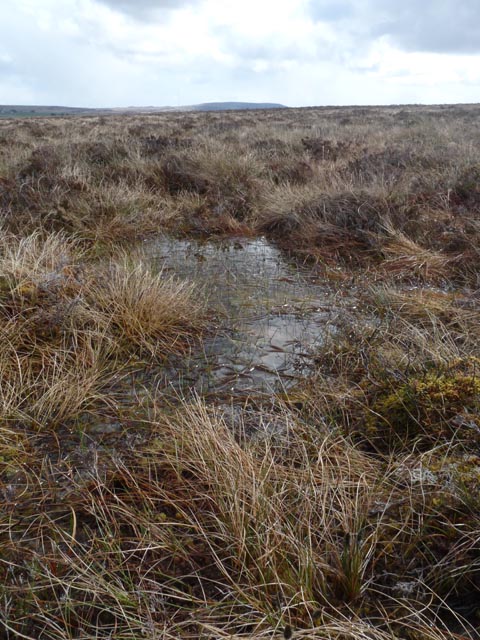
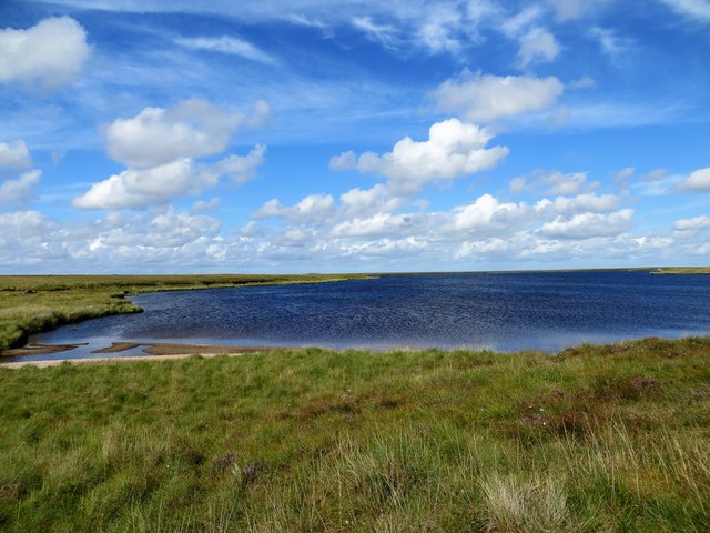
The downs of Reidh Mòr are dominated by wide, sweeping grasslands that provide a home to an array of plant species, including wildflowers and grasses. These downs are typically low-lying and gently sloping, creating a serene and peaceful atmosphere throughout the area. The moorland, on the other hand, is characterized by its heather-covered terrain, interspersed with patches of bog and wetland. The vibrant purple hues of the heather create a striking contrast against the greenery of the surrounding landscape.

Reidh Mòr is also home to a diverse range of wildlife. The open grasslands attract a variety of bird species, such as skylarks, meadow pipits, and lapwings. The moorland provides a habitat for ground-nesting birds like red grouse and golden plovers. Additionally, visitors may spot the occasional hare, deer, or even the elusive wildcat.

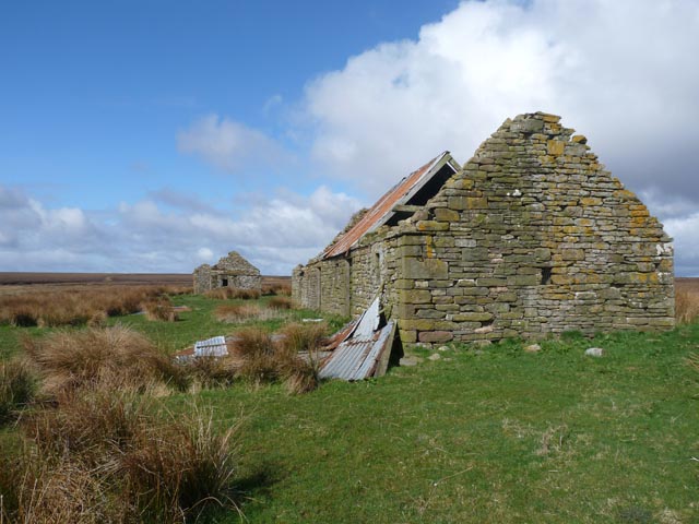
The landscape of Reidh Mòr is largely untouched by human development, allowing visitors to immerse themselves in the unspoiled beauty of nature. Its remote location and vastness make it an ideal destination for nature enthusiasts, hikers, and photographers seeking solitude and breathtaking scenery.

If you have any feedback on the listing, please let us know in the comments section below.

Reidh Mòr Images

Images are sourced within 2km of 58.370148/-3.4518452 or Grid Reference ND1543. Thanks to Geograph Open Source API. All images are credited.

Ford on Loop Burn, Caithness The ford lies on a path which runs between the A9 and Loch Ruard.  The remains of a footbridge can be seen on either side of the burn.
Ford on Loop Burn, Caithness
The ford lies on a path which runs between the A9 and Loch Ruard. The remains of a footbridge can be seen on either side of the burn.
Loch Ruard, Caithness
Lochans, Blar nam Faoileag, Caithness Looking towards the Causeymire wind farm.
Lochans, Blar nam Faoileag, Caithness
Looking towards the Causeymire wind farm.
Fishing hut, Loch Ruard, Caithness Although this is shown as a boathouse on the OS 1:25000 map, the door is well above the water and too narrow for a boat.
Fishing hut, Loch Ruard, Caithness
Although this is shown as a boathouse on the OS 1:25000 map, the door is well above the water and too narrow for a boat.
View across moorland, Cnoc Thormaid, Caithness Looking towards Morven.
View across moorland, Cnoc Thormaid, Caithness
Looking towards Morven.
View across moorland, Cnoc Thormaid, Caithness Looking towards Causeymire Wind Farm.
View across moorland, Cnoc Thormaid, Caithness
Looking towards Causeymire Wind Farm.
Confluence of the Allt Reidhe Mhoir and the Allt a' Choire, Caithness
Remains of Acharaskill farm, Caithness The spelling on the current 1:25,000 OS map (as viewed on Get-a-map 19/04/12) is "Achararskill".  However older maps (eg OS six-inch 1877, OS one-inch 1959) and other references (eg an abstract of an article in an 1848 edition of the John O'Groat Journal) show it spelt as above.
Remains of Acharaskill farm, Caithness
The spelling on the current 1:25,000 OS map (as viewed on Get-a-map 19/04/12) is "Achararskill". However older maps (eg OS six-inch 1877, OS one-inch 1959) and other references (eg an abstract of an article in an 1848 edition of the John O'Groat Journal) show it spelt as above.
View across moorland, Cnoc Thormaid, Caithness Looking towards Ben-a-chielt.
View across moorland, Cnoc Thormaid, Caithness
Looking towards Ben-a-chielt.
Footbridge across the Allt Reidhe Mhoir, Caithness This footbridge is not shown on the 1:25,000 OS map (as viewed on Get-a-map 20/04/12).  It is approximately 100m to the east of those shown at grid ref ND159429.
Footbridge across the Allt Reidhe Mhoir, Caithness
This footbridge is not shown on the 1:25,000 OS map (as viewed on Get-a-map 20/04/12). It is approximately 100m to the east of those shown at grid ref ND159429.
Embankment, Shinvall township, Caithness The OS six inch map published in 1877 shows that the embankment formed a mill lead which ran for a distance of nearly 700m between Little River and a mill to the south of the township.

The building in the photo is a modern barn built of a mixture of modern materials and stone, presumably from the township ruins.
Embankment, Shinvall township, Caithness
The OS six inch map published in 1877 shows that the embankment formed a mill lead which ran for a distance of nearly 700m between Little River and a mill to the south of the township. The building in the photo is a modern barn built of a mixture of modern materials and stone, presumably from the township ruins.
A view across the Flows Bog With Morven being the most prominent hill.
A view across the Flows Bog
With Morven being the most prominent hill.
Loch Ruard
Loch Ruard
Bridge over Allt a' Cheracher
Remains of a shieling beside Loch Ruard
Fishing bothy at Loch Ruard
Ruins of Achararskill
Show me another place!

Reidh Mòr is located at Grid Ref: ND1543 (Lat: 58.370148, Lng: -3.4518452)

Unitary Authority: Highland

Police Authority: Highlands and Islands

What 3 Words

///loitering.abruptly.stilted. Near Dunbeath, Highland

Nearby Locations

Reidh Mòr

Related Wikis

Achavanich

Achavanich ( ak-ə-VAN-ik; Scottish Gaelic: Achadh a’ Mhanaich) is an unusual megalithic horseshoe-shaped structure near Loch Stemster in Caithness, Scotland...

Caithness

Caithness (Scottish Gaelic: Gallaibh [ˈkal̪ˠɪv]; Scots: Caitnes; Old Norse: Katanes) is a historic county, registration county and lieutenancy area of...

Rumster Forest transmitting station

The Rumster Forest transmitting station is a broadcasting and telecommunications facility near the town of Wick, in Caithness, Scotland (grid reference...

Tormsdale

Tormsdale is a megalithic site on the banks of the River Thurso, in Caithness, Scotland. It is 3 kilometres (1.9 mi) south of Westerdale. The site consists...

Houstry

Houstry is a scattered crofting village, in the east coast of Dunbeath, Caithness, Scottish Highlands and is in the Scottish council area of Highland.A...

Westerdale, Highland

Westerdale (Scottish Gaelic: An Dail Shuas) is a scattered crofting village which lies on the River Thurso, located five miles (eight kilometres) directly...

Mybster

Mybster is a small village, in Caithness, Scottish Highlands, and is in the Scottish council area of Highland.Mybster lies 2 miles (3 km) northwest of...

Loch of Toftingall

Loch of Toftingall is a loch located to the east of Mybster in Highland, Scotland. It has a depth of 76 metres (249 ft) and a surface area of 50 hectares...

Have you been to Reidh Mòr?

Leave your review of Reidh Mòr below (or comments, questions and feedback).