Corney Fell

Downs, Moorland in Cumberland Copeland

England

Corney Fell

Buckbarrow beck bridge, Corney Fell, Cumbria Wow!! Fame at last....there I am, about to pass under the bridge. This is where Buckbarrow beck passes under the Corney Fell road.
Buckbarrow beck bridge, Corney Fell, Cumbria Credit: Brian Green

Corney Fell is a scenic area located in the county of Cumberland, England. It is a part of the larger region known as the Lake District National Park, renowned for its natural beauty and picturesque landscapes. Situated in the western part of the park, Corney Fell is a prominent feature of the local geography.

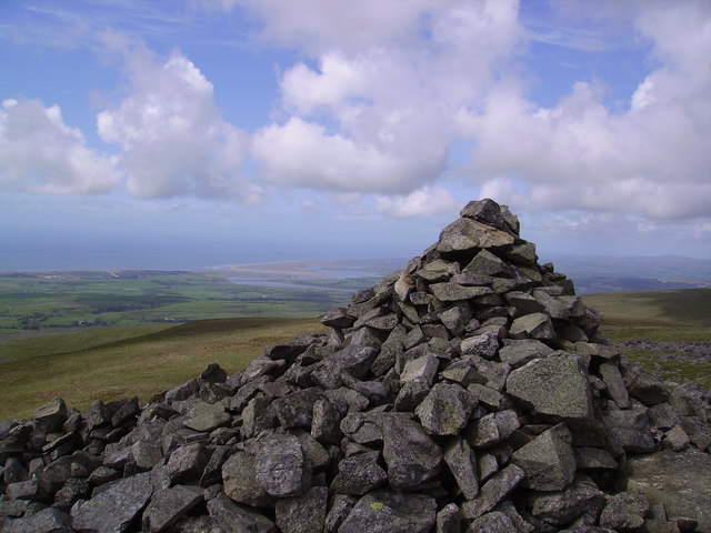
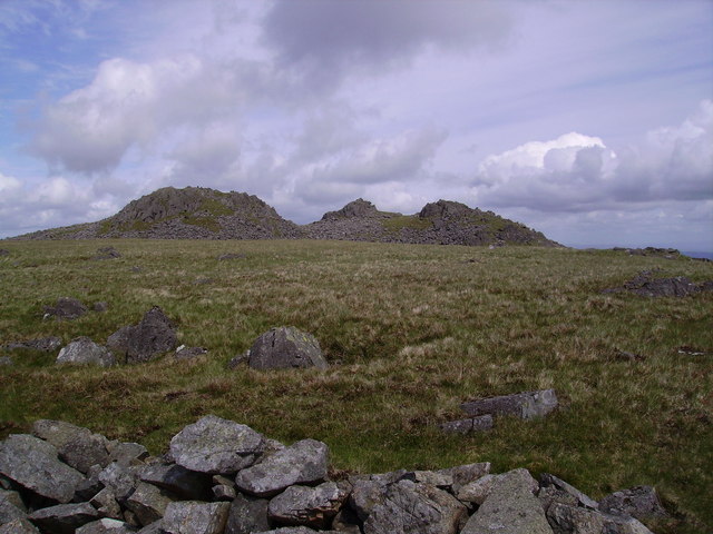
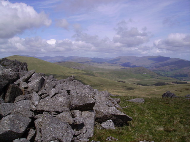
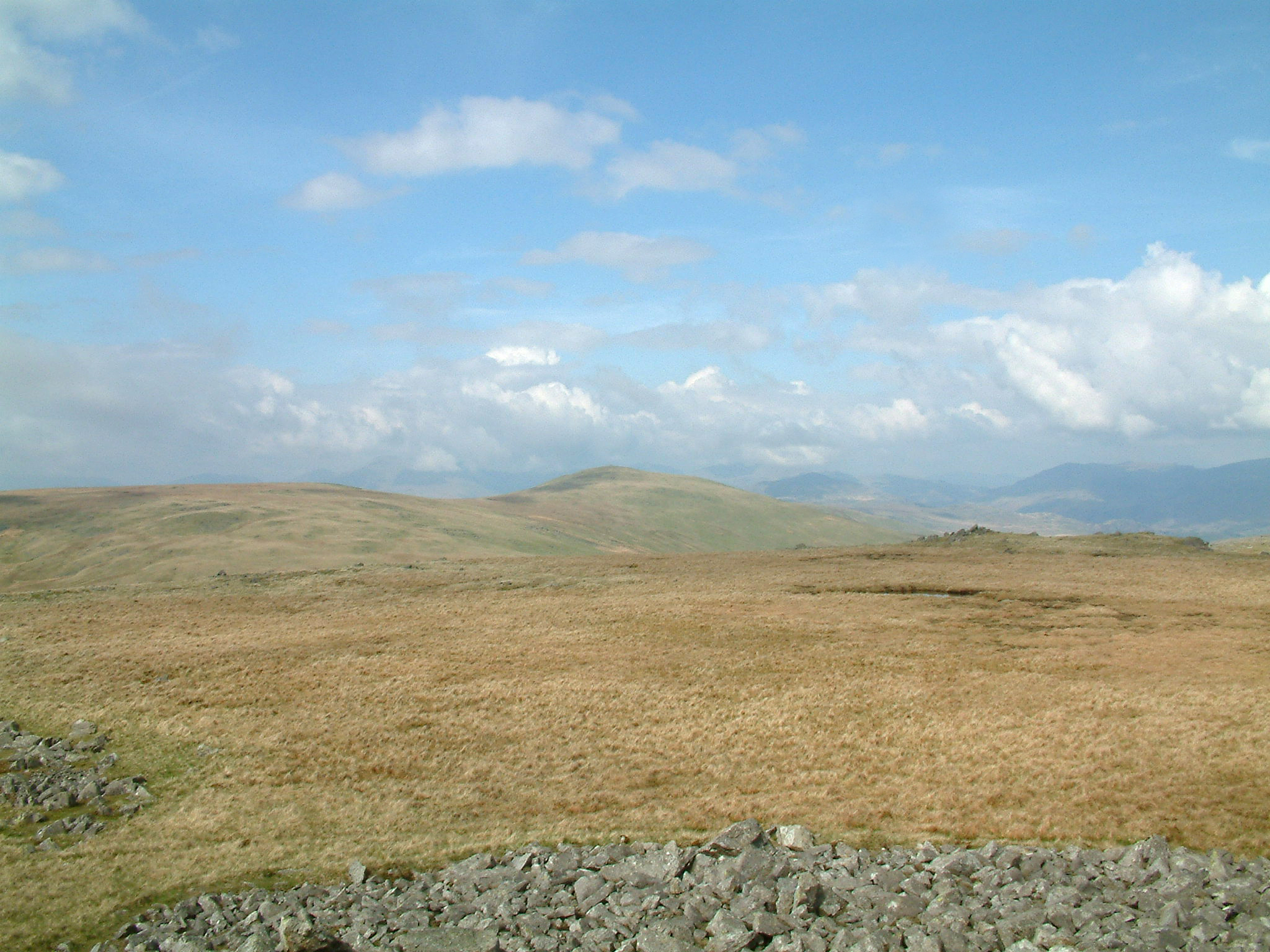
Covering an area of approximately 30 square kilometers, Corney Fell is characterized by rolling hills, open moorland, and lush green pastures. The terrain is diverse, ranging from gentle slopes to steep inclines, offering visitors a variety of walking and hiking opportunities. The highest point of the fell reaches an elevation of around 415 meters (1,360 feet) above sea level, providing stunning panoramic views of the surrounding countryside.

The fell is known for its rich flora and fauna, with an abundance of heather, bracken, and wildflowers dotting the landscape during the summer months. It is also home to a diverse range of wildlife, including red squirrels, birds of prey, and various species of deer.

Corney Fell has historical significance as well, with remnants of ancient settlements and stone circles scattered across the area. These archaeological sites offer a glimpse into the region's past and attract history enthusiasts. Additionally, the fell is intersected by several walking trails, including the popular Corney Fell Road, which provides access to nearby towns and villages.

Overall, Corney Fell is a captivating destination that offers visitors a chance to immerse themselves in the natural beauty and tranquility of the Lake District National Park.

If you have any feedback on the listing, please let us know in the comments section below.

Corney Fell Images

Images are sourced within 2km of 54.316048/-3.3233817 or Grid Reference SD1491. Thanks to Geograph Open Source API. All images are credited.

Buckbarrow beck bridge, Corney Fell, Cumbria Wow!! Fame at last....there I am, about to pass under the bridge. This is where Buckbarrow beck passes under the Corney Fell road.
Buckbarrow beck bridge, Corney Fell, Cumbria
Wow!! Fame at last....there I am, about to pass under the bridge. This is where Buckbarrow beck passes under the Corney Fell road.
Buckbarrowbeck flowing under the Corney Fell road
On Thwaites Fell Walking south from Buckbarrow, a rocky summit in SD1591. The square is almost entirely grassy moorland.
On Thwaites Fell
Walking south from Buckbarrow, a rocky summit in SD1591. The square is almost entirely grassy moorland.
Short finger post This finger post was barely 3ft high. Taken looking up the bridleway that leads to Whit Crags (in distance on the right) and then eventually on to Whitfell.
Short finger post
This finger post was barely 3ft high. Taken looking up the bridleway that leads to Whit Crags (in distance on the right) and then eventually on to Whitfell.
Prior Park Looking up the Fell towards Kinmont Buckbarrow.
Prior Park
Looking up the Fell towards Kinmont Buckbarrow.
Sheep Prior Park Not much to photo in the southern edge of the square other than grass and bog.The sheep was surprised to see me.
Sheep Prior Park
Not much to photo in the southern edge of the square other than grass and bog.The sheep was surprised to see me.
Corney Fell An example of southwest lakeland Silurian Slate.
Corney Fell
An example of southwest lakeland Silurian Slate.
Cairn, Burn Moor On the west edge of the domed Moor. Looking towards the Estuary of the Esk.
Cairn, Burn Moor
On the west edge of the domed Moor. Looking towards the Estuary of the Esk.
Cairn, Kinmont Buckbarrow Looking towards the coast.
Cairn, Kinmont Buckbarrow
Looking towards the coast.
Cairn, Buckbarrow Craggy little Outlying Wainwright. Looking into the Southern Fells
Cairn, Buckbarrow
Craggy little Outlying Wainwright. Looking into the Southern Fells
Great Paddy Crag Looking down the wall which runs over the crag from the small cairn
Great Paddy Crag
Looking down the wall which runs over the crag from the small cairn
Cairn, Burn Moor Looking towards Buckbarrow
Cairn, Burn Moor
Looking towards Buckbarrow
Buckbarrow Approaching from Great Paddy Crag. The ridge looking like a very miniature Cobbler.
Buckbarrow
Approaching from Great Paddy Crag. The ridge looking like a very miniature Cobbler.
Cairn and Wall On Great Paddy Crag
Cairn and Wall
On Great Paddy Crag
From Buckbarrow Looking towards the Duddon Estuary.
From Buckbarrow
Looking towards the Duddon Estuary.
From Buckbarrow Looking over most of the square.Southern Fells on the horizon
From Buckbarrow
Looking over most of the square.Southern Fells on the horizon
Wall, Kinmont Buck Barrow Looking back over Littlecell Bottom.
Wall, Kinmont Buck Barrow
Looking back over Littlecell Bottom.
Kinmont Buckbarrow The small Crag which forms the top.
Kinmont Buckbarrow
The small Crag which forms the top.
Show me another place!

Corney Fell is located at Grid Ref: SD1491 (Lat: 54.316048, Lng: -3.3233817)

Administrative County: Cumbria

District: Copeland

Police Authority: Cumbria

What 3 Words

///snipped.usages.frightens. Near Millom, Cumbria

Related Wikis

Whitfell

Whitfell (or sometimes Whit Fell) is a hill of 573 metres (1,880 ft) in the southwestern part of the Lake District. It is the highest point between Black...

Stainton Pike

Stainton Pike is a hill in the English Lake District, near Waberthwaite, Cumbria. It is the subject of a chapter of Wainwright's book The Outlying Fells...

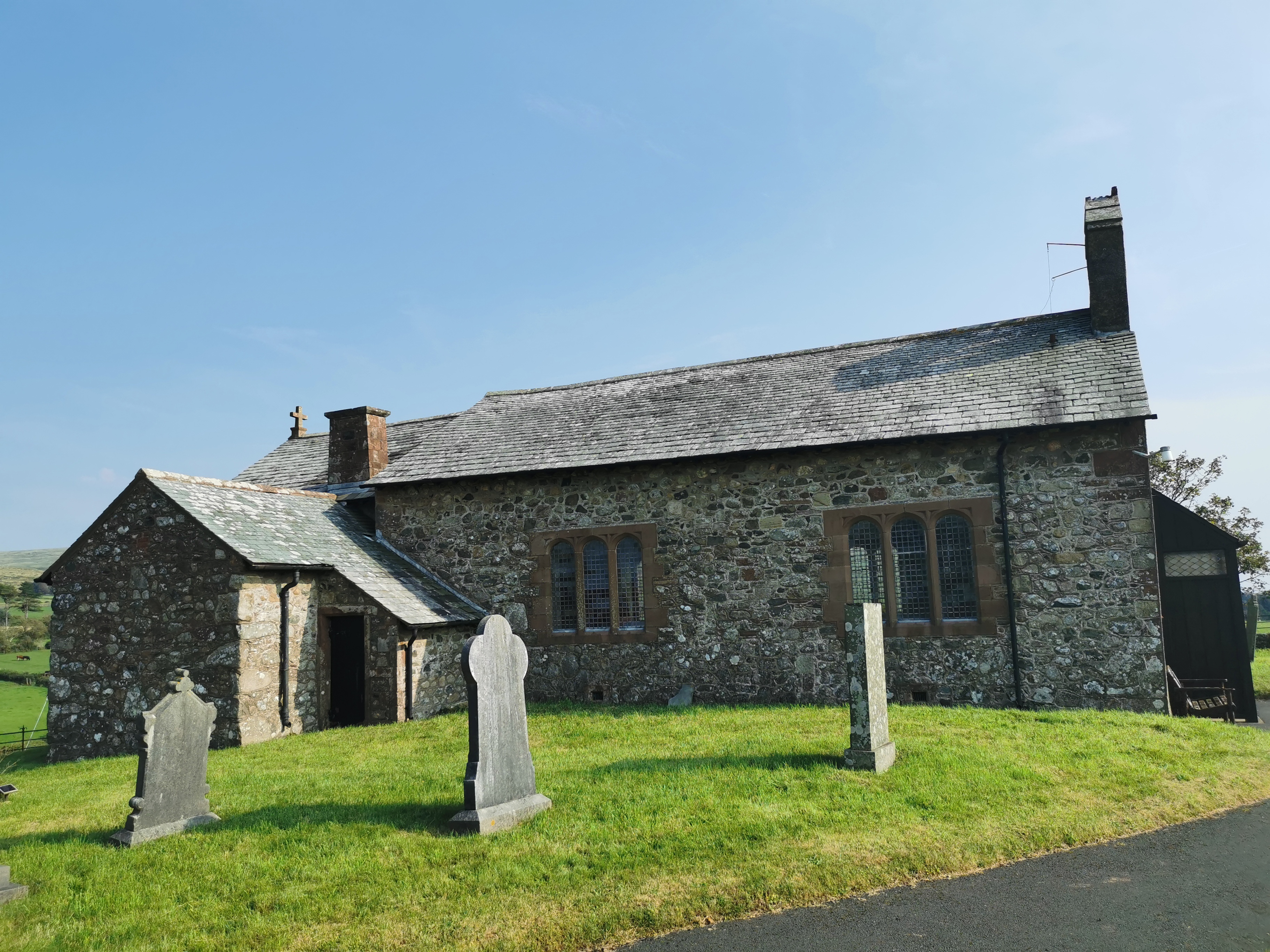
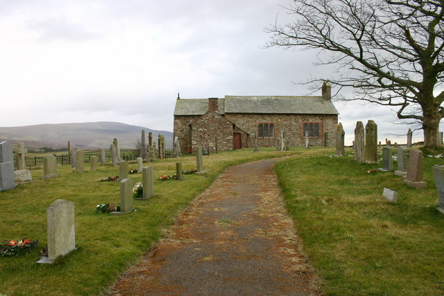
St John the Baptist, Corney

St John the Baptist, is in Corney, Cumbria, England. It is an Anglican parish church in the deanery of Calder, and the diocese of Carlisle. Its benefice...

Corney

Corney is a village and former civil parish, now in the parish of Waberthwaite, in the Cumberland district, in the ceremonial county of Cumbria, England...

Nearby Amenities

Located within 500m of 54.316048,-3.3233817
Hare Raise
Place: locality
Lat/Long: 54.3184944/-3.3176754
The data included in this document is from www.openstreetmap.org. The data is made available under ODbL.

Have you been to Corney Fell?

Leave your review of Corney Fell below (or comments, questions and feedback).