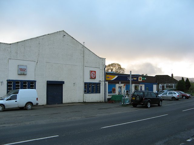
Barnes' Meadow

Downs, Moorland in Perthshire

Scotland

Barnes' Meadow

Trees in Spittalfield Geocaching is a type of global treasure hunt of people looking for caches, or hidden stashes of objects. Geocaching may also be described as a series of hide-and-seek games, where hiders provide online clues for seekers. Seekers use global positioning system (GPS) devices to find hidden caches
Trees in Spittalfield Credit: Ralph Greig

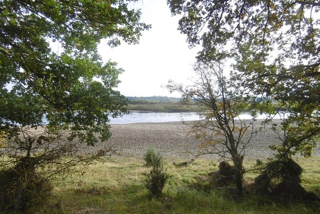
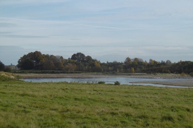
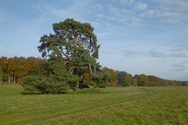
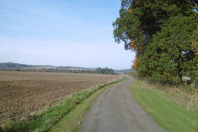
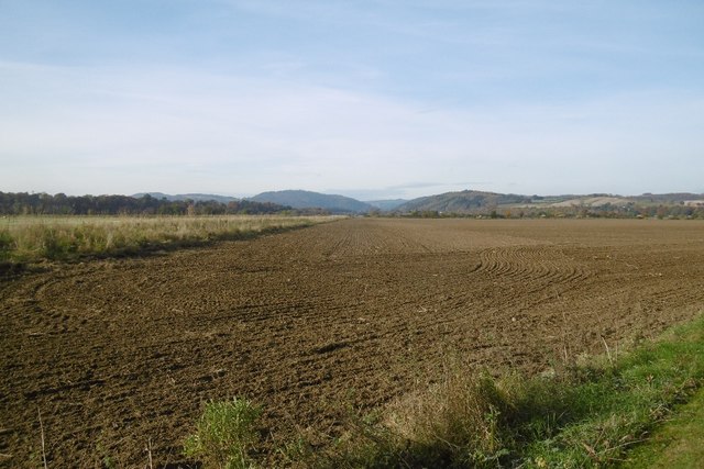
Barnes' Meadow is a picturesque natural area located in the county of Perthshire, Scotland. Situated in the heart of the region, this vast expanse of downs and moorland covers an area of approximately 500 acres. Barnes' Meadow offers visitors a unique and enchanting experience with its diverse collection of flora and fauna.

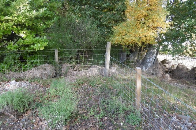
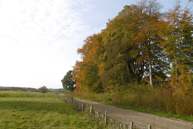
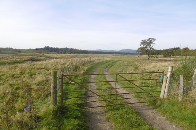
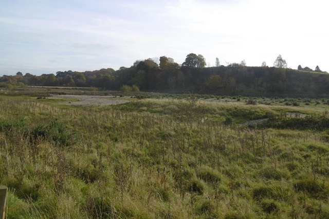
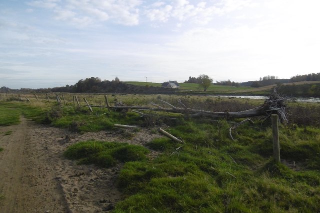
The meadow is characterized by its rolling hills and expansive open spaces, providing a sense of tranquility and serenity. The land is mainly covered with a variety of grasses, heathers, and wildflowers, creating a vibrant and colorful landscape throughout the seasons. This rich and diverse ecosystem supports a wide range of wildlife, including birds, mammals, and insects.

The area is a haven for birdwatchers, as it is home to many species of birds, including buzzards, kestrels, and owls. The moorland also attracts small mammals such as hares, rabbits, and voles. Additionally, visitors may spot the occasional deer or fox roaming through the meadow.

Barnes' Meadow is a popular destination for nature enthusiasts and outdoor lovers who enjoy walking, hiking, or picnicking amidst the stunning scenery. There are several well-marked trails and paths that allow visitors to explore the meadow at their own pace. The breathtaking views, fresh air, and peaceful atmosphere make it an ideal place for relaxation and rejuvenation.

Overall, Barnes' Meadow in Perthshire offers a remarkable blend of natural beauty, biodiversity, and tranquility, making it a must-visit destination for those seeking a peaceful escape into nature.

If you have any feedback on the listing, please let us know in the comments section below.

Barnes' Meadow Images

Images are sourced within 2km of 56.550201/-3.4250855 or Grid Reference NO1240. Thanks to Geograph Open Source API. All images are credited.

Trees in Spittalfield Geocaching is a type of global treasure hunt of people looking for caches, or hidden stashes of objects. Geocaching may also be described as a series of hide-and-seek games, where hiders provide online clues for seekers. Seekers use global positioning system (GPS) devices to find hidden caches
Trees in Spittalfield
Geocaching is a type of global treasure hunt of people looking for caches, or hidden stashes of objects. Geocaching may also be described as a series of hide-and-seek games, where hiders provide online clues for seekers. Seekers use global positioning system (GPS) devices to find hidden caches
Fields around Spittalfield Geocaching is a type of global treasure hunt of people looking for caches, or hidden stashes of objects. Geocaching may also be described as a series of hide-and-seek games, where hiders provide online clues for seekers. Seekers use global positioning system (GPS) devices to find hidden caches
Fields around Spittalfield
Geocaching is a type of global treasure hunt of people looking for caches, or hidden stashes of objects. Geocaching may also be described as a series of hide-and-seek games, where hiders provide online clues for seekers. Seekers use global positioning system (GPS) devices to find hidden caches
River Tay The river is wide with big shingle banks here. There were a lot of waders, swans and ducks along this section of the river.
River Tay
The river is wide with big shingle banks here. There were a lot of waders, swans and ducks along this section of the river.
Flood debris, Hooker's Point Vegetation left by the previous year's floods on the Tay.
Flood debris, Hooker's Point
Vegetation left by the previous year's floods on the Tay.
River Tay The wide river seen from Hooker's Point.
River Tay
The wide river seen from Hooker's Point.
Farm road, Inchtuthil The trees are on a slight bank which takes the land up off the flood prone ground beside the Tay. Beyond the trees is the site of a Roman camp.
Farm road, Inchtuthil
The trees are on a slight bank which takes the land up off the flood prone ground beside the Tay. Beyond the trees is the site of a Roman camp.
River Tay Near Inchtuthil the river flows across a wide flood plain with big shingle banks.  This section was popular with waders and swans.
River Tay
Near Inchtuthil the river flows across a wide flood plain with big shingle banks. This section was popular with waders and swans.
Pine tree near Inchtuthil A pine, alone in a field on the Tay flood plain.
Pine tree near Inchtuthil
A pine, alone in a field on the Tay flood plain.
A gate near Inchtuthil A track across the Tay flood plain.
A gate near Inchtuthil
A track across the Tay flood plain.
Braiding, River Tay Dry channels through shingle and fields beside the Tay.
Braiding, River Tay
Dry channels through shingle and fields beside the Tay.
Tay flood plain Sandy ground, downstream of Caputh.
Tay flood plain
Sandy ground, downstream of Caputh.
Road from Inchtuthil Cottage Now signposted as a path out of Spittalfield.
Road from Inchtuthil Cottage
Now signposted as a path out of Spittalfield.
View towards the Highland Boundary Fault A newly tilled field in the foreground and the emergence of the Tay from the Highlands beyond.
View towards the Highland Boundary Fault
A newly tilled field in the foreground and the emergence of the Tay from the Highlands beyond.
Round bales, Easter Caputh
Inchtuthil Cottage This cottage is actually a substantial house. It stands with another house on the edge of woodland overlooking the Tay.

From the debris in hedges, it appears that the field has flooded recently almost to the garden of the house.
Inchtuthil Cottage
This cottage is actually a substantial house. It stands with another house on the edge of woodland overlooking the Tay. From the debris in hedges, it appears that the field has flooded recently almost to the garden of the house.
Fort by Inchtuthil Cottage This mound is part of a promontory fort, later than the Roman Inchtuthil Fort 1 Km to the north east.

The RCAHMS database <span class="nowrap"><a title="http://www.rcahms.gov.uk/pls/portal/newcanmore.details_gis?inumlink=28598" rel="nofollow ugc noopener" href="http://www.rcahms.gov.uk/pls/portal/newcanmore.details_gis?inumlink=28598">Link</a><img style="margin-left:2px;" alt="External link" title="External link - shift click to open in new window" src="https://s1.geograph.org.uk/img/external.png" width="10" height="10"/></span> reports that it was defended by five ramparts and ditches, and incorporates stones probably taken from the Roman fort.
Fort by Inchtuthil Cottage
This mound is part of a promontory fort, later than the Roman Inchtuthil Fort 1 Km to the north east. The RCAHMS database LinkExternal link reports that it was defended by five ramparts and ditches, and incorporates stones probably taken from the Roman fort.
Bend on River Tay, with Fishings sign.
Boundary alongside old fort, Inchtuthil
Show me another place!

Barnes' Meadow is located at Grid Ref: NO1240 (Lat: 56.550201, Lng: -3.4250855)

Unitary Authority: Perth and Kinross

Police Authority: Tayside

What 3 Words

///oath.footballers.headliner. Near Blairgowrie, Perth & Kinross

Nearby Locations

Barnes' Meadow

Related Wikis

Inchtuthil

Inchtuthil is the site of a Roman legionary fortress situated on a natural platform overlooking the north bank of the River Tay southwest of Blairgowrie...

Gourdie House

Gourdie House is an historic building in Craigie, Perth and Kinross, Scotland. It is a Category A listed building dating to 1765.The building is two storeys...

Tower of Lethendy

Tower of Lethendy is a 17th-century L-plan tower house, about 3.5 miles (5.6 km) south west of Blairgowrie, Perth and Kinross, Scotland, and about 0.5...

Craigie (hamlet), Perth and Kinross

Craigie is a village 6 kilometres (3.7 miles) west of Blairgowrie, in Perth and Kinross, Scotland. It is situated on the eastern side of Loch Clunie.Robert...

Murthly

Murthly (Scottish Gaelic Mòrthlaich) is a village in Perth and Kinross, Scotland. It lies on the south bank of the River Tay, 5 miles (8 kilometres) southeast...

Murthly railway station

Murthly railway station served the village of Murthly, Perth and Kinross, Scotland from 1856 to 1965 on the Perth and Dunkeld Railway. The railway line...
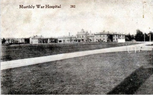
Murthly Hospital

Murthly Hospital, previously known as Murthly Asylum, Perth District Asylum and Perth and District Mental Hospital was a psychiatric hospital in Murthly...

Meikleour Arms

Meikleour Arms (also known as the Meikleour Arms Hotel) is a Category B listed building in Meikleour, Perth and Kinross, Scotland. It dates to 1820, and...

Nearby Amenities

Located within 500m of 56.550201,-3.4250855
Power: pole
Lat/Long: 56.5505634/-3.4172873
Power: pole
Lat/Long: 56.5504569/-3.4187005
Power: pole
Lat/Long: 56.5503628/-3.4199474
Power: pole
Lat/Long: 56.5502711/-3.4212483
Power: pole
Lat/Long: 56.5501584/-3.4225918
Power: pole
Lat/Long: 56.5500569/-3.4239354
Power: pole
Lat/Long: 56.5499516/-3.4252902
Power: pole
Lat/Long: 56.5498451/-3.4266427
Power: pole
Lat/Long: 56.5497659/-3.4277549
Power: pole
Lat/Long: 56.5496643/-3.429013
Power: pole
Lat/Long: 56.549559/-3.4303678
Power: pole
Lat/Long: 56.5494587/-3.4317136
Power: pole
Lat/Long: 56.5492606/-3.4328999
Material: wood
Power: pole
Lat/Long: 56.5528181/-3.4196485
Material: wood
Power: pole
Lat/Long: 56.55286/-3.4209153
Power: pole
Lat/Long: 56.5528975/-3.4221795
Power: pole
Lat/Long: 56.5529514/-3.4234517
Power: pole
Lat/Long: 56.5530039/-3.4247295
Power: pole
Lat/Long: 56.5530398/-3.4259854
Power: pole
Lat/Long: 56.5530863/-3.4272768
Power: pole
Lat/Long: 56.5531268/-3.4285191
Power: pole
Lat/Long: 56.5531762/-3.4296936
Power: pole
Lat/Long: 56.5532137/-3.4309006
Power: pole
Lat/Long: 56.5525821/-3.42954
Power: pole
Lat/Long: 56.5522719/-3.4288059
Power: pole
Lat/Long: 56.5519632/-3.4280475
Power: pole
Lat/Long: 56.551253/-3.4276642
Power: pole
Lat/Long: 56.5505487/-3.42727
Power: pole
Lat/Long: 56.5499208/-3.4269492
Power: pole
Lat/Long: 56.549254/-3.4265876
Power: pole
Lat/Long: 56.5486441/-3.4262233
Power: pole
Lat/Long: 56.54802/-3.4265047
Power: pole
Lat/Long: 56.5473351/-3.4269057
Power: pole
Lat/Long: 56.5466929/-3.4272904
Power: pole
Lat/Long: 56.547189/-3.4265427
Power: pole
Lat/Long: 56.5469537/-3.4260004
Power: pole
Lat/Long: 56.5465513/-3.4250475
Power: pole
Lat/Long: 56.5460942/-3.424096
Power: pole
Lat/Long: 56.5460935/-3.4227952
The data included in this document is from www.openstreetmap.org. The data is made available under ODbL.

Have you been to Barnes' Meadow?

Leave your review of Barnes' Meadow below (or comments, questions and feedback).