Hale
Settlement in Westmorland South Lakeland
England
Hale
Hale, Westmorland is a small village located in the Eden district of Cumbria, England. Situated near the eastern bank of the River Bela, Hale is surrounded by picturesque countryside and offers residents and visitors alike a serene and tranquil setting.
The village itself is characterized by a collection of charming stone houses, many of which date back several centuries, giving it a traditional and historic feel. The local community is tightly knit, with a population of around 300 people, creating a friendly and welcoming atmosphere.
While Hale may be small in size, it boasts a rich history. The village is known for its connection to the Quakers, with the historic Quaker Meeting House being a prominent local landmark. The Meeting House, built in 1700, still stands today and serves as a reminder of Hale's Quaker heritage.
Nature lovers will find much to appreciate in Hale, as the surrounding area offers ample opportunities for outdoor activities. The nearby River Bela is a popular spot for fishing, while the rolling hills and forests provide picturesque settings for walks and hikes.
Despite its rural location, Hale is conveniently located near the town of Milnthorpe, which offers a range of amenities including shops, schools, and medical facilities. Additionally, the village benefits from good transport links, with the M6 motorway just a short drive away, providing easy access to larger towns and cities in the region.
In summary, Hale, Westmorland is a charming and historic village, offering a peaceful and idyllic lifestyle in the heart of the Cumbrian countryside.
If you have any feedback on the listing, please let us know in the comments section below.
Hale Images
Images are sourced within 2km of 54.199582/-2.761207 or Grid Reference SD5078. Thanks to Geograph Open Source API. All images are credited.


Hale is located at Grid Ref: SD5078 (Lat: 54.199582, Lng: -2.761207)
Administrative County: Cumbria
District: South Lakeland
Police Authority: Cumbria
What 3 Words
///reset.custodial.reputable. Near Milnthorpe, Cumbria
Related Wikis

Hale, Cumbria
Hale is a hamlet near Beetham in the south of Cumbria, England. It lies on the A6 road, between Carnforth to the south and Milnthorpe to the north. It...
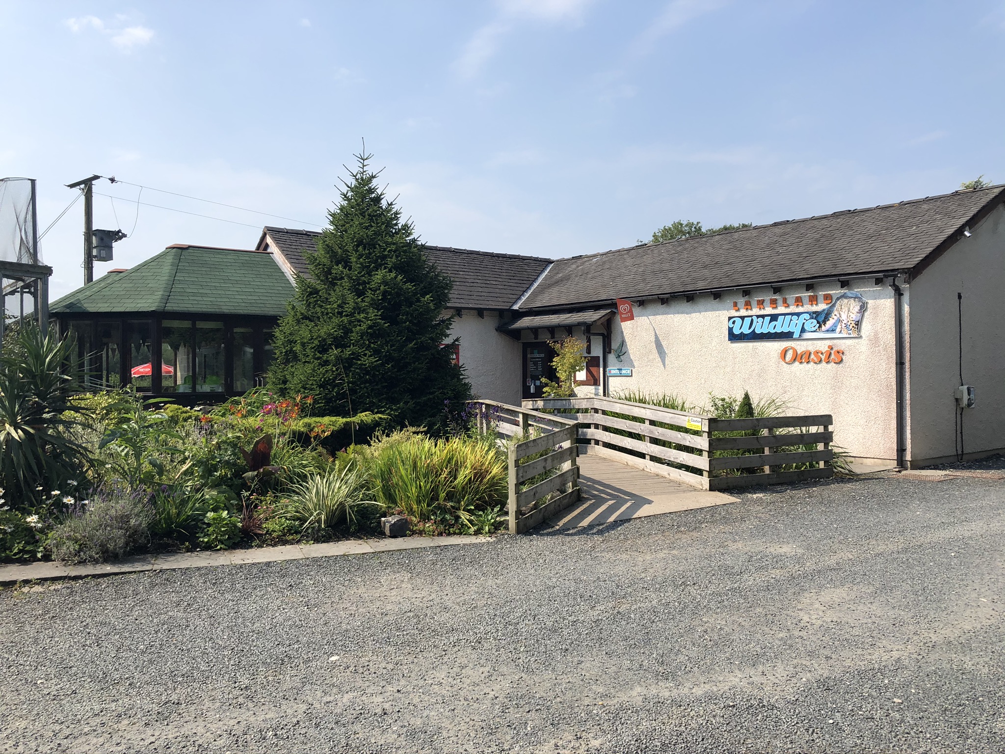
Lakeland Wildlife Oasis
The Lakeland Wildlife Oasis is a small zoological collection near the town of Milnthorpe, Cumbria, England, with a science and evolution theme. Since April...

Slack Head
Slack Head, sometimes written Slackhead, is a hamlet near Beetham, South Lakeland, Cumbria, England. It is in Beetham civil parish. It is a purely residential...

Beetham
Beetham is a village and civil parish in the South Lakeland district, in Cumbria, England, situated on the border with Lancashire, 6 miles (10 km) north...
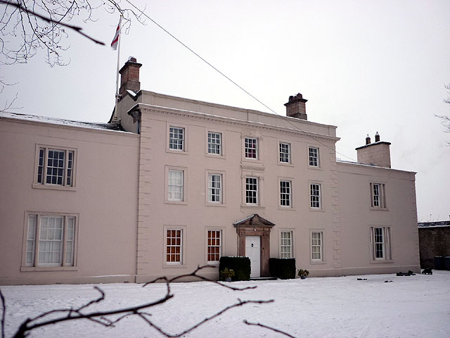
Ashton House, Cumbria
Ashton House is a large country house in Beetham in Cumbria. It is a Grade II* listed building. == History == The house was built in 1678 probably for...

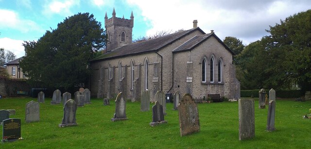
St Michael's Church, Beetham
St Michael's Church is in the village of Beetham, Cumbria, England. It is an active Anglican parish church in the deanery of Kendal, the archdeaconry of...

Storth
Storth is a village near Arnside in Cumbria, England, situated near the border with Lancashire. It is in the historic county of Westmorland. The village...
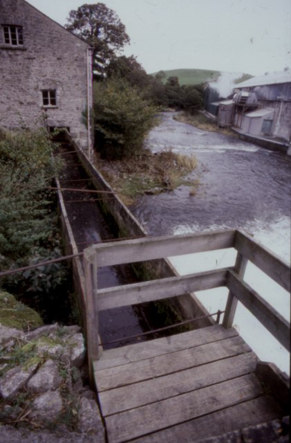
Heron Corn Mill
The Heron Corn Mill is a working 18th-century water mill on the River Bela at Beetham, Cumbria, England. The mill and its mill race are Grade II* listed...
Nearby Amenities
Located within 500m of 54.199582,-2.761207Have you been to Hale?
Leave your review of Hale below (or comments, questions and feedback).