Halcon

Settlement in Somerset Somerset West and Taunton

England

Halcon

Swans on the River Tone The view point is the access bridge for the cattle market/auction site which is visible at centre right. Priory Bridge can be seen in the background.
Swans on the River Tone Credit: Phil Williams

Halcon is a small village located in the county of Somerset, England. It is situated on the southern slopes of the Quantock Hills, a designated Area of Outstanding Natural Beauty. The village lies about 5 miles north of Taunton, the county town of Somerset.

Halcon is a rural community with a population of around 800 residents. The village is characterized by its picturesque landscape, with rolling hills, lush forests, and charming country lanes. The Quantock Hills provide ample opportunities for outdoor activities such as hiking, cycling, and horseback riding, attracting nature enthusiasts and adventure seekers.

In terms of amenities, Halcon has a few local facilities including a primary school, a village hall, and a small convenience store. For more extensive shopping and leisure options, residents often visit nearby towns such as Taunton or Bridgwater.

The village has a rich history dating back to medieval times, and there are several historic landmarks in the area. One notable attraction is the Church of St Mary, a Grade I listed building that dates back to the 12th century. The church features beautiful architectural details and is a popular spot for visitors interested in history and heritage.

Overall, Halcon is a tranquil and scenic village that offers a peaceful countryside lifestyle, while still being within easy reach of larger towns and cities in Somerset.

If you have any feedback on the listing, please let us know in the comments section below.
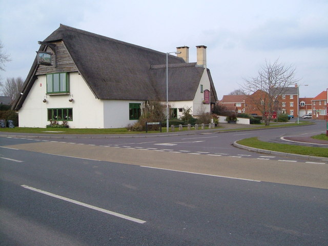
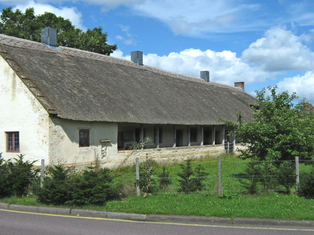
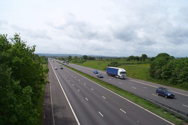
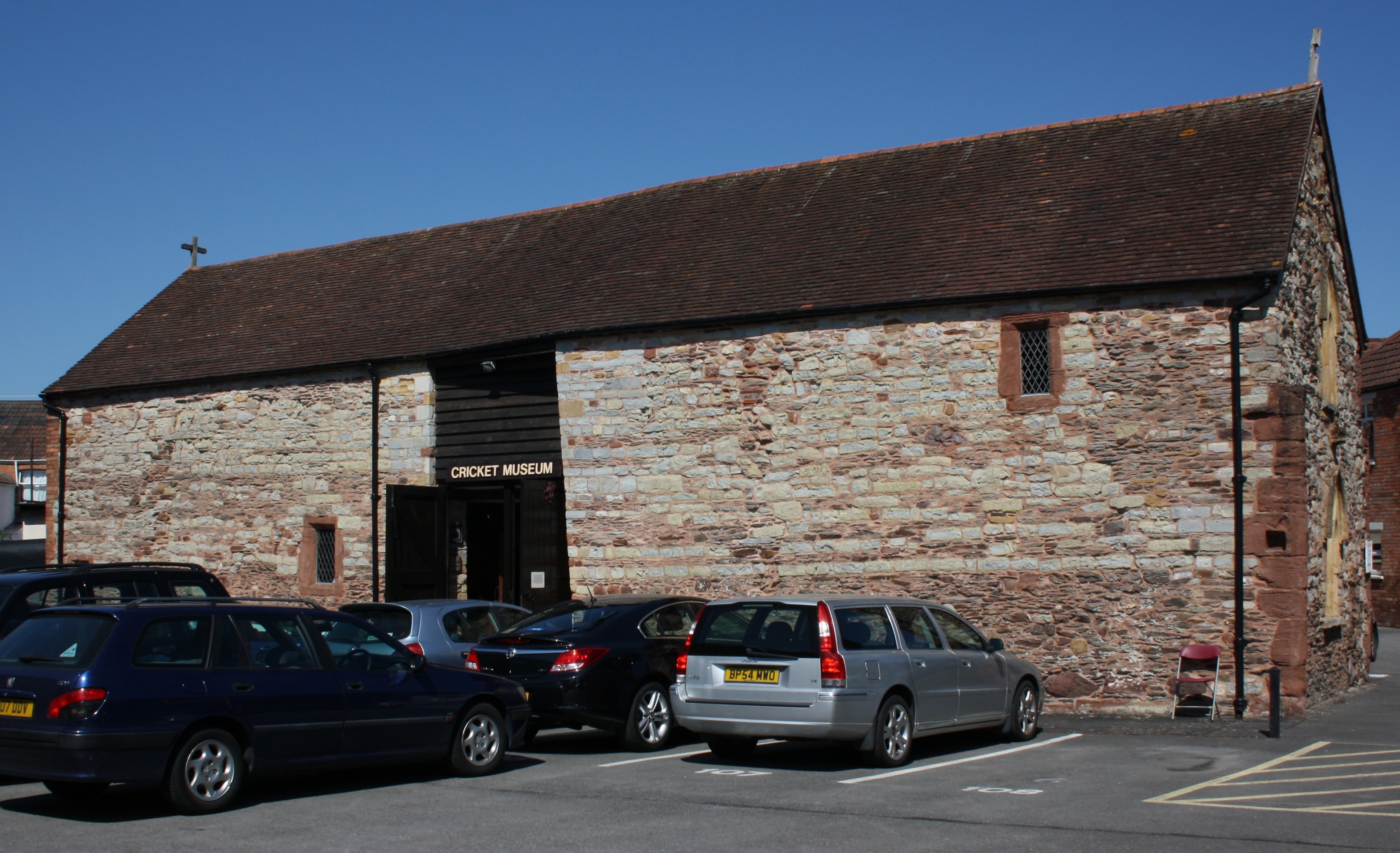
Halcon Images

Images are sourced within 2km of 51.020272/-3.073284 or Grid Reference ST2425. Thanks to Geograph Open Source API. All images are credited.

Swans on the River Tone The view point is the access bridge for the cattle market/auction site which is visible at centre right. Priory Bridge can be seen in the background.
Swans on the River Tone
The view point is the access bridge for the cattle market/auction site which is visible at centre right. Priory Bridge can be seen in the background.
Taunton Carnival Theatreland, the 2005 entry from Harlequins Carnival Club of Ilminster leaves the Priory Bridge Road assembly area during Taunton Carnival procession.
Taunton Carnival
Theatreland, the 2005 entry from Harlequins Carnival Club of Ilminster leaves the Priory Bridge Road assembly area during Taunton Carnival procession.
Taunton Carnival A view over Priory Bridge Road car park, in use as the assembly area for Taunton Carnival 2005. As the skies darken, last minute checks are being made on the floats and the majorettes are preparing to practise their routine.
Taunton Carnival
A view over Priory Bridge Road car park, in use as the assembly area for Taunton Carnival 2005. As the skies darken, last minute checks are being made on the floats and the majorettes are preparing to practise their routine.
Taunton Carnival As the moon rises, a police motor cyclist keeps an eye on some of the carnival floats preparing for the 2005 Taunton Carnival procession.
Taunton Carnival
As the moon rises, a police motor cyclist keeps an eye on some of the carnival floats preparing for the 2005 Taunton Carnival procession.
Taunton Carnival It's rush, rush, rush as start time approaches!  This is a view of some of the carnival floats in the Priory Bridge Road assembly area as they prepare for the 2005 Taunton Carnival procession.
Taunton Carnival
It's rush, rush, rush as start time approaches! This is a view of some of the carnival floats in the Priory Bridge Road assembly area as they prepare for the 2005 Taunton Carnival procession.
Taunton Carnival The 2005 entry form Phoenix Carnival club leaves the assembly area as it starts its journey along the Taunton Carnival procession route.
Taunton Carnival
The 2005 entry form Phoenix Carnival club leaves the assembly area as it starts its journey along the Taunton Carnival procession route.
Taunton Carnival Admiring crowds line the route as the 2005 entry form Gemini Carnival Club starts on its way along the Taunton Carnival procession.  This is a tableau float and the poses will be maintained for the duration of the procession, approximately two hours.
Taunton Carnival
Admiring crowds line the route as the 2005 entry form Gemini Carnival Club starts on its way along the Taunton Carnival procession. This is a tableau float and the poses will be maintained for the duration of the procession, approximately two hours.
The County Ground, Taunton Somerset are playing Hampshire in a four day county fixture. The Ian Botham Stand opposite is named after one of Somerset's most illustrious former players.
The County Ground, Taunton
Somerset are playing Hampshire in a four day county fixture. The Ian Botham Stand opposite is named after one of Somerset's most illustrious former players.
The Creech Castle Hotel. Taunton A local landmark at the busy junction of the A38 and the A358.
The Creech Castle Hotel. Taunton
A local landmark at the busy junction of the A38 and the A358.
Hankridge Farm Sainsbury's. Taunton's only out of town shopping centre is close to the M5 junction. Other stores on site include B&Q, Comet, Curry's and Halfords but the stores are quite small in comparison with those outside larger towns.
Hankridge Farm Sainsbury's.
Taunton's only out of town shopping centre is close to the M5 junction. Other stores on site include B&Q, Comet, Curry's and Halfords but the stores are quite small in comparison with those outside larger towns.
The Merry Monk. Monkton Heathfield. The conveniently located bus stop is handy for those monks who get a little too merry.
The Merry Monk. Monkton Heathfield.
The conveniently located bus stop is handy for those monks who get a little too merry.
St. James's church, Taunton
Firepool Weir, River Tone
Firepool Lock, Taunton and Bridgwater canal Where the canal meets the River Tone
Firepool Lock, Taunton and Bridgwater canal
Where the canal meets the River Tone
Gray's Almshouses, Taunton 17th century. Seen from the rear garden, looking NW. More details of architecture at <span class="nowrap"><a title="http://webapp1.somerset.gov.uk/her/details.asp?prn=44386" rel="nofollow ugc noopener" href="http://webapp1.somerset.gov.uk/her/details.asp?prn=44386">Link</a><img style="margin-left:2px;" alt="External link" title="External link - shift click to open in new window" src="https://s1.geograph.org.uk/img/external.png" width="10" height="10"/></span> .
Gray's Almshouses, Taunton
17th century. Seen from the rear garden, looking NW. More details of architecture at LinkExternal link .
King's College, Taunton This square contains three sizeable academic institutions, and King's College's main building, mid-Victorian Gothic, is certainly the most impressive. Architectural details at <span class="nowrap"><a title="http://www.tauntondeane.gov.uk/tdbcsites/HER/her_lb/lbdets.asp?id=002028" rel="nofollow ugc noopener" href="http://www.tauntondeane.gov.uk/tdbcsites/HER/her_lb/lbdets.asp?id=002028">Link</a><img style="margin-left:2px;" alt="External link" title="External link - shift click to open in new window" src="https://s1.geograph.org.uk/img/external.png" width="10" height="10"/></span> . Viewed from the SW.
King's College, Taunton
This square contains three sizeable academic institutions, and King's College's main building, mid-Victorian Gothic, is certainly the most impressive. Architectural details at LinkExternal link . Viewed from the SW.
The "Master Thatcher", Taunton It may be thatched but this is a modern pub, next to a Tesco Express and set amidst the extensive housing estates of south-east Taunton. Seen from the south across Lisieux (twin town) Way. 2:30 pm
The "Master Thatcher", Taunton
It may be thatched but this is a modern pub, next to a Tesco Express and set amidst the extensive housing estates of south-east Taunton. Seen from the south across Lisieux (twin town) Way. 2:30 pm
Higher Holway, Taunton A couple take their dog for a walk in this little area of green space between the residential suburb of Holway and the M5, foreground. View looking NNW from the Haydon Road bridge over the motorway. 2:36 pm.
Higher Holway, Taunton
A couple take their dog for a walk in this little area of green space between the residential suburb of Holway and the M5, foreground. View looking NNW from the Haydon Road bridge over the motorway. 2:36 pm.
Show me another place!

Halcon is located at Grid Ref: ST2425 (Lat: 51.020272, Lng: -3.073284)

Administrative County: Somerset

District: Somerset West and Taunton

Police Authority: Avon and Somerset

What 3 Words

///tasks.chitchat.denser. Near Taunton, Somerset

Nearby Locations

Halcon Creechbarrow Hill

Related Wikis

Taunton Town F.C.

Taunton Town Football Club are an English football club based in Taunton, Somerset. They compete in the National League South and play their home matches...

St Margaret's Almshouses

St Margaret's Almshouses are part of a 12th-century leper colony in Taunton, Somerset, England. == History == The building was founded as a leper hospital...

Cambria Farm

Cambria Farm is the site of a Bronze, Iron Age, Roman rural settlement, between Ruishton and Taunton, Somerset, England. A survey of the site was carried...

2011 M5 motorway crash

On 4 November 2011, a multiple-vehicle collision occurred on the M5 motorway near Taunton, Somerset, in South West England. The crash involved dozens of...

Tone FM

Tone FM (styled ToneFM) is a community radio station based in Taunton, Somerset, broadcasting to Taunton and the surrounding area on 107.8 FM, 24 hours...

Roman Catholic Church of St Teresa of Lisieux, Taunton

The Roman Catholic Church of St Teresa of Lisieux in Taunton, Somerset, England, dates from 1958–1959. It is the only known church design of Eric Francis...

The St Augustine of Canterbury School, Taunton

The St Augustine of Canterbury School was a joint Church of England and Roman Catholic Voluntary Aided (VA) secondary school in Taunton, Somerset, England...

Taunton Priory

Taunton Priory, or the Priory of St Peter and St Paul, was an Augustinian house of canons founded c. 1115 by William Gyffarde (also called William Giffard...

Nearby Amenities

Located within 500m of 51.020272,-3.073284
Traffic Signals
Lat/Long: 51.0181005/-3.0736807
Traffic Calming: choker
Lat/Long: 51.0199206/-3.0777431
Traffic Calming: hump
Lat/Long: 51.021218/-3.0753328
Give Way
Direction: forward
Lat/Long: 51.0176524/-3.0683507
Traffic Calming: choker
Lat/Long: 51.0195862/-3.0747916
Traffic Calming: choker
Lat/Long: 51.0193116/-3.0753903
Turning Circle
Lat/Long: 51.0182174/-3.0690525
Give Way
Lat/Long: 51.0195263/-3.0700623
Mini Roundabout
Direction: clockwise
Junction: roundabout
Lat/Long: 51.0177065/-3.0686177
Traffic Signals
Traffic Signals: signal
Lat/Long: 51.0240697/-3.0712314
Noexit: yes
Lat/Long: 51.0217364/-3.0668023
Give Way
Direction: backward
Lat/Long: 51.0186048/-3.0667518
Barrier: bollard
Bicycle: yes
Foot: yes
Lat/Long: 51.0210453/-3.0791812
Turning Circle
Lat/Long: 51.0213827/-3.0706148
Turning Circle
Lat/Long: 51.0213412/-3.0771661
Turning Circle
Lat/Long: 51.0191378/-3.0747255
Barrier: cycle_barrier
Bicycle: yes
Foot: yes
Lat/Long: 51.0211578/-3.0663602
Traffic Calming: choker
Lat/Long: 51.0192244/-3.0761821
Traffic Calming: choker
Lat/Long: 51.0198528/-3.0775728
Traffic Calming: choker
Lat/Long: 51.0202601/-3.0743932
Halcon
Is In: Taunton
Place: suburb
Lat/Long: 51.0203158/-3.076026
Traffic Calming: choker
Lat/Long: 51.020236/-3.0770646
Traffic Calming: choker
Lat/Long: 51.0203242/-3.0766906
Traffic Calming: choker
Lat/Long: 51.0208003/-3.0759957
Traffic Calming: choker
Lat/Long: 51.0202454/-3.0754097
Traffic Calming: island
Lat/Long: 51.0202673/-3.0760258
Traffic Calming: choker
Lat/Long: 51.0208291/-3.0774417
Traffic Calming: choker
Lat/Long: 51.0212875/-3.0764714
Turning Circle
Lat/Long: 51.0212963/-3.0744941
Crossing
Crossing: traffic_signals
Crossing Ref: pelican
Lat/Long: 51.0197399/-3.073248
Turning Circle
Lat/Long: 51.01957/-3.0777549
Noexit: yes
Lat/Long: 51.0168876/-3.0690757
Barrier: cycle_barrier
Bicycle: yes
Foot: yes
Lat/Long: 51.0202195/-3.0667242
Barrier: cycle_barrier
Bicycle: yes
Foot: yes
Lat/Long: 51.0211586/-3.0665564
Access: private
Barrier: lift_gate
Bicycle: no
Foot: no
Lat/Long: 51.0231031/-3.0786636
Access: private
Barrier: lift_gate
Bicycle: no
Foot: no
Lat/Long: 51.0231217/-3.0785953
Barrier: cycle_barrier
Bicycle: yes
Foot: yes
Lat/Long: 51.0168163/-3.0713329
Turning Circle
Lat/Long: 51.0188653/-3.0689107
Give Way
Lat/Long: 51.0204626/-3.0686529
Kerb: raised
Lat/Long: 51.0212889/-3.0706001
Traffic Calming: hump
Lat/Long: 51.0199411/-3.0784868
Traffic Calming: hump
Lat/Long: 51.0199659/-3.0793241
Traffic Calming: hump
Lat/Long: 51.0199877/-3.0799539
Barrier: bollard
Bicycle: yes
Foot: yes
Motor Vehicle: no
Lat/Long: 51.0178984/-3.0719743
Crossing
Crossing Island: yes
Lat/Long: 51.0200971/-3.0733945
Crossing
Crossing Island: yes
Lat/Long: 51.0203123/-3.0730867
Barrier: cycle_barrier
Bicycle: yes
Foot: yes
Lat/Long: 51.0182334/-3.0688842
Bus Stop
Halcon Corner
Bus: yes
Direction: 280
Naptan AtcoCode: 3600SOC31011
Naptan Bearing: W
Naptan CommonName: Halcon Corner
Naptan Indicator: W-bound
Naptan NaptanCode: sotajtgp
Naptan PlusbusZoneRef: TAUNTON
Naptan Street: Hamilton Road
Naptan Verified: no
Network: The Buses of Somerset
Network Wikidata: Q17018973
Operator: First South West
Operator Wikidata: Q5454172
Public Transport: platform
Ref: 54
Lat/Long: 51.0179202/-3.0755663
Bus Stop
Halcon Corner
Bus: yes
Direction: 100
Naptan AtcoCode: 3600SOC31010
Naptan Bearing: E
Naptan CommonName: Halcon Corner
Naptan Indicator: E-bound
Naptan NaptanCode: sotajtgm
Naptan PlusbusZoneRef: TAUNTON
Naptan Street: Hamilton Road
Naptan Verified: no
Network: The Buses of Somerset
Network Wikidata: Q17018973
Operator: First South West
Operator Wikidata: Q5454172
Public Transport: platform
Ref: 4;54
Lat/Long: 51.0180616/-3.0758582
Bus Stop
Oxford Inn
Bus: yes
Naptan AtcoCode: 3600SOC31012
Naptan Bearing: SW
Naptan CommonName: Oxford Inn
Naptan Indicator: SW-bound
Naptan NaptanCode: sotajtjp
Naptan PlusbusZoneRef: TAUNTON
Naptan Verified: no
Public Transport: platform
Lat/Long: 51.0196189/-3.0731844
Bus Stop
Oxford Inn
Bus: yes
Naptan AtcoCode: 3600SOC31013
Naptan Bearing: N
Naptan CommonName: Oxford Inn
Naptan Indicator: N-bound
Naptan NaptanCode: sotajtjm
Naptan PlusbusZoneRef: TAUNTON
Naptan Street: Bridgwater Road
Naptan Verified: no
Public Transport: platform
Lat/Long: 51.0205362/-3.0733436
Bus Stop
Laxton Road
Bus: yes
Naptan AtcoCode: 3600SOC31066
Naptan Bearing: W
Naptan CommonName: Laxton Road
Naptan Indicator: W-bound
Naptan NaptanCode: sotajtwd
Naptan PlusbusZoneRef: TAUNTON
Naptan Street: Laxton Road
Naptan Verified: no
Network: The Buses of Somerset
Network Wikidata: Q17018973
Operator: First South West
Operator Wikidata: Q5454172
Public Transport: platform
Ref: 4
Lat/Long: 51.0222159/-3.0706149
Bus Stop
Laxton Road Shops
Bench: no
Bin: no
Bus: yes
Lit: yes
Naptan AtcoCode: 3600SOC31064
Naptan Bearing: NE
Naptan CommonName: Laxton Road Shops
Naptan Indicator: NE-bound
Naptan NaptanCode: sotajtwa
Naptan PlusbusZoneRef: TAUNTON
Naptan Street: Laxton Road
Naptan Verified: no
Network: The Buses of Somerset
Network Wikidata: Q17018973
Operator: First South West
Operator Wikidata: Q5454172
Public Transport: platform
Ref: 4
Shelter: no
Tactile Paving: no
Lat/Long: 51.0195294/-3.0703676
Telephone
Lat/Long: 51.0201377/-3.0723372
Kerb: raised
Lat/Long: 51.0201717/-3.0717758
Post Box
Operator: Royal Mail
Operator Wikidata: Q638098
Lat/Long: 51.0203566/-3.071021
Bus Stop
Bus: yes
Public Transport: platform
Lat/Long: 51.0203423/-3.0720594
Bus Stop
Oxford Inn
Bus: yes
Naptan AtcoCode: 3600SOC31068
Naptan Bearing: W
Naptan CommonName: Oxford Inn
Naptan Indicator: W-bound
Naptan NaptanCode: sotajtjd
Naptan PlusbusZoneRef: TAUNTON
Naptan Street: Roman Road
Naptan Verified: no
Network: The Buses of Somerset
Network Wikidata: Q17018973
Operator: First South West
Operator Wikidata: Q5454172
Public Transport: platform
Ref: 4
Lat/Long: 51.0200808/-3.0736956
Bus Stop
Oxford Inn
Bus: yes
Naptan AtcoCode: 3600SOC31069
Naptan Bearing: E
Naptan CommonName: Oxford Inn
Naptan Indicator: E-bound
Naptan NaptanCode: sotajtjg
Naptan PlusbusZoneRef: TAUNTON
Naptan Street: Roman Road
Naptan Verified: no
Public Transport: platform
Lat/Long: 51.0201618/-3.0736929
Access: customers
Entrance: main
Wheelchair: yes
Lat/Long: 51.0172001/-3.068401
Post Box
Operator: Royal Mail
Operator Wikidata: Q638098
Lat/Long: 51.0198935/-3.07748
Give Way
Lat/Long: 51.0201424/-3.0744117
Give Way
Lat/Long: 51.0201948/-3.0752105
Traffic Calming: choker
Lat/Long: 51.0202058/-3.0748324
Give Way
Lat/Long: 51.0202083/-3.0743991
Give Way
Lat/Long: 51.0202578/-3.075204
Bus Stop
Moorland Close
Bus: yes
Naptan AtcoCode: 3600SOC31070
Naptan Bearing: W
Naptan CommonName: Moorland Close
Naptan Indicator: opp
Naptan NaptanCode: sotajtdp
Naptan PlusbusZoneRef: TAUNTON
Naptan Street: Roman Road
Naptan Verified: no
Network: The Buses of Somerset
Network Wikidata: Q17018973
Operator: First South West
Operator Wikidata: Q5454172
Public Transport: platform
Ref: 4
Lat/Long: 51.020266/-3.0764902
Camera Mount: pole
Man Made: surveillance
Surveillance Type: camera
Lat/Long: 51.0204114/-3.0767449
Give Way
Lat/Long: 51.0200974/-3.073319
Give Way
Lat/Long: 51.0230915/-3.071862
Give Way
Direction: forward
Lat/Long: 51.0239177/-3.0714882
Give Way
Direction: forward
Lat/Long: 51.0244025/-3.0709627
Barrier: cycle_barrier
Bicycle: yes
Foot: yes
Lat/Long: 51.0218685/-3.0670325
Give Way
Direction: forward
Lat/Long: 51.0220017/-3.0694699
Give Way
Lat/Long: 51.0222713/-3.0710573
Give Way
Lat/Long: 51.0223858/-3.0713459
Crossing
Crossing Island: yes
Lat/Long: 51.0224493/-3.0718693
Give Way
Lat/Long: 51.0224614/-3.071928
Give Way
Lat/Long: 51.0198106/-3.0697967
Give Way
Lat/Long: 51.020257/-3.0717682
Give Way
Lat/Long: 51.0202789/-3.070939
Give Way
Lat/Long: 51.0203124/-3.0717611
Give Way
Lat/Long: 51.0203133/-3.073163
Give Way
Lat/Long: 51.0216063/-3.0729123
Give Way
Lat/Long: 51.019438/-3.0708536
Bench
Backrest: yes
Check Date: 2023-02-28
Lat/Long: 51.0214361/-3.0704392
Barrier: bollard
Bicycle: yes
Foot: yes
Lat/Long: 51.0187305/-3.0711828
Give Way
Lat/Long: 51.0163623/-3.0741742
Give Way
Lat/Long: 51.0165385/-3.070338
Crossing
Crossing Island: yes
Lat/Long: 51.0165703/-3.069547
Give Way
Lat/Long: 51.016571/-3.0694718
Give Way
Lat/Long: 51.0165888/-3.0726868
Give Way
Lat/Long: 51.0166468/-3.0709809
Give Way
Lat/Long: 51.0167014/-3.0716605
Give Way
Lat/Long: 51.0167303/-3.0721247
Childcare
Owlets Minerva Primary School Nursery
Addr Street: Outer Circle
Lat/Long: 51.0189375/-3.078197
Give Way
Direction: backward
Lat/Long: 51.020057/-3.0666151
Give Way
Direction: backward
Lat/Long: 51.0204674/-3.0665575
Waste Basket
Waste: trash
Lat/Long: 51.0210946/-3.0669746
Bench
Backrest: no
Material: wood
Seats: 4
Lat/Long: 51.0210878/-3.0669947
Access: delivery
Entrance: service
Lat/Long: 51.0171561/-3.068809
Access: customers
Entrance: main
Lat/Long: 51.0200468/-3.0663938
Access: customers
Entrance: main
Lat/Long: 51.020461/-3.0663487
Taunton
Direction: backward
Traffic Sign: city_limit
Lat/Long: 51.0243701/-3.0728265
Post Box
Operator: Royal Mail
Operator Wikidata: Q638098
Post Box Type: lamp
Ref: TA1 571D
Royal Cypher: EIIR
Royal Cypher Wikidata: Q33102113
Lat/Long: 51.0224495/-3.0681179
Post Box
Operator: Royal Mail
Operator Wikidata: Q638098
Post Box Type: pillar
Ref: TA1 602D
Royal Cypher: EIIR
Royal Cypher Wikidata: Q33102113
Lat/Long: 51.0165208/-3.0696167
Crossing
Lat/Long: 51.0201867/-3.0723811
Traffic Signals
Traffic Signals: signal
Traffic Signals Direction: forward
Lat/Long: 51.0245002/-3.0714916
Traffic Signals
Traffic Signals: signal
Traffic Signals Direction: forward
Lat/Long: 51.0244055/-3.0717257
Traffic Signals
Traffic Signals: signal
Traffic Signals Direction: forward
Lat/Long: 51.0242585/-3.0712985
Traffic Signals
Traffic Signals: signal
Lat/Long: 51.0241826/-3.071557
Traffic Signals
Traffic Signals: signal
Lat/Long: 51.0243751/-3.0712791
Traffic Signals
Traffic Signals: signal
Lat/Long: 51.0244992/-3.0710728
Bus Stop
Laxton Road
Bus: yes
Naptan AtcoCode: 3600SOA56760
Naptan Bearing: N
Naptan CommonName: Laxton Road
Naptan Indicator: N-bound
Naptan NaptanCode: sotdpgta
Naptan PlusbusZoneRef: TAUNTON
Naptan Street: Laxton Road
Naptan Verified: no
Network: The Buses of Somerset
Network Wikidata: Q17018973
Operator: First South West
Operator Wikidata: Q5454172
Public Transport: platform
Ref: 4
Lat/Long: 51.020862/-3.0683214
Bus Stop
Crossways
Bus: yes
Naptan AtcoCode: 3600SOC31072
Naptan NaptanCode: sotajtap
Network: The Buses of Somerset
Network Wikidata: Q17018973
Operator: First South West
Operator Wikidata: Q5454172
Public Transport: platform
Ref: 4
Lat/Long: 51.0199325/-3.0791195
Bus Stop
Ilminster Road
Bus: yes
Direction: 90
Naptan AtcoCode: 3600SOC31106
Naptan Bearing: E
Naptan CommonName: Ilminster Road
Naptan Indicator: E-bound
Naptan NaptanCode: sotajtpj
Naptan PlusbusZoneRef: TAUNTON
Naptan Street: Ilminster Road
Naptan Verified: no
Network: The Buses of Somerset
Network Wikidata: Q17018973
Operator: First South West
Operator Wikidata: Q5454172
Public Transport: platform
Ref: 54
Lat/Long: 51.0180091/-3.0712397
Bus Stop
Ilminster Road
Bus: yes
Direction: 270
Naptan AtcoCode: 3600SOC31107
Naptan Bearing: W
Naptan CommonName: Ilminster Road
Naptan Indicator: W-bound
Naptan NaptanCode: sotajtpg
Naptan PlusbusZoneRef: TAUNTON
Naptan Street: Ilminster Road
Naptan Verified: no
Network: The Buses of Somerset
Network Wikidata: Q17018973
Operator: First South West
Operator Wikidata: Q5454172
Public Transport: platform
Ref: 54
Lat/Long: 51.0179188/-3.0713311
Entrance: main
Level: 0
Wheelchair: yes
Lat/Long: 51.0227265/-3.0721748
The data included in this document is from www.openstreetmap.org. The data is made available under ODbL.

Have you been to Halcon?

Leave your review of Halcon below (or comments, questions and feedback).