Perthi Common

Downs, Moorland in Radnorshire

Wales

Perthi Common

Morning Mist Mist fills the valley while I look down from Aberedew Hill
Morning Mist Credit: Bill Nicholls

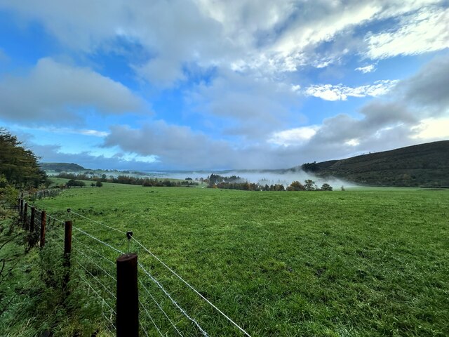
Perthi Common is a captivating expanse of natural beauty located in the county of Radnorshire, Wales. Spread over an area of approximately 5 square miles, it encompasses a diverse range of landscapes including downs and moorland. Situated at an elevation of around 1,000 feet, the common offers breathtaking panoramic views of the surrounding countryside.

The common is characterized by its rolling hills and vast open spaces, making it a haven for nature enthusiasts and outdoor adventurers. It is home to a variety of flora and fauna, with heather, gorse, and bracken dominating the moorland areas. These vibrant plant species provide a picturesque backdrop throughout the year, with the heather blooming in shades of purple during the summer months.

Wildlife thrives in Perthi Common, with several species making it their habitat. Visitors may be lucky enough to spot red grouse, peregrine falcons, or even the elusive black grouse. The common is also a popular grazing ground for sheep, adding to its rural charm.

For those seeking recreational activities, Perthi Common offers ample opportunities for walking, hiking, and birdwatching. A network of well-marked paths and trails crisscrosses the landscape, taking visitors through breathtaking vistas and secluded pockets of wilderness.

A visit to Perthi Common provides a serene escape from the bustling city life, offering a chance to immerse oneself in the tranquility of nature's wonders.

If you have any feedback on the listing, please let us know in the comments section below.

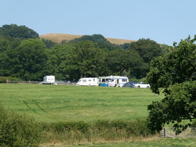
Perthi Common Images

Images are sourced within 2km of 52.182846/-3.3258824 or Grid Reference SO0954. Thanks to Geograph Open Source API. All images are credited.

Morning Mist Mist fills the valley while I look down from Aberedew Hill
Morning Mist
Mist fills the valley while I look down from Aberedew Hill
Glowing cloud The sun making it's presence know by lighting up the clouds as it rises from the old Quarry at Fforest Fields
Glowing cloud
The sun making it's presence know by lighting up the clouds as it rises from the old Quarry at Fforest Fields
Mist over Hundred House Looking down towards Hundred House from the track above fforest Fields campsite
Mist over Hundred House
Looking down towards Hundred House from the track above fforest Fields campsite
Field near Hundred House The village of Hundred House <a href="https://www.geograph.org.uk/gridref/SO1154">SO1154</a> can be seen in the distance.
Field near Hundred House
The village of Hundred House SO1154 can be seen in the distance.
Bryncrach Caravan Park and Campsite Small site near Hundred House.
Bryncrach Caravan Park and Campsite
Small site near Hundred House.
Bungalows at Hundred House On the road north out of the village.
Bungalows at Hundred House
On the road north out of the village.
Along the hill Looking along the side of Aberedw Hill with the mist below in the valley floor
Along the hill
Looking along the side of Aberedw Hill with the mist below in the valley floor
Shadow on the mist Somewhere down there is Fforest Fields Camp site but all you can see is a shadow on the mist.
Shadow on the mist
Somewhere down there is Fforest Fields Camp site but all you can see is a shadow on the mist.
Misty Panoramic The number of times I have climbed up here and looked at this view but today I was lucky to look at it with mist covering everything
Misty Panoramic
The number of times I have climbed up here and looked at this view but today I was lucky to look at it with mist covering everything
Sea of Mist Looking down from Aberedew hill into the valley below which looks like it is filled with a sea of mist
Sea of Mist
Looking down from Aberedew hill into the valley below which looks like it is filled with a sea of mist
Looking across the mist As far and you can see here from Aberedew Hill is mist extending to the valley that connects to this one as well
Looking across the mist
As far and you can see here from Aberedew Hill is mist extending to the valley that connects to this one as well
Hundred House Inn The public house by the A481 road is being renovated as of June 2023.
Hundred House Inn
The public house by the A481 road is being renovated as of June 2023.
Halloween morning The camping field at Fforest Fields in the early Halloween morning
Halloween morning
The camping field at Fforest Fields in the early Halloween morning
Snow Storm at Fforest Fields Not the greatest thing to wake up to in the morning, a snow storm, it did not last that long but it was very cold.
Snow Storm at Fforest Fields
Not the greatest thing to wake up to in the morning, a snow storm, it did not last that long but it was very cold.
Snow on the Hill A smattering of snow laid down on Fforest Hill. it did not last long and the snow soon melted at Fforest Fields
Snow on the Hill
A smattering of snow laid down on Fforest Hill. it did not last long and the snow soon melted at Fforest Fields
Fforest Fields Campsite
Tethered Horse Grazing at Hundred House
Hundred House Inn
Hundred House Inn
Show me another place!

Perthi Common is located at Grid Ref: SO0954 (Lat: 52.182846, Lng: -3.3258824)

Unitary Authority: Powys

Police Authority: Dyfed Powys

What 3 Words

///risky.simulates.snowmen. Near Builth Wells, Powys

Related Wikis

Colwyn Castle

Colwyn Castle was a medieval castle near Llansantffraed in Wales. In the Manor of Glascwm, in the county of Radnorshire.It was built on the site of a Roman...

Gilwern Hill, Powys

Gilwern Hill is a hill about 3 mi / 5 km southeast of Llandrindod Wells in the county of Powys, Wales. == Geology == The hill is composed from a range...

Mechain

Mechain was a medieval cantref in the Kingdom of Powys. This cantref has also been referred to as Y Fyrnwy (Vyrnwy). Mechain may owe its name to the River...

Llanfaredd Halt railway station

Llanfaredd Halt railway station was an unstaffed railway station opened by the Great Western Railway on 7 May 1934 on the old Mid-Wales line between Builth...

District of Radnorshire

The District of Radnorshire (Welsh: Maesyfed) was one of three local government districts of the county of Powys, Wales, from 1974 until 1996. The district...

Llanelwedd

Llanelwedd [ɬanˈɛlwɛð] is a village and community near Builth Wells, in Powys, Wales. It lies within the historic boundaries of Radnorshire. Llanelwedd...

Builth Wells transmitting station

The Builth Wells television relay station is sited on high ground to the north of the town of Builth Wells in Powys, South Wales. It was originally built...

Builth Wells railway station

Builth Wells railway station, in Llanelwedd Powys Wales was opened as Builth station on 21 September 1864 by the Mid-Wales Railway, although excursions...

Nearby Amenities

Located within 500m of 52.182846,-3.3258824
Llansaintfraed in Elwel
Is In: Powys,Wales,UK
Name Cy: Llansanffraid-yn-Elfael
Place: village
Source: npe
Lat/Long: 52.1833/-3.318724
Post Box
Post Box Type: lamp
Ref: LD1 73
Royal Cypher: EIIR
Royal Cypher Wikidata: Q33102113
Lat/Long: 52.1825452/-3.3200437
Direction: 125
Generator Method: photovoltaic
Generator Output Electricity: yes
Generator Solar Modules: 16
Generator Source: solar
Generator Type: solar_photovoltaic_panel
Location: roof
Power: generator
Lat/Long: 52.1814475/-3.3236747
The data included in this document is from www.openstreetmap.org. The data is made available under ODbL.

Have you been to Perthi Common?

Leave your review of Perthi Common below (or comments, questions and feedback).