Aberfan Park

Downs, Moorland in Glamorgan

Wales

Aberfan Park

Track towards Mountain Ash
Track towards Mountain Ash Credit: Alan Hughes

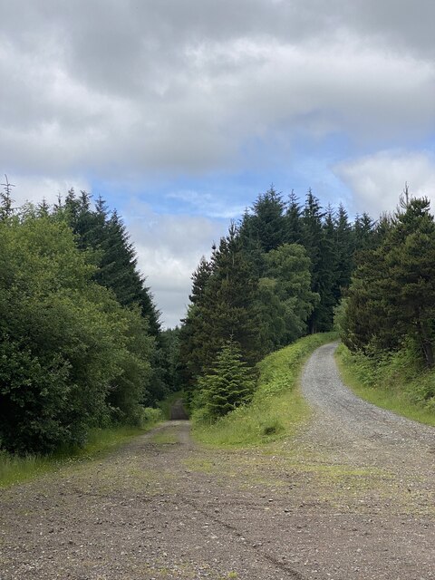
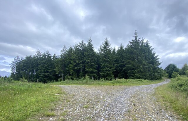
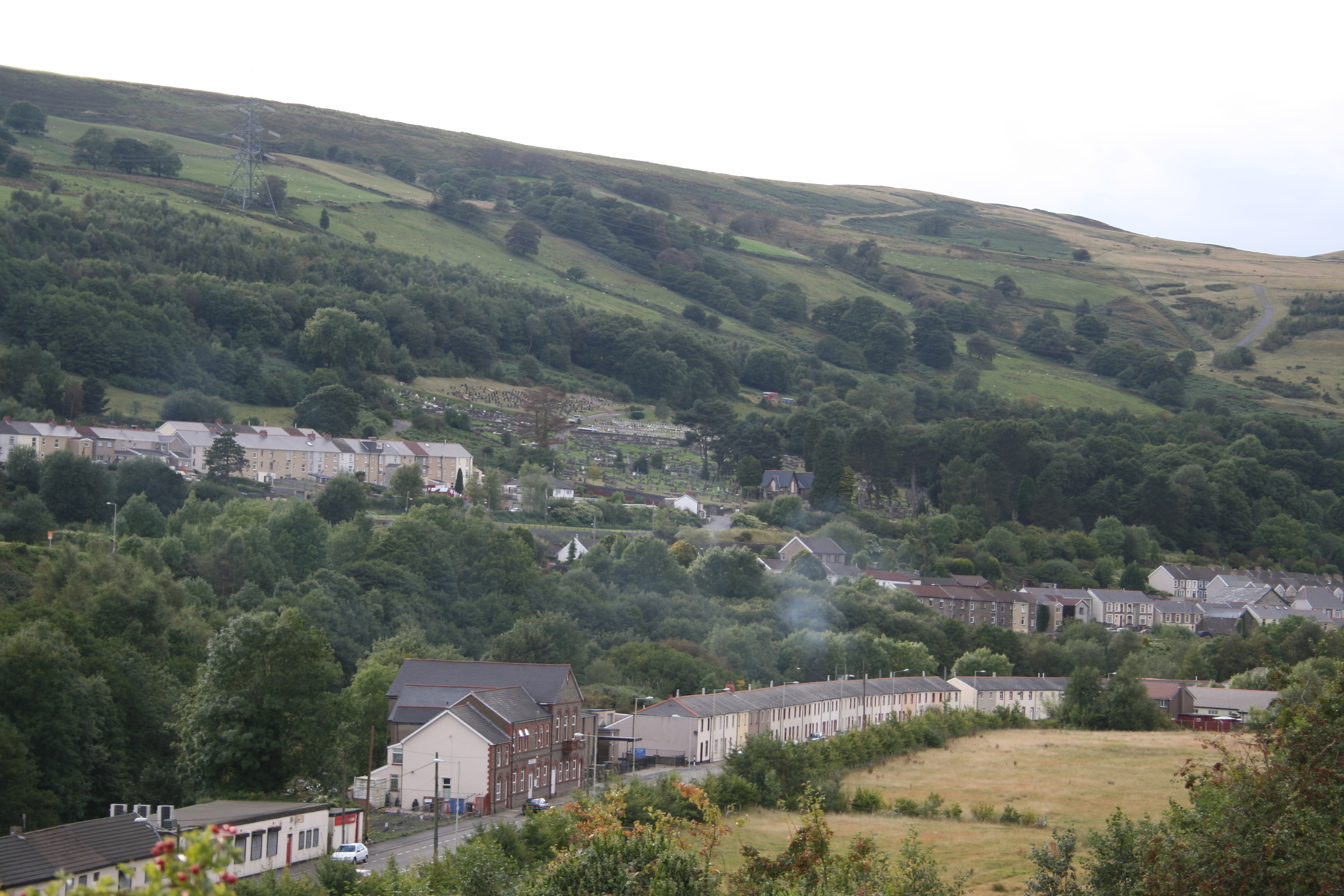
Aberfan Park, located in Glamorgan, Wales, is a picturesque area that encompasses a combination of downs and moorland. Spanning approximately 200 acres, the park offers visitors a tranquil and scenic environment, perfect for relaxation and outdoor activities.

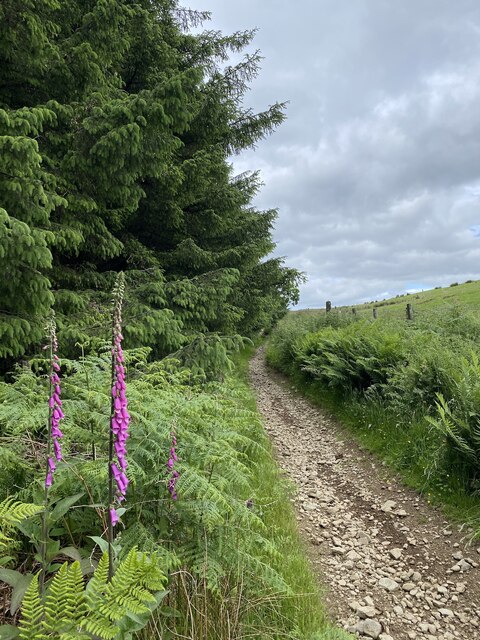
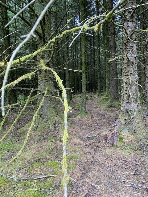
The downs, characterized by rolling hills covered in lush grasses and wildflowers, provide visitors with breathtaking views of the surrounding landscape. These areas are ideal for picnics, leisurely walks, or even flying kites. The expansive moorland, on the other hand, presents a different kind of beauty, with its open expanse of heather and gorse, creating a vibrant purple and yellow tapestry during the summer months.

The park is home to a diverse range of flora and fauna, making it an excellent destination for nature lovers. Visitors can expect to encounter various species of birds, including kestrels and buzzards, soaring through the skies. Additionally, the park is known for its population of grazing animals such as sheep and ponies, adding to the idyllic countryside ambiance.

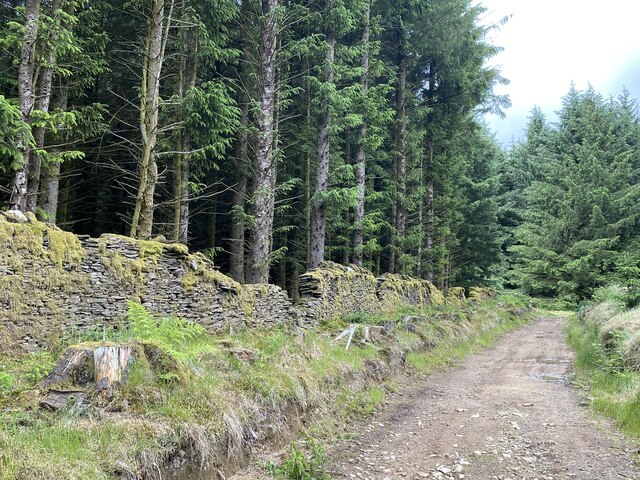
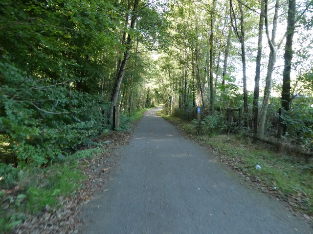
Aberfan Park also offers several recreational facilities to cater to different interests. There are designated areas for camping, with basic amenities provided, allowing visitors to immerse themselves in the natural surroundings. For those who enjoy hiking, the park features a network of well-maintained trails, offering different levels of difficulty to accommodate all skill levels.

Overall, Aberfan Park in Glamorgan is a haven for nature enthusiasts, providing a serene escape from the hustle and bustle of everyday life. With its stunning downs, vibrant moorland, and abundant wildlife, it offers a truly enchanting experience for all who visit.

If you have any feedback on the listing, please let us know in the comments section below.

Aberfan Park Images

Images are sourced within 2km of 51.688253/-3.3405434 or Grid Reference ST0799. Thanks to Geograph Open Source API. All images are credited.

Track towards Mountain Ash
Kissing gate
Kissing gate
Overgrown path A narrow pathway to Mynydd Merthyr.
Overgrown path
A narrow pathway to Mynydd Merthyr.
Forest path towards Mynydd Merthyr
Track junction The low road continues to Mynydd Merthyr, the high road to the summit of Twyn Brynbychan.
Track junction
The low road continues to Mynydd Merthyr, the high road to the summit of Twyn Brynbychan.
Track junction
Track junction
Boundary wall alongside forestry
Merthyr Vale
Merthyr Vale
Over Perthygleision Farm View along the Taff Vale.
Over Perthygleision Farm
View along the Taff Vale.
Stony path bordering forestry
On entering the forest
Stone sleepers on Trevithick Trail These stone sleepers were part of the early 19th century tramway that followed the River Taff.  Now they are one of the points of interest on the cycle path
Stone sleepers on Trevithick Trail
These stone sleepers were part of the early 19th century tramway that followed the River Taff. Now they are one of the points of interest on the cycle path
A woodland path for the Taff Trail
Dying trees by Taff Trail
Taff Trail on the edge of woodland
Taff Trail south of Aberfan
Taff Trail tunnel under A470 south of Aberfan
View over Taff valley from Taff Trail, Aberfan
Show me another place!

Aberfan Park is located at Grid Ref: ST0799 (Lat: 51.688253, Lng: -3.3405434)

Unitary Authority: Merthyr Tydfil

Police Authority: South Wales

What 3 Words

///nips.usages.other. Near Aberfan, Merthyr Tydfil

Related Wikis

Aberfan railway station

Aberfan railway station served the village of Aberfan, near Merthyr Tydfil in Wales. Opened by the Quakers Yard & Merthyr Railway, a joint Great Western...

Merthyr Vale railway station

Merthyr Vale railway station is a railway station serving the villages of Merthyr Vale and Aberfan in Merthyr Tydfil, Wales. It is located on the Merthyr...

Merthyr Vale

Merthyr Vale (Welsh: Ynysowen or Ynyswen) is a linear village and community in the Welsh county borough of Merthyr Tydfil. Lying on the A4054 road it is...

Aberfan

Aberfan (Welsh pronunciation: [ˌabɛrˈvan]) is a former coal mining village in the Taff Valley 4 mi (6 km) south of the town of Merthyr Tydfil, Wales. On...

Aberfan Cemetery

Aberfan Cemetery (Welsh: Mynwent Aberfan) is a cemetery near the village of Aberfan, Merthyr Tydfil. It is one of five cemeteries in Merthyr Tydfil County...

Taff Trail

The Taff Trail (Welsh: Taith Taf) is a popular walking and cycle path that runs for 55 miles (89 km) between Cardiff Bay and Brecon in Wales. It is so...

Mount Pleasant, Merthyr Tydfil

Mount Pleasant is a small village in the south of Merthyr Tydfil County Borough, Wales. It lies about 1 km (2⁄3 mi) south of Merthyr Vale, along the A4054...

Caegarw

Caegarw is a large village situated in Mountain Ash, in Rhondda Cynon Taff, Wales. == Location == It is close to Cefnpennar and Cwmpennar. It is about...

Nearby Amenities

Located within 500m of 51.688253,-3.3405434
Merthyr Vale
Name Cy: Ynysowen
Naptan AtcoCode: 9100MERTHRV
Network: National Rail
Network Website: https://www.nationalrail.co.uk/stations/mev/
Network Wikidata: Q26334
Operator: Trafnidiaeth Cymru
Operator Cy: Trafnidiaeth Cymru
Operator En: Transport for Wales
Operator Website: https://tfw.wales/places/stations/merthyr-vale
Operator Wikidata: Q104878180
Public Transport: station
Railway: station
Ref Crs: MEV
Wikidata: Q3400233
Wikipedia: en:Merthyr Vale railway station
Lat/Long: 51.6869084/-3.3371036
Noexit: yes
Lat/Long: 51.6920675/-3.3433573
Pub
Windsor Hotel
Addr Postcode: CF48 4SB
Addr Street: Cardiff Road
Fhrs Id: 1225412
Source Addr: FHRS Open Data
Lat/Long: 51.6911146/-3.3381571
Railway: stop
Lat/Long: 51.6868666/-3.3370684
Merthyr Vale
Name Cy: Ynysowen
Place: village
Wikidata: Q6820697
Wikipedia: en:Merthyr Vale
Lat/Long: 51.6884118/-3.3362076
Noexit: yes
Lat/Long: 51.6875986/-3.3377397
Mini Roundabout
Lat/Long: 51.6921444/-3.3391464
Crossing
Crossing: marked
Lat/Long: 51.6920039/-3.3424943
Aberfan
Historic Railway: station
Railway: site
Wikidata: Q4667061
Wikipedia: en:Aberfan railway station
Lat/Long: 51.6892302/-3.3441778
Bus Stop
Gordon Lennox Club
Naptan AtcoCode: 5530AWB33782
Naptan NaptanCode: mtyatgd
Survey Date: 2017-08-08
Lat/Long: 51.6895516/-3.341146
Bus Stop
Station Square
Naptan AtcoCode: 5530AWB33781
Naptan NaptanCode: mtyatjm
Survey Date: 2017-08-08
Lat/Long: 51.6871834/-3.3367072
Bus Stop
Station Square
Naptan AtcoCode: 5530AWB33779
Naptan NaptanCode: mtyatjg
Survey Date: 2017-08-08
Lat/Long: 51.6871545/-3.3368799
Bus Stop
Windsor Hotel
Naptan AtcoCode: 5530WDB47488
Naptan NaptanCode: mtygdjd
Survey Date: 2017-08-08
Lat/Long: 51.6911529/-3.3379237
Bus Stop
Station Terrace
Naptan AtcoCode: 5530AWB33787
Naptan NaptanCode: mtyatjd
Survey Date: 2017-08-08
Lat/Long: 51.6854464/-3.3360629
Bus Stop
Station Terrace
Naptan AtcoCode: 5530AWB33786
Naptan NaptanCode: mtyatja
Survey Date: 2017-08-08
Lat/Long: 51.6855287/-3.3359351
Bus Stop
Rachabite Hall
Naptan AtcoCode: 5530AWB33785
Naptan NaptanCode: mtyatjt
Survey Date: 2017-08-08
Lat/Long: 51.6880313/-3.3388443
Bus Stop
Rachabite Hall
Naptan AtcoCode: 5530AWB33784
Naptan NaptanCode: mtyatjp
Survey Date: 2017-08-08
Lat/Long: 51.6880145/-3.3387425
Bus Stop
Gordon Lennox Club
Naptan AtcoCode: 5530AWB33783
Naptan NaptanCode: mtyatgj
Survey Date: 2017-08-08
Lat/Long: 51.6895225/-3.3413332
Bus Stop
Brynteg Terrace
Naptan AtcoCode: 5530AWB33778
Naptan NaptanCode: mtyatgw
Survey Date: 2017-08-08
Lat/Long: 51.689553/-3.3370808
Bus Stop
Brynteg Terrace
Naptan AtcoCode: 5530AWB33777
Naptan NaptanCode: mtyatgt
Survey Date: 2017-08-08
Lat/Long: 51.6897931/-3.3373193
Bus Stop
Coventry Playground
Naptan AtcoCode: 5530AWB33776
Naptan NaptanCode: mtyatgp
Survey Date: 2017-08-08
Lat/Long: 51.6922335/-3.3385777
Bus Stop
Bryngoleu Terminus
Naptan AtcoCode: 5530AWB33761
Naptan NaptanCode: mtyatdw
Survey Date: 2017-08-08
Lat/Long: 51.6841923/-3.3403801
Bus Stop
Ty Bryngoleu
Naptan AtcoCode: 5530AWB33760
Naptan NaptanCode: mtyatma
Survey Date: 2017-08-08
Lat/Long: 51.6850739/-3.3411294
Walters Terrace
Naptan AtcoCode: 5530AWB33759
Naptan BusStopType: CUS
Naptan NaptanCode: mtyatmg
Survey Date: 2017-08-08
Lat/Long: 51.6870663/-3.3422443
Bus Stop
Perthygleision Square
Naptan AtcoCode: 5530AWB33763
Naptan NaptanCode: mtyatjw
Survey Date: 2017-08-08
Lat/Long: 51.685452/-3.3418783
Bus Stop
Canonie Crescent
Naptan AtcoCode: 5530AWB33762
Naptan NaptanCode: mtyatga
Survey Date: 2017-08-08
Lat/Long: 51.6848537/-3.3415135
Bus Stop
Coventry Playground
Naptan AtcoCode: 5530AWB33775
Naptan NaptanCode: mtyatgm
Survey Date: 2017-08-08
Lat/Long: 51.6924199/-3.3387857
Walters Terrace
Naptan AtcoCode: 5530AWB33758
Naptan BusStopType: CUS
Naptan NaptanCode: mtyatmd
Survey Date: 2017-08-08
Lat/Long: 51.6869248/-3.3420376
Bus Stop
Park View
Naptan AtcoCode: 5530AWB33757
Naptan NaptanCode: mtyadmp
Survey Date: 2017-08-08
Lat/Long: 51.688348/-3.3433962
Bus Stop
Park View
Naptan AtcoCode: 5530AWB33756
Naptan NaptanCode: mtyadmj
Survey Date: 2017-08-08
Lat/Long: 51.6884181/-3.3435574
Capel Smyrna
Naptan AtcoCode: 5530AWB33754
Naptan BusStopType: CUS
Naptan NaptanCode: mtyadgt
Survey Date: 2017-08-08
Lat/Long: 51.6914888/-3.3455147
Playground: yes
Lat/Long: 51.6891111/-3.3430108
Playground: yes
Lat/Long: 51.6890247/-3.3428324
Playground: yes
Lat/Long: 51.6890055/-3.342707
Direction: SSE
Generator Method: photovoltaic
Generator Output Electricity: yes
Generator Solar Modules: 6
Generator Source: solar
Generator Type: solar_photovoltaic_panel
Location: roof
Power: generator
Lat/Long: 51.691799/-3.3388734
Direction: 235
Generator Method: photovoltaic
Generator Output Electricity: yes
Generator Solar Modules: 8
Generator Source: solar
Generator Type: solar_photovoltaic_panel
Location: roof
Power: generator
Lat/Long: 51.6865071/-3.3374003
Direction: 235
Generator Method: photovoltaic
Generator Output Electricity: yes
Generator Solar Modules: 10
Generator Source: solar
Generator Type: solar_photovoltaic_panel
Location: roof
Power: generator
Lat/Long: 51.6863159/-3.3373815
Direction: 235
Generator Method: photovoltaic
Generator Output Electricity: yes
Generator Solar Modules: 10
Generator Source: solar
Generator Type: solar_photovoltaic_panel
Location: roof
Power: generator
Lat/Long: 51.6858387/-3.3372501
The data included in this document is from www.openstreetmap.org. The data is made available under ODbL.

Have you been to Aberfan Park?

Leave your review of Aberfan Park below (or comments, questions and feedback).