Fore Brae

Downs, Moorland in Peeblesshire

Scotland

Fore Brae

Path to Annanhead Hill The information board describes the Borders Forest Trust's Corehead project to restore habitat by replanting the slopes with native woodland - see <span class="nowrap"><a title="https://bordersforesttrust.org/wild-heart/corehead" rel="nofollow ugc noopener" href="https://bordersforesttrust.org/wild-heart/corehead">Link</a><img style="margin-left:2px;" alt="External link" title="External link - shift click to open in new window" src="https://s1.geograph.org.uk/img/external.png" width="10" height="10"/></span>.

The path is part of the Annandale Way loop up from Moffat to the highest point on Chalk Rig Edge and the source of the River Annan.
Path to Annanhead Hill Credit: Jim Barton

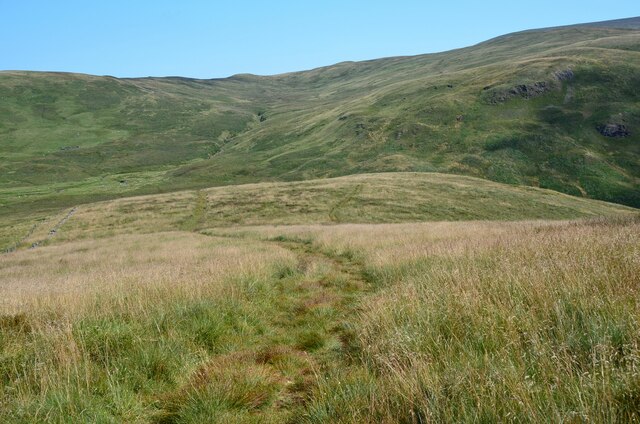
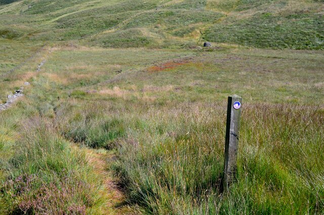
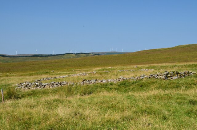
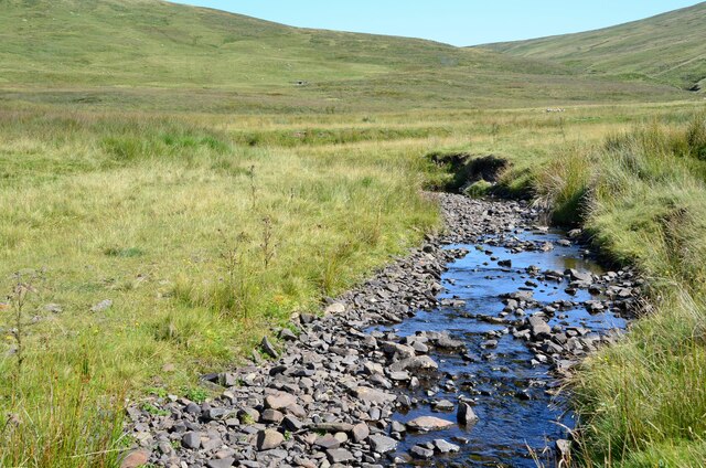
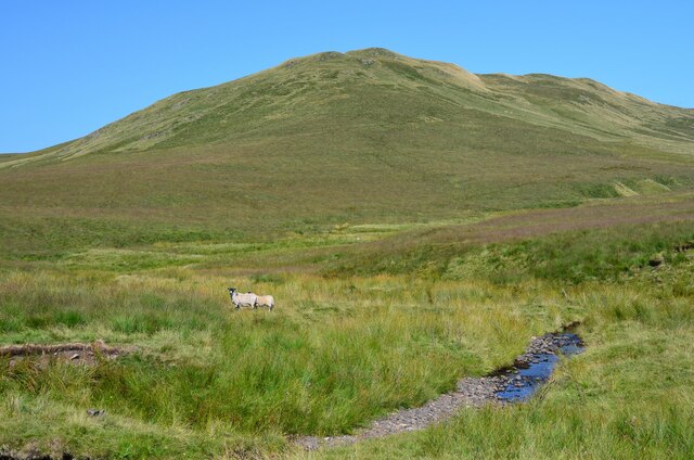
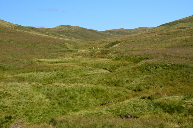
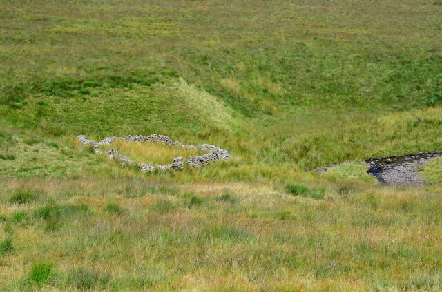
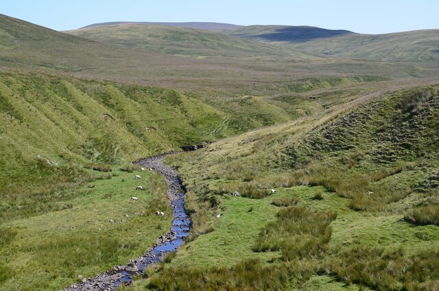
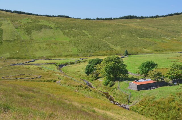
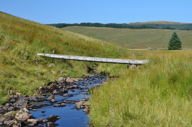
Fore Brae is a picturesque countryside area located in Peeblesshire, Scotland. Situated amidst the stunning Downs and Moorland landscapes, this region offers a unique blend of natural beauty and tranquility. The area is characterized by rolling hills, vast open spaces, and breathtaking panoramic views.

Covered in lush greenery and dotted with vibrant wildflowers, Fore Brae provides a haven for nature enthusiasts and outdoor enthusiasts alike. The terrain is predominantly hilly, with gentle slopes that add to the charm of the landscape. The Downs offer expansive grasslands that are perfect for leisurely walks, picnics, or even horseback riding.

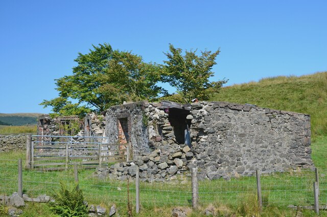
The Moorland areas within Fore Brae showcase a distinct ecosystem, characterized by heather-covered expanses and scattered patches of woodland. This diverse habitat plays host to various species of wildlife, including birds, mammals, and insects. It is not uncommon to spot red grouse, deer, and even the occasional golden eagle in this region.

The peace and tranquility of Fore Brae make it an ideal destination for those seeking solace in nature. The absence of urban development ensures an unspoiled environment, allowing visitors to immerse themselves in the raw beauty of the surroundings.

With its stunning scenery, abundant flora and fauna, and a sense of serenity, Fore Brae in Peeblesshire offers a true escape from the hustle and bustle of city life. Whether one wishes to explore the Downs, immerse themselves in the Moorland, or simply take in the breathtaking views, Fore Brae is a destination that promises to leave a lasting impression.

If you have any feedback on the listing, please let us know in the comments section below.

Fore Brae Images

Images are sourced within 2km of 55.416181/-3.4789602 or Grid Reference NT0614. Thanks to Geograph Open Source API. All images are credited.

Path to Annanhead Hill The information board describes the Borders Forest Trust's Corehead project to restore habitat by replanting the slopes with native woodland - see <span class="nowrap"><a title="https://bordersforesttrust.org/wild-heart/corehead" rel="nofollow ugc noopener" href="https://bordersforesttrust.org/wild-heart/corehead">Link</a><img style="margin-left:2px;" alt="External link" title="External link - shift click to open in new window" src="https://s1.geograph.org.uk/img/external.png" width="10" height="10"/></span>.

The path is part of the Annandale Way loop up from Moffat to the highest point on Chalk Rig Edge and the source of the River Annan.
Path to Annanhead Hill
The information board describes the Borders Forest Trust's Corehead project to restore habitat by replanting the slopes with native woodland - see LinkExternal link. The path is part of the Annandale Way loop up from Moffat to the highest point on Chalk Rig Edge and the source of the River Annan.
Devil's Beef Tub from Annanhead Hill The deep-cut bowl of the Devil's Beef Tub continues round to the right in this view towards Upper Annandale with the A701 road rounding the shoulder of Ericstane Hill above a steep 150m slope below.
Devil's Beef Tub from Annanhead Hill
The deep-cut bowl of the Devil's Beef Tub continues round to the right in this view towards Upper Annandale with the A701 road rounding the shoulder of Ericstane Hill above a steep 150m slope below.
Great Hill and Strait Step The steep west side of Great Hill is well seen from Annanhead Hill. The Strait Step is the precarious-looking path traversing the face, on a route connecting the former farm at Earlshaugh with Corehead in the valley below.
Great Hill and Strait Step
The steep west side of Great Hill is well seen from Annanhead Hill. The Strait Step is the precarious-looking path traversing the face, on a route connecting the former farm at Earlshaugh with Corehead in the valley below.
Viewpoint bench, Annanhead Hill (2) A clear sunny day on which to enjoy the extensive views from the highest parts of the Annandale Way. The bench is inscribed 'Annandale Way Viewpoints'.

Compare with <a href="https://www.geograph.org.uk/photo/4162483">NT0513 : Viewpoint bench, Annanhead Hill</a>.
Viewpoint bench, Annanhead Hill (2)
A clear sunny day on which to enjoy the extensive views from the highest parts of the Annandale Way. The bench is inscribed 'Annandale Way Viewpoints'. Compare with NT0513 : Viewpoint bench, Annanhead Hill.
Descending Peat Knowe On the ridge eastwards towards the notch at the start of the Strait Step pass.
Descending Peat Knowe
On the ridge eastwards towards the notch at the start of the Strait Step pass.
Fence on Great Hill The Annandale Way follows the fence skirting to the north of the 466m summit of Great Hill.
Fence on Great Hill
The Annandale Way follows the fence skirting to the north of the 466m summit of Great Hill.
The Annandale Way on Chalk Rig Edge The highest point of the Way (500m) lies on this almost level grassy ridge. The cairn marking the source of the River Annan lies about 1km to the east.
The Annandale Way on Chalk Rig Edge
The highest point of the Way (500m) lies on this almost level grassy ridge. The cairn marking the source of the River Annan lies about 1km to the east.
East side of Chalk Rig Edge The path descends to the col where a cairn marks the source of the River Annan and the northern end of the Annandale Way. The hillside in the background has the highest of the headstreams of the River Tweed, in Whitehope Burn.
East side of Chalk Rig Edge
The path descends to the col where a cairn marks the source of the River Annan and the northern end of the Annandale Way. The hillside in the background has the highest of the headstreams of the River Tweed, in Whitehope Burn.
Annandale Way near the source of the River Annan The boggy area ahead is the source of the River Annan, marked by the cairn visible above centre. This is also on the E-W watershed of Scotland, since the Tweed rises in the hills immediately to the north, while the Annan flows south to the Solway Firth.
Annandale Way near the source of the River Annan
The boggy area ahead is the source of the River Annan, marked by the cairn visible above centre. This is also on the E-W watershed of Scotland, since the Tweed rises in the hills immediately to the north, while the Annan flows south to the Solway Firth.
Sheepfold by Whitehope Burn The remains of a drystone sheepfold contrasting with the turbines of the Clyde Wind Farm on the skyline.
Sheepfold by Whitehope Burn
The remains of a drystone sheepfold contrasting with the turbines of the Clyde Wind Farm on the skyline.
Whitehope Burn A contender for the source of the Tweed, as it rises significantly higher than the Tweed's Well about 3km to the west.
Whitehope Burn
A contender for the source of the Tweed, as it rises significantly higher than the Tweed's Well about 3km to the west.
The Crown of Scotland A fine name for one hill among many in the moorland N of Hart Fell, seen here across the Whitehope Burn.
The Crown of Scotland
A fine name for one hill among many in the moorland N of Hart Fell, seen here across the Whitehope Burn.
Valley of the Powskein Burn The burn drains the hillsides between Crown of Scotland and Garelet Hill to the Cor Water which becomes the Tweed.
Valley of the Powskein Burn
The burn drains the hillsides between Crown of Scotland and Garelet Hill to the Cor Water which becomes the Tweed.
Sheepfold by the Powskein Burn An old sheepfold east of the remains of Earlshaugh farm.
Sheepfold by the Powskein Burn
An old sheepfold east of the remains of Earlshaugh farm.
The Powskein Burn near Earlshaugh The Powskein Burn upstream of the ruined farm at Earlshaugh.
The Powskein Burn near Earlshaugh
The Powskein Burn upstream of the ruined farm at Earlshaugh.
Farmland and ruins at Earlshaugh Improved fields in the valley of the Cor Water with the remains of the former farmhouse now covered by corrugated iron sheeting. 

Earlshaugh and Tweedshaws were the farms highest in Upper Tweeddale before reaching the boundary with Dumfriesshire. (Source: 'Andrew Lorimer's Life and Times in the Upper Tweed Valley' compiled by Margaret Railton (Tuckwell Press 2002)).
Farmland and ruins at Earlshaugh
Improved fields in the valley of the Cor Water with the remains of the former farmhouse now covered by corrugated iron sheeting. Earlshaugh and Tweedshaws were the farms highest in Upper Tweeddale before reaching the boundary with Dumfriesshire. (Source: 'Andrew Lorimer's Life and Times in the Upper Tweed Valley' compiled by Margaret Railton (Tuckwell Press 2002)).
The ruins of Earlshaugh farm Apparently once a substantial farmhouse, now decaying at this remote spot at the head of the Cor Water.
The ruins of Earlshaugh farm
Apparently once a substantial farmhouse, now decaying at this remote spot at the head of the Cor Water.
Log bridge over the Cor Water The low water level made for an easy crossing by the adjacent ford.
Log bridge over the Cor Water
The low water level made for an easy crossing by the adjacent ford.
Show me another place!

Fore Brae is located at Grid Ref: NT0614 (Lat: 55.416181, Lng: -3.4789602)

Unitary Authority: The Scottish Borders

Police Authority: The Lothians and Scottish Borders

What 3 Words

///courts.stocked.tasteful. Near Moffat, Dumfries & Galloway

Nearby Locations

Foal Burn Head Fore Brae

Related Wikis

Annanhead Hill

Annanhead Hill is a 478-metre (1,568 ft) summit in the Moffat Hills of Scotland. It lies on the boundary between the Scottish Borders and Dumfries and...

Devil's Beef Tub

The Devil's Beef Tub (Marquis of Annandale's Beef-Tub, Beef-Stand, MacCleran's Loup) is a deep, dramatic hollow in the hills north of the Scottish town...

Crown of Scotland (hill)

The Crown of Scotland is a hill in the Scottish Borders, Scotland. At a relatively small elevation from the surrounding peaks, it is situated to the north...

Hart Fell

Hart Fell is a hill in the Moffat Hills range, part of the Southern Uplands of Scotland. It lies north of the town of Moffat on the border with the Scottish...

Nearby Amenities

Located within 500m of 55.416181,-3.4789602
Foal Burn Head
Created By: Potlatch 0.10f
Ele: 510
Graham: no
Munro: no
Natural: peak
Lat/Long: 55.4168607/-3.4838325
The data included in this document is from www.openstreetmap.org. The data is made available under ODbL.

Have you been to Fore Brae?

Leave your review of Fore Brae below (or comments, questions and feedback).