Haine
Settlement in Kent Thanet
England
Haine

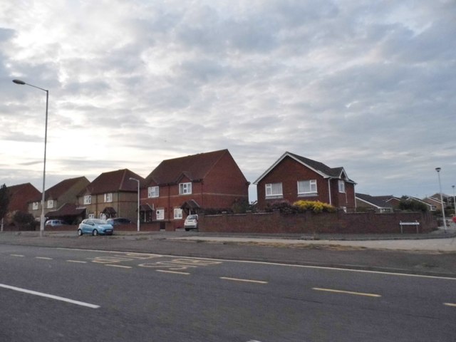
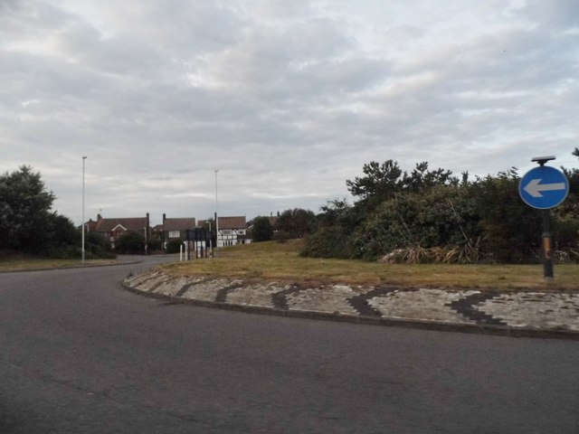
Haine, Kent is a small village located in the southeast of England. Situated in the district of Thanet, it is part of the county of Kent. The village is nestled between the towns of Ramsgate and Margate, offering residents and visitors easy access to the amenities and attractions of both places.
Haine is primarily a residential area, characterized by its quiet and peaceful atmosphere. The village is known for its picturesque countryside, with rolling green fields and charming country lanes. It is an ideal location for those seeking a tranquil and idyllic setting.
Despite its small size, Haine has a close-knit community, with a range of amenities to cater to the needs of its residents. These include a local convenience store, a primary school, and a village hall that hosts various events and activities throughout the year. Additionally, there are several parks and outdoor spaces in and around the village, providing opportunities for recreational activities and leisurely walks.
Transport links in Haine are well-established, with regular bus services connecting the village to nearby towns and cities. The village is also conveniently located near major road networks, making it easily accessible by car.
Overall, Haine, Kent offers a peaceful and scenic setting, perfect for those seeking a quiet village lifestyle while still being within easy reach of larger urban areas.
If you have any feedback on the listing, please let us know in the comments section below.
Haine Images
Images are sourced within 2km of 51.352274/1.387288 or Grid Reference TR3566. Thanks to Geograph Open Source API. All images are credited.


Haine is located at Grid Ref: TR3566 (Lat: 51.352274, Lng: 1.387288)
Administrative County: Kent
District: Thanet
Police Authority: Kent
What 3 Words
///stores.covers.dash. Near St Peters, Kent
Nearby Locations
Related Wikis
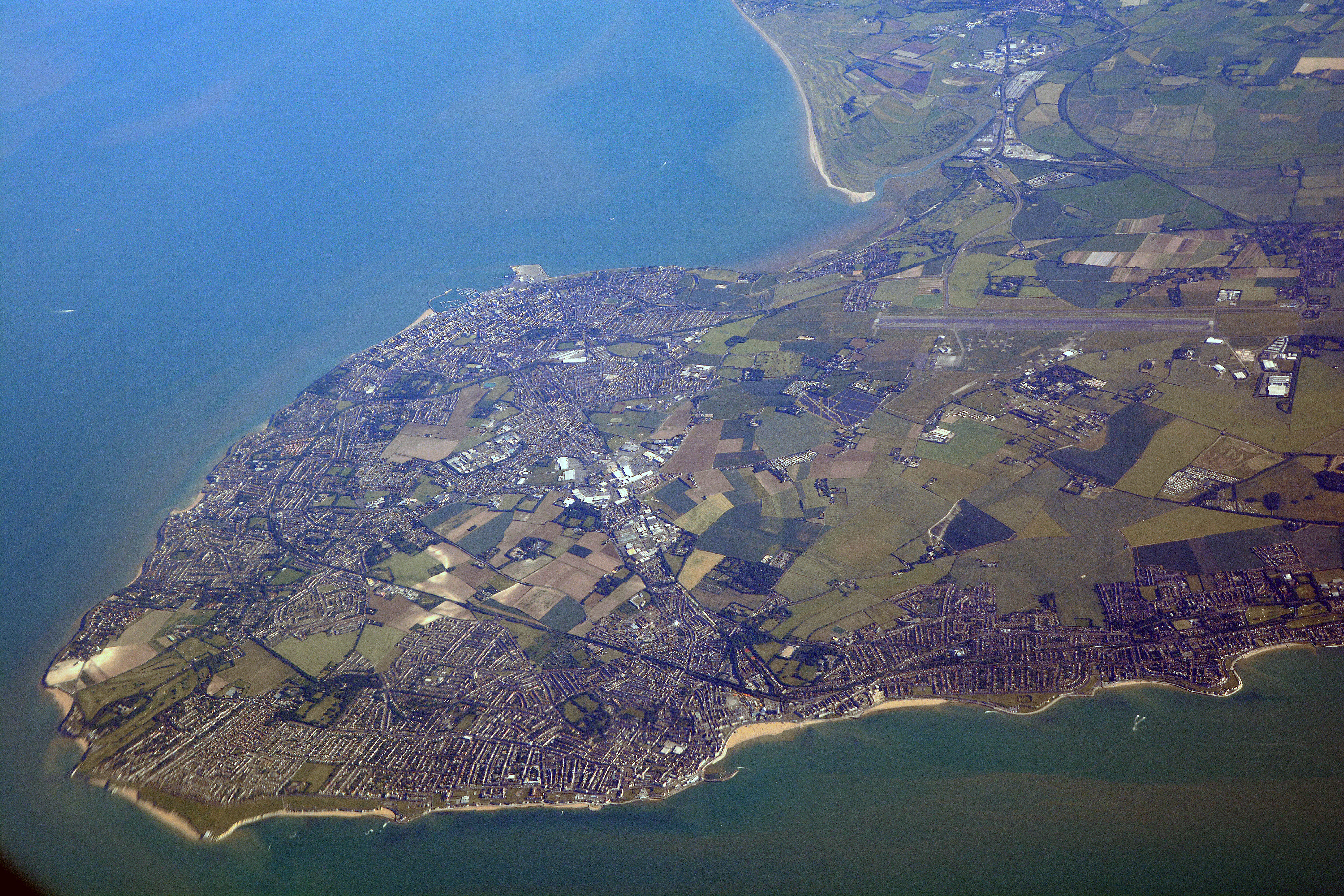
Isle of Thanet
The Isle of Thanet () is a peninsula forming the easternmost part of Kent, England. While in the past it was separated from the mainland by the 600-metre...

Academy FM (Thanet)
Academy FM (Thanet) is a Charity community 24-hour local radio station based in Ramsgate, Kent, England, which broadcasts to the Isle of Thanet. It launched...
The Royal Harbour Academy
The Royal Harbour Academy is a coeducational secondary school and sixth form located over two sites in Ramsgate in the English county of Kent.The school...
Newington, Thanet
Newington is a suburb in the west of the town of Ramsgate, on the eastern tip of Kent, England. == History == Ramsgate Borough Council developed the Newington...

Thanet East (UK Parliament constituency)
Thanet East was a British parliamentary constituency in the Isle of Thanet in Kent. It returned one Member of Parliament (MP) to the House of Commons of...

Westwood, Kent
Westwood is a village and retail estate in Thanet district of Kent, England, and 1.9 miles (3.1 km) south of Margate. == History == Westwood developed...
Thanet & District Reform Synagogue
Thanet & District Reform Synagogue, which is associated with the Movement for Reform Judaism, is a Reform Judaism congregation at 293A Margate Road in...

A254 road
The A254 is a short road running northwest–southeast on the Isle of Thanet in East Kent. The whole length of the road is within Thanet District Council...
Nearby Amenities
Located within 500m of 51.352274,1.387288Have you been to Haine?
Leave your review of Haine below (or comments, questions and feedback).