Aylesbeare Common

Downs, Moorland in Devon East Devon

England

Aylesbeare Common

Aylesbeare Common Trig Point Flush Bracket S3901
Aylesbeare Common Trig Point Flush Bracket S3901 Credit: thejackrustles

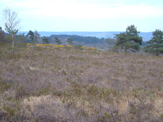
Aylesbeare Common is a vast tract of common land located in Devon, England. Covering an area of approximately 300 hectares, it is a designated Site of Special Scientific Interest (SSSI) and is managed by the Royal Society for the Protection of Birds (RSPB).

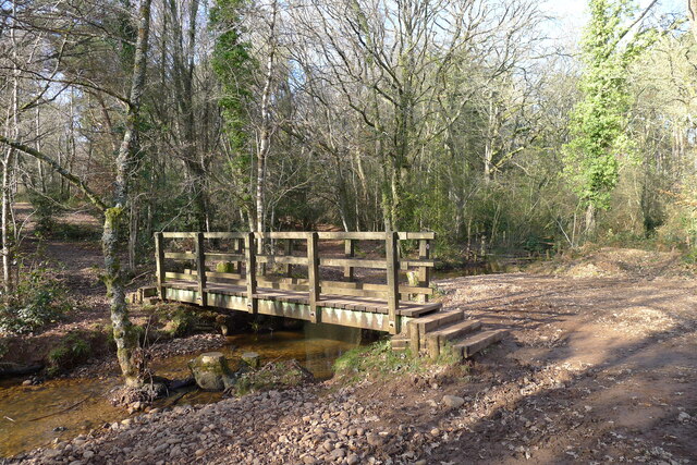
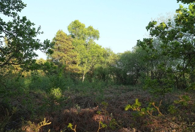
The common is characterized by a diverse range of habitats, including heathland, woodland, and wetland areas. It is situated on the eastern edge of the East Devon Area of Outstanding Natural Beauty (AONB) and offers stunning views of the surrounding countryside.

The heathland on Aylesbeare Common is home to a variety of rare and protected species, including the Dartford warbler, nightjar, and the silver-studded blue butterfly. The area is also notable for its diverse range of plants, such as heather, gorse, and bilberry.

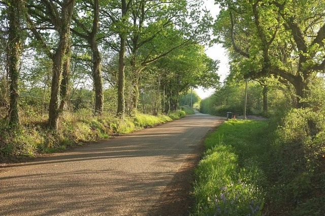
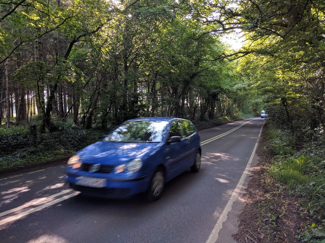
The common is crisscrossed by a network of footpaths and trails, making it a popular destination for walkers and nature enthusiasts. Visitors can explore the vast expanses of open moorland, observe wildlife in their natural habitats, and enjoy the tranquility of the surroundings.

Aylesbeare Common is not only a haven for wildlife but also plays an important role in preserving the natural heritage of the area. The RSPB works diligently to protect and enhance the biodiversity of the common, ensuring that it remains a valuable resource for future generations to enjoy.

If you have any feedback on the listing, please let us know in the comments section below.

Aylesbeare Common Images

Images are sourced within 2km of 50.708067/-3.340484 or Grid Reference SY0590. Thanks to Geograph Open Source API. All images are credited.

Aylesbeare Common Trig Point Flush Bracket S3901
Track across Aylesbeare Common This common, another of the Pebblebed Heaths, is managed by the RSPB with the  chance to see rarer birds like the Dartford warbler and nightjar <span class="nowrap"><a title="https://www.rspb.org.uk/reserves-and-events/reserves-a-z/aylesbeare-common" rel="nofollow ugc noopener" href="https://www.rspb.org.uk/reserves-and-events/reserves-a-z/aylesbeare-common">Link</a><img style="margin-left:2px;" alt="External link" title="External link - shift click to open in new window" src="https://s1.geograph.org.uk/img/external.png" width="10" height="10"/></span>
Track across Aylesbeare Common
This common, another of the Pebblebed Heaths, is managed by the RSPB with the chance to see rarer birds like the Dartford warbler and nightjar LinkExternal link
The East Devon Way entering Harpford Common The seventh, and final Pebblebed Heath common crossed by the East Devon Way
The East Devon Way entering Harpford Common
The seventh, and final Pebblebed Heath common crossed by the East Devon Way
Footbridge on the northern boundary of Harpford Common Taking the East Devon Way over a tributary of the River Otter
Footbridge on the northern boundary of Harpford Common
Taking the East Devon Way over a tributary of the River Otter
Nature reserve track
Easy Devon Way Sign
Easy Devon Way Sign
Aylesbeare Common RSPB Sign
Climbing up to Hawkerland Valley Common A fox chasing a cat has been added to the roof of Morish Cotley since <a href="https://www.geograph.org.uk/photo/5975598">SY0588 : Morish Cotley</a>.
Climbing up to Hawkerland Valley Common
A fox chasing a cat has been added to the roof of Morish Cotley since SY0588 : Morish Cotley.
The East Devon Way entering Hawkerland Valley Common The fifth 'Pebblebed Heath' common visited on the Way today.
The East Devon Way entering Hawkerland Valley Common
The fifth 'Pebblebed Heath' common visited on the Way today.
Joney's Cross Car Park The car parks at this and other Pebblebed Heath sites have been improved since being condemned as "little better than bomb site"s <span class="nowrap"><a title="https://www.devonlive.com/news/devon-news/car-parks-little-better-bomb-6138560" rel="nofollow ugc noopener" href="https://www.devonlive.com/news/devon-news/car-parks-little-better-bomb-6138560">Link</a><img style="margin-left:2px;" alt="External link" title="External link - shift click to open in new window" src="https://s1.geograph.org.uk/img/external.png" width="10" height="10"/></span>
Joney's Cross Car Park
The car parks at this and other Pebblebed Heath sites have been improved since being condemned as "little better than bomb site"s LinkExternal link
A pond in a field Podgers pit junction.
Close to the B3180 and Harp Lane.
A pond in a field
Podgers pit junction. Close to the B3180 and Harp Lane.
Harp Lane junction Linked to the B3180 at the strangely named Podgers Pit.
Harp Lane junction
Linked to the B3180 at the strangely named Podgers Pit.
Oak Road The lane from Tipton Cross to Aylesbeare passes a triangle of access land on the left.
Oak Road
The lane from Tipton Cross to Aylesbeare passes a triangle of access land on the left.
Access land by Oak Road The view on the other side of the lane from <a href="https://www.geograph.org.uk/photo/4958168">SY0592 : Field by Oak Trees</a>. Perhaps rather clearer earlier in the day when the sun was high. The access land forms a triangle between Oak Road and two tracks.
Access land by Oak Road
The view on the other side of the lane from SY0592 : Field by Oak Trees. Perhaps rather clearer earlier in the day when the sun was high. The access land forms a triangle between Oak Road and two tracks.
Track to Venn Ottery hill
Lane to Venn Ottery
Lane to Venn Ottery
Business park at Common Farm
Fast Polo on the A3052
Show me another place!

Aylesbeare Common is located at Grid Ref: SY0590 (Lat: 50.708067, Lng: -3.340484)

Administrative County: Devon

District: East Devon

Police Authority: Devon and Cornwall

What 3 Words

///cope.works.thrillers. Near Newton Poppleford, Devon

Nearby Locations

Aylesbeare Common

Related Wikis

Aylesbeare Common

Aylesbeare Common is a protected area in Devon, England. It is composed largely of heathland and woodland, interspersed with a few streams and ponds....

Fire Beacon Hill

Fire Beacon Hill is a Local Nature Reserve in East Devon, England. It is registered as Common land and known as Harpford Common. Sidmouth Town Council...

Nutwalls

Nutwalls is a hamlet in Devon, England. It is located 9 miles (14 km) south-east of Exeter, close to Aylesbeare. Two cottages built in the 18th century...

Aylesbeare

Aylesbeare is a village and civil parish in the East Devon district of Devon, England, 8 miles (13 km) east of Exeter. According to the 2001 census the...

Nearby Amenities

Located within 500m of 50.708067,-3.340484
Aylesbeare Common
Place: locality
Lat/Long: 50.711732/-3.3390599
Bench
Lat/Long: 50.7071932/-3.3435909
The data included in this document is from www.openstreetmap.org. The data is made available under ODbL.

Have you been to Aylesbeare Common?

Leave your review of Aylesbeare Common below (or comments, questions and feedback).