Leonard Moor

Downs, Moorland in Devon Mid Devon

England

Leonard Moor

Uffculme : The Square Looking towards a tree in the Square.
Uffculme : The Square Credit: Lewis Clarke

Leonard Moor, located in Devon, England, is a picturesque area known for its stunning natural beauty and diverse wildlife. Covering a vast expanse of moorland and downs, it offers a tranquil retreat for nature enthusiasts and outdoor adventurers alike.

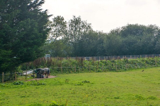
The moorland of Leonard Moor is characterized by its rolling hills, heather-covered expanses, and scattered patches of woodland. This unique landscape provides a habitat for a variety of flora and fauna, including rare species such as Dartford warblers and nightjars. The moorland is also home to numerous grazing animals, such as ponies and sheep, which help maintain the natural balance of the ecosystem.

The downs of Leonard Moor offer sweeping views of the surrounding countryside and are a haven for hikers and walkers. Visitors can enjoy leisurely strolls along well-marked trails, immersing themselves in the peaceful ambiance of the area. The downs are adorned with vibrant wildflowers during the spring and summer months, creating a colorful tapestry against the backdrop of green grasslands.

Leonard Moor is not only a nature lover's paradise but also a place of historical significance. Ancient archaeological remains, including burial mounds and stone circles, can be found scattered across the moorland, offering a glimpse into the area's rich past.

With its unspoiled natural beauty and abundant wildlife, Leonard Moor, Devon, is a destination that captivates visitors with its tranquility and charm. Whether it's exploring the moorland, admiring the panoramic views from the downs, or delving into the area's history, Leonard Moor offers a truly memorable experience for all who venture into its embrace.

If you have any feedback on the listing, please let us know in the comments section below.

Leonard Moor Images

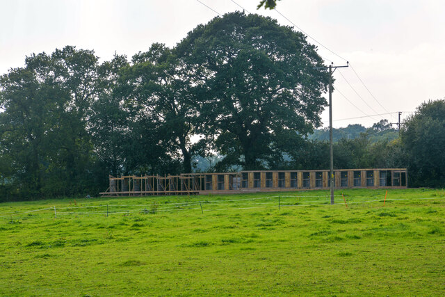
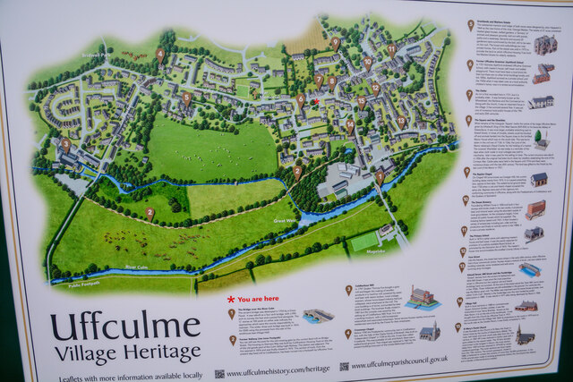
Images are sourced within 2km of 50.914196/-3.3498413 or Grid Reference ST0513. Thanks to Geograph Open Source API. All images are credited.

Uffculme : The Square Looking towards a tree in the Square.
Uffculme : The Square
Looking towards a tree in the Square.
The Penzance to Paddington train arriving at Tiverton Parkway
Old Bridge Marker on Bridge Street, Uffculme County Bridge Marker on the southwest side of Bridge Street, against the front wall of No.17. Uffculme parish. Inscribed C to mark the extent of roadway adjoining Uffculme Bridge that the County was obliged to maintain.

Milestone Society National ID: DV_UCAH01br
Old Bridge Marker on Bridge Street, Uffculme
County Bridge Marker on the southwest side of Bridge Street, against the front wall of No.17. Uffculme parish. Inscribed C to mark the extent of roadway adjoining Uffculme Bridge that the County was obliged to maintain. Milestone Society National ID: DV_UCAH01br
Uffculme : Bridwell Park People enjoy the Uffculme Show at Bridwell Park.
Uffculme : Bridwell Park
People enjoy the Uffculme Show at Bridwell Park.
Uffculme : Bridwell Park People enjoy the Uffculme Show at Bridwell Park.
Uffculme : Bridwell Park
People enjoy the Uffculme Show at Bridwell Park.
Uffculme : Bridwell Park A horse display at the Uffculme Show.
Uffculme : Bridwell Park
A horse display at the Uffculme Show.
Uffculme : Bridwell Park Lord Ivar Mountbatten seen here judging the classic cars. He is a third cousin, once removed of Queen Elizabeth II and a first cousin, once removed of Prince Philip, Duke of Edinburgh.
Uffculme : Bridwell Park
Lord Ivar Mountbatten seen here judging the classic cars. He is a third cousin, once removed of Queen Elizabeth II and a first cousin, once removed of Prince Philip, Duke of Edinburgh.
Uffculme : Bridwell Park A classic car show at the Uffculme Country Fair.
Uffculme : Bridwell Park
A classic car show at the Uffculme Country Fair.
Uffculme : Bridwell Park Looking towards a classic car show on the estate.
Uffculme : Bridwell Park
Looking towards a classic car show on the estate.
Uffculme : Bridwell Park Military vehicles at the Uffculme Show.
Uffculme : Bridwell Park
Military vehicles at the Uffculme Show.
Uffculme : Pleasant Stream An area known as Pleasant Stream.
Uffculme : Pleasant Stream
An area known as Pleasant Stream.
Uffculme : Pleasant Stream An area known as Pleasant Stream.
Uffculme : Pleasant Stream
An area known as Pleasant Stream.
Uffculme : Grassy Field A grassy field in the countryside.
Uffculme : Grassy Field
A grassy field in the countryside.
Uffculme : Grassy Field A grassy field in an area known as Pleasant Stream.
Uffculme : Grassy Field
A grassy field in an area known as Pleasant Stream.
Uffculme : Commercial Road An event to launch the town's heritage trail takes place.
Uffculme : Commercial Road
An event to launch the town's heritage trail takes place.
Uffculme : Heritage Sign A heritage sign in Uffculme.
Uffculme : Heritage Sign
A heritage sign in Uffculme.
Uffculme : Commercial Road An event to launch the village heritage trail takes place.
Uffculme : Commercial Road
An event to launch the village heritage trail takes place.
Sampford Peverell : North Devon Link Road A361 An accident has taken place on the link road.
Sampford Peverell : North Devon Link Road A361
An accident has taken place on the link road.
Show me another place!

Leonard Moor is located at Grid Ref: ST0513 (Lat: 50.914196, Lng: -3.3498413)

Administrative County: Devon

District: Mid Devon

Police Authority: Devon and Cornwall

What 3 Words

///crockery.country.arise. Near Uffculme, Devon

Related Wikis

Tiverton Parkway railway station

Tiverton Parkway railway station is on the Bristol to Exeter line in Devon, England. Despite being named after the town of Tiverton it is actually located...

Ayshford

Ayshford is a hamlet and historic manor in the parish of Burlescombe in the district of Mid-Devon, Devon, England. It was anciently the seat of the de...

Uffculme School

Uffculme School is a mixed secondary school located in Uffculme in the English county of Devon.Previously a community school administered by Devon County...

Appledore, Mid Devon

Appledore is a small village near Uffculme in Devon, England, about 7 miles (11 kilometres) east of Tiverton.Appledore was listed in the Domesday Book...

Nearby Amenities

Located within 500m of 50.914196,-3.3498413
Pub
Waterloo Cross
Addr City: Cullompton
Addr Postcode: EX15 3ES
Fhrs Id: 187440
Source Addr Postcode: FHRS Open Data
Wikidata: Q80477032
Lat/Long: 50.9173698/-3.3455219
Barrier: stile
Lat/Long: 50.914384/-3.3427959
Charging Station
Gridserve
Capacity: 2
Contact Website: https://electrichighway.gridserve.com/tiverton-services
Operator: Gridserve
Operator Wikidata: Q89575318
Lat/Long: 50.9166312/-3.3548216
Give Way
Direction: forward
Lat/Long: 50.9171996/-3.3535384
Parking
Parking: layby
Lat/Long: 50.9172849/-3.3480459
Devonshire Gate
Addr City: Tiverton
Addr Housename: Devonshire Gate
Addr Postcode: EX16 7EJ
Office: yes
Lat/Long: 50.9182517/-3.3527927
Bus Stop
Waterloo Cross
Bus: yes
Naptan AtcoCode: 1100DEC11499
Naptan Bearing: NE
Naptan BusStopType: MKD
Naptan Indicator: NE-bound
Naptan LocalityName: Ayshford
Naptan NaptanCode: dvndwtgp
Naptan NptgLocality: E0007750
Naptan Status: act
Naptan StopType: BCT
Naptan Street: B3181
Naptan TimingStatus: OTH
Public Transport: platform
Source: naptan
Lat/Long: 50.9168106/-3.345521
Bus Stop
Waterloo Cross
Bus: yes
Naptan AtcoCode: 1100DEC11508
Naptan Bearing: SW
Naptan BusStopType: MKD
Naptan Indicator: SW-bound
Naptan LocalityName: Ayshford
Naptan NaptanCode: dvndwtja
Naptan NptgLocality: E0007750
Naptan Status: act
Naptan StopType: BCT
Naptan Street: B3181
Naptan TimingStatus: OTH
Public Transport: platform
Source: naptan
Lat/Long: 50.9168392/-3.3453796
Bus Stop
Little Chef
Bus: yes
Naptan AtcoCode: 1100DEC11501
Naptan Bearing: E
Naptan BusStopType: MKD
Naptan Indicator: opp
Naptan LocalityName: Ayshford
Naptan NaptanCode: dvndwtdm
Naptan NptgLocality: E0007750
Naptan Status: act
Naptan StopType: BCT
Naptan TimingStatus: OTH
Public Transport: platform
Source: naptan
Lat/Long: 50.9172813/-3.3532036
Bus Stop
Little Chef
Bus: yes
Naptan AtcoCode: 1100DEC11502
Naptan Bearing: W
Naptan BusStopType: CUS
Naptan Indicator: W-bound
Naptan LocalityName: Ayshford
Naptan NaptanCode: dvndwtdj
Naptan NptgLocality: E0007750
Naptan Status: act
Naptan StopType: BCT
Naptan TimingStatus: OTH
Public Transport: platform
Source: naptan
Lat/Long: 50.9171815/-3.3531143
Access: permissive
Barrier: height_restrictor
Bicycle: yes
Foot: yes
Height: 2
Horse: yes
Material: metal
Maxheight: 1.9
Lat/Long: 50.9133471/-3.3529251
Give Way
Direction: backward
Lat/Long: 50.9153098/-3.3541808
Stop
Direction: backward
Lat/Long: 50.9099028/-3.3502554
Give Way
Direction: backward
Lat/Long: 50.9172147/-3.351677
The data included in this document is from www.openstreetmap.org. The data is made available under ODbL.

Have you been to Leonard Moor?

Leave your review of Leonard Moor below (or comments, questions and feedback).