Bad na Caorach

Downs, Moorland in Morayshire

Scotland

Bad na Caorach

Càrr Mòr This is a vast expanse of flattish boggy ground on the highest part of the Dava Way.
Càrr Mòr Credit: Anne Burgess

Bad na Caorach, located in Morayshire, Scotland, is a picturesque region characterized by its stunning downs and moorlands. Situated amidst the beautiful Scottish countryside, this area spans over several kilometers, offering visitors a unique and captivating experience.

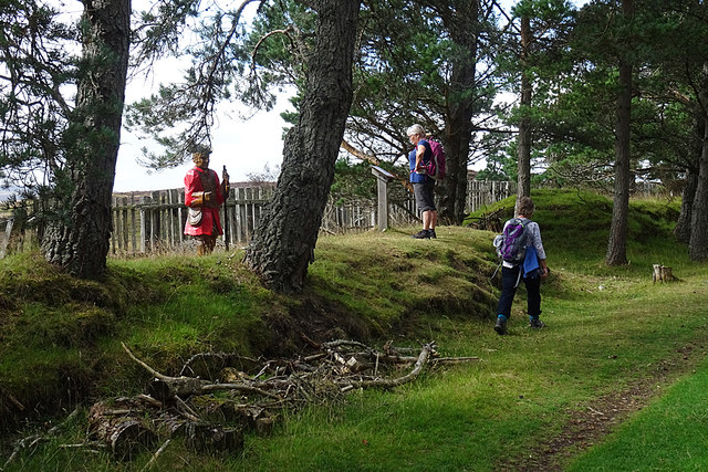
The downs of Bad na Caorach showcase rolling hills and vast expanses of open grassland. These downs are rich in biodiversity, with a variety of plant species, including heather, gorse, and wildflowers, dotting the landscape. The undulating terrain provides a perfect habitat for a range of wildlife, such as deer, rabbits, and various bird species.

The moorland of Bad na Caorach is equally captivating, with its rugged and untamed beauty. This area is characterized by heath and peat bogs, creating a unique ecosystem that supports a diverse array of flora and fauna. Moorland birds, including red grouse, curlews, and golden plovers, can often be spotted here, adding to the region's appeal for birdwatchers and nature enthusiasts.

Visitors to Bad na Caorach can explore the downs and moorland through various walking trails and paths that wind through the area. These trails offer breathtaking views of the surrounding countryside, providing ample opportunities for photography and relaxation. Additionally, the region's remote and tranquil atmosphere make it an ideal destination for those seeking peace and solitude.

Overall, Bad na Caorach in Morayshire is a haven for nature lovers, with its stunning downs and moorlands offering a glimpse into the unspoiled beauty of the Scottish countryside.

If you have any feedback on the listing, please let us know in the comments section below.

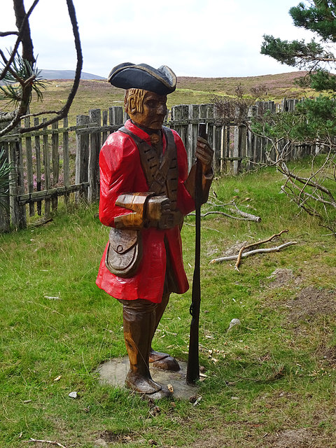
Bad na Caorach Images

Images are sourced within 2km of 57.410168/-3.6156432 or Grid Reference NJ0336. Thanks to Geograph Open Source API. All images are credited.

Càrr Mòr This is a vast expanse of flattish boggy ground on the highest part of the Dava Way.
Càrr Mòr
This is a vast expanse of flattish boggy ground on the highest part of the Dava Way.
Moorland Drain The drain cuts through the bog and flows into Allt na Ceàrdaich.
Moorland Drain
The drain cuts through the bog and flows into Allt na Ceàrdaich.
Dragonfly You can just about make out the shape of its almost-invisible wings. I tried to catch it with the light shimmering on them but it flew off before I could find the right angle.
Dragonfly
You can just about make out the shape of its almost-invisible wings. I tried to catch it with the light shimmering on them but it flew off before I could find the right angle.
Heatherbell Cutting This was one of the most exposed parts of the railway line, and the information board nearby tells of trains lost in deep snowdrifts and passengers being rescued from snowbound carriages.
Heatherbell Cutting
This was one of the most exposed parts of the railway line, and the information board nearby tells of trains lost in deep snowdrifts and passengers being rescued from snowbound carriages.
Old Snow Fence This is part of the snow fence erected alongside the Heatherbell Cutting to protect trains from winter blizzards. The posts have been eroded into strange shapes by rain and wind.
Old Snow Fence
This is part of the snow fence erected alongside the Heatherbell Cutting to protect trains from winter blizzards. The posts have been eroded into strange shapes by rain and wind.
Redcoat Soldier I am slightly at a loss to account for the presence of this redcoat in Heatherbell cutting. Perhaps he commemorates soldiers who marched over Dava Moor on the 18th century military road which is now the route of the A939, a couple of hundred metres west of here. Or perhaps he is one of the dragoons who marched to the Battle of Cromdale in 1690. It also seems that he has been moved from where he was four years ago - see <a href="https://www.geograph.org.uk/photo/6018367">NJ0133 : The old railway line, now a cycling and walking route</a> - perhaps because he was too close to the A939?
Redcoat Soldier
I am slightly at a loss to account for the presence of this redcoat in Heatherbell cutting. Perhaps he commemorates soldiers who marched over Dava Moor on the 18th century military road which is now the route of the A939, a couple of hundred metres west of here. Or perhaps he is one of the dragoons who marched to the Battle of Cromdale in 1690. It also seems that he has been moved from where he was four years ago - see NJ0133 : The old railway line, now a cycling and walking route - perhaps because he was too close to the A939?
A Dead Pine The closest tree is, or rather was, a Scots Pine, but it has succumbed to the harshness of the environment beside the Dava Way.
A Dead Pine
The closest tree is, or rather was, a Scots Pine, but it has succumbed to the harshness of the environment beside the Dava Way.
Moorland Road The rough road leaves the Dava Way but it only leads to some grouse butts on the moor before fizzling out.
Moorland Road
The rough road leaves the Dava Way but it only leads to some grouse butts on the moor before fizzling out.
Large Fungus This was well over a foot in diameter. I wonder if it might be Slippery Jack (Suillus luteus)?
Large Fungus
This was well over a foot in diameter. I wonder if it might be Slippery Jack (Suillus luteus)?
Yellow Toadstool Unfortunately I do not know what species of fungus this is.
Yellow Toadstool
Unfortunately I do not know what species of fungus this is.
Red Mushrooms Or maybe toadstools. As I do not know what species they are, they could be either.
Red Mushrooms
Or maybe toadstools. As I do not know what species they are, they could be either.
Dava Way Approaching the clump of trees around <a href="https://www.geograph.org.uk/photo/6577136">NJ0136 : Heatherbell Cutting</a>.
Dava Way
Approaching the clump of trees around NJ0136 : Heatherbell Cutting.
Natural Carving These sleepers, probably used as a snow fence, have been sculpted by wind and water into curious shapes.
Natural Carving
These sleepers, probably used as a snow fence, have been sculpted by wind and water into curious shapes.
Heatherbell Cutting The cutting is named after nearby <a href="https://www.geograph.org.uk/photo/1963465">NJ0036 : Heatherbell</a>, now abandoned. An information board tells about the occasions when trains got stuck in snow here, but it says nothing about the <a href="https://www.geograph.org.uk/photo/6577140">NJ0136 : Redcoat Soldier</a>.
Heatherbell Cutting
The cutting is named after nearby NJ0036 : Heatherbell, now abandoned. An information board tells about the occasions when trains got stuck in snow here, but it says nothing about the NJ0136 : Redcoat Soldier.
Redcoat Soldier I am slightly at a loss to account for the presence of this redcoat in Heatherbell cutting. Perhaps he commemorates soldiers who marched over Dava Moor on the 18th century military road which is now the route of the A939, a couple of hundred metres west of here. Or perhaps he is one of the dragoons who marched to the Battle of Cromdale in 1690. It also seems that he has been moved from where he was two years ago - see <a href="https://www.geograph.org.uk/photo/6018367">NJ0133 : The old railway line, now a cycling and walking route</a> - perhaps because he was too close to the A939?
Redcoat Soldier
I am slightly at a loss to account for the presence of this redcoat in Heatherbell cutting. Perhaps he commemorates soldiers who marched over Dava Moor on the 18th century military road which is now the route of the A939, a couple of hundred metres west of here. Or perhaps he is one of the dragoons who marched to the Battle of Cromdale in 1690. It also seems that he has been moved from where he was two years ago - see NJ0133 : The old railway line, now a cycling and walking route - perhaps because he was too close to the A939?
Gold-ringed Dragonfly (Cordulegaster boltonii) At least I think that's what it is. It was a good 10 centimetres long, and remained obligingly motionless while we photographed it.
Gold-ringed Dragonfly (Cordulegaster boltonii)
At least I think that's what it is. It was a good 10 centimetres long, and remained obligingly motionless while we photographed it.
Gold-ringed Dragonfly (Cordulegaster boltonii) The rounded inner wing margins suggest that this is a female.
Gold-ringed Dragonfly (Cordulegaster boltonii)
The rounded inner wing margins suggest that this is a female.
Gold-ringed Dragonfly (Cordulegaster boltonii) A close-up to show the insect's six legs clasping a rush stem.
Gold-ringed Dragonfly (Cordulegaster boltonii)
A close-up to show the insect's six legs clasping a rush stem.
Show me another place!

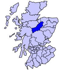
Bad na Caorach is located at Grid Ref: NJ0336 (Lat: 57.410168, Lng: -3.6156432)

Unitary Authority: Highland

Police Authority: Highlands and Islands

What 3 Words

///crop.mashing.deleting. Near Grantown-on-Spey, Highland

Related Wikis

Dava railway station

Dava railway station was opened in 1864, on the Inverness and Perth Junction Railway, one year after the route was opened. == Station layout == The station...

Lochindorb

Lochindorb (from the Scottish Gaelic: Loch nan Doirb meaning "loch of the minnows") is a freshwater loch north of Grantown on Spey in the Highland council...

Castle Grant platform railway station

Castle Grant platform railway station was a railway station serving Castle Grant, in Strathspey in Scotland. == History == This station was opened with...

Castle Grant

Castle Grant stands a mile north of Grantown-on-Spey and was the former seat of the Clan Grant chiefs of Strathspey in Highlands, Scotland. It was originally...

Dorback Burn, Findhorn

The Dorback Burn (Scottish Gaelic: Dorbag / Uisge Dhorbaig) is a right-bank tributary of the River Findhorn in northeast Scotland. It emerges from the...

Ian Charles Community Hospital

Ian Charles Community Hospital is a health facility in Castle Road East, Grantown-on-Spey, Scotland. It is managed by NHS Highland. == History == The facility...

Badenoch and Strathspey

Badenoch and Strathspey is a former district of Highland region in Scotland. The district was created under the Local Government (Scotland) Act 1973 as...

Strathspey Thistle F.C.

Strathspey Thistle Football Club are a senior football club from Grantown-on-Spey in the Highlands of Scotland. They currently play in the Highland Football...

Have you been to Bad na Caorach?

Leave your review of Bad na Caorach below (or comments, questions and feedback).