Black Moss

Downs, Moorland in Cumberland Copeland

England

Black Moss

Field next to Carletonmoor Woods Gateway entering field next to Carletonmoor Woods
Field next to Carletonmoor Woods Credit: P Gaskell

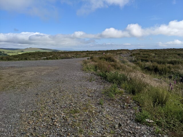
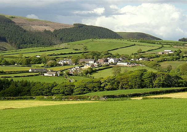
Black Moss, Cumberland (Downs, Moorland) is a picturesque and serene area located in the county of Cumberland, England. Covering a vast expanse of land, it is primarily known for its breathtaking beauty and captivating moorland landscapes. The area is characterized by its rolling hills, expansive green fields, and scattered patches of dense woodland.

The verdant moorland of Black Moss is home to a rich diversity of flora and fauna, making it a haven for nature enthusiasts. Visitors can expect to encounter a variety of plant species, such as heather, bracken, and bilberry bushes, which create a stunning tapestry of colors throughout the seasons. The moorland is also interspersed with numerous sparkling streams and small waterfalls, adding to its overall charm.

The Cumberland Downs, a prominent feature of Black Moss, offer breathtaking panoramic views of the surrounding area. These ancient hills provide a tranquil setting, ideal for leisurely walks or challenging hikes for those seeking a more adventurous experience.

In addition to its natural beauty, Black Moss boasts a rich cultural history. The area is dotted with remnants of ancient settlements and stone circles, offering a glimpse into the region's past. These archaeological sites provide a fascinating opportunity for visitors to explore and learn about the area's early inhabitants.

Overall, Black Moss, Cumberland (Downs, Moorland) is a captivating destination that combines natural splendor with a rich cultural heritage. Whether one seeks solace in the peaceful moorland or wishes to delve into the area's history, Black Moss offers a truly unforgettable experience for all who visit.

If you have any feedback on the listing, please let us know in the comments section below.

Black Moss Images

Images are sourced within 2km of 54.483446/-3.5003244 or Grid Reference NY0210. Thanks to Geograph Open Source API. All images are credited.

Field next to Carletonmoor Woods Gateway entering field next to Carletonmoor Woods
Field next to Carletonmoor Woods
Gateway entering field next to Carletonmoor Woods
Road approaching Scurgill Approaching Scurgill from Carletonmoor Woods
Road approaching Scurgill
Approaching Scurgill from Carletonmoor Woods
Egremont Castle The west gatehouse and curtain wall
Egremont Castle
The west gatehouse and curtain wall
Egremont Castle Gate House The original castle was built on a mound above the River Ehen on the site of a Danish fort following the conquest of Cumberland in 1092 by William II of England.  The present castle was built by William Meschin, who founded the castle between 1120 and 1135. Further additions were made in the 13th century. It eventually fell into disuse and became the ruin it is today.

<span class="nowrap"><a title="https://en.wikipedia.org/wiki/Egremont_Castle" rel="nofollow ugc noopener" href="https://en.wikipedia.org/wiki/Egremont_Castle">Link</a><img style="margin-left:2px;" alt="External link" title="External link - shift click to open in new window" src="https://s1.geograph.org.uk/img/external.png" width="10" height="10"/></span>
Egremont Castle Gate House
The original castle was built on a mound above the River Ehen on the site of a Danish fort following the conquest of Cumberland in 1092 by William II of England. The present castle was built by William Meschin, who founded the castle between 1120 and 1135. Further additions were made in the 13th century. It eventually fell into disuse and became the ruin it is today. LinkExternal link
The main street of Egremont
A closed garage near the A595
Briscoemill Bridge over the River Ehen
Cottages at Briscoe Mill
Farm building and field access near Row Foot farm
Buildings at Row Foot farm
Fields below Dent hill
The end of the forest road on the south side of Dent
Egremont Wall Art
Egremont Wall Art
Road to Grange Brow Road to Grange Brow with hedgerows
Road to Grange Brow
Road to Grange Brow with hedgerows
Farmstead at Grange Farmstead at Grange with vernacular and modern farm buildings
Farmstead at Grange
Farmstead at Grange with vernacular and modern farm buildings
Wilton Village Passing through Wilton Village towards Grange
Wilton Village
Passing through Wilton Village towards Grange
Dike Nook Road leaving Wilton village
Dike Nook
Road leaving Wilton village
Farm track Gateway to a farm track bordered by a hedgerow and post and wire fence
Farm track
Gateway to a farm track bordered by a hedgerow and post and wire fence
Show me another place!

Black Moss is located at Grid Ref: NY0210 (Lat: 54.483446, Lng: -3.5003244)

Administrative County: Cumbria

District: Copeland

Police Authority: Cumbria

What 3 Words

///points.pleaser.agent. Near Egremont, Cumbria

Nearby Locations

Black Moss

Related Wikis

Briscoe, Cumbria

Briscoe is a hamlet in Cumbria, England. It is located to the east of Egremont. == See also == List of places in Cumbria == References ==

Wilton, Cumbria

Wilton is a hamlet in the Copeland district, in the county of Cumbria, England. It is near the small town of Egremont. In 1870-72 it had a population of...

St Thomas Cross Platform railway station

St Thomas Cross Platform was a railway station used by workmen's trains on the Moor Row to Sellafield line on what is now the southeastern, Cringlethwaite...

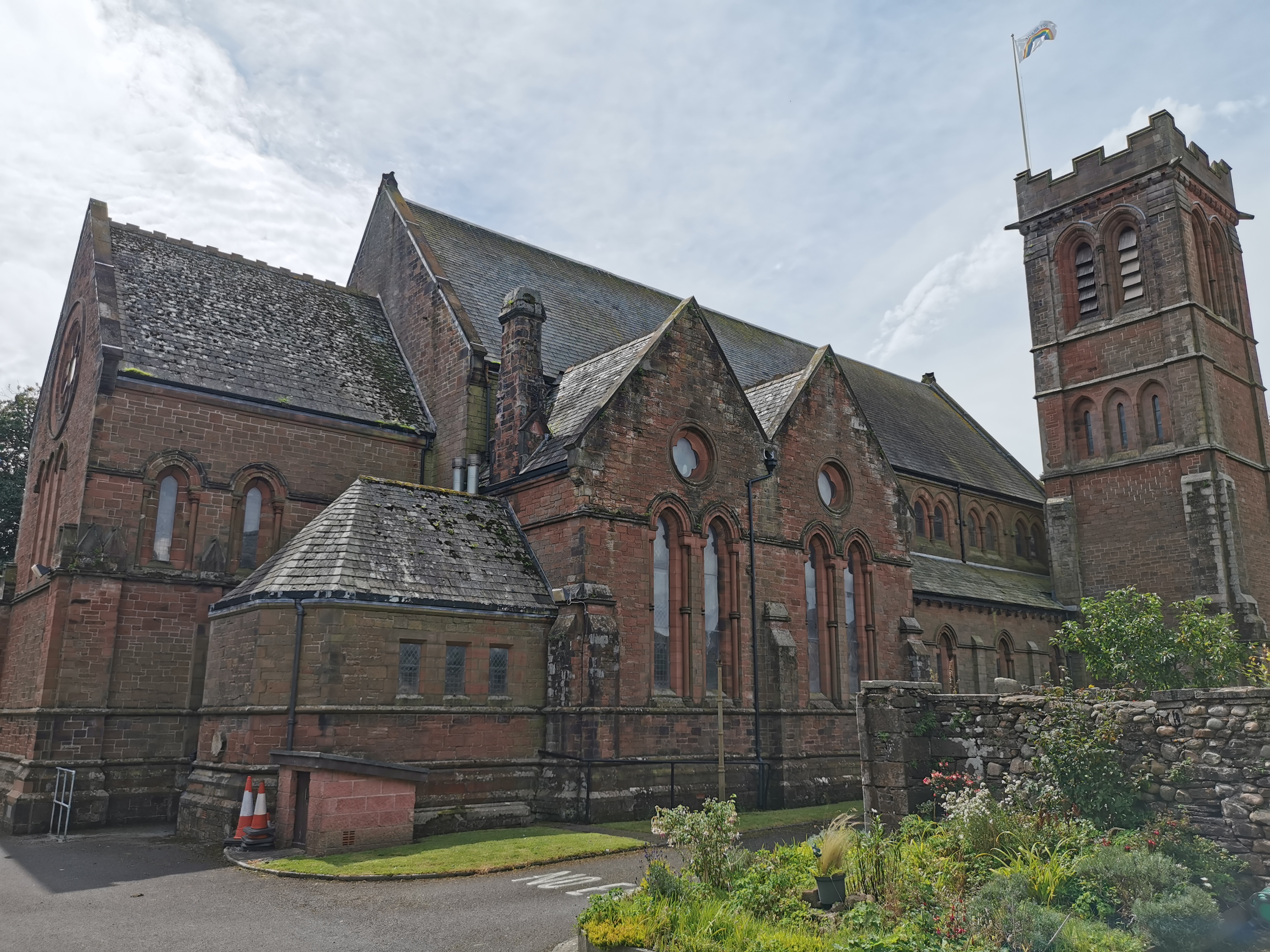
St Mary & St Michael, Egremont

St Mary & St Michael is in Egremont, Cumbria, England. It is an active Anglican parish church in the deanery of Calder, and the diocese of Carlisle. Its...

Nearby Amenities

Located within 500m of 54.483446,-3.5003244
Power: pole
Lat/Long: 54.4805635/-3.5062033
Power: pole
Lat/Long: 54.4815249/-3.5065056
Power: pole
Lat/Long: 54.4825094/-3.5067164
Power: pole
Lat/Long: 54.483279/-3.5068994
Power: pole
Lat/Long: 54.4841063/-3.5068517
Power: pole
Lat/Long: 54.4851993/-3.5068
Power: pole
Lat/Long: 54.4866043/-3.4948461
Power: pole
Lat/Long: 54.4870711/-3.4958565
Power: pole
Lat/Long: 54.4842342/-3.5046763
Power: pole
Lat/Long: 54.484418/-3.5036701
Power: pole
Lat/Long: 54.4862555/-3.5062483
Power: pole
Lat/Long: 54.4852261/-3.5056633
Power: pole
Lat/Long: 54.4834759/-3.5038893
Power: pole
Lat/Long: 54.4828305/-3.5031804
Power: pole
Lat/Long: 54.4819527/-3.5022791
Power: pole
Lat/Long: 54.4812663/-3.5015607
Power: pole
Lat/Long: 54.4805578/-3.5008099
Power: pole
Lat/Long: 54.4808833/-3.5028698
Power: pole
Lat/Long: 54.4807482/-3.5020466
Power: pole
Lat/Long: 54.4805855/-3.5001411
Power: pole
Lat/Long: 54.480632/-3.4994246
Power: pole
Lat/Long: 54.4806718/-3.4982908
Power: pole
Lat/Long: 54.4807371/-3.497138
Power: pole
Lat/Long: 54.4808567/-3.4960728
Power: pole
Lat/Long: 54.4810991/-3.4944607
The data included in this document is from www.openstreetmap.org. The data is made available under ODbL.

Have you been to Black Moss?

Leave your review of Black Moss below (or comments, questions and feedback).