Yellow Moss

Downs, Moorland in Lanarkshire

Scotland

Yellow Moss

Coulter Reservoir A view of the distinctively-shaped reservoir from the southern slope of Culter Fell.
Coulter Reservoir Credit: Alan O'Dowd

Yellow Moss, located in Lanarkshire, Scotland, is a picturesque area known for its unique combination of downs and moorland landscapes. Situated in the southern part of Scotland, Yellow Moss encompasses an area of approximately 500 acres, making it an ideal destination for nature enthusiasts and outdoor lovers.

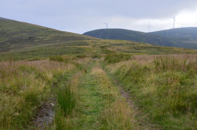
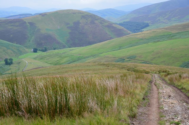
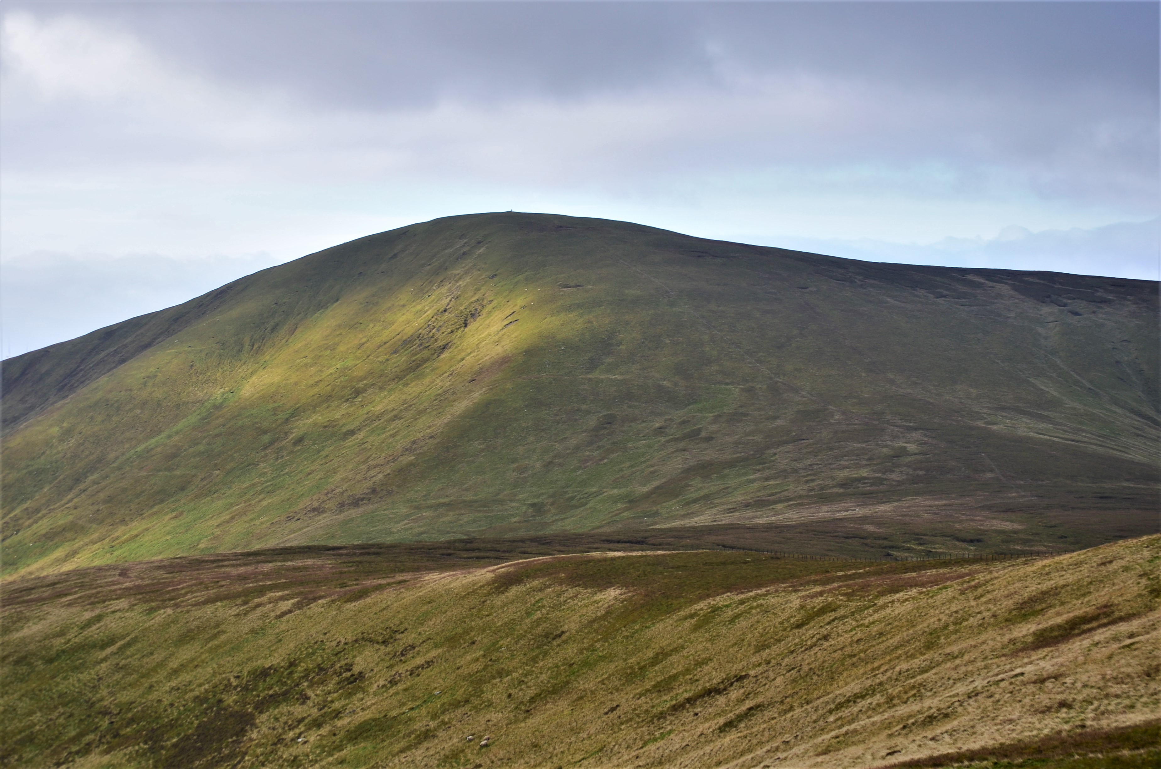
The downs of Yellow Moss boast gently rolling hills covered in lush green grass, offering breathtaking panoramic views of the surrounding countryside. This terrain is perfect for outdoor activities such as hiking, picnicking, and horseback riding. The tranquil atmosphere and vast open spaces make it a popular spot for families and individuals seeking a peaceful retreat.

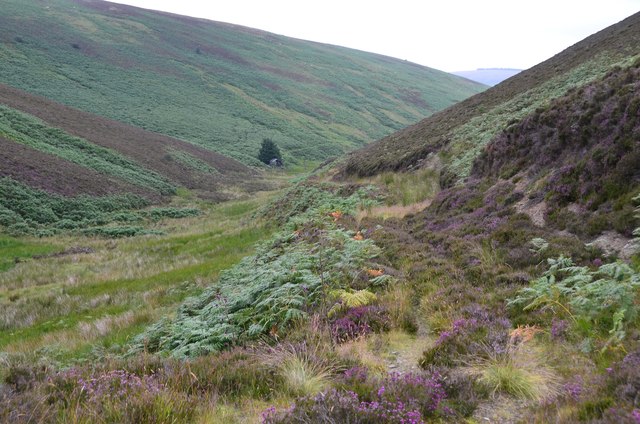
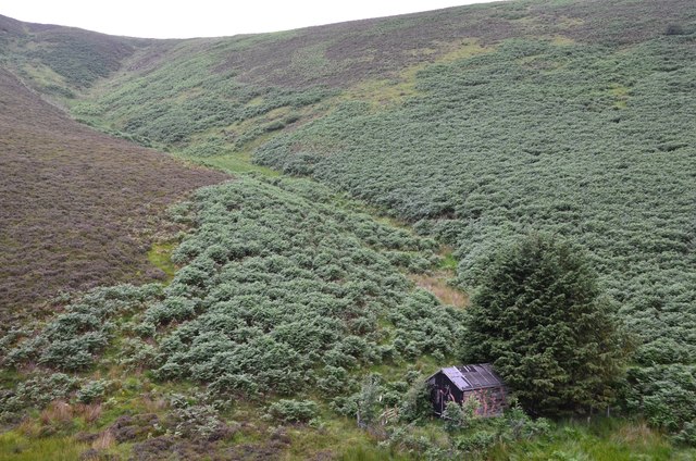
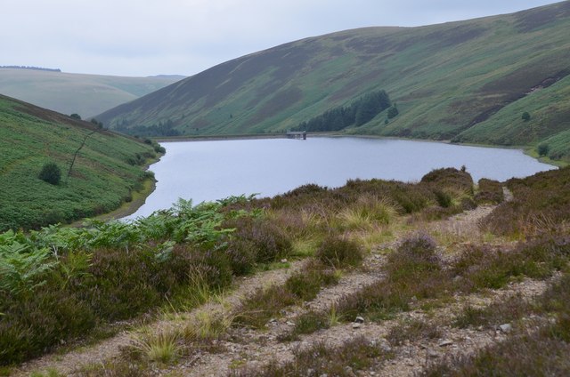
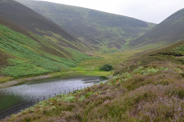
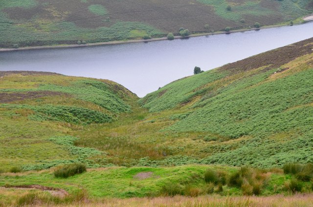
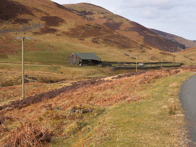
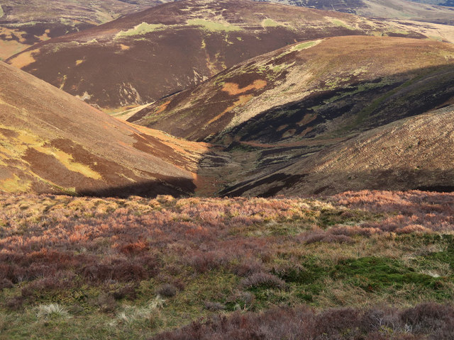
In contrast, the moorland of Yellow Moss showcases a diverse range of plant and animal life. With its heather-covered expanses, scattered bogs, and small lochs, the moorland offers a distinctively rugged beauty. It is a haven for birdwatchers, as various species of birds, including red grouse and golden plovers, can be spotted throughout the year. The moorland also provides a habitat for several small mammals, such as stoats and hares.

Yellow Moss is not only a haven for nature enthusiasts but also a historically significant site. The area is dotted with remnants of ancient settlements, including stone circles and burial mounds, providing a glimpse into the region's rich history. Archaeological excavations have uncovered artifacts from different time periods, shedding light on the lives of the people who once inhabited this land.

Overall, Yellow Moss in Lanarkshire is a captivating destination that offers a harmonious blend of downs and moorland landscapes, making it an ideal place to immerse oneself in the beauty of nature while exploring the area's historical roots.

If you have any feedback on the listing, please let us know in the comments section below.

Yellow Moss Images

Images are sourced within 2km of 55.535106/-3.5453943 or Grid Reference NT0227. Thanks to Geograph Open Source API. All images are credited.

Coulter Reservoir A view of the distinctively-shaped reservoir from the southern slope of Culter Fell.
Coulter Reservoir
A view of the distinctively-shaped reservoir from the southern slope of Culter Fell.
Coulter Reservoir from the air The distinctive shape of the reservoir as seen  from a Prague bound flight from Glasgow.
Coulter Reservoir from the air
The distinctive shape of the reservoir as seen from a Prague bound flight from Glasgow.
Overgrown track, Duncan Gill Although it is shown as a track, the route has been heavily overgrown and is more like a sheep trod, with occasional gaps and steep banks where burn crossings have been eroded.
Overgrown track, Duncan Gill
Although it is shown as a track, the route has been heavily overgrown and is more like a sheep trod, with occasional gaps and steep banks where burn crossings have been eroded.
The Grip, Upper Cowgill Reservoir A strange name for this short gully at the SW end of the reservoir.
The Grip, Upper Cowgill Reservoir
A strange name for this short gully at the SW end of the reservoir.
Upper Cowgill Reservoir A view from the track junction at the base of Todlaw Rig.
Upper Cowgill Reservoir
A view from the track junction at the base of Todlaw Rig.
Upper Cowgill Reservoir The eastern arm of the reservoir and the valley of the Fair Burn.
Upper Cowgill Reservoir
The eastern arm of the reservoir and the valley of the Fair Burn.
Mere Cleuch and Upper Cowgill Reservoir The bracken-covered banks of the burn seen from the track to Cowgill Rig.
Mere Cleuch and Upper Cowgill Reservoir
The bracken-covered banks of the burn seen from the track to Cowgill Rig.
South from Cowgill Rig The track from Upper Cowgill Reservoir keeps on the ridge to descend northwards to the road near Windgill Knowe. On the skyline are some of the turbines in the Clyde Extension Wind Farm.
South from Cowgill Rig
The track from Upper Cowgill Reservoir keeps on the ridge to descend northwards to the road near Windgill Knowe. On the skyline are some of the turbines in the Clyde Extension Wind Farm.
Track descending Cowgill Rig The track meets the road south of Windgill cottage, in the trees L of centre.
Track descending Cowgill Rig
The track meets the road south of Windgill cottage, in the trees L of centre.
Culter Fell from the air The 748m Culter Fell is prominent in the foreground, where part of Coulter reservoir can also be seen.
Culter Fell from the air
The 748m Culter Fell is prominent in the foreground, where part of Coulter reservoir can also be seen.
Heather moorland on the slopes of Fell Shin With the road to Coulter Reservoir in the foreground
Heather moorland on the slopes of Fell Shin
With the road to Coulter Reservoir in the foreground
Electricity poles in Culter Water valley The power supply to the reservoir works at Culter Waterhead
Electricity poles in Culter Water valley
The power supply to the reservoir works at Culter Waterhead
Coulter Reservoir Dam Built by Motherwell Town Council the work started in 1900 and took 5 years to finish.
Coulter Reservoir Dam
Built by Motherwell Town Council the work started in 1900 and took 5 years to finish.
Lone tree near Coulter Reservoir One of a few isolated trees in this area of moorland
Lone tree near Coulter Reservoir
One of a few isolated trees in this area of moorland
Fence on Dod Hill A view with the usual wind turbines and an unexpected old traffic cone
Fence on Dod Hill
A view with the usual wind turbines and an unexpected old traffic cone
Fence on Hudderstone Looking towards Tinto
Fence on Hudderstone
Looking towards Tinto
Looking down to Lea Gill A short tributary of the Culter Water
Looking down to Lea Gill
A short tributary of the Culter Water
View south from Ward Law High moorland with Woodycleuch Dod on the right, Coulter Reservoir on the left and the wind turbines on the horizon
View south from Ward Law
High moorland with Woodycleuch Dod on the right, Coulter Reservoir on the left and the wind turbines on the horizon
Show me another place!

Yellow Moss is located at Grid Ref: NT0227 (Lat: 55.535106, Lng: -3.5453943)

Unitary Authority: South Lanarkshire

Police Authority: Lanarkshire

What 3 Words

///rebirth.straying.nightlife. Near Biggar, South Lanarkshire

Related Wikis

Culter Fell

Culter Fell is a hill in the Culter Hills range, part of the Southern Uplands of Scotland. It is the county top of the historic county of Lanarkshire,...

Gathersnow Hill

Gathersnow Hill is a hill in the Culter Hills range, part of the Southern Uplands of Scotland. It lies west of the village of Tweedsmuir on the border...

Unthank, South Lanarkshire

Unthank is a small village in South Lanarkshire, Scotland. == Note == The geographic coordinates are from the Ordnance Survey. == References ==

Lamington, South Lanarkshire

Lamington is a conservation village in South Lanarkshire in Scotland, roughly between Biggar and Lanark and sits astride the A702 trunk road. It is reputed...

Nearby Amenities

Located within 500m of 55.535106,-3.5453943
Yellow Moss
Place: locality
Lat/Long: 55.5353916/-3.5453582
Bowies Well
Place: locality
Lat/Long: 55.5372859/-3.5469461
The data included in this document is from www.openstreetmap.org. The data is made available under ODbL.

Have you been to Yellow Moss?

Leave your review of Yellow Moss below (or comments, questions and feedback).