Distington Moss

Downs, Moorland in Cumberland Copeland

England

Distington Moss

A595 north east of Lowca
A595 north east of Lowca Credit: Colin Pyle

Distington Moss is a vast area of moorland located in Cumberland, England. Stretching over an expansive 6,000 acres, it is known for its stunning natural beauty and unique ecological significance. The moss is situated between the towns of Whitehaven and Workington, offering a peaceful and secluded retreat for nature enthusiasts and wildlife lovers.

The landscape of Distington Moss is characterized by its rolling hills, heather-covered moors, and scattered patches of woodland. The area is rich in biodiversity, providing a home to a diverse range of plant and animal species. It is particularly renowned for its birdlife, attracting birdwatchers from far and wide. Species such as curlews, lapwings, and red grouse can often be spotted in the moss, making it a haven for bird enthusiasts.

The moss also boasts several walking trails and footpaths, allowing visitors to explore its natural wonders at their own pace. These paths offer breathtaking views of the surrounding countryside and provide an opportunity to encounter the diverse flora and fauna that call the moss their home. Additionally, the moss is intersected by several streams and small rivers, enhancing its charm and offering a sense of tranquility.

Distington Moss plays a vital role in maintaining the local ecosystem and acts as a natural water filtration system, purifying water and preventing flooding in the region. It also serves as a carbon sink, absorbing greenhouse gases and contributing to the fight against climate change.

Overall, Distington Moss is a captivating natural landscape that offers visitors a chance to immerse themselves in the beauty of Cumberland's countryside and appreciate the importance of preserving such valuable habitats.

If you have any feedback on the listing, please let us know in the comments section below.

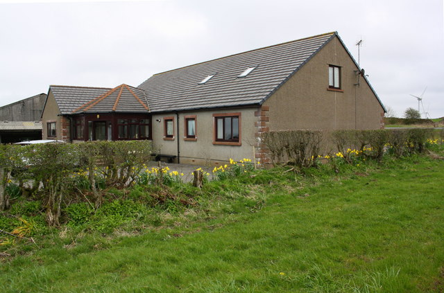
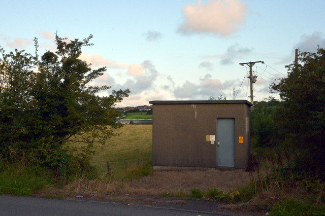
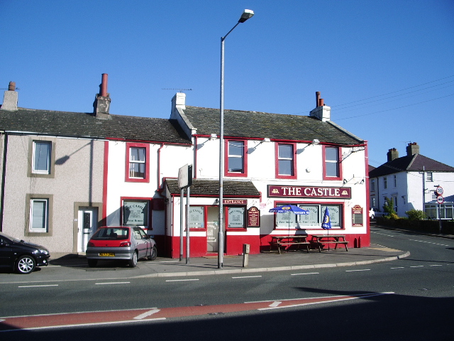
Distington Moss Images

Images are sourced within 2km of 54.572851/-3.535151 or Grid Reference NY0020. Thanks to Geograph Open Source API. All images are credited.

A595 north east of Lowca
Bungalow and farm buildings
Walled bridge. The design is most strange for this bridge with the rightangle only on one end.
Walled bridge.
The design is most strange for this bridge with the rightangle only on one end.
Railway without train. The farmer seems to have made good use of the embankments when choosing the site for the stockpen.
Railway without train.
The farmer seems to have made good use of the embankments when choosing the site for the stockpen.
Farm Machinery This neglected piece of farm machinery from another era is in a field adjacent to the A595 between Howgate and Distington. It would seem to be a prime candidate for restoration. View is looking north from the roadside, with the buildings of Lowca Lowhouse on the hillside in the distance.
Farm Machinery
This neglected piece of farm machinery from another era is in a field adjacent to the A595 between Howgate and Distington. It would seem to be a prime candidate for restoration. View is looking north from the roadside, with the buildings of Lowca Lowhouse on the hillside in the distance.
National Cycle Track This bridge takes the National Cycle Track No72 over the "C" class road near to Lowca Lowhouses and in doing so keeping this section of the cycle track, traffic free.
National Cycle Track
This bridge takes the National Cycle Track No72 over the "C" class road near to Lowca Lowhouses and in doing so keeping this section of the cycle track, traffic free.
Lowca Beck
Lowca Beck
Rosehill Barn
Rosehill Barn
Bridge name/date stone for Barngill Bridge Cumberland County Council stone dated 1919.

Bridge Marker by the UC road, in parish of Distington (Copeland District), Barngill Bridge, River Lowca, set in bridge parapet.

Milestone Society National ID: CU_DIST01br
Bridge name/date stone for Barngill Bridge
Cumberland County Council stone dated 1919. Bridge Marker by the UC road, in parish of Distington (Copeland District), Barngill Bridge, River Lowca, set in bridge parapet. Milestone Society National ID: CU_DIST01br
Barngill Bridge over Lowca Beck There is a name/date stone at the middle of the parapet
Barngill Bridge over Lowca Beck
There is a name/date stone at the middle of the parapet
Benchmark on east parapet of Barngill Bridge Ordnance Survey rivet benchmark described on the Bench Mark Database at <span class="nowrap"><a title="https://www.bench-marks.org.uk/bm30146" rel="nofollow ugc noopener" href="https://www.bench-marks.org.uk/bm30146">Link</a><img style="margin-left:2px;" alt="External link" title="External link - shift click to open in new window" src="https://s1.geograph.org.uk/img/external.png" width="10" height="10"/></span>
Benchmark on east parapet of Barngill Bridge
Ordnance Survey rivet benchmark described on the Bench Mark Database at LinkExternal link
Lowca Beck viewed over eastern parapet of Barngill Bridge There is an OS benchmark <a href="https://www.geograph.org.uk/photo/5990939">NX9921 : Benchmark on east parapet of Barngill Bridge</a> on top of the parapet at the middle of the image
Lowca Beck viewed over eastern parapet of Barngill Bridge
There is an OS benchmark NX9921 : Benchmark on east parapet of Barngill Bridge on top of the parapet at the middle of the image
Whitehaven Premier Inn, Howden
The B5306 at Howgate, Moresby
House on the B5306 at Howgate, Moresby
Electricity substation on the B5306 at Howgate, Moresby
A beck seen from the B5306, Howgate, Moresby The beck enters a tunnel under the road and emerges from it some distance to the north west just before flowing into Lowca Beck west.
A beck seen from the B5306, Howgate, Moresby
The beck enters a tunnel under the road and emerges from it some distance to the north west just before flowing into Lowca Beck west.
Benchmark on buttress of bridge of dismantled railway Ordnance Survey cut mark benchmark described on the Bench Mark Database at <span class="nowrap"><a title="www.bench-marks.org.uk/bm113447" rel="nofollow ugc noopener" href="http://www.bench-marks.org.uk/bm113447">Link</a><img style="margin-left:2px;" alt="External link" title="External link - shift click to open in new window" src="https://s1.geograph.org.uk/img/external.png" width="10" height="10"/></span>
Benchmark on buttress of bridge of dismantled railway
Ordnance Survey cut mark benchmark described on the Bench Mark Database at LinkExternal link
Show me another place!

Distington Moss is located at Grid Ref: NY0020 (Lat: 54.572851, Lng: -3.535151)

Administrative County: Cumbria

District: Copeland

Police Authority: Cumbria

What 3 Words

///replayed.link.apple. Near Distington, Cumbria

Nearby Locations

Distington Moss

Related Wikis

Watch Hill (Whitehaven)

Watch Hill is a small hill lying on the western fringe of the Lake District in England, north east of Whitehaven. It should not be confused with another...

Millgrove railway station (England)

Millgrove railway station was a private station on the Cleator and Workington Junction Railway (C&WJR) main line from Moor Row to Workington Central. It...

Common End, Cumbria

Common End is a hamlet within the civil parish of Distington in Cumbria, England. Common End was on the A595 road until it was by-passed. == References ==

Moresby Parks railway station

Moresby Parks railway station was opened by the Cleator and Workington Junction Railway (C&WJR) in 1879. It was situated just north of the summit of the...

Nearby Amenities

Located within 500m of 54.572851,-3.535151
Generator Method: wind_turbine
Generator Source: wind
Generator Type: horizontal_axis
Power: generator
Lat/Long: 54.5737966/-3.5313427
Generator Method: wind_turbine
Generator Source: wind
Generator Type: horizontal_axis
Power: generator
Lat/Long: 54.5722176/-3.5287903
Distington Moss
Place: locality
Lat/Long: 54.5715616/-3.537407
The data included in this document is from www.openstreetmap.org. The data is made available under ODbL.

Have you been to Distington Moss?

Leave your review of Distington Moss below (or comments, questions and feedback).