Hunthills Moor
Downs, Moorland in Dumfriesshire
Scotland
Hunthills Moor

Hunthills Moor is a captivating expanse of downs and moorland located in Dumfriesshire, Scotland. Stretching over a vast area of approximately 1,500 hectares, this picturesque landscape offers a diverse range of natural features and breathtaking views.
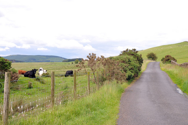
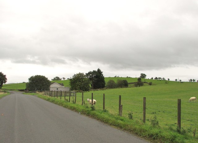
The moorland is characterized by gently rolling hills covered in heather, which paint the terrain in vibrant shades of purple during the summer months. The heathland is interspersed with small pockets of woodland, creating a beautiful contrast between the dense, dark hues of the trees and the open, golden grasslands.
Hunthills Moor is home to a rich variety of wildlife, making it a haven for nature enthusiasts and bird watchers. Visitors may have the opportunity to spot an array of bird species, including red grouse, curlews, and golden plovers. The moorland also provides a habitat for mammals such as mountain hares and red deer, adding to the area's natural charm and biodiversity.
The moorland is crisscrossed with a network of walking trails, which allow visitors to explore the area at their own pace. These trails offer breathtaking panoramic views of the surrounding countryside, including the nearby Lowther Hills and the rolling Southern Uplands.
Hunthills Moor is also of historical significance, as it is home to several ancient monuments and archaeological sites. These include stone circles and burial cairns, providing a glimpse into the area's rich cultural heritage.
Overall, Hunthills Moor is a stunning natural landscape that offers a unique blend of beauty, wildlife, and historical significance. Whether one is seeking a peaceful stroll, a bird-watching adventure, or a glimpse into the past, this moorland is sure to captivate and inspire.
If you have any feedback on the listing, please let us know in the comments section below.
Hunthills Moor Images
Images are sourced within 2km of 55.167775/-3.5766475 or Grid Reference NX9987. Thanks to Geograph Open Source API. All images are credited.


Hunthills Moor is located at Grid Ref: NX9987 (Lat: 55.167775, Lng: -3.5766475)
Unitary Authority: Dumfries and Galloway
Police Authority: Dumfries and Galloway
What 3 Words
///twinkled.richer.speeches. Near Locharbriggs, Dumfries & Galloway
Nearby Locations
Related Wikis

Ae Bridgend
Ae Bridgend is a hamlet in the Scottish council area of Dumfries and Galloway next to the River Ae. It is located at an altitude of 96.9 meters above sea...

Parkgate, Dumfries and Galloway
Parkgate is a small village in Dumfries and Galloway, Scotland. The village centre is located just to the east of the A701 approximately 8 miles (13 km...
Ae, Dumfries and Galloway
Ae (pronounced ) is a village in Dumfries and Galloway, south west Scotland. The village is located on the edge of a 15,000-acre (61 km2) human-made conifer...
Shieldhill railway station
Shieldhill railway station was a station which served Shieldhill, in the Scottish county of Dumfries and Galloway. It was served by trains on a local line...

Amisfield railway station
Amisfield railway station was a station which served Amisfield, in the Scottish county of Dumfries and Galloway. It was served by trains on a local line...

Amisfield
Amisfield is a village in Dumfries and Galloway, Scotland. It is located about 5 miles north of Dumfries and next to the A701 Dumfries to Edinburgh road...

Duncow
Duncow is a small settlement in the civil parish of Kirkmahoe, Dumfries and Galloway, Scotland. Located in the geographical centre of the parish, Duncow...

Dumfriesshire
Dumfriesshire or the County of Dumfries or Shire of Dumfries (Scottish Gaelic: Siorrachd Dhùn Phris) is a historic county and registration county in southern...
Nearby Amenities
Located within 500m of 55.167775,-3.5766475Have you been to Hunthills Moor?
Leave your review of Hunthills Moor below (or comments, questions and feedback).