Shepherd's Wood

Downs, Moorland in Lanarkshire

Scotland

Shepherd's Wood

Northbound A74(M), South Lanarkshire The A74(M) and M74 form a major motorway which runs for over 80 miles in Scotland. Following an extension opened on 28 June 2011, it connects the M8 motorway west of Glasgow to the English border at Gretna,where it becomes the M6. In conjunction with the M6, it forms one of the two major cross-border routes between Scotland and England. As the motorway is one continuous route and has a continuous junction numbering system, the entire route is often erroneously referred to as M74 although, the section south of Abington (more than half its length) is officially the A74(M).

More information :
<span class="nowrap"><a title="http://www.sabre-roads.org.uk/wiki/index.php?title=M74/A74(M)" rel="nofollow ugc noopener" href="http://www.sabre-roads.org.uk/wiki/index.php?title=M74/A74(M)">Link</a><img style="margin-left:2px;" alt="External link" title="External link - shift click to open in new window" src="https://s1.geograph.org.uk/img/external.png" width="10" height="10"/></span>  SABRE Wiki
<span class="nowrap"><a title="http://en.wikipedia.org/wiki/A74(M)_and_M74_motorways" rel="nofollow ugc noopener" href="http://en.wikipedia.org/wiki/A74(M)_and_M74_motorways">Link</a><img style="margin-left:2px;" alt="External link" title="External link - shift click to open in new window" src="https://s1.geograph.org.uk/img/external.png" width="10" height="10"/></span>  Wikipedia
<span class="nowrap"><a title="http://www.cbrd.co.uk/motorway/m74" rel="nofollow ugc noopener" href="http://www.cbrd.co.uk/motorway/m74">Link</a><img style="margin-left:2px;" alt="External link" title="External link - shift click to open in new window" src="https://s1.geograph.org.uk/img/external.png" width="10" height="10"/></span>  cbrd
Northbound A74(M), South Lanarkshire Credit: David Dixon

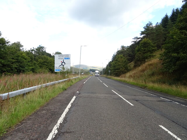
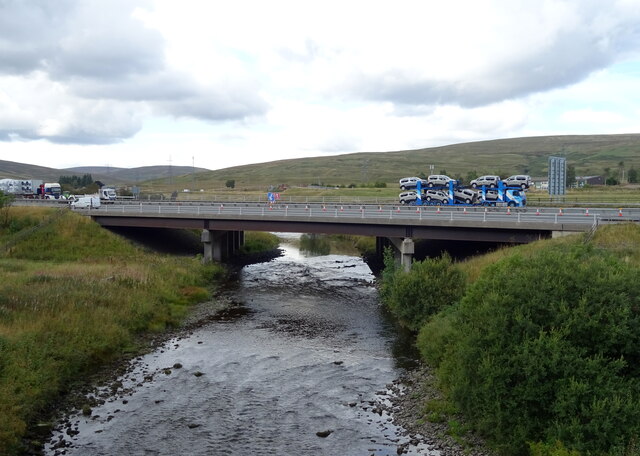
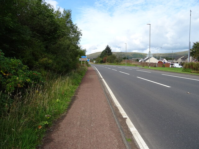
Shepherd's Wood, located in the county of Lanarkshire, Scotland, is a picturesque and diverse natural area that encompasses downs and moorland landscapes. Spread over an expansive area, it showcases the unique and captivating beauty of the Scottish countryside.

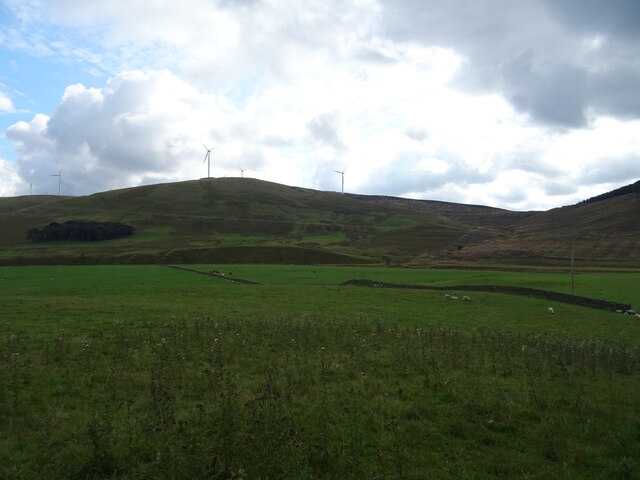
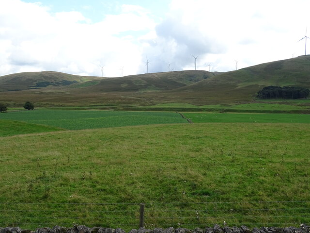
The downs of Shepherd's Wood are characterized by gently rolling hills covered in lush green grasses and scattered with small outcrops of rocks. They offer breathtaking panoramic views of the surrounding countryside, making it a popular destination for nature lovers and hikers alike. The peaceful and serene ambiance of the downs makes it an ideal spot for relaxation and contemplation.

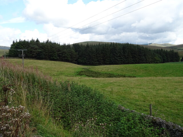
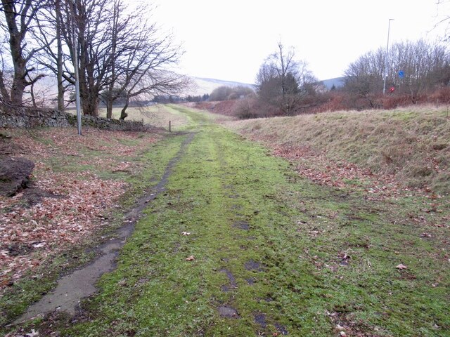
Moving towards the moorland section of Shepherd's Wood, visitors are greeted by a rugged and wild terrain. Here, heather-covered hills stretch as far as the eye can see, creating a vibrant purple landscape during the summer months. The moorland is also home to a variety of wildlife, including birds of prey, deer, and smaller mammals, adding to the area's natural charm.

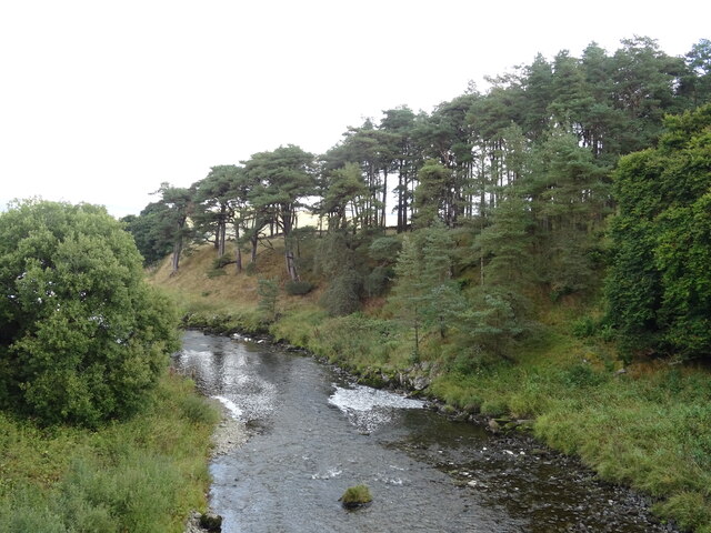
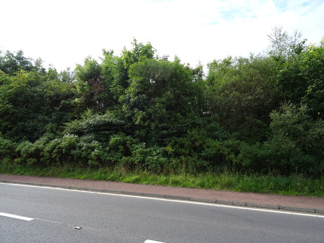
The woodlands within Shepherd's Wood are rich and diverse, hosting a wide array of tree species, including oak, birch, and rowan. These woodlands provide a sheltered habitat for many birds and animals, creating a haven for nature enthusiasts and birdwatchers. The tranquil atmosphere and the gentle rustling of leaves make it a perfect place for a peaceful stroll or a picnic.

In conclusion, Shepherd's Wood in Lanarkshire, Scotland, offers a captivating blend of downs, moorland, and woodlands, showcasing the natural beauty and diversity of the region. Whether visitors seek panoramic vistas, rugged terrains, or tranquil woodlands, Shepherd's Wood has something to offer for everyone.

If you have any feedback on the listing, please let us know in the comments section below.

Shepherd's Wood Images

Images are sourced within 2km of 55.445702/-3.6556983 or Grid Reference NS9518. Thanks to Geograph Open Source API. All images are credited.

Northbound A74(M), South Lanarkshire The A74(M) and M74 form a major motorway which runs for over 80 miles in Scotland. Following an extension opened on 28 June 2011, it connects the M8 motorway west of Glasgow to the English border at Gretna,where it becomes the M6. In conjunction with the M6, it forms one of the two major cross-border routes between Scotland and England. As the motorway is one continuous route and has a continuous junction numbering system, the entire route is often erroneously referred to as M74 although, the section south of Abington (more than half its length) is officially the A74(M).

More information :
<span class="nowrap"><a title="http://www.sabre-roads.org.uk/wiki/index.php?title=M74/A74(M)" rel="nofollow ugc noopener" href="http://www.sabre-roads.org.uk/wiki/index.php?title=M74/A74(M)">Link</a><img style="margin-left:2px;" alt="External link" title="External link - shift click to open in new window" src="https://s1.geograph.org.uk/img/external.png" width="10" height="10"/></span>  SABRE Wiki
<span class="nowrap"><a title="http://en.wikipedia.org/wiki/A74(M)_and_M74_motorways" rel="nofollow ugc noopener" href="http://en.wikipedia.org/wiki/A74(M)_and_M74_motorways">Link</a><img style="margin-left:2px;" alt="External link" title="External link - shift click to open in new window" src="https://s1.geograph.org.uk/img/external.png" width="10" height="10"/></span>  Wikipedia
<span class="nowrap"><a title="http://www.cbrd.co.uk/motorway/m74" rel="nofollow ugc noopener" href="http://www.cbrd.co.uk/motorway/m74">Link</a><img style="margin-left:2px;" alt="External link" title="External link - shift click to open in new window" src="https://s1.geograph.org.uk/img/external.png" width="10" height="10"/></span>  cbrd
Northbound A74(M), South Lanarkshire
The A74(M) and M74 form a major motorway which runs for over 80 miles in Scotland. Following an extension opened on 28 June 2011, it connects the M8 motorway west of Glasgow to the English border at Gretna,where it becomes the M6. In conjunction with the M6, it forms one of the two major cross-border routes between Scotland and England. As the motorway is one continuous route and has a continuous junction numbering system, the entire route is often erroneously referred to as M74 although, the section south of Abington (more than half its length) is officially the A74(M). More information : LinkExternal link SABRE Wiki LinkExternal link Wikipedia LinkExternal link cbrd
Cleared woodland, Bodsberry Hill Above the B7076.
Cleared woodland, Bodsberry Hill
Above the B7076.
Woodland near the A74(M)
Rough grazing and woodland beside the B7076 Looking towards the A74(M).
Rough grazing and woodland beside the B7076
Looking towards the A74(M).
National Cycle Route 74 towards Crawford On the B7076.
National Cycle Route 74 towards Crawford
On the B7076.
B7076 approaching roundabout Heading north on National Cycle Route 74.
B7076 approaching roundabout
Heading north on National Cycle Route 74.
A74(M) bridge over the River Clyde From Elvanfoot Bridge on the B7076.
A74(M) bridge over the River Clyde
From Elvanfoot Bridge on the B7076.
B7076, Elvanfoot Bridge Heading north where it shortly becomes the A702.
B7076, Elvanfoot Bridge
Heading north where it shortly becomes the A702.
The River Clyde, Elvanfoot Bridge
Grazing towards the River Clyde Off the A702.
Grazing towards the River Clyde
Off the A702.
Stoneyburn Wood
Stoneyburn Wood
Grazing, Stoneyburn Towards the River Clyde.
Grazing, Stoneyburn
Towards the River Clyde.
A702, Stoneyburn Towards Crawford.
A702, Stoneyburn
Towards Crawford.
National Cycle Route 74, Stoneyburn Towards Crawford.
National Cycle Route 74, Stoneyburn
Towards Crawford.
National Cycle Route 74, Crawford Beside the A702.
National Cycle Route 74, Crawford
Beside the A702.
Woodland beside the A702, Crawford
A74(M) near Bodsberry End Towards Glasgow.
A74(M) near Bodsberry End
Towards Glasgow.
An old alignment of the A74 Now grassed over this was the single carriageway road replaced by a dual carriageway bypass of Crawford. The current motorway is slightly further again to the west.
An old alignment of the A74
Now grassed over this was the single carriageway road replaced by a dual carriageway bypass of Crawford. The current motorway is slightly further again to the west.
Show me another place!

Shepherd's Wood is located at Grid Ref: NS9518 (Lat: 55.445702, Lng: -3.6556983)

Unitary Authority: South Lanarkshire

Police Authority: Lanarkshire

What 3 Words

///prune.breezes.camps. Near Douglas, South Lanarkshire

Related Wikis

Elvanfoot railway station

Elvanfoot railway station was a station which served Elvanfoot, in the Scottish county of South Lanarkshire. It was served by local trains on what is now...

Elvanfoot

Elvanfoot is a small village in South Lanarkshire, Scotland. Elvanfoot is located at the confluence of the River Clyde and Elvan Water. The Clyde is crossed...

Crawford, South Lanarkshire

Crawford is a village and civil parish in South Lanarkshire, Scotland.Crawford is close to the source of the River Clyde and the A74(M) motorway, 50 miles...
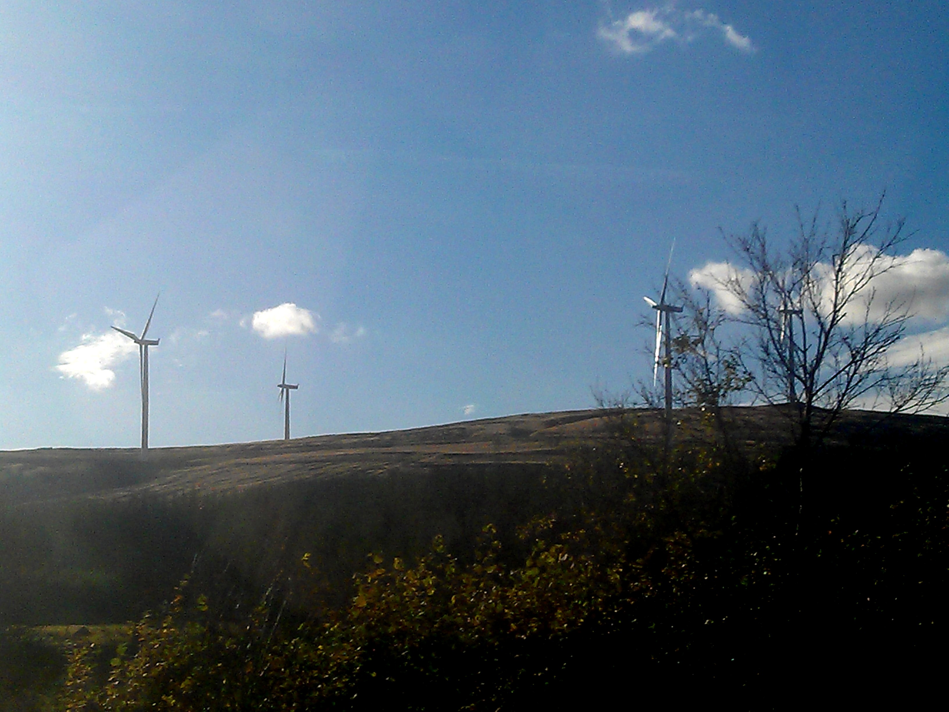
Clyde Wind Farm

The Clyde Wind Farm is a 522 megawatt (MW) wind farm near Abington in South Lanarkshire, Scotland. == Planning == The first stage of the project consists...

Crawford railway station (Scotland)

Crawford railway station was a station which served the village of Crawford, near Abington, in the Scottish county of South Lanarkshire. It was served...

Crawford Castle

Crawford Castle, substantially in ruins, is located on the north bank of the River Clyde, around 1⁄2 mile (800 metres) north of Crawford, South Lanarkshire...
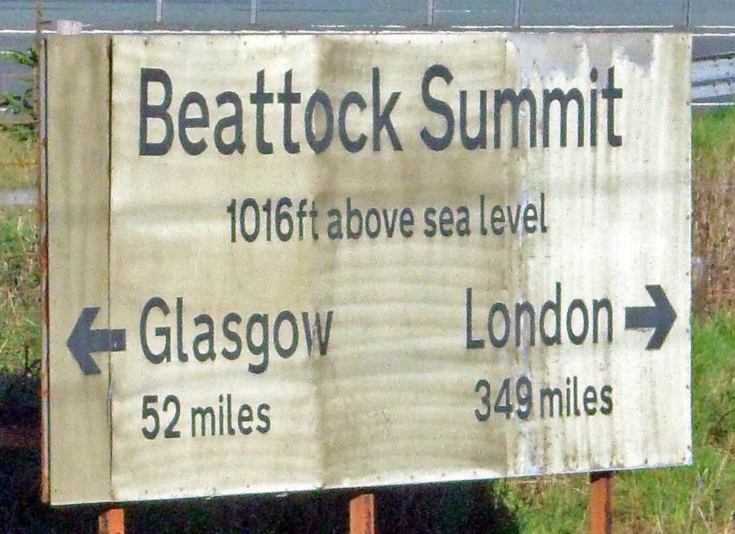
Beattock Summit

Beattock Summit is the highest point of the West Coast Main Line (WCML) railway and of the A74(M) motorway as they cross between Dumfries and Galloway...

Abington railway station

Abington railway station was a station which served Abington, in the Scottish county of South Lanarkshire. It was served by local trains on what is now...

Nearby Amenities

Located within 500m of 55.445702,-3.6556983
Created By: Merkaartor 0.13
Lat/Long: 55.4451269/-3.6504206
Created By: Merkaartor 0.13
Lat/Long: 55.4470083/-3.6509227
Created By: Merkaartor 0.13
Lat/Long: 55.4472031/-3.6501502
Motorway Junction
Ref: 14
Lat/Long: 55.4473519/-3.6519395
Created By: Merkaartor 0.13
Lat/Long: 55.4446633/-3.6506328
Created By: Merkaartor 0.13
Lat/Long: 55.4427901/-3.651833
Created By: Merkaartor 0.13
Lat/Long: 55.4434573/-3.6519333
Created By: Merkaartor 0.13
Lat/Long: 55.4440133/-3.6509486
Created By: Merkaartor 0.13
Lat/Long: 55.4430743/-3.6511435
Created By: Merkaartor 0.13
Lat/Long: 55.4437134/-3.6509969
Created By: Merkaartor 0.13
Lat/Long: 55.4445829/-3.6507622
Created By: Merkaartor 0.13
Lat/Long: 55.4445407/-3.6506794
Created By: Merkaartor 0.13
Lat/Long: 55.444128/-3.6508951
Created By: Merkaartor 0.13
Lat/Long: 55.4441221/-3.6509675
Created By: Merkaartor 0.13
Lat/Long: 55.4420575/-3.6515595
Power: pole
Lat/Long: 55.4443258/-3.6496978
Place: farm
Lat/Long: 55.4437394/-3.6583755
Power: pole
Lat/Long: 55.443145/-3.6598841
Power: pole
Lat/Long: 55.4433286/-3.6594399
Power: pole
Lat/Long: 55.4435662/-3.6589111
Power: pole
Lat/Long: 55.4437185/-3.6585642
Power: pole
Lat/Long: 55.4419739/-3.6599857
Power: pole
Lat/Long: 55.4425799/-3.6599645
Power: pole
Lat/Long: 55.443583/-3.6597805
Power: pole
Lat/Long: 55.4440029/-3.659918
Power: pole
Lat/Long: 55.4444744/-3.6600661
Power: pole
Lat/Long: 55.4413602/-3.6548666
Power: pole
Lat/Long: 55.4414946/-3.6538142
Power: pole
Lat/Long: 55.4416002/-3.6529935
Power: pole
Lat/Long: 55.4416823/-3.6522954
Power: pole
Lat/Long: 55.4414922/-3.6573119
Power: pole
Lat/Long: 55.4422121/-3.6574515
Power: pole
Lat/Long: 55.4429452/-3.65757
Power: pole
Lat/Long: 55.4436639/-3.6577159
Power: pole
Lat/Long: 55.4443718/-3.6575467
Power: pole
Lat/Long: 55.4450329/-3.6573521
Power: pole
Lat/Long: 55.4457384/-3.6571448
Power: pole
Lat/Long: 55.4497273/-3.6538383
Power: pole
Lat/Long: 55.4489202/-3.6546805
Power: pole
Lat/Long: 55.4481491/-3.6554432
Power: pole
Lat/Long: 55.4473627/-3.6562045
The data included in this document is from www.openstreetmap.org. The data is made available under ODbL.

Have you been to Shepherd's Wood?

Leave your review of Shepherd's Wood below (or comments, questions and feedback).