Barnhill Wood

Downs, Moorland in Kirkcudbrightshire

Scotland

Barnhill Wood

Old Boundary Marker Terregles Road, Maxwelltown Municipal Boundary Marker on the north side of Terregles Road, Maxwelltown, 30 metres west of the junction with Hardthorn Road. PB is thought to refer to Maxwelltown Police Burgh, 1833 to 1929.

Milestone Society National ID: DF_MXT04pb
Old Boundary Marker Terregles Road, Maxwelltown Credit: J Glew

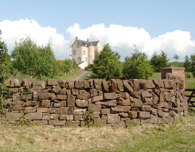
Barnhill Wood, located in Kirkcudbrightshire, Scotland, is a picturesque natural area that encompasses both downs and moorland landscapes. Spanning approximately 200 acres, this woodland is a haven for nature enthusiasts and offers a diverse range of flora and fauna.

The downs in Barnhill Wood are characterized by rolling hills and open grasslands. The undulating terrain provides stunning panoramic views of the surrounding countryside, making it a popular spot for hiking and picnicking. The grassy downs are home to a variety of wildflowers, including heather, bluebells, and primroses, which create a vibrant and colorful display during the spring and summer months.

In contrast, the moorland areas of Barnhill Wood are characterized by their wet and boggy terrain. Here, visitors can observe unique plant species such as sphagnum moss and cotton grass, which thrive in these damp conditions. The moorland is also home to a variety of birds, including the elusive red grouse, as well as various insects and small mammals.

Barnhill Wood is not only a haven for wildlife but also provides an important habitat for several protected species, including the Eurasian otter and the Scottish wildcat. The wood is managed by a local conservation group, who work to maintain and enhance the natural habitats found within the area.

With its diverse landscapes and rich biodiversity, Barnhill Wood in Kirkcudbrightshire offers a tranquil and captivating experience for those seeking to immerse themselves in the beauty of nature.

If you have any feedback on the listing, please let us know in the comments section below.

Barnhill Wood Images

Images are sourced within 2km of 55.076046/-3.6477227 or Grid Reference NX9476. Thanks to Geograph Open Source API. All images are credited.

Old Boundary Marker Terregles Road, Maxwelltown Municipal Boundary Marker on the north side of Terregles Road, Maxwelltown, 30 metres west of the junction with Hardthorn Road. PB is thought to refer to Maxwelltown Police Burgh, 1833 to 1929.

Milestone Society National ID: DF_MXT04pb
Old Boundary Marker Terregles Road, Maxwelltown
Municipal Boundary Marker on the north side of Terregles Road, Maxwelltown, 30 metres west of the junction with Hardthorn Road. PB is thought to refer to Maxwelltown Police Burgh, 1833 to 1929. Milestone Society National ID: DF_MXT04pb
Entrance to a yard at Garroch Business Park
The Lincluden Rhino The rhino sculpture was created in the early 1980s by local artist Robbie Coleman as part of a scheme to brighten up the Lincluden environment. The subject and it's location on top of a bus shelter were suggested by local schoolchildren.

The bus shelter was later relocated and a mock one now acts as a plinth with the rhino on top. See <a href="https://www.geograph.org.uk/photo/186918">NX9677 : Rhinos  at Lincluden</a> & <a href="https://www.geograph.org.uk/photo/186920">NX9677 : Rhino statue, Lincluden</a>.
The Lincluden Rhino
The rhino sculpture was created in the early 1980s by local artist Robbie Coleman as part of a scheme to brighten up the Lincluden environment. The subject and it's location on top of a bus shelter were suggested by local schoolchildren. The bus shelter was later relocated and a mock one now acts as a plinth with the rhino on top. See NX9677 : Rhinos at Lincluden & NX9677 : Rhino statue, Lincluden.
Dumfries - Old Bridge The Old Bridge and weir at Dumfries
Dumfries - Old Bridge
The Old Bridge and weir at Dumfries
Disused ford, Hardlawbank The site of a former ford through Cluden Water, now showing no signs of use, just the remains of a scooter.
Disused ford, Hardlawbank
The site of a former ford through Cluden Water, now showing no signs of use, just the remains of a scooter.
Foot Bridge Bridge over the A75 at Dumfries taken from a car travelling east
Foot Bridge
Bridge over the A75 at Dumfries taken from a car travelling east
Church, Maxwelltown, Dumfries
Lincluden Collegiate Church These ruins now in the care of Historic Scotland date from the 14th century and were built on the site of a Nunnery dating from the 12th century. It was founded by the 3rd Earl of Douglas (Archibald the Grim) and was abandoned in the 18th century and the area used as a quarry until 1832 when the Laird stepped in to consolidate the ruins.
Lincluden Collegiate Church
These ruins now in the care of Historic Scotland date from the 14th century and were built on the site of a Nunnery dating from the 12th century. It was founded by the 3rd Earl of Douglas (Archibald the Grim) and was abandoned in the 18th century and the area used as a quarry until 1832 when the Laird stepped in to consolidate the ruins.
Weir on River Nith Flowing through the city of Dumfries, the weir on the river once powered a local cornmill. Part of a salmon ladder can just be seen to the right
Weir on River Nith
Flowing through the city of Dumfries, the weir on the river once powered a local cornmill. Part of a salmon ladder can just be seen to the right
Rhinos  at Lincluden This statue is located adjacent to the A76, opposite the McDonald's restaurant at Lincluden. The tower of the cable-stayed footbridge over the A75 can be seen in the background.
The Scotland Magazine, issue 6 dated 15 October 2005, provides the following information on this statue:-
" During the 1980s, an arts grant of £1,500 was awarded towards improving the Lincluden area on the outskirts of Dumfries. Local schoolchildren decided that a rhinoceros on the top of the bus shelter on Glasgow Road would be fun. With the assistance of local artist Robbie Coleman, the first rhino was sculpted and put in place. It attracted a lot of attention, was never vandalised and remained in place until recently when road works necessitated the removal of the bus shelter. With work completed, it was agreed to build a mock shelter that would be set back from the road, but still visible to passing motorists. the rhino has therefore been relocated, and this time is accompanied by a baby rhino. "
Rhinos at Lincluden
This statue is located adjacent to the A76, opposite the McDonald's restaurant at Lincluden. The tower of the cable-stayed footbridge over the A75 can be seen in the background. The Scotland Magazine, issue 6 dated 15 October 2005, provides the following information on this statue:- " During the 1980s, an arts grant of £1,500 was awarded towards improving the Lincluden area on the outskirts of Dumfries. Local schoolchildren decided that a rhinoceros on the top of the bus shelter on Glasgow Road would be fun. With the assistance of local artist Robbie Coleman, the first rhino was sculpted and put in place. It attracted a lot of attention, was never vandalised and remained in place until recently when road works necessitated the removal of the bus shelter. With work completed, it was agreed to build a mock shelter that would be set back from the road, but still visible to passing motorists. the rhino has therefore been relocated, and this time is accompanied by a baby rhino. "
Rhino statue, Lincluden A view looking northeast to the rhino statue on top of the mock bus shelter at Lincluden.
Rhino statue, Lincluden
A view looking northeast to the rhino statue on top of the mock bus shelter at Lincluden.
Glasgow Road in Dumfries
Cuckoo Bridge Retail Park
Superstore Carpark in Dumfries
Devorgilla Bridge It's nearly 600 yrs old
Devorgilla Bridge
It's nearly 600 yrs old
Tower home near Maryfield
Terregles War Memorial
Nunwood Road, approaching Terregles
Show me another place!

Barnhill Wood is located at Grid Ref: NX9476 (Lat: 55.076046, Lng: -3.6477227)

Unitary Authority: Dumfries and Galloway

Police Authority: Dumfries and Galloway

What 3 Words

///list.waltzes.globe. Near Dumfries, Dumfries & Galloway

Nearby Locations

Barnhill Wood

Related Wikis

Maxwelltown railway station

Maxwelltown railway station was a station in Dumfries and Galloway, Scotland, located on the Dumfries-to-Stranraer direct railway line. It served the town...

Maxwelltown High School

Maxwelltown High School was a state funded, six-year comprehensive secondary school in the Lochside area of Dumfries, Scotland. Founded in 1971, Maxwelltown...

Summerhill, Dumfries

Summerhill in Dumfries is a post war residential suburb on the west side of the town. It is located on the Maxwelltown side of the River Nith that runs...

Newbridge Drive

Newbridge Drive is a relatively new suburb in Dumfries. It is situated on the Maxwelltown side of the River Nith and is approx 1.8 miles north-west from...

Palmerston Park

Palmerston Park is a football stadium on Terregles Street in Dumfries, Dumfries and Galloway, Scotland. It is the home ground of Scottish League One club...

HM Prison Dumfries

HM Prison Dumfries services the courts of Dumfries and Galloway, Scotland. The establishment serves as a local community prison that holds adult and under...

Terregles House

Terregles House was a late 18th-century country house, located near Terregles, in the historical county of Kirkcudbrightshire around 2 miles west of Dumfries...

Dumfries and Galloway Royal Infirmary

Dumfries and Galloway Royal Infirmary is the main hospital in Dumfries and Galloway, Scotland. The hospital is managed by NHS Dumfries and Galloway....

Nearby Amenities

Located within 500m of 55.076046,-3.6477227
Turning Circle
Lat/Long: 55.0727484/-3.6426061
Noexit: yes
Lat/Long: 55.0737077/-3.6454043
Power: pole
Lat/Long: 55.0767747/-3.6549291
Power: pole
Lat/Long: 55.0775524/-3.6541031
Power: pole
Lat/Long: 55.0782915/-3.6533389
Power: pole
Lat/Long: 55.0790992/-3.6524749
Power: pole
Lat/Long: 55.0797912/-3.65175
Power: pole
Lat/Long: 55.0721829/-3.6451252
Power: pole
Lat/Long: 55.0730465/-3.6450509
Power: pole
Lat/Long: 55.073185/-3.645734
Power: pole
Lat/Long: 55.0734218/-3.6468648
Power: pole
Lat/Long: 55.0729688/-3.6533776
Power: pole
Lat/Long: 55.0734692/-3.6522893
Power: pole
Lat/Long: 55.0739817/-3.6517907
Power: pole
Lat/Long: 55.0744736/-3.6512965
Generator Method: photovoltaic
Generator Output Electricity: yes
Generator Source: solar
Generator Type: solar_photovoltaic_panel
Power: generator
Lat/Long: 55.0732575/-3.644825
Generator Method: photovoltaic
Generator Output Electricity: yes
Generator Source: solar
Generator Type: solar_photovoltaic_panel
Power: generator
Lat/Long: 55.0734972/-3.6451515
The data included in this document is from www.openstreetmap.org. The data is made available under ODbL.

Have you been to Barnhill Wood?

Leave your review of Barnhill Wood below (or comments, questions and feedback).