Parc y Sarn

Downs, Moorland in Montgomeryshire

Wales

Parc y Sarn

Coed y Sarn
Coed y Sarn Credit: N Chadwick

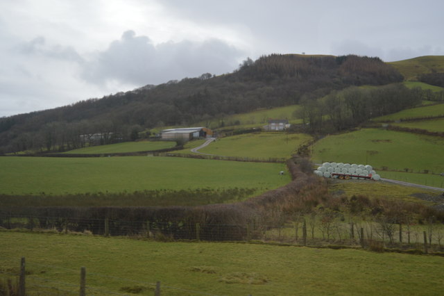
Parc y Sarn is a stunning area located in Montgomeryshire, Wales. Nestled in the heart of the region, it encompasses both downs and moorland landscapes, offering visitors a diverse and picturesque setting.

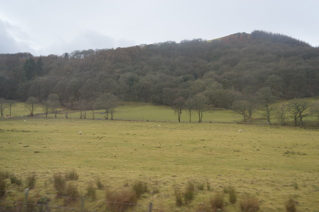
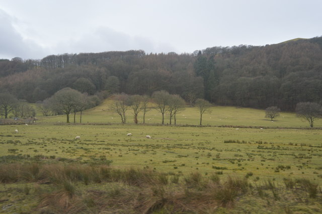
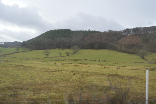
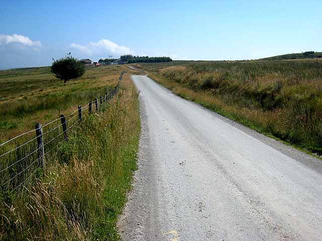
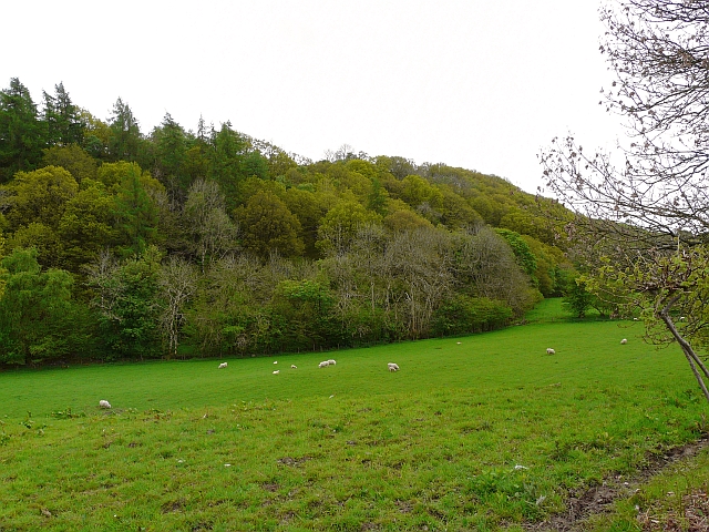
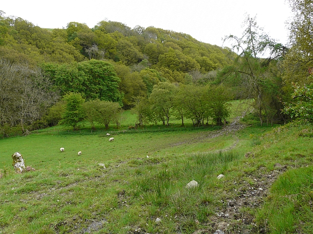
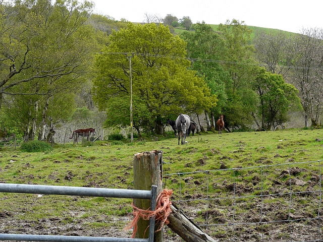
The downs of Parc y Sarn are characterized by their rolling hills and expansive views. The grassy slopes are perfect for leisurely walks or picnics, allowing visitors to admire the surrounding countryside. The downs are often dotted with grazing livestock, adding to the charm of the area.

In contrast, the moorland of Parc y Sarn offers a more rugged and wild experience. The terrain is covered in heather and bracken, creating a beautiful tapestry of colors. The moorland is home to a variety of wildlife, including birds such as curlews and red grouse. It is a haven for nature enthusiasts and provides ample opportunities for birdwatching and photography.

Parc y Sarn is also known for its historical significance. The area is rich in archaeological sites, with numerous ancient burial mounds and standing stones scattered throughout the landscape. These remnants of the past add an air of mystery and intrigue to the area, making it a popular destination for history buffs.

Overall, Parc y Sarn in Montgomeryshire is a captivating blend of downs and moorland landscapes. Its natural beauty, diverse wildlife, and historical significance make it a must-visit location for those seeking an authentic Welsh experience.

If you have any feedback on the listing, please let us know in the comments section below.

Parc y Sarn Images

Images are sourced within 2km of 52.553073/-3.5666715 or Grid Reference SN9396. Thanks to Geograph Open Source API. All images are credited.

Coed y Sarn
Coed y Sarn
Coed y Sarn
Coed y Sarn
Rough grassland near Carno
Allt Goch
Allt Goch
Carreg Llwyd prehistoric stone row A single prehistoric stone row measuring 24.4m long, including at least 15 large, medium and small-sized stones. The row is orientated north to south. <span class="nowrap"><a title="https://stonerows.wordpress.com/gazetteer/region/mid-wales/carreg-llwyd/" rel="nofollow ugc noopener" href="https://stonerows.wordpress.com/gazetteer/region/mid-wales/carreg-llwyd/">Link</a><img style="margin-left:2px;" alt="External link" title="External link - shift click to open in new window" src="https://s1.geograph.org.uk/img/external.png" width="10" height="10"/></span>
Carreg Llwyd prehistoric stone row
A single prehistoric stone row measuring 24.4m long, including at least 15 large, medium and small-sized stones. The row is orientated north to south. LinkExternal link
Cledan Valley rock formations Layers of sedimentary rocks can be seen in the cliffs above the Afon Cledan near Carno, Powys. Notice the two thicker layers amongst the thinner beds.
Cledan Valley rock formations
Layers of sedimentary rocks can be seen in the cliffs above the Afon Cledan near Carno, Powys. Notice the two thicker layers amongst the thinner beds.
Cledan Valley Tipis
Cledan Valley Tipis
The Carno wind farm
The Carno wind farm
Carno Wind Farm Carno Wind Farm, <span class="nowrap"><a title="http://www.cat.org.uk/grew/project.tmpl?command=search&db=grew.db&eqSKUdatarq=16&dir=grew" rel="nofollow ugc noopener" href="http://www.cat.org.uk/grew/project.tmpl?command=search&db=grew.db&eqSKUdatarq=16&dir=grew">Link</a><img style="margin-left:2px;" alt="External link" title="External link - shift click to open in new window" src="https://s1.geograph.org.uk/img/external.png" width="10" height="10"/></span> opened 1996, was at the time of its completion the largest wind farm in Europe with 56 turbines installed with a total capacity of over 33 Megawatts. The towers, each over 30 metres high dominate the landscape for miles around. Opinions about wind farms are varied, with strongly opposed views about their value and desirability. On the two occasions when I visited the site, not one of the 56 turbines was turning, despite a moderate breeze. There may have been good technical reasons for this, but it does not make for good publicity for wind power.

This site road extends well to the north of that shown on the Landranger map and is obviously new. Together with a cluster of site Portakabins (not seen on this photo), it seem so to be evidence of a further expansion of the wind farm onto the moors to the north.
Carno Wind Farm
Carno Wind Farm, LinkExternal link opened 1996, was at the time of its completion the largest wind farm in Europe with 56 turbines installed with a total capacity of over 33 Megawatts. The towers, each over 30 metres high dominate the landscape for miles around. Opinions about wind farms are varied, with strongly opposed views about their value and desirability. On the two occasions when I visited the site, not one of the 56 turbines was turning, despite a moderate breeze. There may have been good technical reasons for this, but it does not make for good publicity for wind power. This site road extends well to the north of that shown on the Landranger map and is obviously new. Together with a cluster of site Portakabins (not seen on this photo), it seem so to be evidence of a further expansion of the wind farm onto the moors to the north.
Carno Wind Farm Carno Wind Farm, <span class="nowrap"><a title="http://www.cat.org.uk/grew/project.tmpl?command=search&db=grew.db&eqSKUdatarq=16&dir=grew" rel="nofollow ugc noopener" href="http://www.cat.org.uk/grew/project.tmpl?command=search&db=grew.db&eqSKUdatarq=16&dir=grew">Link</a><img style="margin-left:2px;" alt="External link" title="External link - shift click to open in new window" src="https://s1.geograph.org.uk/img/external.png" width="10" height="10"/></span> opened 1996, was at the time of its completion the largest wind farm in Europe with 56 turbines installed with a total capacity of over 33 Megawatts. The towers, each over 30 metres high dominate the landscape for miles around. Opinions about wind farms are varied, with strongly opposed views about their value and desirability. On the two occasions when I visited the site, not one of the 56 turbines was turning, despite a moderate breeze. There may have been good technical reasons for this, but it does not make for good publicity for wind power.

The road making plant in the foreground is just some of the machinery required to build and maintain roads round the site.
Carno Wind Farm
Carno Wind Farm, LinkExternal link opened 1996, was at the time of its completion the largest wind farm in Europe with 56 turbines installed with a total capacity of over 33 Megawatts. The towers, each over 30 metres high dominate the landscape for miles around. Opinions about wind farms are varied, with strongly opposed views about their value and desirability. On the two occasions when I visited the site, not one of the 56 turbines was turning, despite a moderate breeze. There may have been good technical reasons for this, but it does not make for good publicity for wind power. The road making plant in the foreground is just some of the machinery required to build and maintain roads round the site.
Pantlle Nestling in a valley below Carno Wind Farm, this farmstead, although still in good condition, is clearly not occupied.
Pantlle
Nestling in a valley below Carno Wind Farm, this farmstead, although still in good condition, is clearly not occupied.
Access road from Carno Wind Farm The narrow country lane from Carno up onto the moors has been extensively improved and widened to facilitate the construction and servicing of Carno Wind Farm. The site yard <a href="https://www.geograph.org.uk/gridref/SN9396">SN9396</a> of Jones Brothers who are involved in maintaining and developing the site can be seen in the background.
Access road from Carno Wind Farm
The narrow country lane from Carno up onto the moors has been extensively improved and widened to facilitate the construction and servicing of Carno Wind Farm. The site yard SN9396 of Jones Brothers who are involved in maintaining and developing the site can be seen in the background.
Site yard at Carno Wind Farm Carno Wind Farm, <span class="nowrap"><a title="http://www.cat.org.uk/grew/project.tmpl?command=search&db=grew.db&eqSKUdatarq=16&dir=grew" rel="nofollow ugc noopener" href="http://www.cat.org.uk/grew/project.tmpl?command=search&db=grew.db&eqSKUdatarq=16&dir=grew">Link</a><img style="margin-left:2px;" alt="External link" title="External link - shift click to open in new window" src="https://s1.geograph.org.uk/img/external.png" width="10" height="10"/></span> opened 1996, was at the time of its completion the largest wind farm in Europe with 56 turbines installed with a total capacity of over 33 Megawatts. The towers, each over 30 metres high dominate the landscape for miles around. Opinions about wind farms are varied, with strongly opposed views about their value and desirability. On the two occasions when I visited the site, not one of the 56 turbines was turning, despite a moderate breeze. There may have been good technical reasons for this, but it does not make for good publicity for wind power.

This image shows the site yard of Jones Brothers who are responsible for the development of Carno II Wind Farm  <span class="nowrap"><a title="http://www.fimltd.co.uk/downloads/Carno%20Presss%20Release%20Feb%202008.pdf" rel="nofollow ugc noopener" href="http://www.fimltd.co.uk/downloads/Carno%20Presss%20Release%20Feb%202008.pdf">Link</a><img style="margin-left:2px;" alt="External link" title="External link - shift click to open in new window" src="https://s1.geograph.org.uk/img/external.png" width="10" height="10"/></span> which is under construction to the north of the original site. The new site will consist of twelve turbines or even larger size (49 metre high towers) with a total capacity of 15.6 Mw. New roads have been put in, but there is little sign yet of the new turbines. The published completion date of October 2008 looks decidedly optimistic.
Site yard at Carno Wind Farm
Carno Wind Farm, LinkExternal link opened 1996, was at the time of its completion the largest wind farm in Europe with 56 turbines installed with a total capacity of over 33 Megawatts. The towers, each over 30 metres high dominate the landscape for miles around. Opinions about wind farms are varied, with strongly opposed views about their value and desirability. On the two occasions when I visited the site, not one of the 56 turbines was turning, despite a moderate breeze. There may have been good technical reasons for this, but it does not make for good publicity for wind power. This image shows the site yard of Jones Brothers who are responsible for the development of Carno II Wind Farm LinkExternal link which is under construction to the north of the original site. The new site will consist of twelve turbines or even larger size (49 metre high towers) with a total capacity of 15.6 Mw. New roads have been put in, but there is little sign yet of the new turbines. The published completion date of October 2008 looks decidedly optimistic.
Livestock pens above Carno
Green green grass Grazing sheep in the Afon Cerniog valley. Looking towards mixed woodland of Coed y Pentre.
Green green grass
Grazing sheep in the Afon Cerniog valley. Looking towards mixed woodland of Coed y Pentre.
Field boundary View towards Coed y Pentre (woods) in the Afon Cerniog valley. This is the top of the field seen in <a href="https://www.geograph.org.uk/photo/1310684">SN9595 : Green green grass</a> .
Field boundary
View towards Coed y Pentre (woods) in the Afon Cerniog valley. This is the top of the field seen in SN9595 : Green green grass .
Y-junction The road to Gorfanc bends left, with a track to Castell on the right. It was a pleasure to see primroses (left) so abundant in the banks of this quiet country road.
Y-junction
The road to Gorfanc bends left, with a track to Castell on the right. It was a pleasure to see primroses (left) so abundant in the banks of this quiet country road.
Have you brought some grub? Lots of these chaps in fields around Castell.
Have you brought some grub?
Lots of these chaps in fields around Castell.
Show me another place!

Parc y Sarn is located at Grid Ref: SN9396 (Lat: 52.553073, Lng: -3.5666715)

Unitary Authority: Powys

Police Authority: Dyfed Powys

What 3 Words

///walking.slant.securing. Near Staylittle, Powys

Related Wikis

Carno F.C.

Carno Football Club is an amateur Welsh football team based in the village of Carno. The team competes in the Central Wales Northern Division. The club...

Carno wind farm

Carno is a wind farm of 68 turbines which started operation in October 1996. It covers an area of over 600 hectares on Trannon Moor, a plateau to the west...

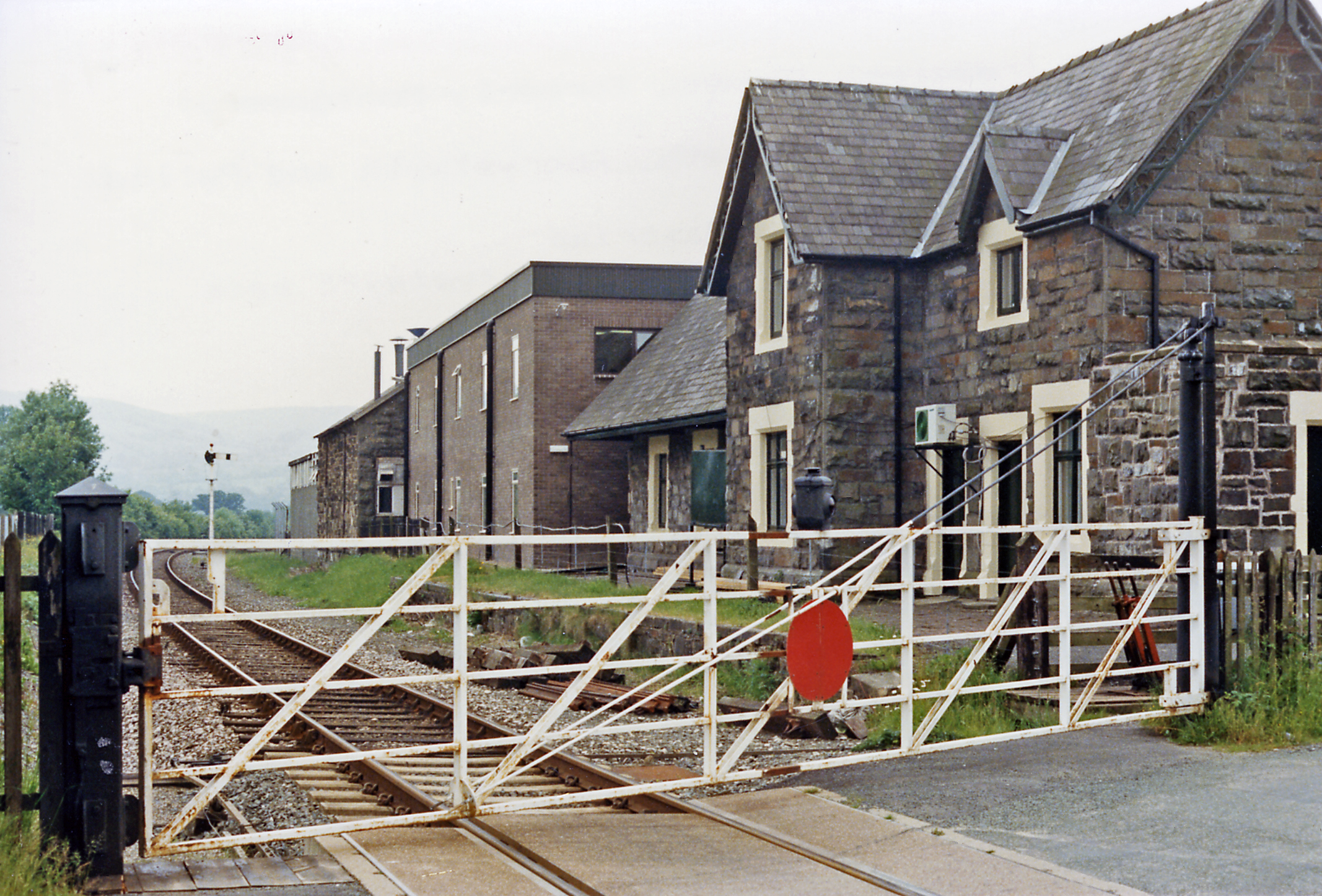
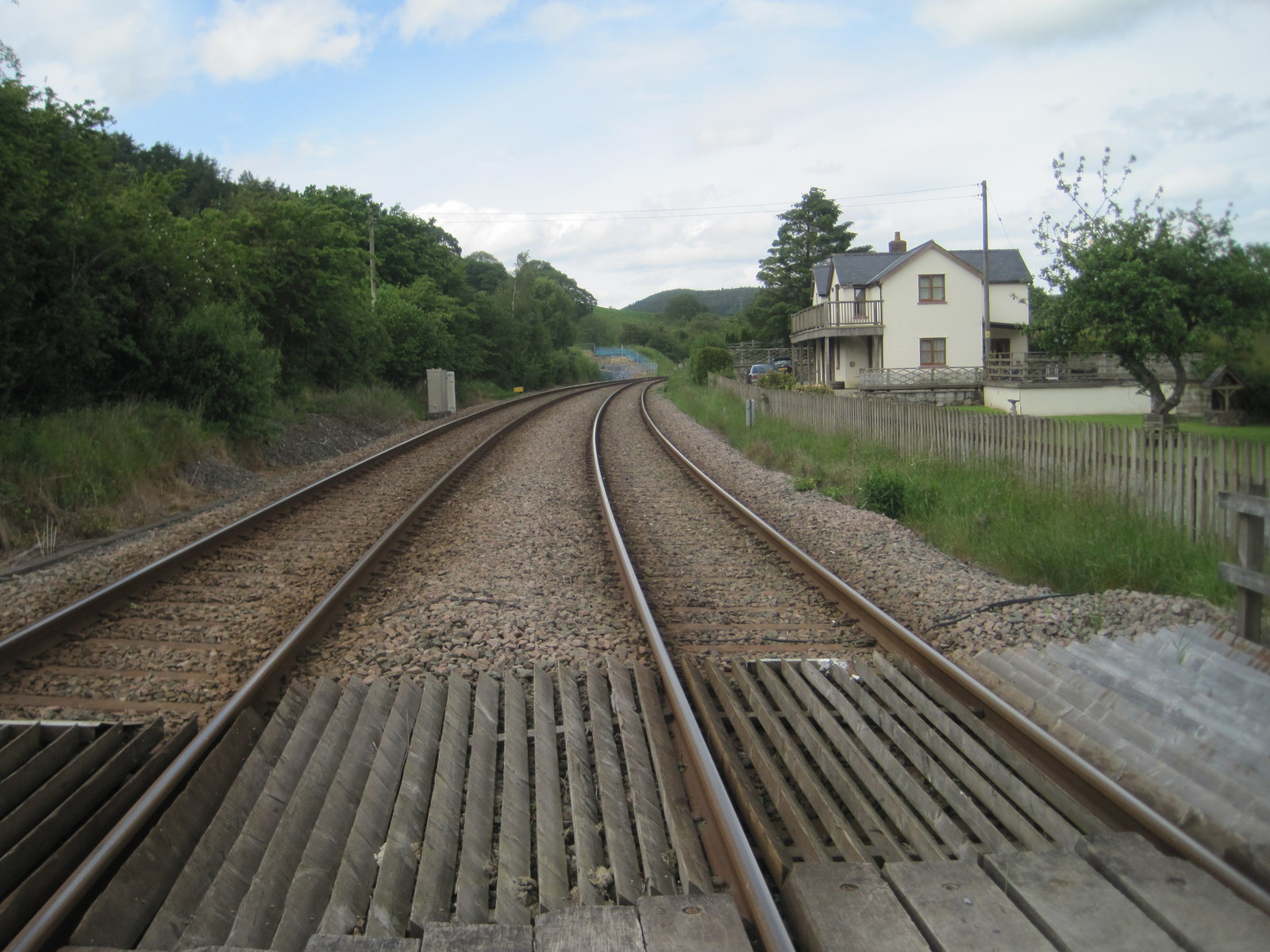
Carno railway station

Carno is a closed railway station in Carno, on the Cambrian Line, that was part of the Newtown and Machynlleth Railway. The station was closed in 1965...
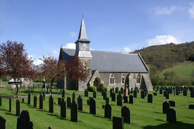
Carno

Carno is a village in Powys, Wales. The community, which is also a parish in the historic county of Montgomeryshire, comprises the townships of Derlwyn...
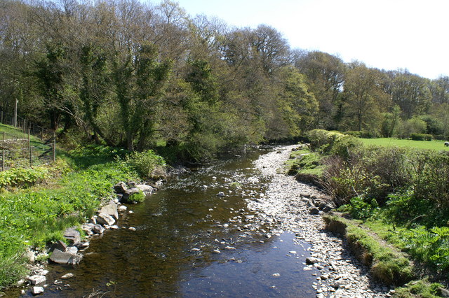
River Carno

The River Carno (Welsh: Afon Carno) is a river in Powys, mid Wales, and a tributary of the River Severn. The river is named after the village of Carno...

Golfa railway station

Golfa railway station is a preserved station that serves the area of Golfa, Powys, Wales, on the Welshpool and Llanfair Light Railway. == History == The...

Talerddig railway station

Talerddig railway station was a station in Talerddig, Powys, Wales. The station opened in 1900 and closed on 14 June 1965, one of many on the line abandoned...

Talerddig

Talerddig is a village in Powys, mid Wales, located on the main A470 road between Llanbrynmair and Carno. It is part of Llanbrynmair community. == Talerddig... ==

Nearby Amenities

Located within 500m of 52.553073,-3.5666715
Building: yes
Lat/Long: 52.5569384/-3.5660914
Building: yes
Lat/Long: 52.554251/-3.563495
Power: pole
Lat/Long: 52.5562916/-3.5626924
Power: pole
Lat/Long: 52.555592/-3.5643554
Power: pole
Lat/Long: 52.5548957/-3.5659915
Power: pole
Lat/Long: 52.5541912/-3.5676867
Power: pole
Lat/Long: 52.5535111/-3.5692987
Power: pole
Lat/Long: 52.5528311/-3.5709429
Power: pole
Lat/Long: 52.5521493/-3.5725549
Power: pole
Lat/Long: 52.5516568/-3.5736197
The data included in this document is from www.openstreetmap.org. The data is made available under ODbL.

Have you been to Parc y Sarn?

Leave your review of Parc y Sarn below (or comments, questions and feedback).