Black Moss

Downs, Moorland in Perthshire

Scotland

Black Moss

Turbines of the Griffin Wind Farm The turbines of the wind farm as seen from a forest road in the Griffin Forest to the west of Creag a' Mhadaidh. The coniferous plantings of the forest are in states varying between mature, clear-felled and replanted.
Turbines of the Griffin Wind Farm Credit: Trevor Littlewood

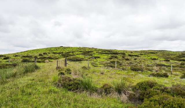
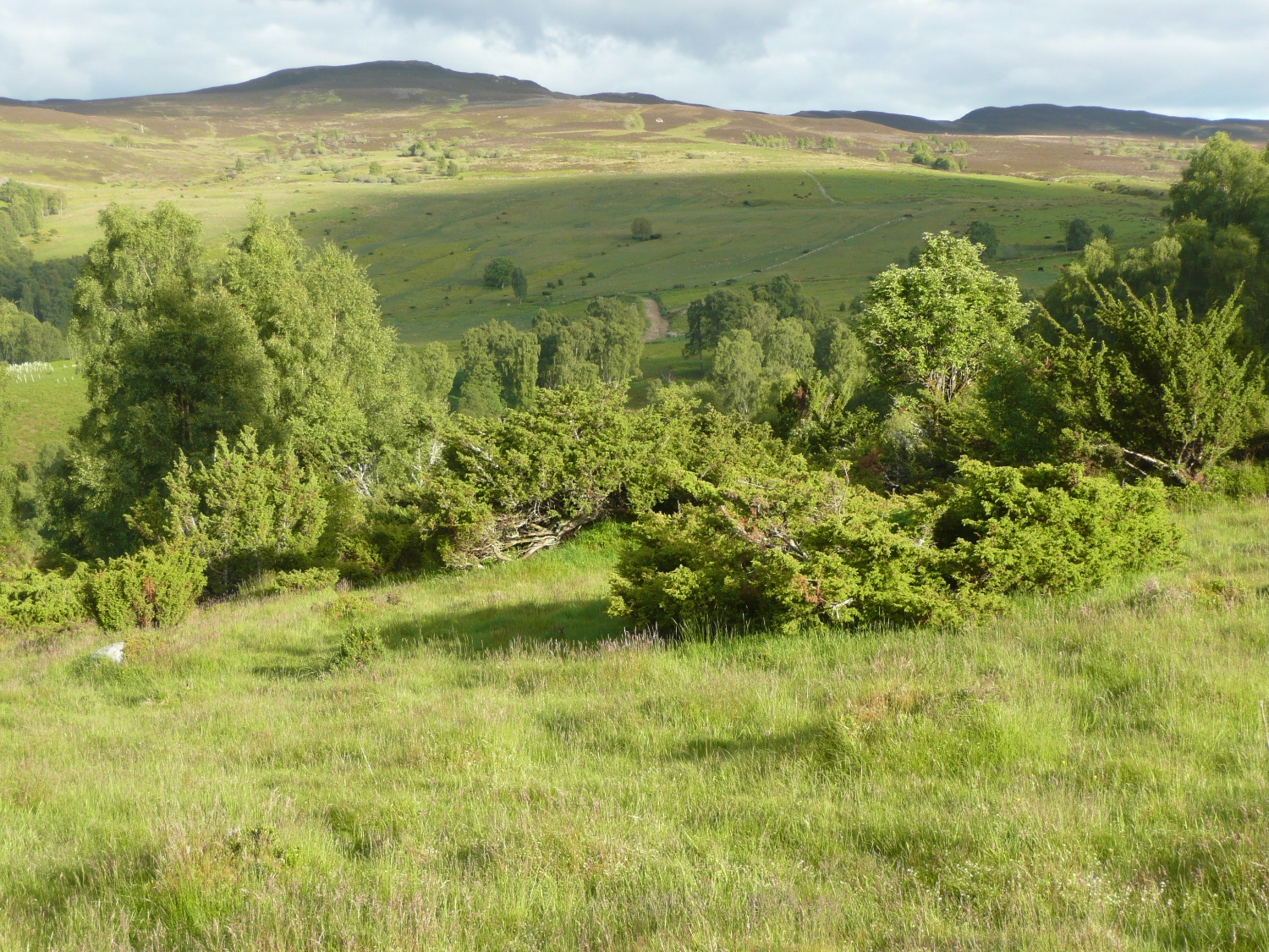
Black Moss is a picturesque area located in the heart of Perthshire, Scotland. Known for its breathtaking downs and moorland, it attracts nature enthusiasts and outdoor adventurers from all around the world. The landscape of Black Moss is characterized by rolling hills covered in lush, green grass and heather, creating a serene and tranquil atmosphere.

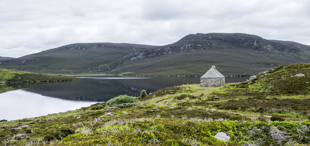
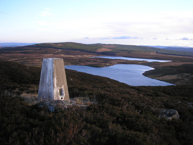
The area is home to an array of wildlife, including red deer, mountain hares, and various bird species, making it a popular spot for birdwatching and wildlife photography. The moorland is dotted with small lochs, providing a peaceful setting for fishing and boating activities.

Black Moss offers a wide range of outdoor activities to cater to all interests and skill levels. Hiking and walking trails crisscross the area, allowing visitors to explore the stunning scenery and discover hidden gems along the way. The downs provide an excellent terrain for mountain biking and horseback riding, with trails suitable for beginners and more experienced riders.

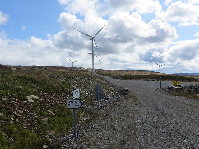
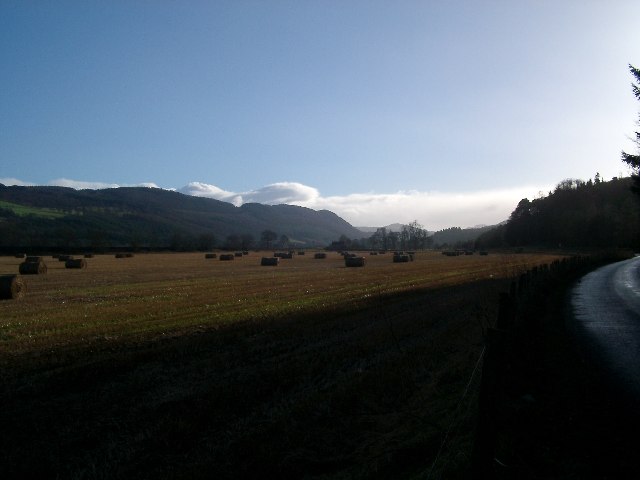
For those seeking a more relaxed experience, Black Moss is also home to several picnic spots, perfect for enjoying a packed lunch while taking in the breathtaking views. The area is easily accessible, with ample parking and well-maintained paths and trails.

Overall, Black Moss, Perthshire, offers a unique and captivating experience for nature enthusiasts and outdoor adventurers alike. Its downs and moorland provide a stunning backdrop for a variety of activities, making it a must-visit destination for anyone looking to immerse themselves in Scotland's natural beauty.

If you have any feedback on the listing, please let us know in the comments section below.

Black Moss Images

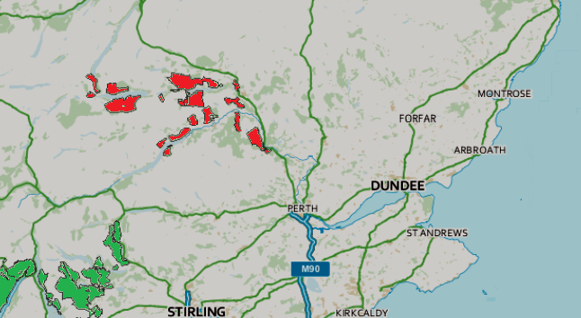
Images are sourced within 2km of 56.603514/-3.7312549 or Grid Reference NN9347. Thanks to Geograph Open Source API. All images are credited.

Turbines of the Griffin Wind Farm The turbines of the wind farm as seen from a forest road in the Griffin Forest to the west of Creag a' Mhadaidh. The coniferous plantings of the forest are in states varying between mature, clear-felled and replanted.
Turbines of the Griffin Wind Farm
The turbines of the wind farm as seen from a forest road in the Griffin Forest to the west of Creag a' Mhadaidh. The coniferous plantings of the forest are in states varying between mature, clear-felled and replanted.
Low crag on east face of Creag a' Choir Odhair There are several outcrops of rock on the east face of the minor hill, Creag a' Choir Odhair. Fallen rocks from the outcrops lie among heather and bilberry on the slope below. The view beyond is to the north with Strath Tay being the obvious valley trench.
Low crag on east face of Creag a' Choir Odhair
There are several outcrops of rock on the east face of the minor hill, Creag a' Choir Odhair. Fallen rocks from the outcrops lie among heather and bilberry on the slope below. The view beyond is to the north with Strath Tay being the obvious valley trench.
Moorland north of Craig Lochie The moorland is at the low point between Craig Lochie and Creag a' Choir Odhair.
Farragon Hill is distant but prominent at the centre of the image. The summit cone of Schiehallion just shows above pale green vegetation on the left side ridge.
Moorland north of Craig Lochie
The moorland is at the low point between Craig Lochie and Creag a' Choir Odhair. Farragon Hill is distant but prominent at the centre of the image. The summit cone of Schiehallion just shows above pale green vegetation on the left side ridge.
Summit cairn of Craig Lochie The attractive beehive cairn on a ready-made rock plinth at the 520 m.  summit of Craig Lochie. There's a trig point very nearby too, unusually not at the highest point, but a metre lower. Beyond the cairn is a shallow heather dome on the same hill; it's another metre lower than the trig point, (so at 518 m.). Distantly, and dimly seen beyond that, are peaks of the Ben Lawers range.
Summit cairn of Craig Lochie
The attractive beehive cairn on a ready-made rock plinth at the 520 m. summit of Craig Lochie. There's a trig point very nearby too, unusually not at the highest point, but a metre lower. Beyond the cairn is a shallow heather dome on the same hill; it's another metre lower than the trig point, (so at 518 m.). Distantly, and dimly seen beyond that, are peaks of the Ben Lawers range.
Moorland west of Little Loch Skiach A view from a largely overgrown hill road which passes between Loch Skiach and Little Loch Skiach. The latter can be seen beyond the pale green moorland band. 
The low line of hills beyond the loch is Elrick More.
Moorland west of Little Loch Skiach
A view from a largely overgrown hill road which passes between Loch Skiach and Little Loch Skiach. The latter can be seen beyond the pale green moorland band. The low line of hills beyond the loch is Elrick More.
Open gate in fence line An overgrown hill road passes between Little Loch Skiach and Loch Skiach; it's seen here, heading west, approaching the gate in a fence.
Open gate in fence line
An overgrown hill road passes between Little Loch Skiach and Loch Skiach; it's seen here, heading west, approaching the gate in a fence.
Hut beside Loch Skiach The hut is reckoned to be one used by fisher-folk at Loch Skiach. It's open - it was found, literally open-doored with no one around! 
Craig Lochie is the hill beyond.
(The door was secured on leaving.)
Hut beside Loch Skiach
The hut is reckoned to be one used by fisher-folk at Loch Skiach. It's open - it was found, literally open-doored with no one around! Craig Lochie is the hill beyond. (The door was secured on leaving.)
Logging road, Griffin Forest A waymarked route between Aberfeldy and Dunkeld crosses what was once moorland and now is a uniform Sitka spruce plantation.
Logging road, Griffin Forest
A waymarked route between Aberfeldy and Dunkeld crosses what was once moorland and now is a uniform Sitka spruce plantation.
Pond, Griffin Forest Looks like something the bulldozers had left behind, but may be natural.
Pond, Griffin Forest
Looks like something the bulldozers had left behind, but may be natural.
Trail bike mess Not illegal damage, this was left behind after a competition three weeks earlier. Fortunately the forest is a turbine infested Sitka hell-hole so it does not matter too much, but the organisers could at least remove their litter which is lying about all over the forest.
Trail bike mess
Not illegal damage, this was left behind after a competition three weeks earlier. Fortunately the forest is a turbine infested Sitka hell-hole so it does not matter too much, but the organisers could at least remove their litter which is lying about all over the forest.
Ride, Griffin Forest Well and truly churned up by motorbikes.
Ride, Griffin Forest
Well and truly churned up by motorbikes.
Road, Griffin Forest Approaching the new edge of the forest and the wind farm.
Road, Griffin Forest
Approaching the new edge of the forest and the wind farm.
Road, Griffin Forest An unplanted bit with a few small crags in the foreground. The road runs from Aberfeldy to Dunkeld.
Road, Griffin Forest
An unplanted bit with a few small crags in the foreground. The road runs from Aberfeldy to Dunkeld.
Griffin wind farm The road predates the forest which used to stand here and is not part of the wind farm road network which is large, ugly and intrusive as always. It is possible to get from the old road to the new network at the turbine tower in the photograph.
Griffin wind farm
The road predates the forest which used to stand here and is not part of the wind farm road network which is large, ugly and intrusive as always. It is possible to get from the old road to the new network at the turbine tower in the photograph.
Griffin wind farm There is a huge area of hard standing beside each of the turbines. This was previously a conifer plantation and before that, not that long ago, moorland.
Griffin wind farm
There is a huge area of hard standing beside each of the turbines. This was previously a conifer plantation and before that, not that long ago, moorland.
Griffin wind farm A road junction on former moorland which had a brief spell as a conifer plantation before the bulldozers moved in.
Griffin wind farm
A road junction on former moorland which had a brief spell as a conifer plantation before the bulldozers moved in.
Meall Reamhar Much of the square was planted in the 1980s and recently felled to make way for a wind farm. This is one of the few directions without a turbine and/or a road in the view.
Meall Reamhar
Much of the square was planted in the 1980s and recently felled to make way for a wind farm. This is one of the few directions without a turbine and/or a road in the view.
Road cutting, Meall Reamhar Service road on the Griffin wind farm. There were conifers here briefly from the 1980s to around 2010.
Road cutting, Meall Reamhar
Service road on the Griffin wind farm. There were conifers here briefly from the 1980s to around 2010.
Show me another place!

Black Moss is located at Grid Ref: NN9347 (Lat: 56.603514, Lng: -3.7312549)

Unitary Authority: Perth and Kinross

Police Authority: Tayside

What 3 Words

///retiring.scornful.encloses. Near Aberfeldy, Perth & Kinross

Nearby Locations

Black Moss Creag Craiggan

Related Wikis

Have you been to Black Moss?

Leave your review of Black Moss below (or comments, questions and feedback).