Coed Llwydion

Downs, Moorland in Brecknockshire

Wales

Coed Llwydion

Trig Point Cefn Llechid The trig point on the summit of Cefn Llechid is exactly 400m above sea level, in the background is Pen y Fan and Corn Du, the highest and second highest mountains in the Brecon Beacons.
Trig Point Cefn Llechid Credit: Philip Halling

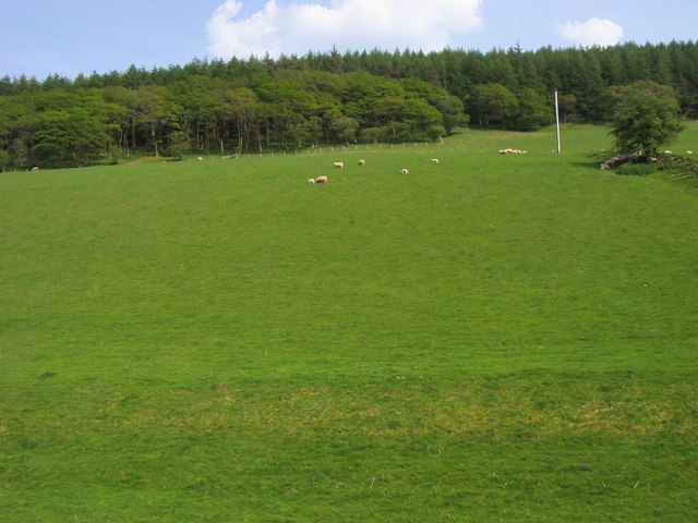
Coed Llwydion is a picturesque area located in Brecknockshire, Wales. Situated in the heart of the county, it is known for its stunning downs and moorland landscapes. The area is surrounded by rolling hills, offering breathtaking views of the countryside.

Covering an expansive area, Coed Llwydion is home to a diverse range of flora and fauna. The downs are characterized by vast open grasslands, interspersed with patches of heather and gorse. These areas provide an ideal habitat for various bird species, including skylarks and meadow pipits. The moorland, on the other hand, is dominated by heath and boggy areas, offering a unique environment for plants like cotton grass and bog moss.

Coed Llwydion is a popular destination for outdoor enthusiasts, attracting hikers, nature lovers, and photographers alike. There are numerous walking trails that crisscross the area, allowing visitors to explore its natural beauty. The rolling hills and open spaces provide an excellent opportunity for leisurely walks or more challenging hikes.

The area also boasts historical significance, with traces of human activity dating back to the Bronze Age. Visitors can discover ancient burial mounds and stone circles, adding an element of intrigue to their journey through Coed Llwydion.

Overall, Coed Llwydion is a captivating destination for those seeking a serene escape in the heart of Brecknockshire. With its stunning downs, moorland landscapes, and rich history, it offers a memorable experience for all who visit.

If you have any feedback on the listing, please let us know in the comments section below.

Coed Llwydion Images

Images are sourced within 2km of 51.934153/-3.5506892 or Grid Reference SN9327. Thanks to Geograph Open Source API. All images are credited.

Trig Point Cefn Llechid The trig point on the summit of Cefn Llechid is exactly 400m above sea level, in the background is Pen y Fan and Corn Du, the highest and second highest mountains in the Brecon Beacons.
Trig Point Cefn Llechid
The trig point on the summit of Cefn Llechid is exactly 400m above sea level, in the background is Pen y Fan and Corn Du, the highest and second highest mountains in the Brecon Beacons.
The Brecon Beacons Pen y Fan and Corn Du, the two highest summits in the Brecon Beacons, viewed from a bridleway leading up to Cefn Llechid
The Brecon Beacons
Pen y Fan and Corn Du, the two highest summits in the Brecon Beacons, viewed from a bridleway leading up to Cefn Llechid
St. Cynog Church, Defynnog
Former police station
Sennybridge This is a view (south-)west douwn the main street A40 through Sennybridge. An information board in the car park off the left of shot states that the car park is adjacent to the old Brecon & Neath railway. Unfortunately, there is no evidence of the dismantled railway by the car park. The only sign I could find is that the large yellow building is a pub called "The Usk Railway".
Sennybridge
This is a view (south-)west douwn the main street A40 through Sennybridge. An information board in the car park off the left of shot states that the car park is adjacent to the old Brecon & Neath railway. Unfortunately, there is no evidence of the dismantled railway by the car park. The only sign I could find is that the large yellow building is a pub called "The Usk Railway".
Fields Tylebychan is visible just below centre left
Fields
Tylebychan is visible just below centre left
A4215 Road Scene The white line at bottom right is part of the turning for Cefnbrynich.
A4215 Road Scene
The white line at bottom right is part of the turning for Cefnbrynich.
Defynnog, Phone Box in Garden This telephone box appears to be sited in its original position, and if you look on the map here you will see it shown as a working box ... it isn't - it is a private box with an old A/B Telephone in it complete with directories and the door padlocked up with a note on it about the box.  Interesting that Ordnance Survey still have it shown as a working box.  Nearest box is outside the church, just a short walk away.
Defynnog, Phone Box in Garden
This telephone box appears to be sited in its original position, and if you look on the map here you will see it shown as a working box ... it isn't - it is a private box with an old A/B Telephone in it complete with directories and the door padlocked up with a note on it about the box. Interesting that Ordnance Survey still have it shown as a working box. Nearest box is outside the church, just a short walk away.
Farm gate Farm gate with horses grazing in a field beyond.
Farm gate
Farm gate with horses grazing in a field beyond.
Narrow country road with post box Shortly before joining the A4215, an unusually designed post box can be seen beside the narrow road.  It's unclear whether any post is now being collected as there were no collection details posted.
Narrow country road with post box
Shortly before joining the A4215, an unusually designed post box can be seen beside the narrow road. It's unclear whether any post is now being collected as there were no collection details posted.
Weir by Wern-ddu Afon Senni Weir by Wern-ddu
Weir by Wern-ddu
Afon Senni Weir by Wern-ddu
Field and Wood off A4067 Field and Wood South East off the A4067
Field and Wood off A4067
Field and Wood South East off the A4067
Entrance to B&B Entrance to  Blaen-car B&B
Entrance to B&B
Entrance to Blaen-car B&B
Lane by Bailea Lane by Bailea heading down towards the A40
Lane by Bailea
Lane by Bailea heading down towards the A40
Ancient Road
Ancient Road
River (Afon) Senni The River Senni from the eastern bank
River (Afon) Senni
The River Senni from the eastern bank
High Street (A40) High Street (A40) Sennybridge heading towards Brecon
High Street (A40)
High Street (A40) Sennybridge heading towards Brecon
St Cynog Church, Defynog The church seen on a wet and gloomy day in August 2009
St Cynog Church, Defynog
The church seen on a wet and gloomy day in August 2009
Show me another place!

Coed Llwydion is located at Grid Ref: SN9327 (Lat: 51.934153, Lng: -3.5506892)

Unitary Authority: Powys

Police Authority: Dyfed Powys

What 3 Words

///swim.ecologist.galaxies. Near Cray, Powys

Nearby Locations

Coed Cochion Coed Llwydion

Related Wikis

Cefn Llechid

Cefn Llechid is a small area of unenclosed land in the Brecon Beacons National Park east of Sennybridge in the county of Powys, Wales. It lies within Fforest...
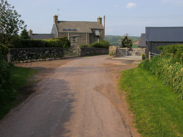
Defynnog

Defynnog, also known as Devynock in some historical documents, is a small village in the community of Maescar in the historic county of Brecknockshire...
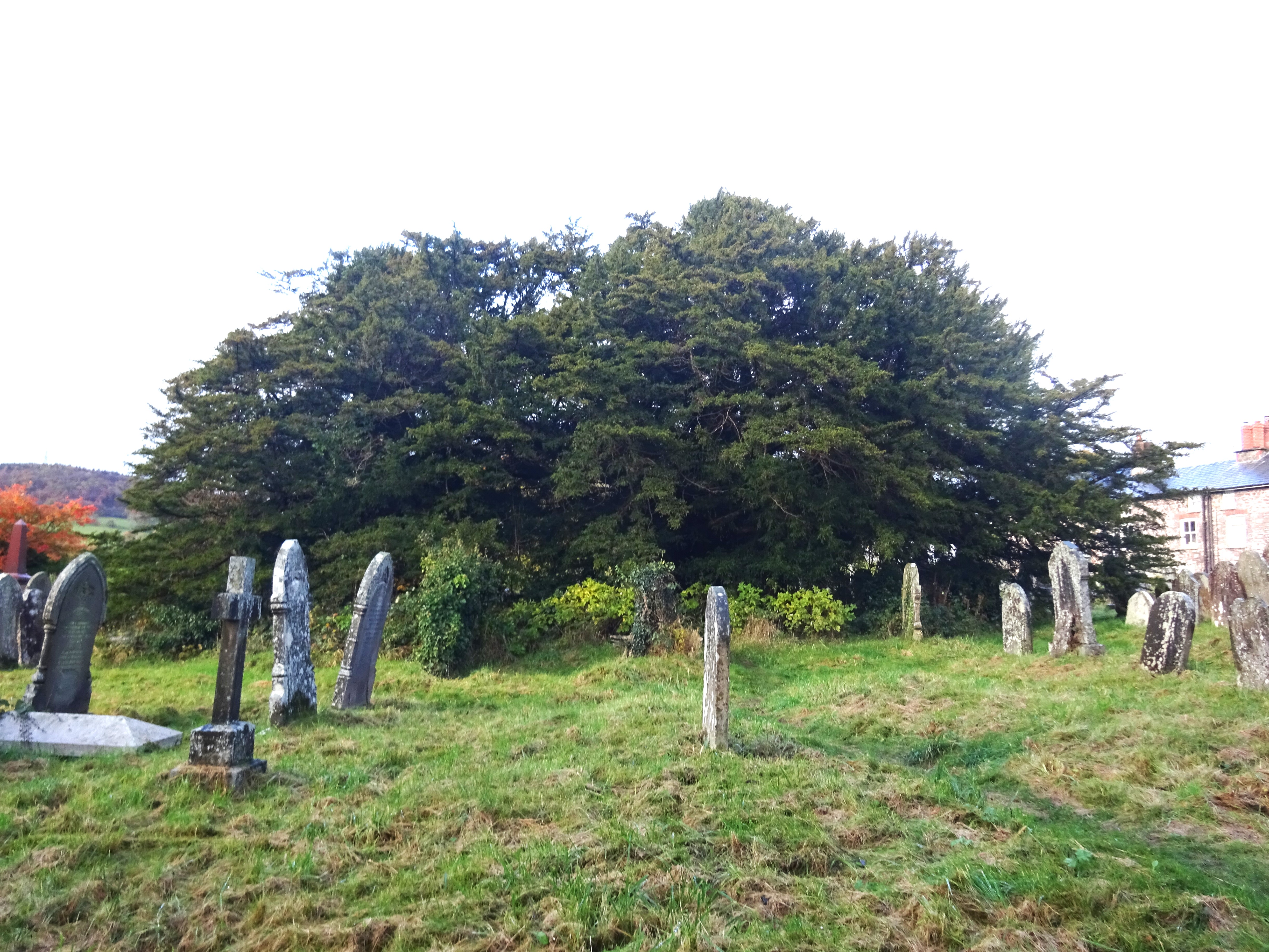
Defynnog Yew

The Defynnog Yew (Welsh: Ywen Defynnog) (SN9253027960) is one of a group of ancient yews (Taxus baccata) in the churchyard of St Cynog's Church, which...
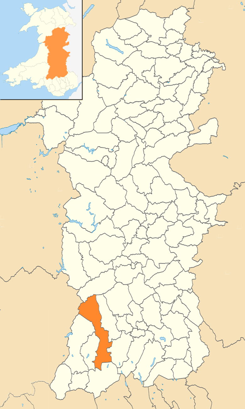
Maescar

Maescar is a community in the county of Powys, Wales, and is 35.4 miles (56.9 km) from Cardiff and 148.7 miles (239.3 km) from London. It is in the historic...

Have you been to Coed Llwydion?

Leave your review of Coed Llwydion below (or comments, questions and feedback).