Gwaunbant Park

Downs, Moorland in Glamorgan

Wales

Gwaunbant Park

Pontycymmer Pontycymmer, railway heritage, one of the wagons with rails and sleepers for laying extension to tracks already laid
Pontycymmer Credit: Colin Prosser

Gwaunbant Park is a picturesque 140-acre park located in the county of Glamorgan, Wales. The park is renowned for its stunning landscape, consisting of rolling downs and vast moorland, making it an idyllic destination for nature enthusiasts and outdoor lovers.

The park offers a diverse range of flora and fauna, showcasing the beauty of the Welsh countryside. Visitors can explore the park's extensive network of walking trails, which wind through heather-covered moorland and offer breathtaking panoramic views of the surrounding area. The park is also home to a variety of wildlife, including red kites, peregrine falcons, and wild ponies, providing ample opportunities for bird-watching and wildlife spotting.

In addition to its natural beauty, Gwaunbant Park offers various recreational activities for visitors to enjoy. The park features a well-maintained golf course, providing golfers with a challenging and scenic experience. There are also designated picnic areas where visitors can relax and enjoy the peaceful surroundings. For those seeking a bit of adventure, the park offers horse riding trails and opportunities for mountain biking.

Gwaunbant Park is a popular destination for families and individuals alike, offering a tranquil retreat from the hustle and bustle of everyday life. With its stunning landscape, diverse wildlife, and range of recreational activities, the park offers something for everyone to enjoy. Whether it's a leisurely stroll through the moorland or an exhilarating bike ride, Gwaunbant Park is a must-visit destination for nature lovers in Glamorgan.

If you have any feedback on the listing, please let us know in the comments section below.

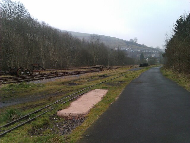
Gwaunbant Park Images

Images are sourced within 2km of 51.612278/-3.5813315 or Grid Reference SS9091. Thanks to Geograph Open Source API. All images are credited.

Pontycymmer Pontycymmer, railway heritage, one of the wagons with rails and sleepers for laying extension to tracks already laid
Pontycymmer
Pontycymmer, railway heritage, one of the wagons with rails and sleepers for laying extension to tracks already laid
Pontycymmer heritage railway Pontycymmer heritage railway, view down the track from the cycletrack, of track laid
Pontycymmer heritage railway
Pontycymmer heritage railway, view down the track from the cycletrack, of track laid
Pontycymmer heritage railway Pontycymmer heritage railway, inside the engine shed, one of the steam loco's on view, with 68070
Pontycymmer heritage railway
Pontycymmer heritage railway, inside the engine shed, one of the steam loco's on view, with 68070
Pontycymmer heritage railway Pontycymmer heritage railway, view from the sheds
Pontycymmer heritage railway
Pontycymmer heritage railway, view from the sheds
Ordnance Survey Pivot This OS pivot can be found on a stone west edge of the path. It marks a point 1680.38ft above mean sea level.
Ordnance Survey Pivot
This OS pivot can be found on a stone west edge of the path. It marks a point 1680.38ft above mean sea level.
Pont-yr-Hyl in the Garw Valley Aerial shot of the Garw Valley. Supports Blog post 
<span class="nowrap"><a title="https://railwayheritageroutes.blogspot.com/2023/11/garw-valley-4-port-talbot-junction-to.html" rel="nofollow ugc noopener" href="https://railwayheritageroutes.blogspot.com/2023/11/garw-valley-4-port-talbot-junction-to.html">Link</a><img style="margin-left:2px;" alt="External link" title="External link - shift click to open in new window" src="https://s1.geograph.org.uk/img/external.png" width="10" height="10"/></span>
Pont-yr-Hyl in the Garw Valley
Aerial shot of the Garw Valley. Supports Blog post LinkExternal link
Garwfechan Valley From Pontyrhyl an aerial shot up the valley which contained two collieries at different times.

Supports blog post:
<span class="nowrap"><a title="https://railwayheritageroutes.blogspot.com/2023/11/garw-valley-4-port-talbot-junction-to.html" rel="nofollow ugc noopener" href="https://railwayheritageroutes.blogspot.com/2023/11/garw-valley-4-port-talbot-junction-to.html">Link</a><img style="margin-left:2px;" alt="External link" title="External link - shift click to open in new window" src="https://s1.geograph.org.uk/img/external.png" width="10" height="10"/></span>
Garwfechan Valley
From Pontyrhyl an aerial shot up the valley which contained two collieries at different times. Supports blog post: LinkExternal link
Blaengarw Top of the Garw valley.
Blaengarw
Top of the Garw valley.
Pontycymmer Fire Station Pontycymmer Fire Station, Victoria Street, Pontycymmer is part of South Wales Fire & Rescue Service
Pontycymmer Fire Station
Pontycymmer Fire Station, Victoria Street, Pontycymmer is part of South Wales Fire & Rescue Service
Coal loading point at Pontycymer During the early 90s this mineral line was re-opened to allow the removal of some open cast coal from the area around Pontycmer. At one time the railway served the colliery at Blaengarw just up the valley. Once the coal had been removed the line was once again mothballed. The mines all closed some years ago.
Coal loading point at Pontycymer
During the early 90s this mineral line was re-opened to allow the removal of some open cast coal from the area around Pontycmer. At one time the railway served the colliery at Blaengarw just up the valley. Once the coal had been removed the line was once again mothballed. The mines all closed some years ago.
Blaengarw Post Office Opposite The Strand and Herbert Street junction. Looking in the direction of Pontycymer.
Blaengarw Post Office
Opposite The Strand and Herbert Street junction. Looking in the direction of Pontycymer.
Blaengarw Hotel Large public house on the corner of The Strand, looking towards the head of the valley.
Blaengarw Hotel
Large public house on the corner of The Strand, looking towards the head of the valley.
Village of Pantygog on A4064 Alongside Afon Garw in the valley below
Village of Pantygog on A4064
Alongside Afon Garw in the valley below
Police Station  and police van  - Blaengarw
Police Station and police van - Blaengarw
Derelict building on approach to village of Braich y Cymmer on A4064 This is on the side of the main road through the village.  Destroyed by fire in the late 1990s, it used to be a kite retailer's premises.
Derelict building on approach to village of Braich y Cymmer on A4064
This is on the side of the main road through the village. Destroyed by fire in the late 1990s, it used to be a kite retailer's premises.
Scarp slope on the east side of Mynydd Llangeinwyr The scarp slope on the east side of Mynydd Llangeinwyr, steepened by landslipping.  View over Cwm Ogwr Fawr to the Ogmore Forest
Scarp slope on the east side of Mynydd Llangeinwyr
The scarp slope on the east side of Mynydd Llangeinwyr, steepened by landslipping. View over Cwm Ogwr Fawr to the Ogmore Forest
Tussock grass Tussocks make for careful walking otherwise it is easy to twist an ankle. Ogmore vale lies below to the east.
Tussock grass
Tussocks make for careful walking otherwise it is easy to twist an ankle. Ogmore vale lies below to the east.
Above the valleys Looking down into Cwm Gawr.
Above the valleys
Looking down into Cwm Gawr.
Show me another place!

Gwaunbant Park is located at Grid Ref: SS9091 (Lat: 51.612278, Lng: -3.5813315)

Unitary Authority: Bridgend

Police Authority: South Wales

What 3 Words

///quick.hometown.snoozing. Near Pontycymer, Bridgend

Related Wikis

Pontycymer

Pontycymer, also spelt Pontycymmer, is a former mining village in Wales. It is situated in the Garw Valley, in Bridgend County Borough, about 7 miles or...

Garw/Ffaldau Colliery

The Garw/Ffaldau Colliery was a colliery formed in 1975 in Pontycymer, Wales. It was formed from the joining together of the Garw Colliery and the Ffaldau...

Pontycymmer railway station

Pontycymmer railway station served the village of Pontycymer, in the historical county of Glamorganshire, Wales, from 1889 to 1953 on the Garw Valley Railway...

Blaengarw railway station

Blaengarw railway station served the village of Blaengarw, in the historical county of Glamorgan, Wales, from 1902 to 1953 on the Garw Valley Railway....

Nearby Amenities

Located within 500m of 51.612278,-3.5813315
Traffic Signals
Crossing: traffic_signals
Crossing Island: no
Kerb: lowered
Tactile Paving: yes
Lat/Long: 51.6094995/-3.5835389
Pontycymer
Name Cy: Pontycymer
Place: town
Wikidata: Q7228399
Wikipedia: en:Pontycymer
Lat/Long: 51.6088629/-3.5797523
Place Of Worship
Lat/Long: 51.6103539/-3.583706
Place Of Worship
Lat/Long: 51.610105/-3.5825996
Police
Lat/Long: 51.6151584/-3.5863282
Addr City: Pontycymer
Addr Housenumber: 54
Addr Postcode: CF32 8DB
Addr Street: Oxford Street
Lat/Long: 51.6094865/-3.583276
Power: pole
Lat/Long: 51.6138745/-3.5815202
Power: pole
Lat/Long: 51.6139686/-3.5798357
Power: pole
Lat/Long: 51.6131592/-3.5791639
Power: pole
Lat/Long: 51.6122498/-3.5784316
Power: pole
Lat/Long: 51.6113295/-3.5761195
Power: pole
Lat/Long: 51.6103518/-3.5750413
Railway: switch
Lat/Long: 51.608409/-3.5842369
Post Box
Collection Times: Mo-Fr 09:00; Sa 07:00
Operator: Royal Mail
Post Box Mounting: stone_wall
Post Box Type: wall
Ref: CF32 24D
Royal Cypher: GVIR
Royal Cypher Wikidata: Q33102169
Lat/Long: 51.6147156/-3.5857111
Post Box
Collection Times: Mo-Fr 09:00; Sa 07:00
Operator: Royal Mail
Post Box Mounting: stone_wall
Post Box Type: wall
Ref: CF32 27D
Royal Cypher: EIIR
Royal Cypher Wikidata: Q33102113
Lat/Long: 51.6090942/-3.583218
Post Box
Collection Times: Mo-Fr 16:30; Sa 12:00
Operator: Royal Mail
Post Box Mounting: pier
Post Box Type: lamp
Ref: CF32 190
Royal Cypher: EIIR
Royal Cypher Wikidata: Q33102113
Lat/Long: 51.6110414/-3.584476
Post Box
Collection Times: Mo-Fr 09:00; Sa 07:00
Operator: Royal Mail
Post Box Mounting: stone_wall
Post Box Type: wall
Ref: CF32 22D
Royal Cypher: GR
Royal Cypher Wikidata: Q33102273
Lat/Long: 51.6102377/-3.5825615
Direction: 80
Generator Method: photovoltaic
Generator Output Electricity: yes
Generator Solar Modules: 6
Generator Source: solar
Generator Type: solar_photovoltaic_panel
Location: roof
Power: generator
Lat/Long: 51.6114055/-3.5804694
Direction: WSW
Generator Method: photovoltaic
Generator Output Electricity: yes
Generator Solar Modules: 10
Generator Source: solar
Generator Type: solar_photovoltaic_panel
Location: roof
Power: generator
Lat/Long: 51.6135656/-3.5827768
Direction: E
Generator Method: photovoltaic
Generator Output Electricity: yes
Generator Solar Modules: 8
Generator Source: solar
Generator Type: solar_photovoltaic_panel
Location: roof
Power: generator
Lat/Long: 51.6105267/-3.5866606
Direction: 170
Generator Method: photovoltaic
Generator Output Electricity: yes
Generator Solar Modules: 10
Generator Source: solar
Generator Type: solar_photovoltaic_panel
Location: roof
Power: generator
Lat/Long: 51.6113412/-3.5804406
Direction: SSE
Generator Method: photovoltaic
Generator Output Electricity: yes
Generator Solar Modules: 3
Generator Source: solar
Generator Type: solar_photovoltaic_panel
Location: roof
Power: generator
Lat/Long: 51.6080856/-3.580859
Direction: WSW
Generator Method: photovoltaic
Generator Output Electricity: yes
Generator Solar Modules: 4
Generator Source: solar
Generator Type: solar_photovoltaic_panel
Location: roof
Power: generator
Lat/Long: 51.6080746/-3.5809371
Direction: SSE
Generator Method: photovoltaic
Generator Output Electricity: yes
Generator Solar Modules: 5
Generator Source: solar
Generator Type: solar_photovoltaic_panel
Location: roof
Power: generator
Lat/Long: 51.608695/-3.5833219
Direction: WSW
Generator Method: photovoltaic
Generator Output Electricity: yes
Generator Solar Modules: 12
Generator Source: solar
Generator Type: solar_photovoltaic_panel
Location: roof
Power: generator
Lat/Long: 51.6079498/-3.5803387
Direction: 185
Generator Method: photovoltaic
Generator Output Electricity: yes
Generator Solar Modules: 7
Generator Source: solar
Generator Type: solar_photovoltaic_panel
Location: roof
Power: generator
Lat/Long: 51.6103101/-3.5799035
The data included in this document is from www.openstreetmap.org. The data is made available under ODbL.

Have you been to Gwaunbant Park?

Leave your review of Gwaunbant Park below (or comments, questions and feedback).