Combeleigh Heath

Downs, Moorland in Somerset Somerset West and Taunton

England

Combeleigh Heath

Hedge and ditch by B3224 Land around this road has been reclaimed from marshland, so the ditch is probably a reminder of that
Hedge and ditch by B3224 Credit: David Smith

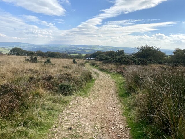
Combeleigh Heath is a picturesque area located in Somerset, England. Situated on the outskirts of the village of Combeleigh, it is known for its stunning natural beauty and diverse landscape. The heath stretches across rolling hills, downs, and moorland, offering visitors a unique and varied experience.

The heath is characterized by its open, expansive vistas, allowing for breathtaking views of the surrounding countryside. The undulating terrain is covered in a patchwork of heather, grasses, and wildflowers, creating a vibrant and colorful landscape. The area is also home to a variety of wildlife, including birds, small mammals, and reptiles, making it a popular destination for nature enthusiasts and wildlife photographers.

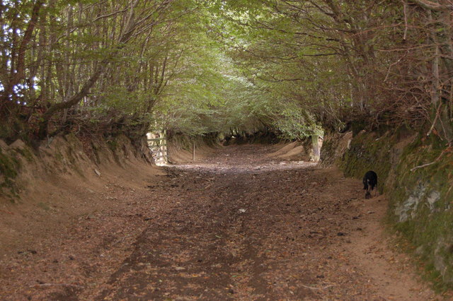
Combeleigh Heath is crisscrossed by a network of footpaths and bridleways, providing ample opportunities for exploration and outdoor activities. Hiking and cycling are particularly popular, allowing visitors to immerse themselves in the tranquil surroundings and discover hidden gems along the way. The heath is also a great spot for picnicking, with designated areas offering stunning views and peaceful settings.

In addition to its natural beauty, Combeleigh Heath is steeped in history. The area is dotted with ancient burial mounds and stone circles, providing insight into its past inhabitants. Visitors can also explore nearby Combeleigh Castle, a medieval fortress that offers a glimpse into the region's rich heritage.

Overall, Combeleigh Heath is a captivating destination that showcases the best of Somerset's countryside. With its stunning vistas, diverse wildlife, and rich history, it is a must-visit location for those seeking a true escape into nature.

If you have any feedback on the listing, please let us know in the comments section below.

Combeleigh Heath Images

Images are sourced within 2km of 51.146/-3.5756475 or Grid Reference SS8939. Thanks to Geograph Open Source API. All images are credited.

Hedge and ditch by B3224 Land around this road has been reclaimed from marshland, so the ditch is probably a reminder of that
Hedge and ditch by B3224
Land around this road has been reclaimed from marshland, so the ditch is probably a reminder of that
Hegebank by B3224
Hegebank by B3224
Dunkery Beacon At 519m the highest point on Exmoor.
Dunkery Beacon
At 519m the highest point on Exmoor.
Bridleway to Dunkery Bridge
Sheep in a field at Long Lane Head Near to Dunkery Gate.
Sheep in a field at Long Lane Head
Near to Dunkery Gate.
Bridleway to Codsend This part of the route marked as (Holloway Lane) slopes gently down hill all the way to Codsend. It tends to get very boggy in the winter months.
Bridleway to Codsend
This part of the route marked as (Holloway Lane) slopes gently down hill all the way to Codsend. It tends to get very boggy in the winter months.
Round this bend to Codsend This is a small farming community at the end of a single road. The photograph shows the last few metres of bridleway/farm road before the start of the road.
Round this bend to Codsend
This is a small farming community at the end of a single road. The photograph shows the last few metres of bridleway/farm road before the start of the road.
Very wide Bridleway off Thorne Lane Approx 200 years ago, this route (Pinn Lane) was used by horse drawn wagons carrying stone from Pinn Quarry at its western end to build many of the local farms and houses.
Very wide Bridleway off Thorne Lane
Approx 200 years ago, this route (Pinn Lane) was used by horse drawn wagons carrying stone from Pinn Quarry at its western end to build many of the local farms and houses.
Cutthorne valley A view of Cutthorne valley, site of a post medieval field gutter system listed as archaeologically important. The property has been occupied and farmed since Saxon times and was the home of Johannes de Cotehorne in 1327.( Lay Subsidy records)
Cutthorne valley
A view of Cutthorne valley, site of a post medieval field gutter system listed as archaeologically important. The property has been occupied and farmed since Saxon times and was the home of Johannes de Cotehorne in 1327.( Lay Subsidy records)
Ancient cobbled courtyard at Cutthorne This centuries old cobbled yard was part of an original network of tracks which connected all the farms locally. Heading south from this yard away from what is now the B3224 would lead to Thorne Lane (the Old Hare Path) and Pinn Lane. The buildings are a two storey C17th threshing barn and single storey C18th shippon.
Ancient cobbled courtyard at Cutthorne
This centuries old cobbled yard was part of an original network of tracks which connected all the farms locally. Heading south from this yard away from what is now the B3224 would lead to Thorne Lane (the Old Hare Path) and Pinn Lane. The buildings are a two storey C17th threshing barn and single storey C18th shippon.
Ancient track near Cutthorne The track is a bridleway and takes walkers and riders towards Ballpark Copse.
Ancient track near Cutthorne
The track is a bridleway and takes walkers and riders towards Ballpark Copse.
Ancient track near Cutthorne The track known as Pinn Lane is used as a bridleway.
Ancient track near Cutthorne
The track known as Pinn Lane is used as a bridleway.
Long Lane Head The north end of Long Lane <a href="https://www.geograph.org.uk/photo/4429729">SS9039 : West Somerset : Long Lane</a> from Luckwell Bridge
Long Lane Head
The north end of Long Lane SS9039 : West Somerset : Long Lane from Luckwell Bridge
Cutcombe : B3224 Looking along the B3224.
Cutcombe : B3224
Looking along the B3224.
Cutcombe: near Luckwell Bridge A footpath and bridleway leads to West Mill and on to Wheddon Cross, by the river Quarme. Since this photograph was taken the fields have been fenced in. The track follows the course of the leat to the mill, now filled in
Cutcombe: near Luckwell Bridge
A footpath and bridleway leads to West Mill and on to Wheddon Cross, by the river Quarme. Since this photograph was taken the fields have been fenced in. The track follows the course of the leat to the mill, now filled in
Blagdon Cross The B3224 at Blagdon Cross, Somerset. Enroute, Land's End to John O'Groats.
Blagdon Cross
The B3224 at Blagdon Cross, Somerset. Enroute, Land's End to John O'Groats.
Bridleway to Blagdon Wood Could this be a tunnel of green gloom?
Bridleway to Blagdon Wood
Could this be a tunnel of green gloom?
The Bridge at Luckwell Bridge This old narrow bridge now spans the River Quarme in the centre of the small community of Luckwell Bridge.  It is easily missed by motorists speeding along the B3224 between Wheddon Cross and Exford.
The Bridge at Luckwell Bridge
This old narrow bridge now spans the River Quarme in the centre of the small community of Luckwell Bridge. It is easily missed by motorists speeding along the B3224 between Wheddon Cross and Exford.
Show me another place!

Combeleigh Heath is located at Grid Ref: SS8939 (Lat: 51.146, Lng: -3.5756475)

Administrative County: Somerset

District: Somerset West and Taunton

Police Authority: Avon and Somerset

What 3 Words

///defenders.blossom.vans. Near Porlock, Somerset

Related Wikis

Dunkery Hill

Dunkery Beacon at the summit of Dunkery Hill is the highest point on Exmoor and in Somerset, England. It is also the highest point in southern England...

Timberscombe

Timberscombe is a village and civil parish on the River Avill 2.5 miles (4 km) south-west of Dunster, and 5.5 miles (9 km) south of Minehead within the...

Sweetworthy

Sweetworthy is the site of two Iron Age hill forts or enclosures at Luccombe, 4 kilometres (2 mi) south of Porlock, Somerset, England. They are on the...

Cutcombe

Cutcombe is a village and civil parish 9 miles (14 km) south of Minehead and north of Dulverton straddling the ridge between Exmoor and the Brendon Hills...

Church of St John, Cutcombe

The Anglican Church of St John in Cutcombe, Somerset, England was built in the 13th and 14th centuries. It is a Grade II* listed building. == History... ==

Road Castle

Road Castle is an Iron Age bank and ditch in the West Somerset district of Somerset, England. The hill fort is situated approximately 2 miles (3.2 km)...

Church of St Mary Magdelene, Exford

The Anglican Church of St Mary Magdelene in Exford, Somerset, England was built in the 15th century. It is a Grade II* listed building. == History == Nothing...

Stoke Pero Church

Stoke Pero Church in Stoke Pero, Somerset, England was built in the 13th century. It is a Grade II* listed building. Standing 1,013 feet (309 meters) above...

Nearby Amenities

Located within 500m of 51.146,-3.5756475
Combleigh
Place: farm
Lat/Long: 51.1427608/-3.5726652
Higher Hawkington
Place: hamlet
Lat/Long: 51.146063/-3.5827917
Combeleigh Heath
Place: locality
Lat/Long: 51.1454154/-3.5742585
Long Lane Head
Place: locality
Lat/Long: 51.1482702/-3.5765411
The data included in this document is from www.openstreetmap.org. The data is made available under ODbL.

Have you been to Combeleigh Heath?

Leave your review of Combeleigh Heath below (or comments, questions and feedback).