Bad Garbh

Downs, Moorland in Perthshire

Scotland

Bad Garbh

Crossing the north ridge of Creag an Loch
Crossing the north ridge of Creag an Loch Credit: Alan Reid

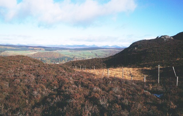
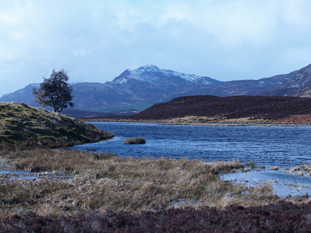
Bad Garbh is a region located in Perthshire, Scotland, known for its rugged landscapes and wild beauty. Nestled amidst the rolling hills and moorlands, it is an area of outstanding natural beauty that attracts outdoor enthusiasts and nature lovers alike.

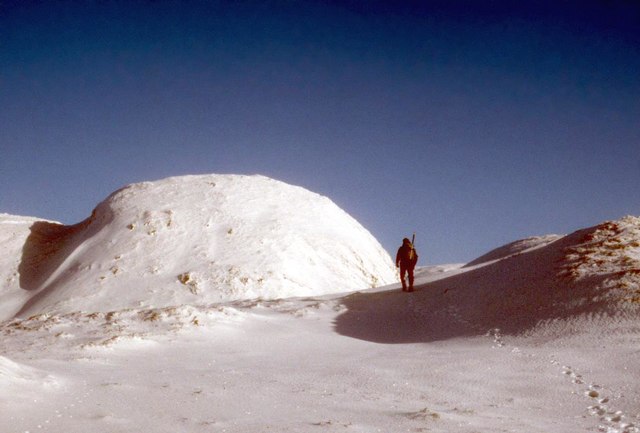
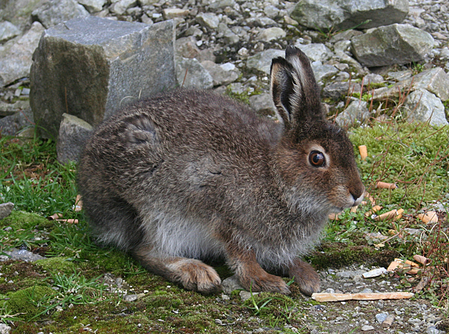
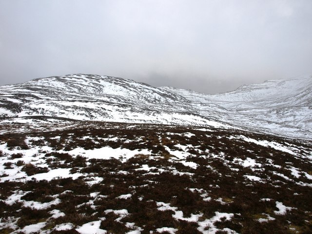
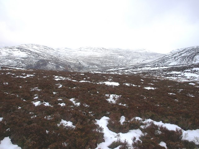
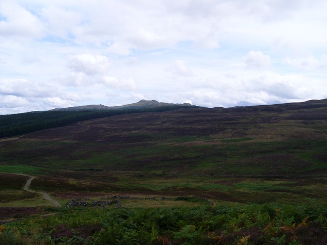
The Downs of Bad Garbh offer breathtaking panoramic views of the surrounding countryside. These undulating hills are covered in heather, giving the landscape a vibrant purple hue during the summer months. The area is home to a variety of wildlife, including red deer, mountain hares, and golden eagles, making it a popular spot for wildlife enthusiasts and birdwatchers.

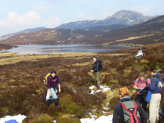
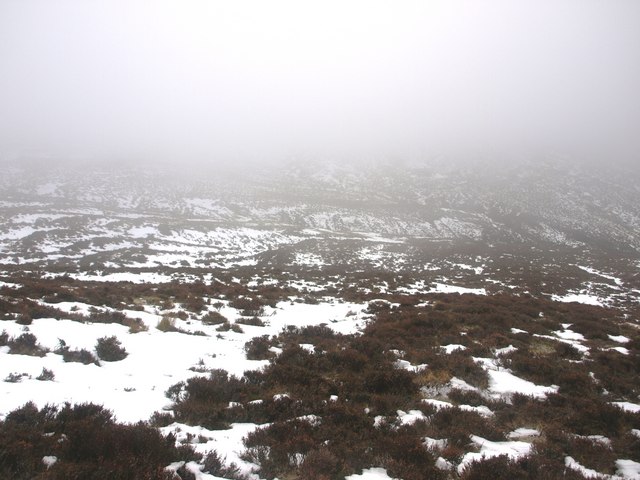
The Moorland of Bad Garbh is characterized by its vast expanses of open, treeless spaces. The terrain is peppered with peat bogs and small lochs, creating a unique and diverse ecosystem. It is a haven for birdlife, with species such as the curlew, red grouse, and black-throated diver making their homes here.

The climate in Bad Garbh can be unpredictable, with frequent changes in weather patterns. Rain showers are not uncommon, and the area can experience harsh winds, particularly in the winter months. However, these challenging conditions only add to the allure of the region, attracting those seeking adventure and solitude in the great outdoors.

With its unspoiled landscapes and rich biodiversity, Bad Garbh offers a true escape from the hustle and bustle of everyday life. Whether it is hiking along the winding trails, capturing stunning photographs, or simply immersing oneself in the tranquility of nature, this region in Perthshire is a true gem waiting to be discovered.

If you have any feedback on the listing, please let us know in the comments section below.

Bad Garbh Images

Images are sourced within 2km of 56.681182/-3.9276485 or Grid Reference NN8256. Thanks to Geograph Open Source API. All images are credited.

Crossing the north ridge of Creag an Loch
Southwest slopes of Farragon Hill
Mine road bypassing Meall Tairneachan, 1985 The mine road bypasses Meall Tairneachan heading for the Foss Mine which extracted barytes. Barytes is  mined for use in the offshore oil industry. The mine became uneconomic and presumably has closed. A new mine has probably already opened, nearer to Farragon Hill which is the middle-distance mountain to the right in the image.
Mine road bypassing Meall Tairneachan, 1985
The mine road bypasses Meall Tairneachan heading for the Foss Mine which extracted barytes. Barytes is mined for use in the offshore oil industry. The mine became uneconomic and presumably has closed. A new mine has probably already opened, nearer to Farragon Hill which is the middle-distance mountain to the right in the image.
Lochan Lairig Laoigh The mainly frozen surface of Lochan Lairig Laoigh between Creag an Loch which rises to the left and Farragon Hill, out of view to the right.
Lochan Lairig Laoigh
The mainly frozen surface of Lochan Lairig Laoigh between Creag an Loch which rises to the left and Farragon Hill, out of view to the right.
Foss Mine These are the buildings at the entrance to the mine, which is to the left in front of the green nissen hut. The mine extracts barite (barium sulphate) for use as drilling mud in the oil industry and in paper and textiles.
Foss Mine
These are the buildings at the entrance to the mine, which is to the left in front of the green nissen hut. The mine extracts barite (barium sulphate) for use as drilling mud in the oil industry and in paper and textiles.
Foss Mine Spoil and a settling pond in the open-cast part of the mine, which extracts barite for use in the oil, paper and textile industries. Happily, it is not widely visible. The hill in the background is Creag an Loch, and Farragon Hill is beyond that.
Foss Mine
Spoil and a settling pond in the open-cast part of the mine, which extracts barite for use in the oil, paper and textile industries. Happily, it is not widely visible. The hill in the background is Creag an Loch, and Farragon Hill is beyond that.
Foss Mine This area is where the extracted barite is first stored. Different grades of the ore are mixed here to make a product of the right density for industrial use before being shipped to Aberdeen for further processing.
Foss Mine
This area is where the extracted barite is first stored. Different grades of the ore are mixed here to make a product of the right density for industrial use before being shipped to Aberdeen for further processing.
Mountain Hare Mountain or Blue Hares have taken to frequenting the Foss barite workings. They are accustomed to people, and the mine staff take them food in the form of left-over vegetables. This one was wary, but content to have its photograph taken while it tackled some carrot sticks.
Mountain Hare
Mountain or Blue Hares have taken to frequenting the Foss barite workings. They are accustomed to people, and the mine staff take them food in the form of left-over vegetables. This one was wary, but content to have its photograph taken while it tackled some carrot sticks.
Bad an t-Sluichd Hollow in the grouse moors south of Loch Tummel.
Bad an t-Sluichd
Hollow in the grouse moors south of Loch Tummel.
Rough ground west of Farragon Hill The Corbett, Meall Tairneachan, is the first high ground, with the distinctive cone of Schiehallion in the distance.
Rough ground west of Farragon Hill
The Corbett, Meall Tairneachan, is the first high ground, with the distinctive cone of Schiehallion in the distance.
Barytes mine from Farragon Hill The mine can just be seen to the left of the photo;  Schiehallion in the distance.  Barytes is mined for use in various industries, including paper-making.  But the output of this mine will almost certainly go to Aberdeen as a prime constituent of drilling mud for the North Sea oil industry.
Barytes mine from Farragon Hill
The mine can just be seen to the left of the photo; Schiehallion in the distance. Barytes is mined for use in various industries, including paper-making. But the output of this mine will almost certainly go to Aberdeen as a prime constituent of drilling mud for the North Sea oil industry.
Crossing Lick Hill Walking across pathless ground on the way from Farragon Hill to Lochan Lairig Laoigh.
Crossing Lick Hill
Walking across pathless ground on the way from Farragon Hill to Lochan Lairig Laoigh.
Lochan Lairig Laoigh Farragon Hill is seen at the back.  This was taken on a long walk from Glassie Farm over Farragon Hill and back via Cnoc Rawer.
Lochan Lairig Laoigh
Farragon Hill is seen at the back. This was taken on a long walk from Glassie Farm over Farragon Hill and back via Cnoc Rawer.
Wild landscape South of Loch Tummel The view of the upper glen northeast of Farragon Hill. Short heather, both kinds, and tusock grass.
Wild landscape South of Loch Tummel
The view of the upper glen northeast of Farragon Hill. Short heather, both kinds, and tusock grass.
Upper Glen Frenich. The upper Frenich burn. Heather, tussock grass and snow.
Upper Glen Frenich.
The upper Frenich burn. Heather, tussock grass and snow.
View East across Glen Frenich. The view across the Frenich burn from the saddle north of Doire Leathan.
View East across Glen Frenich.
The view across the Frenich burn from the saddle north of Doire Leathan.
Craig Loisgte. The heather hillside North of Meall Tairneachan.
Craig Loisgte.
The heather hillside North of Meall Tairneachan.
Barytes mine, Meall Tairneachan The mine was opened to extract barytes, a mineral which is mostly barium sulphate. Barium containing compounds are dense so this common mineral has found a use as a component of mud, a heavy slurry used to control the release of oil and gas from oil wells. This mine served the North Sea industry. 
At the time of visit it was deserted.
Barytes mine, Meall Tairneachan
The mine was opened to extract barytes, a mineral which is mostly barium sulphate. Barium containing compounds are dense so this common mineral has found a use as a component of mud, a heavy slurry used to control the release of oil and gas from oil wells. This mine served the North Sea industry. At the time of visit it was deserted.
Show me another place!

Bad Garbh is located at Grid Ref: NN8256 (Lat: 56.681182, Lng: -3.9276485)

Unitary Authority: Perth and Kinross

Police Authority: Tayside

What 3 Words

///train.encroach.tuned. Near Aberfeldy, Perth & Kinross

Nearby Locations

Bad Garbh

Related Wikis

Meall Tàirneachan

Meall Tairneachan (787 m) is a mountain in the Grampian Mountains of Scotland, located northwest of Aberfeldy in Perthshire. The peak lies in an area of...

Farragon Hill

Farragon Hill (782 m) is a peak in the foothills of the Grampian Mountains of Scotland. It lies above the town of Aberfeldy in Perthshire. The hill is...

Loch Tummel

Loch Tummel (Scottish Gaelic: Loch Teimheil) is a long, narrow loch, seven kilometres (4+1⁄2 miles) northwest of Pitlochry in the council area of Perth...

Tummel hydro-electric power scheme

The Tummel hydro-electric power scheme is an interconnected network of dams, power stations, aqueducts and electric power transmission in the Grampian...

Loch Derculich

Loch Derculich is a freshwater loch in central highlands of Scotland, in Perth and Kinross. Loch Tummel is located three miles to the north. == Habitation... ==

Loch Bhac

Loch Bhac (Bhaic or Vach) is a fine freshwater trout loch, located in the west part of the Allean Forest, and east part of Tay Forest park, and slightly...

Creag Odhar

Creag Odhar is a rocky mountain peak in the southern Highlands of Scotland, in Perthshire north of Aberfeldy. The name is Gaelic, from creag, meaning...

Tummel Bridge

Tummel Bridge is a double arched hump-backed former military bridge crossing the River Tummel at Tummel Bridge, Perth & Kinross, Scotland. A Category A...

Have you been to Bad Garbh?

Leave your review of Bad Garbh below (or comments, questions and feedback).