Bankend Moor
Downs, Moorland in Kirkcudbrightshire
Scotland
Bankend Moor

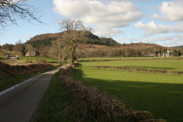
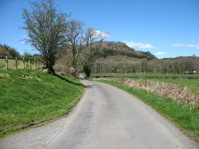
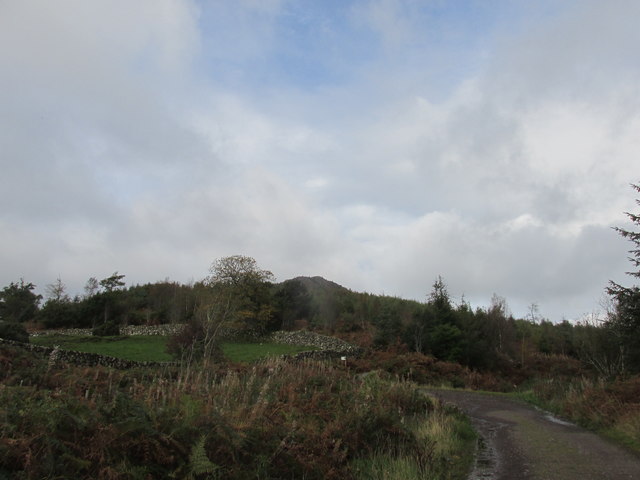
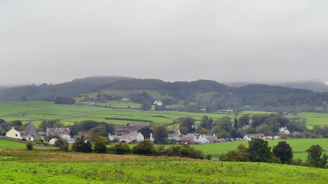
Bankend Moor is a picturesque area located in Kirkcudbrightshire, Scotland. This region is known for its stunning downs and moorland landscapes, captivating visitors with its natural beauty and tranquility.
Covering an area of approximately several square kilometers, Bankend Moor is characterized by rolling hills covered in heather, grasses, and scattered patches of woodland. The moorland is dominated by a diverse range of plant species, including heather, gorse, and bilberry, contributing to its vibrant and colorful appearance.
The area is rich in wildlife, providing a habitat for various species. Visitors to Bankend Moor may spot birds such as curlews, lapwings, and meadow pipits, soaring through the skies or perched on the heather-covered hills. The moorland is also home to a variety of small mammals, including rabbits and hares.
Bankend Moor offers breathtaking panoramic views, making it an ideal destination for nature lovers, hikers, and photographers. The rolling hills, dotted with sheep and grazing cattle, provide a sense of serenity and a perfect backdrop for outdoor activities.
Access to Bankend Moor is easy, with well-maintained paths and trails crisscrossing the area. Visitors can explore the moorland on foot or by bike, immersing themselves in the natural wonders of this tranquil landscape.
Overall, Bankend Moor in Kirkcudbrightshire is a stunning example of Scottish downs and moorland, offering a peaceful escape from the hustle and bustle of daily life. Its beauty and biodiversity make it a must-visit destination for those seeking to connect with nature.
If you have any feedback on the listing, please let us know in the comments section below.
Bankend Moor Images
Images are sourced within 2km of 54.858351/-3.8785912 or Grid Reference NX7953. Thanks to Geograph Open Source API. All images are credited.


Bankend Moor is located at Grid Ref: NX7953 (Lat: 54.858351, Lng: -3.8785912)
Unitary Authority: Dumfries and Galloway
Police Authority: Dumfries and Galloway
What 3 Words
///outgrown.bonkers.guess. Near Dalbeattie, Dumfries & Galloway
Nearby Locations
Related Wikis

Orchardton Castle
Orchardton Castle overlooks the Solway Coast. Built in the 1880s, this is a Grade B listed property formerly known as Orchardton House. Built around a...

Auchencairn
Auchencairn ([ɔxən'kʰɛ:(r)n]) is a village in the historical county of Kirkcudbrightshire in the Dumfries and Galloway region of Scotland. It is located...

Urr Water
Urr Water or River Urr (arc. River Orr) is a river in which flows through the counties of Dumfriesshire and Kirkcudbrightshire in southwest Scotland....

Rough Firth
Rough Firth is an inlet on the northern coast of the Solway Firth in the Stewartry area of Dumfries and Galloway, Scotland. The firth lies between Almorness...

Palnackie
Palnackie is a village in the parish of Buittle in the historical county of Kirkcudbrightshire in Dumfries and Galloway, Scotland. It has a population...
Rockcliffe, Dumfries and Galloway
Rockcliffe is a small, coastal village in Kirkcudbrightshire, Dumfries and Galloway in Scotland, with a view of Rough Island, Hestan Island, the Solway...

Kippford
Kippford (/ˈkɪpfəd/; otherwise Scaur) is a small village along the Solway coast, in the historic county of Kirkcudbrightshire in Dumfries and Galloway...

Rough Island, Scotland
"Rough Island" is also used as a translation of "Garbh Eilean", a common Scottish name for islandsRough Island is a 20-acre (8 ha) uninhabited tidal island...
Have you been to Bankend Moor?
Leave your review of Bankend Moor below (or comments, questions and feedback).