Bryniau Poethion

Downs, Moorland in Merionethshire

Wales

Bryniau Poethion

Pont dros Afon Taihirion / Bridge over Afon Taihirion
Pont dros Afon Taihirion / Bridge over Afon Taihirion Credit: Ceri Thomas

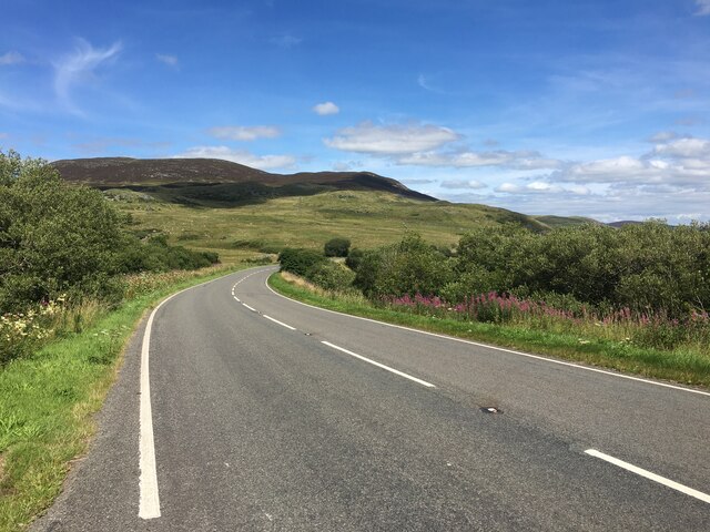
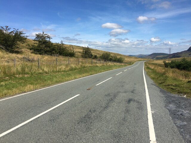
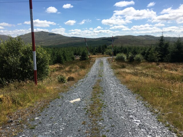
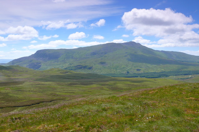
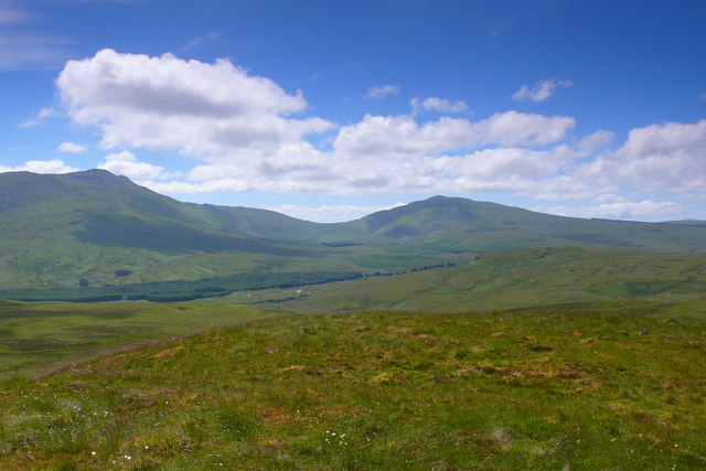
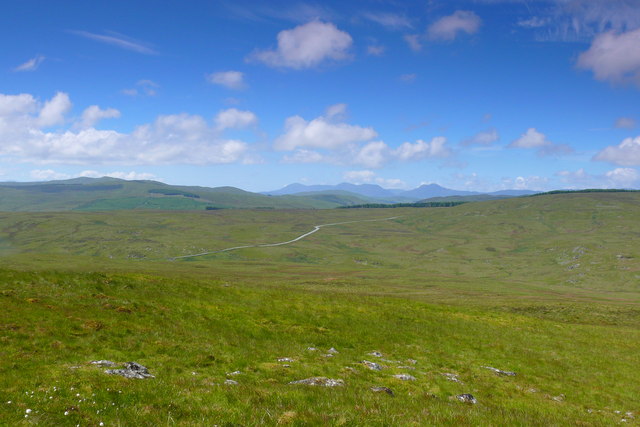
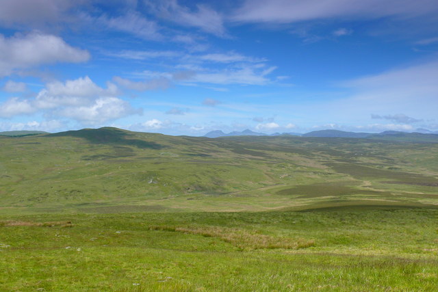
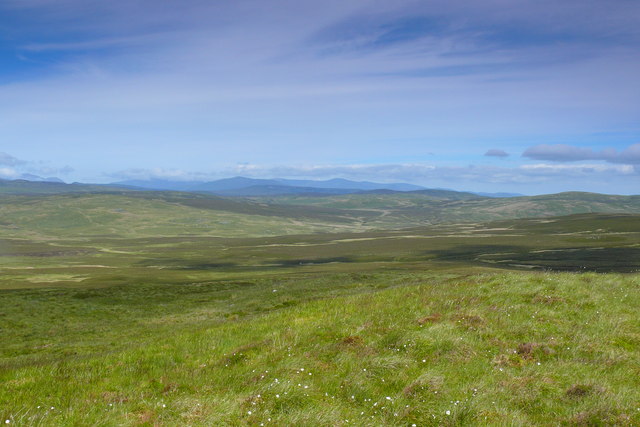
Bryniau Poethion, located in Merionethshire, is a region known for its stunning downs and moorland landscapes. Situated in the northwestern part of Wales, the area is characterized by its rolling hills, vast open spaces, and diverse flora and fauna.

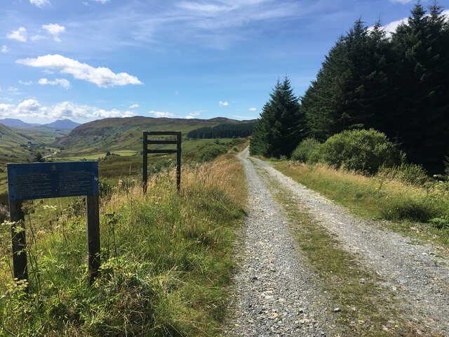
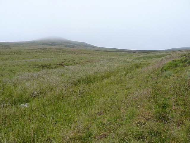
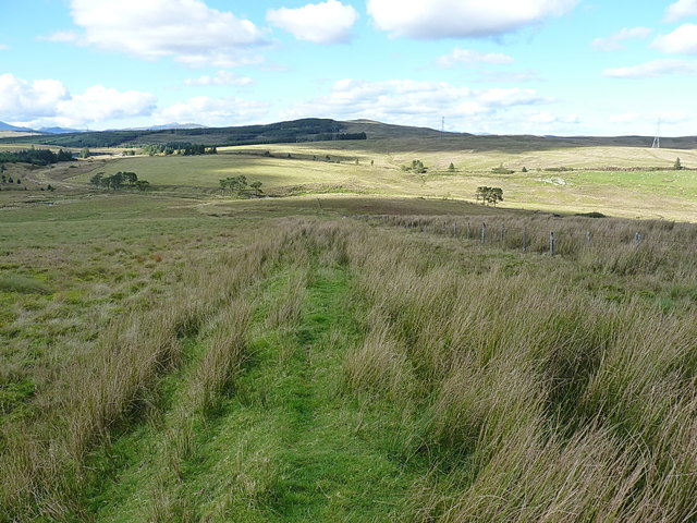
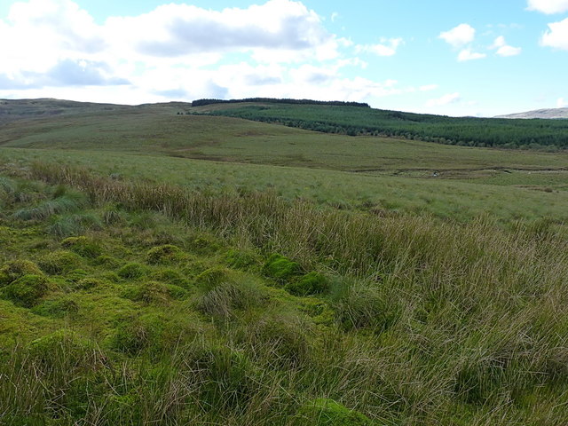
The downs of Bryniau Poethion offer breathtaking panoramic views of the surrounding countryside. They are covered in a rich tapestry of grasses, heather, and wildflowers, creating a vibrant and colorful spectacle throughout the year. The gentle slopes of the downs provide an ideal terrain for walking, hiking, and horse riding enthusiasts, who can explore the area's extensive network of trails.

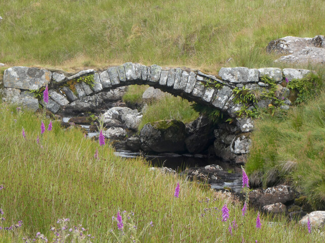
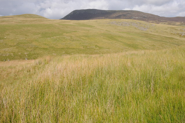
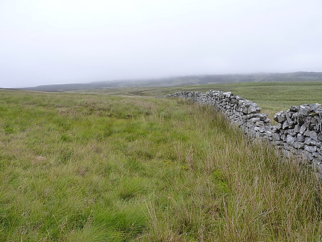
The moorland of Bryniau Poethion is a unique and ecologically significant habitat. It consists of large expanses of wet, peaty ground, interspersed with rocky outcrops and heathland. This diverse environment supports a wide range of plant and animal species, including mosses, lichens, bog cotton, and various bird species, such as curlews and red grouse.

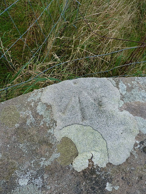
Bryniau Poethion is also home to several ancient archaeological sites, including burial cairns and stone circles, which provide insights into the region's rich history. Visitors can immerse themselves in the area's past and explore the remnants of these ancient civilizations.

Overall, Bryniau Poethion in Merionethshire offers a captivating natural landscape that appeals to both nature lovers and history enthusiasts. Its downs and moorland provide a serene and tranquil escape from the hustle and bustle of modern life, offering visitors a chance to reconnect with nature and discover the hidden treasures of this remarkable region.

If you have any feedback on the listing, please let us know in the comments section below.

Bryniau Poethion Images

Images are sourced within 2km of 52.9383/-3.7986795 or Grid Reference SH7939. Thanks to Geograph Open Source API. All images are credited.

Pont dros Afon Taihirion / Bridge over Afon Taihirion
A4212 near Nant Ddu
A4212 near Nant Ddu
Gravel track following route of disused railway line near Llyn Tryweryn
B4391 near Pont Nant-y-Lladron
Forestry track near Pont Nant-y-Llandron
B4391 towards Bala
B4391 towards Bala
Mochowgryn and Arenig Fach Mochowgryn and Arenig Fach viewed from across the Afon Taihirion.
Mochowgryn and Arenig Fach
Mochowgryn and Arenig Fach viewed from across the Afon Taihirion.
Mochowgryn Arenig Fawr oddi ar Fochowgryn / Arenig Fawr from Mochowgryn.
Mochowgryn
Arenig Fawr oddi ar Fochowgryn / Arenig Fawr from Mochowgryn.
Mochowgryn Golygfa o Foel Llyfnant oddi ar Fochowgryn / A view of Moel Llyfnant oddi ar Mochowgryn.
Mochowgryn
Golygfa o Foel Llyfnant oddi ar Fochowgryn / A view of Moel Llyfnant oddi ar Mochowgryn.
Mochowgryn Y Rhinogydd oddi ar Fochowgryn / The Rhinogs from Mochowgryn.
Mochowgryn
Y Rhinogydd oddi ar Fochowgryn / The Rhinogs from Mochowgryn.
Mochowgryn Y Moelwynion oddi ar Fochowgryn / The Moelwyns from Mochowgryn.
Mochowgryn
Y Moelwynion oddi ar Fochowgryn / The Moelwyns from Mochowgryn.
Mochowgryn Golygfa dros Y Migneint oddi ar Fochowgryn tuag at Y Glyderau a'r Carneddau / A view over The Migneint from Mochowgryn towards the Glyders and the Carneddau.
Mochowgryn
Golygfa dros Y Migneint oddi ar Fochowgryn tuag at Y Glyderau a'r Carneddau / A view over The Migneint from Mochowgryn towards the Glyders and the Carneddau.
Drystone wall on the moors of Mochowgryn An old wall, but one that peters out in a couple of hundred yards.
Drystone wall on the moors of Mochowgryn
An old wall, but one that peters out in a couple of hundred yards.
The valley of the Nant yr Achub The small stream in the dip about 20 yards away drains the southern slopes of Mochowgryn.
The valley of the Nant yr Achub
The small stream in the dip about 20 yards away drains the southern slopes of Mochowgryn.
Summit cairn - Mochowgryn A small cairn on the 496m summit of this hill.
Summit cairn - Mochowgryn
A small cairn on the 496m summit of this hill.
Old field boundary and modern fence A little way above the Afon Treweryn and the disused railway line. The modern fence lies a few yards to the east of an older linear feature in the field, which I took to be a former (and long collapsed) boundary wall or fence-bottom.
Old field boundary and modern fence
A little way above the Afon Treweryn and the disused railway line. The modern fence lies a few yards to the east of an older linear feature in the field, which I took to be a former (and long collapsed) boundary wall or fence-bottom.
Over the Nant y Gist-Faen to the Penllyn Forest Rough grazing land in the valley of the Afon Treweryn.
Over the Nant y Gist-Faen to the Penllyn Forest
Rough grazing land in the valley of the Afon Treweryn.
OS pivot mark - Nant Ddu, railway bridge parapet wall An OS pivot mark on the coping stone of a now-disused railway bridge over the Afon Treweryn; originally levelled in 1942 at 384.636m above Ordnance Datum Newlyn.
OS pivot mark - Nant Ddu, railway bridge parapet wall
An OS pivot mark on the coping stone of a now-disused railway bridge over the Afon Treweryn; originally levelled in 1942 at 384.636m above Ordnance Datum Newlyn.
Show me another place!

Bryniau Poethion is located at Grid Ref: SH7939 (Lat: 52.9383, Lng: -3.7986795)

Unitary Authority: Gwynedd

Police Authority: North Wales

What 3 Words

///conveys.cups.regret. Near Ffestiniog, Gwynedd

Nearby Locations

Bryniau Poethion

Related Wikis

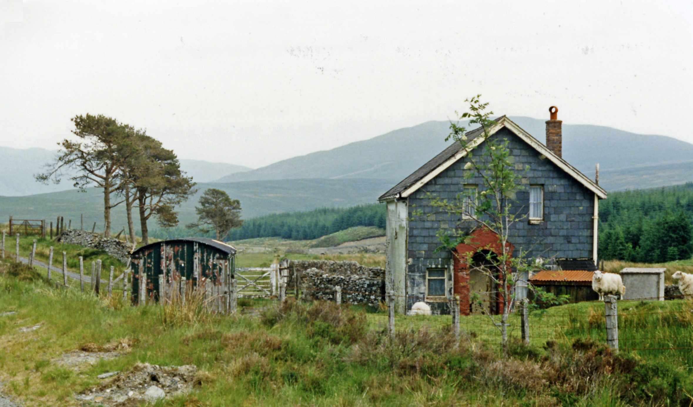
Cwm Prysor Halt railway station

Cwm Prysor Halt (named simply Cwm Prysor until 1953) was a railway station which served the remote rural area of Cwm Prysor, east of Trawsfynydd, Gwynedd...
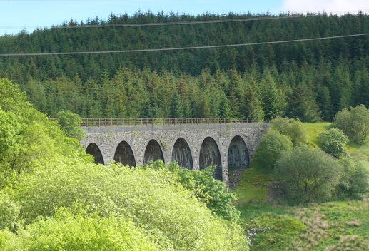
Cwm Prysor Viaduct

Cwm Prysor Viaduct, which is occasionally referred to as Blaen-y-Cwm Viaduct, is a railway viaduct which crosses the Afon Prysor in thinly populated uplands...
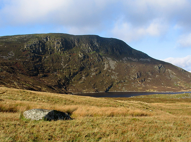
Arenig Fach

Arenig Fach is a mountain in southern Snowdonia, north Wales. It is a peak in the Arenig range and lies to the north of its parent peak Arenig Fawr. It...

Migneint

The Migneint (Welsh pronunciation: [ˈmɪɡnaint]) is a large expanse of moorland in central Snowdonia, north-west Wales. It is part of the Migneint-Arenig...

Arenig railway station

Arenig railway station stood beneath Arenig Fawr on the Great Western Railway's Bala Ffestiniog Line in Gwynedd, Wales. It served this thinly populated...

Foel Boeth

Foel Boeth is the twin top of Gallt y Daren in the southern half of the Snowdonia National Park in Gwynedd, North Wales, and forms part of the Arenig mountain...

Gallt y Daren

Gallt y Daren is a peak in the southern half of the Snowdonia National Park in Gwynedd, North Wales, and forms part of the Arenig mountain range. It is...

Arenig Fawr South Top

Arenig Fawr South Top is the twin top of Arenig Fawr in southern Snowdonia, North Wales. It is the second highest member of the Arenig range, being 18...

Nearby Amenities

Located within 500m of 52.9383,-3.7986795
Power: tower
Lat/Long: 52.9393747/-3.8045752
Power: tower
Lat/Long: 52.9395182/-3.8018958
Power: tower
Lat/Long: 52.9396567/-3.7993477
Power: tower
Lat/Long: 52.9397927/-3.7960856
Power: tower
Lat/Long: 52.9398916/-3.7942228
The data included in this document is from www.openstreetmap.org. The data is made available under ODbL.

Have you been to Bryniau Poethion?

Leave your review of Bryniau Poethion below (or comments, questions and feedback).