Bagley Green

Settlement in Somerset Somerset West and Taunton

England

Bagley Green

Dobrée Park, Rockwell Green
Dobrée Park, Rockwell Green Credit: Jonathan Thacker

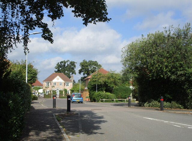
Bagley Green is a picturesque village located in Somerset, a county in southwestern England. Situated in the Mendip Hills, Bagley Green is known for its idyllic rural setting and stunning natural beauty. The village is nestled amongst rolling green hills, lush meadows, and charming woodlands, providing residents and visitors with a peaceful and tranquil environment.

The village is home to a small population, which contributes to its close-knit and friendly community. The residents of Bagley Green take pride in their village, and it is evident in the well-maintained houses with their beautiful gardens and vibrant flower displays. The architecture in the village is predominantly traditional, with charming cottages and stone-built houses that add to the village's charm.

Despite its small size, Bagley Green offers a range of amenities to its residents. The village has a community center, a local pub, and a small convenience store that caters to the basic needs of the community. Additionally, Bagley Green has a primary school, providing education for the local children.

The surrounding countryside offers plenty of opportunities for outdoor activities and exploration. The Mendip Hills Area of Outstanding Natural Beauty is a short distance away, providing residents with stunning walks, cycling routes, and nature trails. The nearby Cheddar Gorge, with its dramatic cliffs and caves, is a popular attraction for both locals and tourists.

In conclusion, Bagley Green is a charming and peaceful village located in the heart of Somerset's beautiful countryside. Its idyllic setting, friendly community, and access to stunning natural landscapes make it a desirable place to live or visit.

If you have any feedback on the listing, please let us know in the comments section below.
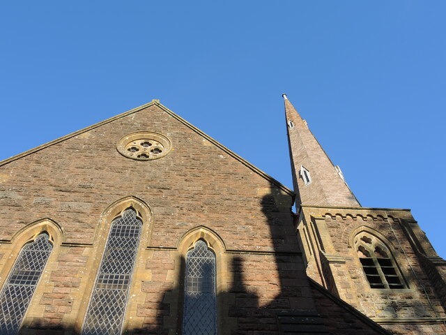
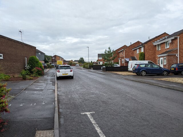
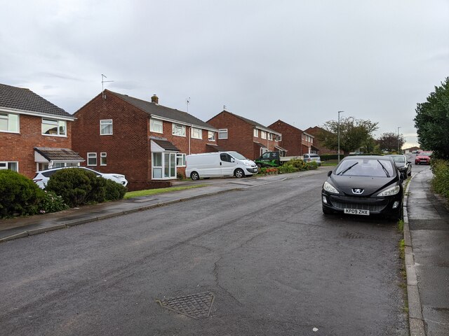
Bagley Green Images

Images are sourced within 2km of 50.966275/-3.250042 or Grid Reference ST1219. Thanks to Geograph Open Source API. All images are credited.

Dobrée Park, Rockwell Green
Layby on the A38, heading east
Entrance to new housing estate being built on the A38
Sampford Farm, Sampford Arundel
Railway bridge over the former A38
Sampford Arundel Primary School
Churchyard gates, Sampford Arundel Commemorate Queen Victoria's Diamond Jubilee 1897 <span class="nowrap"><a title="https://historicengland.org.uk/listing/the-list/list-entry/1344595?section=official-list-entry" rel="nofollow ugc noopener" href="https://historicengland.org.uk/listing/the-list/list-entry/1344595?section=official-list-entry">Link</a><img style="margin-left:2px;" alt="External link" title="External link - shift click to open in new window" src="https://s1.geograph.org.uk/img/external.png" width="10" height="10"/></span>
Churchyard gates, Sampford Arundel
Commemorate Queen Victoria's Diamond Jubilee 1897 LinkExternal link
War memorial, Sampford Arundel Erected in 1921 <span class="nowrap"><a title="https://historicengland.org.uk/listing/the-list/list-entry/1436144?section=official-list-entry" rel="nofollow ugc noopener" href="https://historicengland.org.uk/listing/the-list/list-entry/1436144?section=official-list-entry">Link</a><img style="margin-left:2px;" alt="External link" title="External link - shift click to open in new window" src="https://s1.geograph.org.uk/img/external.png" width="10" height="10"/></span>
War memorial, Sampford Arundel
Erected in 1921 LinkExternal link
Church of the Holy Cross, Sampford Arundel The tower dates from the fifteenth century, most of the rest was rebuilt in the 1870s <span class="nowrap"><a title="https://historicengland.org.uk/listing/the-list/list-entry/1178017?section=official-list-entry" rel="nofollow ugc noopener" href="https://historicengland.org.uk/listing/the-list/list-entry/1178017?section=official-list-entry">Link</a><img style="margin-left:2px;" alt="External link" title="External link - shift click to open in new window" src="https://s1.geograph.org.uk/img/external.png" width="10" height="10"/></span>
Church of the Holy Cross, Sampford Arundel
The tower dates from the fifteenth century, most of the rest was rebuilt in the 1870s LinkExternal link
The churchyard, Sampford Arundel
Barn at Sampford Arundel
Grass field near Beam Bridge
Abandoned route of the A38, Beam Bridge
A troubled tower All Saints church is not that old but the wooden shingles on the spire have been causing concerns. The local community has been trying to raise £20,000 for repairs.
A troubled tower
All Saints church is not that old but the wooden shingles on the spire have been causing concerns. The local community has been trying to raise £20,000 for repairs.
West end of All Saints church, Rockwell Green The end wall and the shodows of the neighbours.
West end of All Saints church, Rockwell Green
The end wall and the shodows of the neighbours.
Old Milestone east of Beam Bridge, against old Toll House Metal plate attached to stone post by the UC road, in parish of Sampford Arundel (Taunton Deane
District), Beam Bridge, beside old toll house, against rendered wall, on East side of road. Taunton roll top iron plate, erected by the Taunton turnpike trust in the 19th century. An earlier photograph can be found here <a title="https://www.geograph.org.uk/photo/6035573" href="https://www.geograph.org.uk/photo/6035573">Link</a>.

Inscription reads:-
TAUNTON
9
MILES 

Somerset HER listed. HER number: 37673 <span class="nowrap"><a title="https://www.heritagegateway.org.uk/Gateway/Results_Single.aspx?uid=37673&resourceID=100" rel="nofollow ugc noopener" href="https://www.heritagegateway.org.uk/Gateway/Results_Single.aspx?uid=37673&resourceID=100">Link</a><img style="margin-left:2px;" alt="External link" title="External link - shift click to open in new window" src="https://s1.geograph.org.uk/img/external.png" width="10" height="10"/></span>

Milestone Society National ID: SO_TAEX09
Old Milestone east of Beam Bridge, against old Toll House
Metal plate attached to stone post by the UC road, in parish of Sampford Arundel (Taunton Deane District), Beam Bridge, beside old toll house, against rendered wall, on East side of road. Taunton roll top iron plate, erected by the Taunton turnpike trust in the 19th century. An earlier photograph can be found here Link. Inscription reads:- TAUNTON 9 MILES Somerset HER listed. HER number: 37673 LinkExternal link Milestone Society National ID: SO_TAEX09
Barn Meads Road, looking west
Barn Meads Road, looking east
Show me another place!

Bagley Green is located at Grid Ref: ST1219 (Lat: 50.966275, Lng: -3.250042)

Administrative County: Somerset

District: Somerset West and Taunton

Police Authority: Avon and Somerset

What 3 Words

///locating.cabbages.rams. Near Hemyock, Devon

Nearby Locations

Bagley Green

Related Wikis

Rockwell Green

Rockwell Green is a village near Wellington, in the Somerset West and Taunton district of Somerset, England. It lies just east of the Somerset-Devon border...
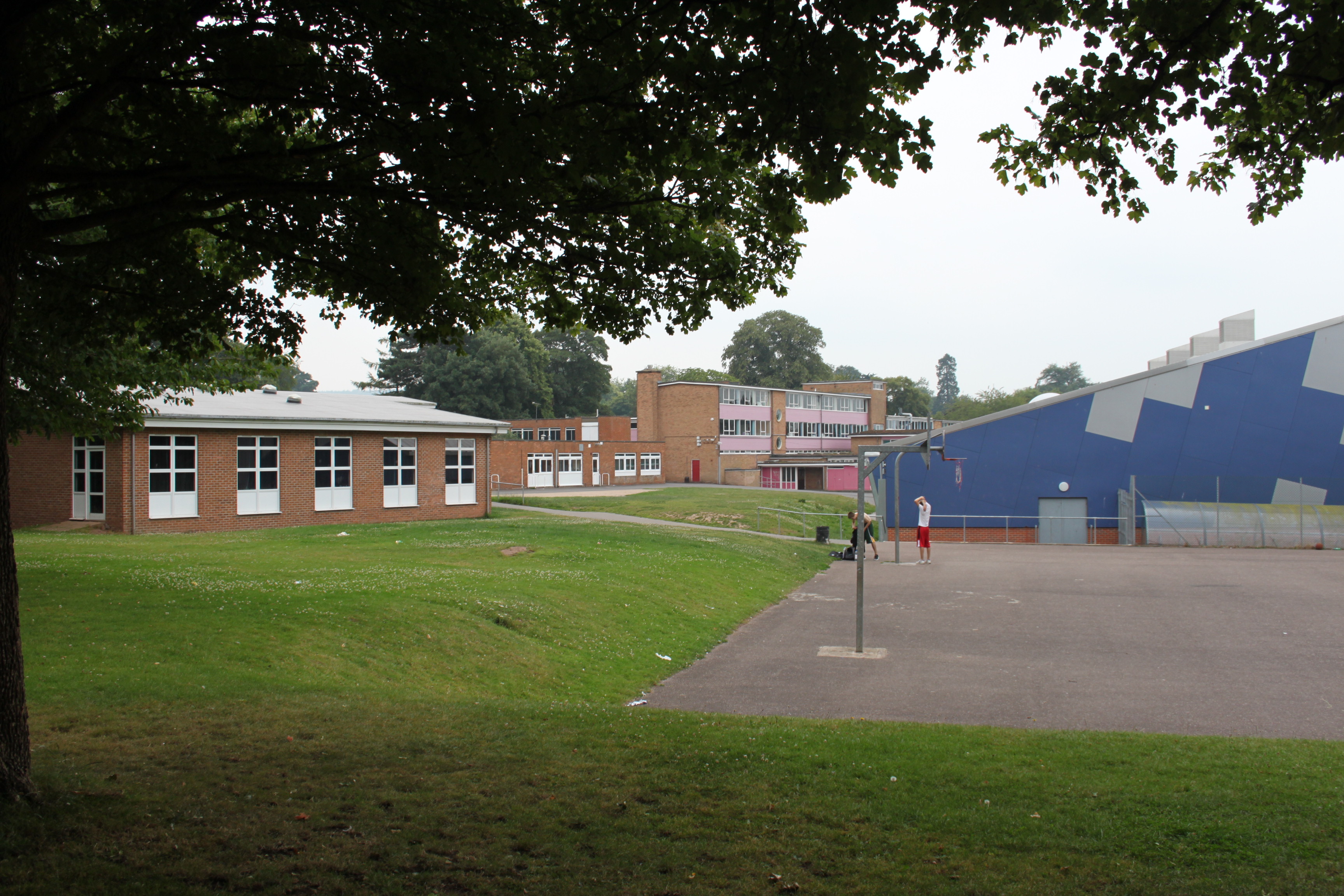
Court Fields School

Court Fields School is located in Wellington, Somerset, England. Court Fields is home to the “Theatre Of Leaves”, which is known to be one of the most...

Wellington Rural District, Somerset

Wellington was a rural district in Somerset, England, from 1894 to 1974. It was created in 1894 under the Local Government Act 1894. In 1974 it was abolished...

Wellington Without

Wellington Without is a civil parish in Somerset, England. It lies south of Wellington and has a population of 727. The parish includes the hamlet of Ford...

Wellington A.F.C.

Wellington Association Football Club are a football club based in Wellington, Somerset, England. They are currently members of the Western League Premier...

Sampford Arundel

Sampford Arundel is a village and civil parish in Somerset, England. It is situated near Wellington and 10 miles (16.1 km) south west of Taunton. The village...

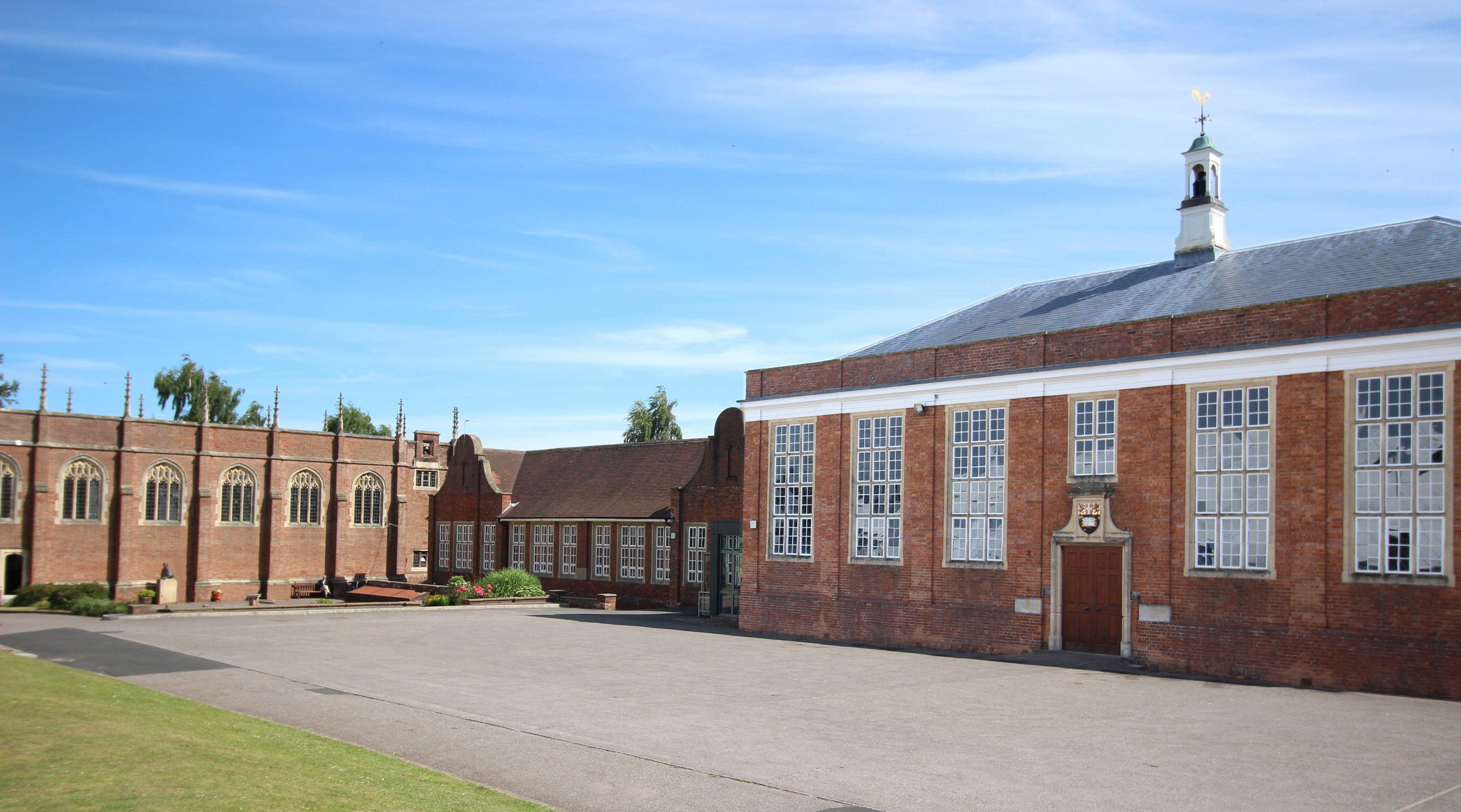
Wellington School, Somerset

Wellington School is a co-educational independent boarding and day school in the English public school tradition for pupils aged 3–18 located in Wellington...

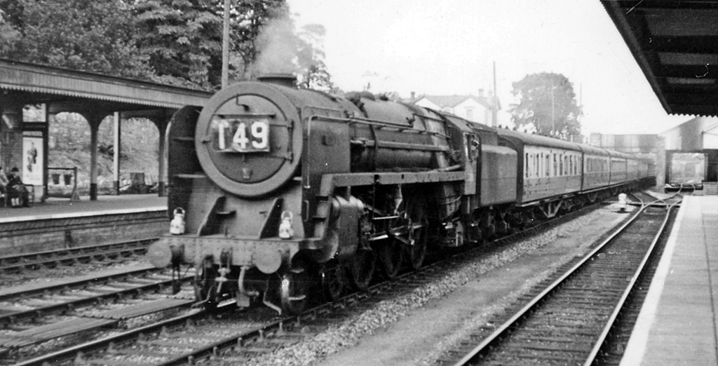
Wellington railway station (Somerset)

Wellington railway station was a former railway station located in Wellington in Somerset on the Bristol–Exeter line. It served the town between 1843...

Nearby Amenities

Located within 500m of 50.966275,-3.250042
Give Way
Direction: backward
Lat/Long: 50.9695011/-3.2500241
Give Way
Direction: forward
Lat/Long: 50.9699227/-3.2493794
Give Way
Direction: forward
Lat/Long: 50.9654656/-3.2495507
Give Way
Direction: forward
Lat/Long: 50.9656496/-3.2489379
Traffic Calming: bump
Lat/Long: 50.9698018/-3.2499493
Traffic Calming: bump
Lat/Long: 50.9700831/-3.250018
Traffic Calming: bump
Lat/Long: 50.9701236/-3.250194
Traffic Calming: bump
Lat/Long: 50.9704308/-3.2501896
Traffic Calming: bump
Lat/Long: 50.9704738/-3.249259
Give Way
Direction: backward
Lat/Long: 50.9704749/-3.2482786
Give Way
Direction: backward
Lat/Long: 50.9694999/-3.2481135
Give Way
Direction: backward
Lat/Long: 50.9703006/-3.2503115
Traffic Calming: bump
Lat/Long: 50.9706705/-3.2496625
Post Box
Pitt Farm
Collection Times: Mo-Fr 09:00; Sa 07:00
Operator: Royal Mail
Operator Wikidata: Q638098
Post Box Type: lamp
Postal Code: TA21 9PY
Ref: TA21 499
Royal Cypher: EIIR
Royal Cypher Wikidata: Q33102113
Lat/Long: 50.9697504/-3.2497222
Wellington
Direction: forward
Traffic Sign: city_limit
Lat/Long: 50.9669578/-3.2533532
Access: private
Entrance: yes
Lat/Long: 50.9696481/-3.2465003
Access: private
Entrance: yes
Lat/Long: 50.9696493/-3.2463454
Access: private
Entrance: yes
Lat/Long: 50.9696394/-3.2466517
Access: private
Entrance: yes
Lat/Long: 50.9697236/-3.2469301
Access: private
Entrance: yes
Lat/Long: 50.9696373/-3.2467422
Access: private
Entrance: yes
Lat/Long: 50.9696563/-3.2461846
Access: private
Entrance: yes
Lat/Long: 50.9698081/-3.2459733
Access: private
Entrance: yes
Lat/Long: 50.9699152/-3.2459346
Access: private
Entrance: yes
Lat/Long: 50.9700027/-3.246265
Access: private
Entrance: yes
Lat/Long: 50.9700007/-3.2464263
Access: private
Entrance: yes
Lat/Long: 50.9698151/-3.2469088
Access: private
Entrance: yes
Lat/Long: 50.9699032/-3.2470116
Access: private
Entrance: yes
Lat/Long: 50.9699072/-3.2465531
Access: private
Entrance: yes
Lat/Long: 50.9699577/-3.2469136
Access: private
Entrance: yes
Lat/Long: 50.9699907/-3.2467705
Access: private
Entrance: yes
Lat/Long: 50.970222/-3.2468073
Access: private
Entrance: yes
Lat/Long: 50.97019/-3.2470309
Access: private
Entrance: yes
Lat/Long: 50.9701538/-3.2471758
Access: private
Entrance: yes
Lat/Long: 50.9699097/-3.247524
Access: private
Entrance: yes
Lat/Long: 50.9700545/-3.2475693
Access: private
Entrance: yes
Lat/Long: 50.9698067/-3.2473799
Access: private
Entrance: yes
Lat/Long: 50.9697115/-3.2475343
Access: private
Entrance: yes
Lat/Long: 50.969613/-3.2476867
Noexit: yes
Lat/Long: 50.969964/-3.2480069
Noexit: yes
Lat/Long: 50.9699281/-3.248008
Access: private
Entrance: yes
Lat/Long: 50.9696639/-3.2478484
Access: private
Entrance: yes
Lat/Long: 50.9698696/-3.2477947
Access: private
Entrance: yes
Lat/Long: 50.9700236/-3.2478075
Access: private
Entrance: yes
Lat/Long: 50.9701018/-3.2480213
Barrier: bollard
Bicycle: yes
Foot: yes
Material: plastic
Lat/Long: 50.9688057/-3.2457331
Barrier: bollard
Bicycle: yes
Foot: yes
Material: plastic
Lat/Long: 50.9691588/-3.2458913
Access: private
Entrance: yes
Lat/Long: 50.9688753/-3.2477983
Access: private
Entrance: yes
Lat/Long: 50.969/-3.2477887
Noexit: yes
Lat/Long: 50.9690667/-3.2479808
Access: private
Entrance: yes
Lat/Long: 50.9693529/-3.2477981
Access: private
Entrance: yes
Lat/Long: 50.9691585/-3.2477719
Noexit: yes
Lat/Long: 50.969084/-3.2479834
Access: private
Entrance: yes
Lat/Long: 50.9694208/-3.2476817
Access: private
Entrance: yes
Lat/Long: 50.9693337/-3.2475062
Access: private
Entrance: yes
Lat/Long: 50.9691148/-3.2474814
Access: private
Entrance: yes
Lat/Long: 50.9689728/-3.2474226
Access: private
Entrance: yes
Lat/Long: 50.9687946/-3.2471879
Access: private
Entrance: yes
Lat/Long: 50.9687915/-3.2461023
Access: private
Entrance: yes
Lat/Long: 50.9689476/-3.2466146
Access: private
Entrance: yes
Lat/Long: 50.9689647/-3.2464161
Access: private
Entrance: yes
Lat/Long: 50.9690042/-3.2461742
Access: private
Entrance: yes
Lat/Long: 50.9690319/-3.2459413
Access: private
Entrance: yes
Lat/Long: 50.9688227/-3.2463925
Crossing
Bicycle: no
Crossing: unmarked
Lat/Long: 50.9687544/-3.2468014
Crossing
Bicycle: no
Crossing: unmarked
Lat/Long: 50.968913/-3.2468777
Crossing
Bicycle: no
Crossing: unmarked
Lat/Long: 50.9686414/-3.2466162
Access: private
Entrance: yes
Lat/Long: 50.9692423/-3.2466211
Access: private
Entrance: yes
Lat/Long: 50.9691996/-3.246845
Access: private
Entrance: yes
Lat/Long: 50.9692442/-3.247068
Access: private
Entrance: yes
Lat/Long: 50.9694102/-3.2465339
Access: private
Entrance: yes
Lat/Long: 50.9693828/-3.2467147
Access: private
Entrance: yes
Lat/Long: 50.9693535/-3.2468696
Access: private
Entrance: yes
Lat/Long: 50.9693265/-3.2470268
Access: private
Entrance: yes
Lat/Long: 50.9692369/-3.2463706
Access: private
Entrance: yes
Lat/Long: 50.9694163/-3.2463143
Access: private
Entrance: yes
Lat/Long: 50.9692806/-3.2461862
Access: private
Entrance: yes
Lat/Long: 50.9693955/-3.2461812
The data included in this document is from www.openstreetmap.org. The data is made available under ODbL.

Have you been to Bagley Green?

Leave your review of Bagley Green below (or comments, questions and feedback).