Bagtor Down

Downs, Moorland in Devon Teignbridge

England

Bagtor Down

Haytor - Car Park Several car parks line the road below Haytor where grass and bracken are prominent on the moorland.
Haytor - Car Park Credit: Colin Smith

Bagtor Down is a picturesque area located in the county of Devon, England. Situated in the southern part of Dartmoor National Park, it encompasses a vast expanse of downs and moorland, offering breathtaking views and a serene natural environment.

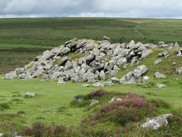
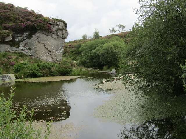
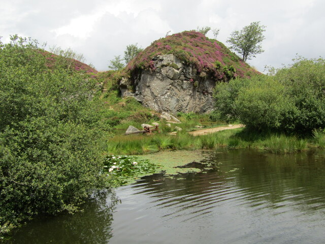
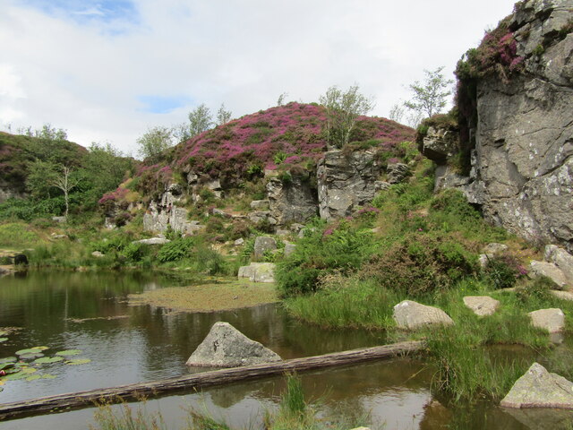
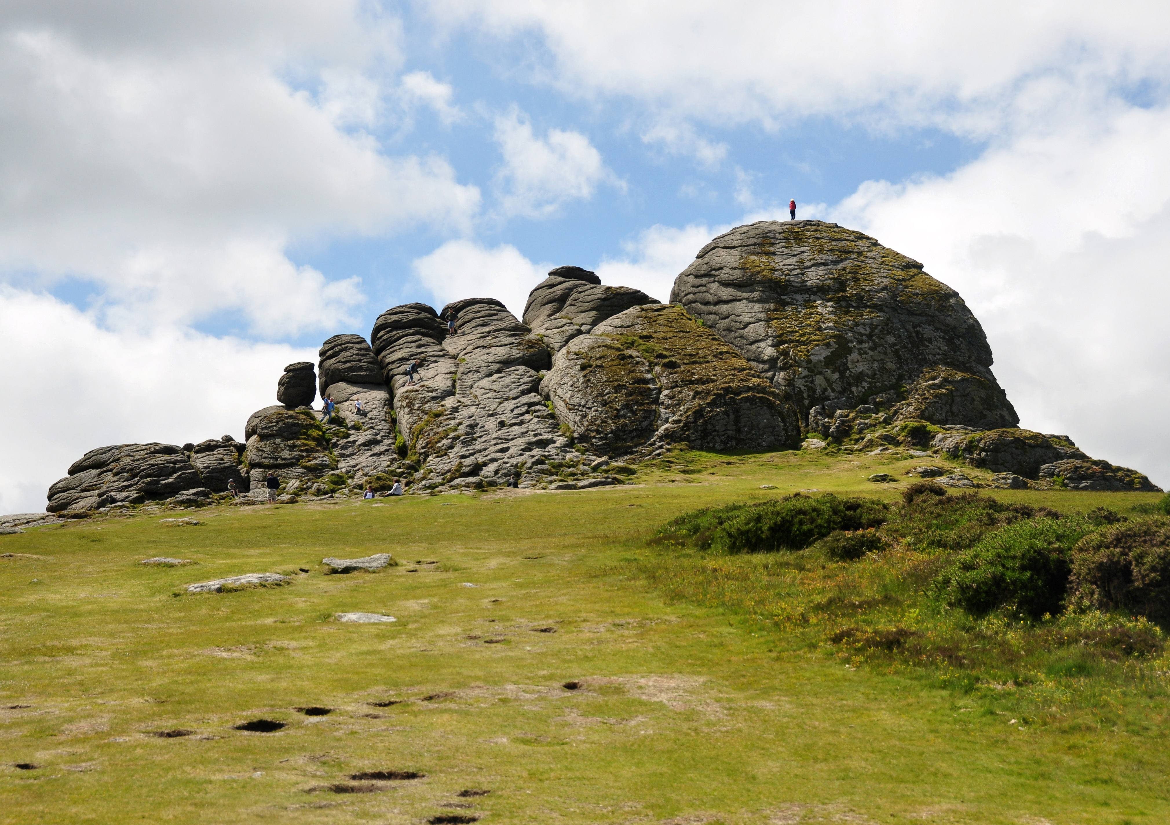
The landscape of Bagtor Down is characterized by rolling hills, open grasslands, and scattered granite tors. These tors, such as Hound Tor and Smallacombe Rocks, add a dramatic touch to the scenery, creating a unique and distinctive backdrop. The area is also dotted with ancient stone walls and remnants of Bronze Age settlements, giving a glimpse into the rich historical heritage of the region.

The vegetation in Bagtor Down is predominantly heather and gorse, creating a stunning purple and yellow carpet during the summer months. This attracts a variety of wildlife, including Dartmoor ponies, sheep, and numerous bird species. Walking trails crisscross the downs, allowing visitors to explore and appreciate the natural beauty at their own pace.

Bagtor Down offers a peaceful and tranquil escape from the hustle and bustle of city life. The unspoiled landscape and the absence of modern developments create a sense of timelessness and tranquility. It is a popular destination for nature lovers, hikers, and photographers, who seek solace in the captivating beauty of the moorland.

Overall, Bagtor Down is a hidden gem in Devon, offering a unique blend of natural beauty and historical significance. Whether one is looking for a leisurely stroll or a challenging hike, this area has something to offer for everyone who appreciates the serenity and splendor of the great outdoors.

If you have any feedback on the listing, please let us know in the comments section below.

Bagtor Down Images

Images are sourced within 2km of 50.567033/-3.7564567 or Grid Reference SX7575. Thanks to Geograph Open Source API. All images are credited.

Haytor - Car Park Several car parks line the road below Haytor where grass and bracken are prominent on the moorland.
Haytor - Car Park
Several car parks line the road below Haytor where grass and bracken are prominent on the moorland.
Haytor Rocks Popular and prominent granite outcrop (457m amsl) only a few minutes walk from the road below. The jointed and weathered rocks rise up to 50 feet above the grassy, moorland surroundings.
<span class="nowrap"><a title="www.dartmoor.gov.uk" rel="nofollow ugc noopener" href="http://www.dartmoor.gov.uk">Link</a><img style="margin-left:2px;" alt="External link" title="External link - shift click to open in new window" src="https://s1.geograph.org.uk/img/external.png" width="10" height="10"/></span>
Haytor Rocks
Popular and prominent granite outcrop (457m amsl) only a few minutes walk from the road below. The jointed and weathered rocks rise up to 50 feet above the grassy, moorland surroundings. LinkExternal link
Haytor - Moorland Blooming heather on the moorland slope north of Haytor Rocks. Granite outcrops abound.
<span class="nowrap"><a title="www.dartmoor.gov.uk" rel="nofollow ugc noopener" href="http://www.dartmoor.gov.uk">Link</a><img style="margin-left:2px;" alt="External link" title="External link - shift click to open in new window" src="https://s1.geograph.org.uk/img/external.png" width="10" height="10"/></span>
Haytor - Moorland
Blooming heather on the moorland slope north of Haytor Rocks. Granite outcrops abound. LinkExternal link
Haytor - Disused Quarry Former granite quarry on the moorland north of Haytor Rocks.
Haytor - Disused Quarry
Former granite quarry on the moorland north of Haytor Rocks.
Haytor - Disused Quarry Former granite quarry on the moorland north of Haytor Rocks. Blooming heather in profusion.
<span class="nowrap"><a title="www.dartmoor.gov.uk" rel="nofollow ugc noopener" href="http://www.dartmoor.gov.uk">Link</a><img style="margin-left:2px;" alt="External link" title="External link - shift click to open in new window" src="https://s1.geograph.org.uk/img/external.png" width="10" height="10"/></span>
Haytor - Disused Quarry
Former granite quarry on the moorland north of Haytor Rocks. Blooming heather in profusion. LinkExternal link
Haytor - Disused Granite Tramway The historic Haytor Granite Tramway was built ca 1820 for transporting granite from Haytor Down to the Stover Canal, some 10 miles away. Note that the trackbed has been made of flanged granite, to guide the wheels of horse-drawn wagons.
<span class="nowrap"><a title="www.dartmoor.gov.uk" rel="nofollow ugc noopener" href="http://www.dartmoor.gov.uk">Link</a><img style="margin-left:2px;" alt="External link" title="External link - shift click to open in new window" src="https://s1.geograph.org.uk/img/external.png" width="10" height="10"/></span>
Haytor - Disused Granite Tramway
The historic Haytor Granite Tramway was built ca 1820 for transporting granite from Haytor Down to the Stover Canal, some 10 miles away. Note that the trackbed has been made of flanged granite, to guide the wheels of horse-drawn wagons. LinkExternal link
Haytor Rocks Popular and prominent granite outcrop (457m amsl) only a few minutes walk from the road below. The jointed and weathered rocks rise up to 50 feet above the grassy, moorland surroundings. A party of rock climbers has arrived there.
<span class="nowrap"><a title="www.dartmoor.gov.uk" rel="nofollow ugc noopener" href="http://www.dartmoor.gov.uk">Link</a><img style="margin-left:2px;" alt="External link" title="External link - shift click to open in new window" src="https://s1.geograph.org.uk/img/external.png" width="10" height="10"/></span>
Haytor Rocks
Popular and prominent granite outcrop (457m amsl) only a few minutes walk from the road below. The jointed and weathered rocks rise up to 50 feet above the grassy, moorland surroundings. A party of rock climbers has arrived there. LinkExternal link
Haytor - Disused Granite Tramway The historic Haytor Granite Tramway was built ca 1820 for transporting granite from Haytor Down to the Stover Canal, some 10 miles away. Note that the trackbed has been made of flanged granite, to guide the wheels of horse-drawn wagons.
<span class="nowrap"><a title="www.dartmoor.gov.uk" rel="nofollow ugc noopener" href="http://www.dartmoor.gov.uk">Link</a><img style="margin-left:2px;" alt="External link" title="External link - shift click to open in new window" src="https://s1.geograph.org.uk/img/external.png" width="10" height="10"/></span>
Haytor - Disused Granite Tramway
The historic Haytor Granite Tramway was built ca 1820 for transporting granite from Haytor Down to the Stover Canal, some 10 miles away. Note that the trackbed has been made of flanged granite, to guide the wheels of horse-drawn wagons. LinkExternal link
Haytor Quarry A spoil heap of granite blocks lies by a disused quarry on the northern slopes of Haytor Rocks.
<span class="nowrap"><a title="www.dartmoor.gov.uk" rel="nofollow ugc noopener" href="http://www.dartmoor.gov.uk">Link</a><img style="margin-left:2px;" alt="External link" title="External link - shift click to open in new window" src="https://s1.geograph.org.uk/img/external.png" width="10" height="10"/></span>
Haytor Quarry
A spoil heap of granite blocks lies by a disused quarry on the northern slopes of Haytor Rocks. LinkExternal link
Haytor - Disused Quarry Haytor Quarry (now flooded) was opened in the late 18th century and worked sporadically throughout the 19th century until the 1860s. Granite from here was used in the old London Bridge and the British Museum.
<span class="nowrap"><a title="www.dartmoor.gov.uk" rel="nofollow ugc noopener" href="http://www.dartmoor.gov.uk">Link</a><img style="margin-left:2px;" alt="External link" title="External link - shift click to open in new window" src="https://s1.geograph.org.uk/img/external.png" width="10" height="10"/></span>
Haytor - Disused Quarry
Haytor Quarry (now flooded) was opened in the late 18th century and worked sporadically throughout the 19th century until the 1860s. Granite from here was used in the old London Bridge and the British Museum. LinkExternal link
Haytor Quarry Haytor Quarry (now flooded) was opened in the late 18th century and worked sporadically throughout the 19th century until the 1860s. Granite from here was used in the old London Bridge and the British Museum.
<span class="nowrap"><a title="www.dartmoor.gov.uk" rel="nofollow ugc noopener" href="http://www.dartmoor.gov.uk">Link</a><img style="margin-left:2px;" alt="External link" title="External link - shift click to open in new window" src="https://s1.geograph.org.uk/img/external.png" width="10" height="10"/></span>
Haytor Quarry
Haytor Quarry (now flooded) was opened in the late 18th century and worked sporadically throughout the 19th century until the 1860s. Granite from here was used in the old London Bridge and the British Museum. LinkExternal link
Haytor Quarry - Winding Gear Haytor Quarry (now flooded) was opened in the late 18th century and worked sporadically throughout the 19th century until the 1860s. Granite from here was used in the old London Bridge and the British Museum.
<span class="nowrap"><a title="www.dartmoor.gov.uk" rel="nofollow ugc noopener" href="http://www.dartmoor.gov.uk">Link</a><img style="margin-left:2px;" alt="External link" title="External link - shift click to open in new window" src="https://s1.geograph.org.uk/img/external.png" width="10" height="10"/></span>
Haytor Quarry - Winding Gear
Haytor Quarry (now flooded) was opened in the late 18th century and worked sporadically throughout the 19th century until the 1860s. Granite from here was used in the old London Bridge and the British Museum. LinkExternal link
Haytor Quarry Haytor Quarry (now flooded) was opened in the late 18th century and worked sporadically throughout the 19th century until the 1860s. Granite from here was used in the old London Bridge and the British Museum.
<span class="nowrap"><a title="www.dartmoor.gov.uk" rel="nofollow ugc noopener" href="http://www.dartmoor.gov.uk">Link</a><img style="margin-left:2px;" alt="External link" title="External link - shift click to open in new window" src="https://s1.geograph.org.uk/img/external.png" width="10" height="10"/></span>
Haytor Quarry
Haytor Quarry (now flooded) was opened in the late 18th century and worked sporadically throughout the 19th century until the 1860s. Granite from here was used in the old London Bridge and the British Museum. LinkExternal link
Show me another place!

Bagtor Down is located at Grid Ref: SX7575 (Lat: 50.567033, Lng: -3.7564567)

Administrative County: Devon

District: Teignbridge

Police Authority: Devon and Cornwall

What 3 Words

///communal.older.removable. Near Ashburton, Devon

Related Wikis

Rippon Tor

Rippon Tor is a striking tor on eastern Dartmoor, in England, that stands at 473 metres (1,552 ft) above sea level. It has three cairns, of which are some...

Haytor

Haytor, also known as Haytor Rocks, Hay Tor, or occasionally Hey Tor, is a granite tor on the eastern edge of Dartmoor in the English county of Devon....

Ilsington

Ilsington is a village and civil parish situated on the eastern edge of Dartmoor, Devon, England. It is one of the largest parishes in the county, and...

River Lemon

The River Lemon is a 9.9 miles (15.9 kilometres) river in the county of Devon in southwest England. It is a tributary of the River Teign, starting on Dartmoor...

Nearby Amenities

Located within 500m of 50.567033,-3.7564567
Ford: yes
Lat/Long: 50.5672581/-3.7519933
The data included in this document is from www.openstreetmap.org. The data is made available under ODbL.

Have you been to Bagtor Down?

Leave your review of Bagtor Down below (or comments, questions and feedback).