Berry Brae

Downs, Moorland in Dumfriesshire

Scotland

Berry Brae

Road from Shinnellhead The left hand fork is one of the many forestry tracks in the area
Road from Shinnellhead Credit: wrobison

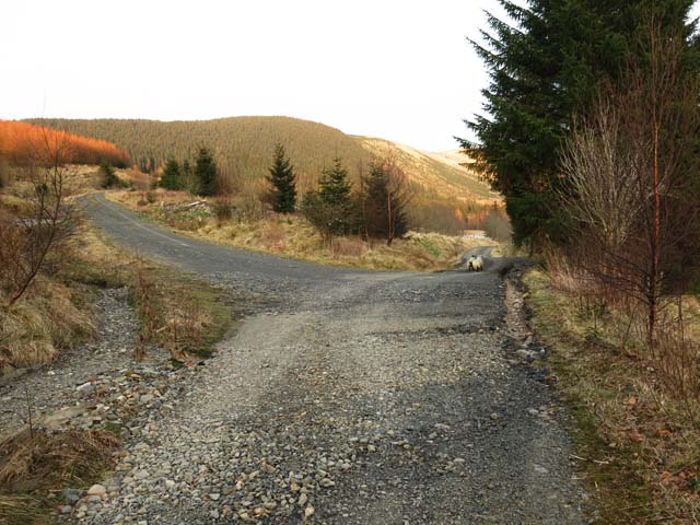
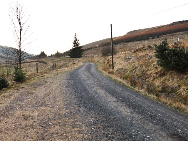
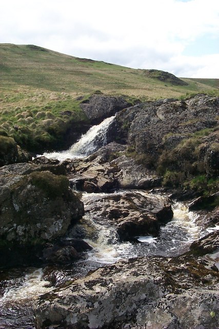
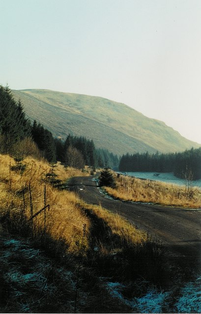
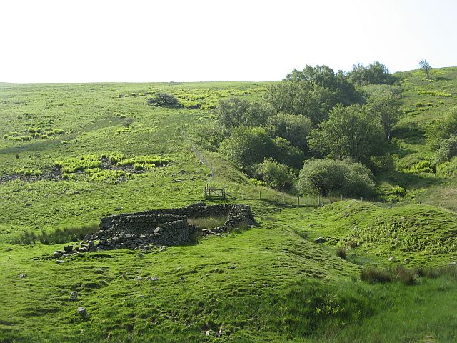
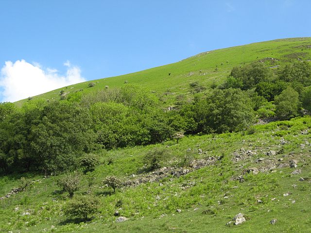
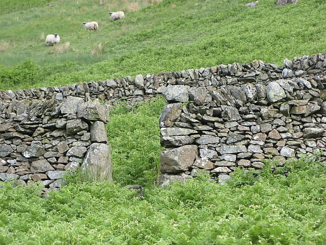
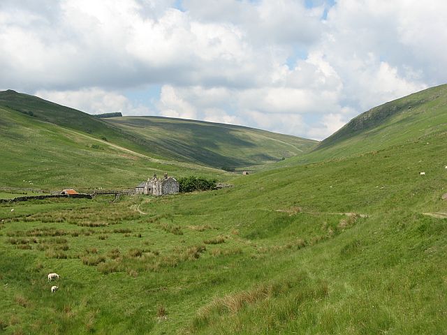
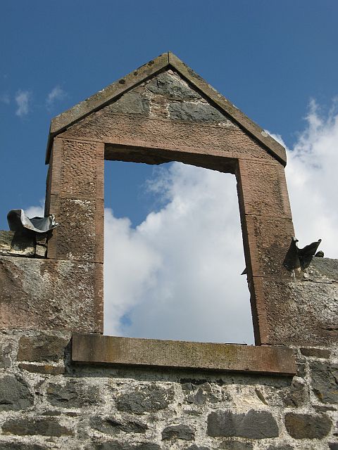
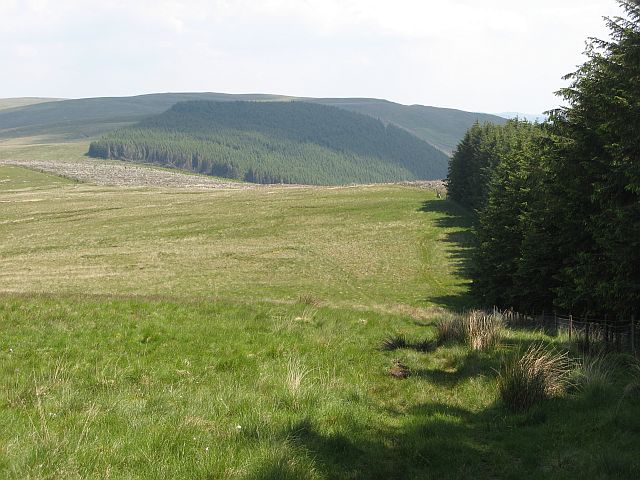
Berry Brae is a picturesque area located in Dumfriesshire, Scotland. Situated amidst the enchanting Downs and Moorland, it offers a unique and tranquil experience for visitors and locals alike. The region is renowned for its stunning natural beauty, with rolling hills, rich green pastures, and breathtaking views that stretch for miles.

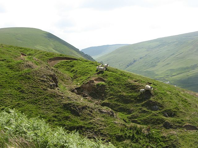
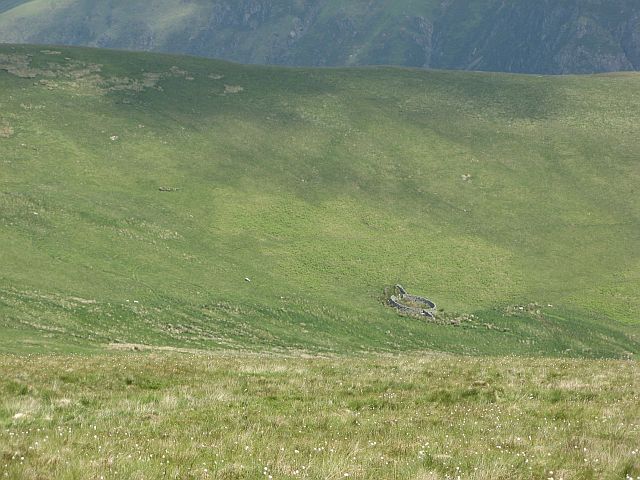
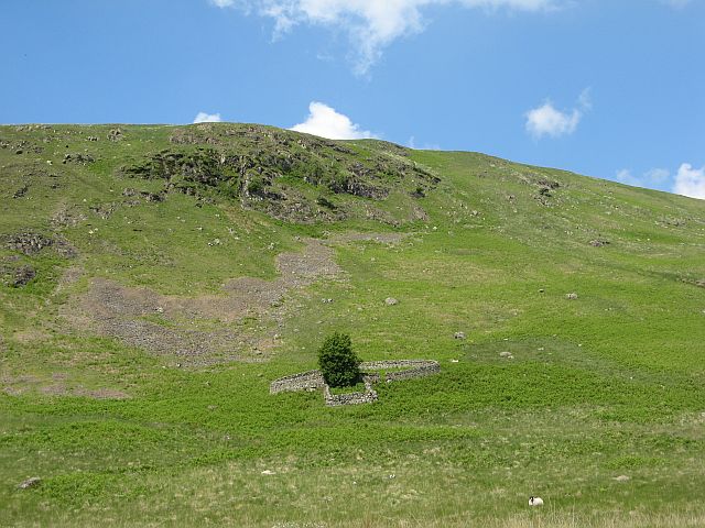
The landscape of Berry Brae is a captivating blend of rugged moors and peaceful downs. The moorland, characterized by its expansive open spaces, is covered in heather and scattered with rocky outcrops, providing a haven for wildlife such as deer, birds of prey, and various species of flora. The downs, on the other hand, are gentle slopes dotted with grazing sheep and cattle, creating a harmonious pastoral scene.

The area is ideal for outdoor enthusiasts as it offers numerous opportunities for activities such as hiking, cycling, and birdwatching. There are well-marked trails that meander through the countryside, allowing visitors to explore the diverse terrain at their own pace. The panoramic views from the hilltops are particularly breathtaking, offering a sense of awe and tranquility.

In addition to its natural beauty, Berry Brae is also home to charming rural communities, where visitors can experience the warm hospitality and rich cultural heritage of the region. The local villages offer quaint cottages, traditional pubs, and small shops selling locally produced goods, allowing visitors to immerse themselves in the authentic Scottish countryside lifestyle.

Overall, Berry Brae in Dumfriesshire is a captivating destination that showcases the beauty of the Downs and Moorland. With its stunning landscapes, outdoor activities, and charming communities, it offers a memorable experience for all who venture into its enchanting embrace.

If you have any feedback on the listing, please let us know in the comments section below.

Berry Brae Images

Images are sourced within 2km of 55.277542/-3.9656302 or Grid Reference NX7599. Thanks to Geograph Open Source API. All images are credited.

Road from Shinnellhead The left hand fork is one of the many forestry tracks in the area
Road from Shinnellhead
The left hand fork is one of the many forestry tracks in the area
Road to Shinnellhead The road follows the Shinnel Water through a mixture of moorland and forestry
Road to Shinnellhead
The road follows the Shinnel Water through a mixture of moorland and forestry
Road to Shinnellhead Passing some recent forestry felling
Road to Shinnellhead
Passing some recent forestry felling
March Burn, Shinnel Glen The house in the distance is Appin Lodge.
March Burn, Shinnel Glen
The house in the distance is Appin Lodge.
Chanlock Burn,  waterfall
Chanlock Burn, waterfall
Sharp Craig Trees are currently being felled and replanted
Sharp Craig
Trees are currently being felled and replanted
Chanlockhead This ruined cottage is now even more derelict  - needs rescuing! Chanlock burn to the left.
Chanlockhead
This ruined cottage is now even more derelict - needs rescuing! Chanlock burn to the left.
Sheil Cleuch Ruined sheep fank, and restored burn. Fenced off the remnant woodland in the Sheil Cleuch has regenerated, with the added bonus of cover for game birds.
Sheil Cleuch
Ruined sheep fank, and restored burn. Fenced off the remnant woodland in the Sheil Cleuch has regenerated, with the added bonus of cover for game birds.
Craigdasher Woodland of ash, rowan, and hazel on a scree slope. There was a lot of birdsong coming from this fragment of the forest that once covered these hills. Numerous willow warblers, chaffinches, wheatears, a cuckoo and yellowhammer amongst the cast.
Craigdasher
Woodland of ash, rowan, and hazel on a scree slope. There was a lot of birdsong coming from this fragment of the forest that once covered these hills. Numerous willow warblers, chaffinches, wheatears, a cuckoo and yellowhammer amongst the cast.
Fank, Braxhole Rush Entrance to one of the many circular sheep fanks along the Chanlock Water.
Fank, Braxhole Rush
Entrance to one of the many circular sheep fanks along the Chanlock Water.
Chanlockhead Ruined farm, abandoned before the electrification of the Scar Water.
Chanlockhead
Ruined farm, abandoned before the electrification of the Scar Water.
Chanlockhead The ruin of what was a substantial house.
Chanlockhead
The ruin of what was a substantial house.
Chanlockhead Dormer window now unsupported by the roof. While local stone is used for the walls, most houses in the hills of Dumfriesshire bought in sandstone for more specialist parts of the building. Must have been hard work getting the blocks up here.
Chanlockhead
Dormer window now unsupported by the roof. While local stone is used for the walls, most houses in the hills of Dumfriesshire bought in sandstone for more specialist parts of the building. Must have been hard work getting the blocks up here.
Sheep on Craigbuie Hill Most of the Chanlock sheep were down in the glen, but there were some further up the hill.
Sheep on Craigbuie Hill
Most of the Chanlock sheep were down in the glen, but there were some further up the hill.
Greenside Aptly named hill above the Dalzean Burn.  The Scar Water fanks have a couple of walls added to the usual circular arrangement.
Greenside
Aptly named hill above the Dalzean Burn. The Scar Water fanks have a couple of walls added to the usual circular arrangement.
Blackcraig Hill Small peat hags near the summit of Blackcraig Hill. The peatlands on Blackcraig are not deeply dissected, and there are few hags, despite the gentle contours.
Blackcraig Hill
Small peat hags near the summit of Blackcraig Hill. The peatlands on Blackcraig are not deeply dissected, and there are few hags, despite the gentle contours.
Black Craig Broken crag on the north side of the Chanlock Water. Very distinctive sheep fank, one of a pair, below.
Black Craig
Broken crag on the north side of the Chanlock Water. Very distinctive sheep fank, one of a pair, below.
Scaur Law The ridge running southeast from Ox Hill is owned by the Forestry Commission on the Shinnel side. The Chanlock side of the hill is still a sheep farm.
Scaur Law
The ridge running southeast from Ox Hill is owned by the Forestry Commission on the Shinnel side. The Chanlock side of the hill is still a sheep farm.
Show me another place!

Berry Brae is located at Grid Ref: NX7599 (Lat: 55.277542, Lng: -3.9656302)

Unitary Authority: Dumfries and Galloway

Police Authority: Dumfries and Galloway

What 3 Words

///minivans.origins.upsetting. Near Sanquhar, Dumfries & Galloway

Nearby Locations

Berry Brae

Related Wikis

Carsphairn and Scaur Hills

The Carsphairn and Scaur Hills are the western and eastern hills respectively of a hill range in the Southern Uplands of Scotland. Ordnance Survey maps...

Grennan Hill

Grennan Hill is the site of an Iron Age hill fort outside Penpont in Dumfries and Galloway, Scotland. == References == Schedule "Grennan Hill, NMRS Number...

Tynron

Tynron is a village and civil parish in Dumfries and Galloway, south-west Scotland, lying in a hollow of the Shinnel Water, 2 miles (3.2 km) from Moniaive...

Tynron Doon

Tynron Doon is a multivallate Iron Age hill fort outside the village of Tynron in Dumfries and Galloway, Scotland. It was occupied on and off from the...

Craigdarroch

"Craigdarroch, An Accessory to Murder" is an expansion set for the board game Kill Doctor Lucky Craigdarroch is a house near Moniaive, Dumfries and Galloway...

Moniaive

Moniaive ( 'monny-IVE'; Scottish Gaelic: Am Moine Naomh, "The Holy Moor") is a village in the Parish of Glencairn, in Dumfries and Galloway, southwest...

Moniaive railway station

Moniaive railway station is the closed station terminus of the Cairn Valley Light Railway (CVR) branch, from Dumfries. It served the rural area of Moniaive...

Mennock

Mennock is a small village or hamlet which lies 2 miles (3.2 km) south-east of Sanquhar on the A76, in Dumfriesshire, in the District Council Region of...

Nearby Amenities

Located within 500m of 55.277542,-3.9656302
The data included in this document is from www.openstreetmap.org. The data is made available under ODbL.

Have you been to Berry Brae?

Leave your review of Berry Brae below (or comments, questions and feedback).