Badachreamh

Downs, Moorland in Inverness-shire

Scotland

Badachreamh

A9, northbound The A9 is a strategic link between the Highlands of Scotland and the Central Belt. It runs 279 miles from junction 5 of the M9 at Polmont to Scrabster. Originally it ran from Edinburgh.
<span class="nowrap"><a title="https://www.sabre-roads.org.uk/wiki/index.php?title=A9" rel="nofollow ugc noopener" href="https://www.sabre-roads.org.uk/wiki/index.php?title=A9">Link</a><img style="margin-left:2px;" alt="External link" title="External link - shift click to open in new window" src="https://s1.geograph.org.uk/img/external.png" width="10" height="10"/></span>
A9, northbound Credit: N Chadwick

Badachreamh is a small village located in Inverness-shire, Scotland. Situated in the region known for its picturesque landscape, Badachreamh is nestled amidst the downs and moorland, creating a stunning and serene environment.

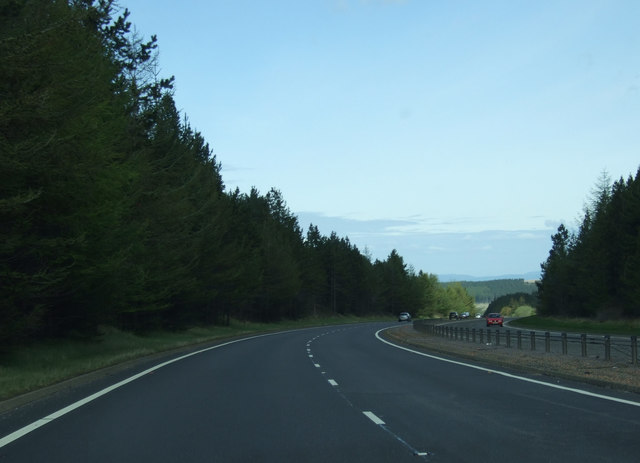
The village is surrounded by rolling hills covered in heather, creating a vibrant purple hue during the summer months. The downs offer breathtaking views of the surrounding countryside, with their gentle slopes and lush greenery. The moorland, on the other hand, adds a rugged and wild aspect to the landscape, with its vast expanse of open space and scattered patches of shrubs and grass.

Badachreamh is known for its tranquility and the sense of peace it brings to its residents and visitors alike. The village offers a getaway from the hustle and bustle of city life, allowing visitors to immerse themselves in the natural beauty of the Scottish highlands.

The downs and moorland of Badachreamh also provide an ideal setting for outdoor activities such as hiking, bird watching, and nature photography. The diverse flora and fauna of the region make it a haven for nature enthusiasts, with the opportunity to spot rare species of birds, including the golden eagle and the red grouse.

Overall, Badachreamh in Inverness-shire offers a unique and idyllic setting for those seeking a peaceful retreat amidst the downs and moorland of the Scottish highlands.

If you have any feedback on the listing, please let us know in the comments section below.

Badachreamh Images

Images are sourced within 2km of 57.388686/-4.1163824 or Grid Reference NH7235. Thanks to Geograph Open Source API. All images are credited.

A9, northbound The A9 is a strategic link between the Highlands of Scotland and the Central Belt. It runs 279 miles from junction 5 of the M9 at Polmont to Scrabster. Originally it ran from Edinburgh.
<span class="nowrap"><a title="https://www.sabre-roads.org.uk/wiki/index.php?title=A9" rel="nofollow ugc noopener" href="https://www.sabre-roads.org.uk/wiki/index.php?title=A9">Link</a><img style="margin-left:2px;" alt="External link" title="External link - shift click to open in new window" src="https://s1.geograph.org.uk/img/external.png" width="10" height="10"/></span>
A9, northbound
The A9 is a strategic link between the Highlands of Scotland and the Central Belt. It runs 279 miles from junction 5 of the M9 at Polmont to Scrabster. Originally it ran from Edinburgh. LinkExternal link
Summit cairn on Meall Mor (Moy)
Forestry road near Daviot
Forestry boundary fence The area to the east of the fence is being replanted with some native trees.
Forestry boundary fence
The area to the east of the fence is being replanted with some native trees.
Forestry as far as the eye can see Brashing nearest the camera, where trees have been felled and a newish plantation on the right
Forestry as far as the eye can see
Brashing nearest the camera, where trees have been felled and a newish plantation on the right
Log pile In the forestry on Beinn a' Bheurlaich
Log pile
In the forestry on Beinn a' Bheurlaich
General Wades Bridge at Mid Lairgs A bridge (probably) dating from around the 1750's built by General Wade.
This is typical of the style of bridge built during this road improvement age in the Highlands following The Battle of Culloden.
The road leading to this bridge has fallen into disrepair and cannot be followed much further NW of this point as there is a modern quarry across the original route.
General Wades Bridge at Mid Lairgs
A bridge (probably) dating from around the 1750's built by General Wade. This is typical of the style of bridge built during this road improvement age in the Highlands following The Battle of Culloden. The road leading to this bridge has fallen into disrepair and cannot be followed much further NW of this point as there is a modern quarry across the original route.
Young plantation on Beinn a' Bheurlaich
Forestry road junction
A9 Lay-by
A9 Lay-by
A9 Lay-by
A9 Lay-by
A9 heading west Towards Inverness.
A9 heading west
Towards Inverness.
Woodland beside the A9
The A9 towards Inverness  Heading north west.
The A9 towards Inverness
Heading north west.
A9, Auchbain Heading north west towards Inverness.
A9, Auchbain
Heading north west towards Inverness.
A9 heading west Towards Inverness.
A9 heading west
Towards Inverness.
A9,  Badachreamh Heading north west towards Inverness.
A9, Badachreamh
Heading north west towards Inverness.
Show me another place!

Badachreamh is located at Grid Ref: NH7235 (Lat: 57.388686, Lng: -4.1163824)

Unitary Authority: Highland

Police Authority: Highlands and Islands

What 3 Words

///flamenco.funny.lasts. Near Milton of Leys, Highland

Nearby Locations

Badachreamh

Related Wikis

Moy railway station

Moy railway station served in the village of Moy, Highland, Scotland from 1897 to 1965 on the Inverness and Aviemore Direct Railway. == History == The...

Moy Hall

Moy Hall near the village of Moy, south of Inverness, is the home of the chiefs of the Clan Mackintosh, a Highland Scottish clan. == History == The original...

Balnafoich

Balnafoich (Scottish Gaelic: Baile na Faich meaning Township of the Green Field) was once only a small croft, but is now a little settlement lying 7 miles...

Inverernie

Inverernie (Gaelic: Inbhir Fhearna) is a small settlement, with a local shop, within Farr and the wider area of Strathnairn in the Highlands of Scotland...

Nearby Amenities

Located within 500m of 57.388686,-4.1163824
Created By: Merkaartor 0.12
Lat/Long: 57.3909235/-4.1234457
The data included in this document is from www.openstreetmap.org. The data is made available under ODbL.

Have you been to Badachreamh?

Leave your review of Badachreamh below (or comments, questions and feedback).