Ffridd Forfudd
Downs, Moorland in Caernarfonshire
Wales
Ffridd Forfudd

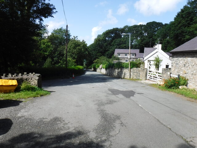
Ffridd Forfudd is a region located in Caernarfonshire, Wales, known for its stunning downs and moorland landscapes. This area covers a vast expanse of approximately 100 square kilometers and is situated near the picturesque town of Caernarfon. It is renowned for its breathtaking natural beauty and diverse ecosystems.
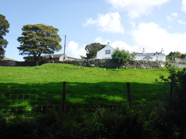
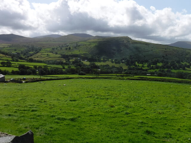
The downs of Ffridd Forfudd are characterized by rolling hills covered in lush green grasses and scattered with wildflowers. These open spaces provide grazing land for livestock, such as sheep and cattle, which are a common sight in the area. The downs also offer visitors sweeping panoramic views of the surrounding countryside and the nearby Snowdonia National Park.
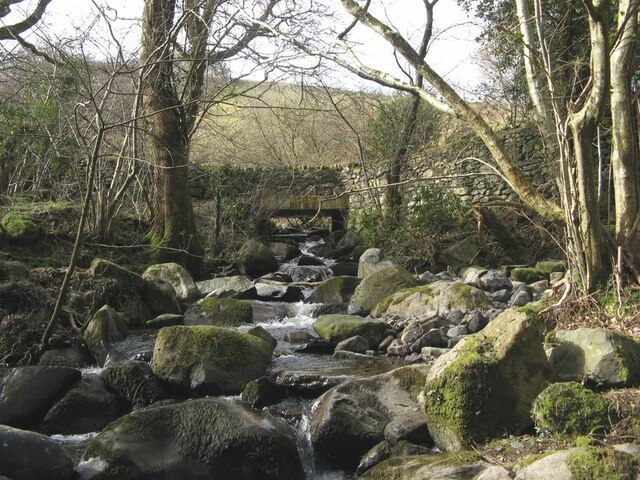
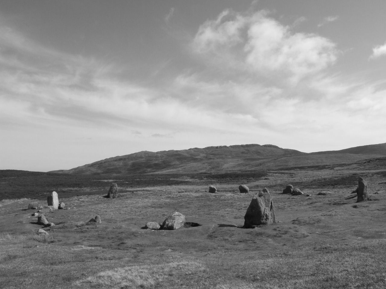
The moorland areas of Ffridd Forfudd are dominated by heather and gorse, creating a vibrant purple and yellow tapestry across the landscape. These moors provide a habitat for a variety of wildlife, including birds, insects, and small mammals. They also offer opportunities for outdoor activities such as hiking, birdwatching, and photography.
Ffridd Forfudd is a popular destination for nature lovers and outdoor enthusiasts who seek tranquility and a chance to immerse themselves in the natural wonders of Wales. The region's unspoiled beauty, combined with its rich cultural heritage, makes it a must-visit location for those exploring Caernarfonshire. Whether it's a leisurely walk through the downs or an adventurous hike across the moorland, Ffridd Forfudd offers a truly captivating experience for visitors of all ages.
If you have any feedback on the listing, please let us know in the comments section below.
Ffridd Forfudd Images
Images are sourced within 2km of 53.24015/-3.9373017 or Grid Reference SH7073. Thanks to Geograph Open Source API. All images are credited.


Ffridd Forfudd is located at Grid Ref: SH7073 (Lat: 53.24015, Lng: -3.9373017)
Unitary Authority: Conwy
Police Authority: North Wales
What 3 Words
///dragons.patrolled.grapevine. Near Penmaenmawr, Conwy
Nearby Locations
Related Wikis

Bwlch-y-Ddeufaen
Bwlch-y-Ddeufaen (Welsh: Gap/Pass of the Two Stones) is a mountain pass in Conwy county borough, north Wales, traversable only on foot or horseback, following...
Tal y Fan
Tal y Fan is an outlying peak of the Carneddau mountains in North Wales. It is one of the four Marilyns that make up the Carneddau, the others being Carnedd...

Penmaenmawr & Welsh Granite Co.
The Penmaenmawr & Welsh Granite Co. owned and operated a major granite quarry on the north Wales coast located between Conwy and Llanfairfechan. Granite...
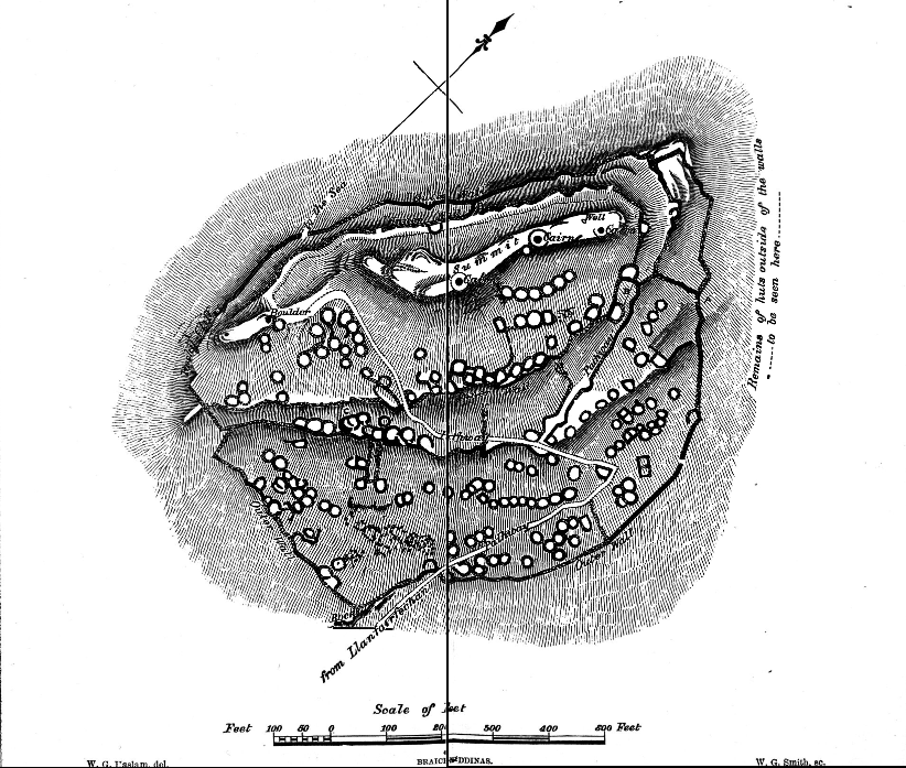
Braich-y-Dinas
Braich-y-Dinas was an extensive hillfort at the summit of Penmaenmawr, one of the northernmost peaks of the Carneddau mountain range on North coast of...

Llanfairfechan
Llanfairfechan (Welsh for 'Little St Mary's Parish') is a town and community in the Conwy County Borough, Wales. It is known as a seaside resort and had...

St Winifred's School
St Winifred's School was a school for girls in Llanfairfechan, Conwy County Borough, Wales. == History == St. Winifred's was founded on 3 May 1887 and...

Penmaenmawr
Penmaenmawr (, Welsh: [ˈpɛnmaːɨnmaur] ) is a town and community in Conwy County Borough, Wales, which was formerly in the parish of Dwygyfylchi and the...

Penmaenmawr railway station
Penmaenmawr railway station serves the town of Penmaenmawr, Wales, and is located on the North Wales Coast Line travelling from Crewe to Holyhead, 49+1...
Related Videos

1. The Cambrian Way. Hardest long distance trail in Britain. Wild camping near summit of Foel Lwyd.
11th September 2018 Day one on the The Cambrian Way mountain trail 479 km (298 miles) with a total ascent of 22460 m (73700 ...

TAL Y FAN & FOEL LUS FROM SYCHNANT PASS JUNE 2020
Day 1: Tal Y Fan. Day 2: Foel Lus and the Fairy Glen for a dip. Such a hot day it was a struggle in the heat. Capelulo Dwgyfwchi.

Tal Y Fan drone footage
Hike up to Tal Y Fan from Sychnant pass, footage taken with dji mini 2.

3000BC Prehistoric stone circles, Cefn Coch, Penmaenmawr and Circle 275, wild moody sky.
I headed out to find a couple of stone circles, I was alone and I did not like it.. Dark was in the air moody sky and heavy cloud.
Nearby Amenities
Located within 500m of 53.24015,-3.9373017Have you been to Ffridd Forfudd?
Leave your review of Ffridd Forfudd below (or comments, questions and feedback).