Uwch Mynydd

Downs, Moorland in Merionethshire

Wales

Uwch Mynydd

Old barn on Banc-y-Frân A solid but roofless stone barn sits on a small rise in the adjacent field. Diffwys can be seen in the distance.
Old barn on Banc-y-Frân Credit: Nigel Brown

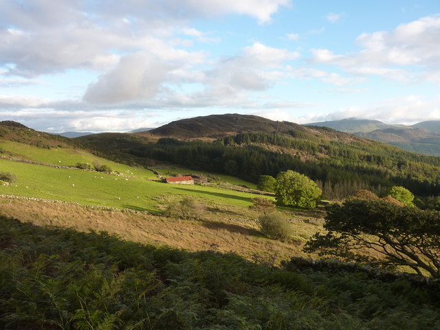
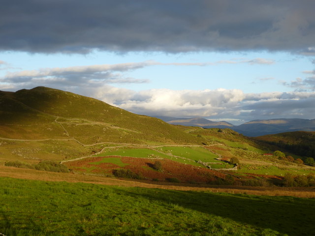
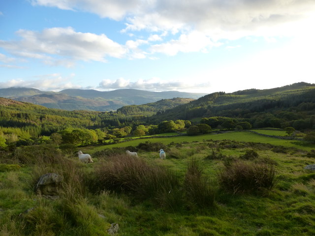
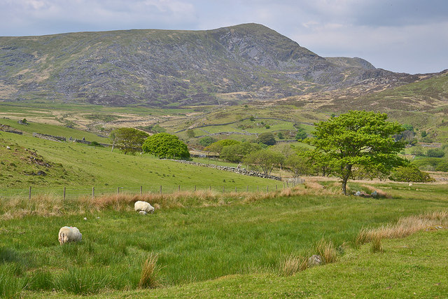
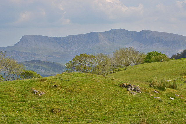
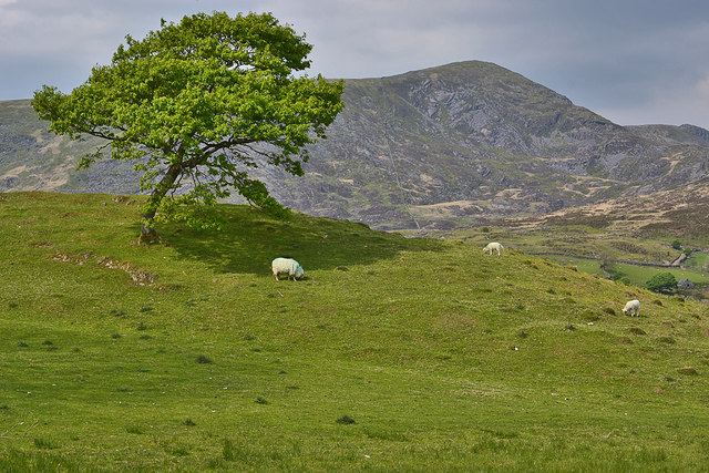
Uwch Mynydd, located in the historic county of Merionethshire in Wales, is a picturesque expanse of downs and moorland. Spanning over a vast area, it is known for its rugged and untouched natural beauty.

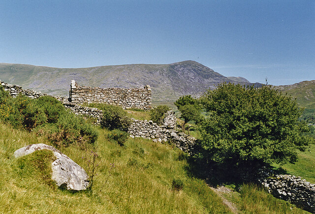
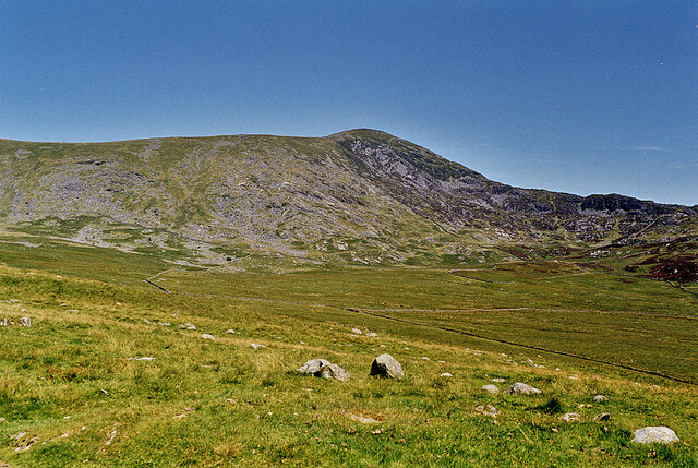
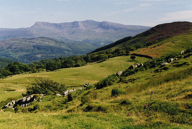
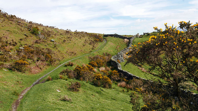
The landscape of Uwch Mynydd is characterized by rolling hills, heather-covered moors, and scattered rocky outcrops. The area is largely uninhabited, with only a few scattered farms and cottages dotting the landscape. This adds to the sense of tranquility and remoteness that Uwch Mynydd offers to visitors.

The downs of Uwch Mynydd are covered in a carpet of lush grasses, providing a habitat for a variety of wildlife species. The moorland, on the other hand, is dominated by heather, which blooms in vibrant purples during the summer months, creating a stunning visual spectacle. This unique ecosystem supports a range of plants and animals, including birds, insects, and small mammals.

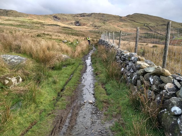
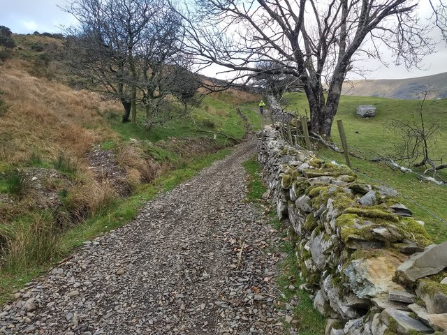
The area also boasts several walking and hiking trails, allowing visitors to explore its natural wonders. The paths meander through the moors and up the hills, offering panoramic views of the surrounding countryside. The tranquility and unspoiled nature of Uwch Mynydd make it an ideal destination for nature lovers, hikers, and those seeking a peaceful retreat.

Overall, Uwch Mynydd in Merionethshire is a haven of natural beauty, with its downs and moorland providing a stunning backdrop for outdoor enthusiasts and those seeking solace in the heart of nature.

If you have any feedback on the listing, please let us know in the comments section below.
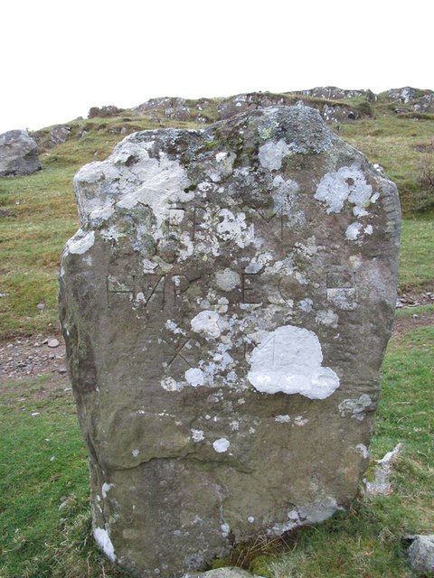
Uwch Mynydd Images

Images are sourced within 2km of 52.759871/-3.9927859 or Grid Reference SH6519. Thanks to Geograph Open Source API. All images are credited.

Old barn on Banc-y-Frân A solid but roofless stone barn sits on a small rise in the adjacent field. Diffwys can be seen in the distance.
Old barn on Banc-y-Frân
A solid but roofless stone barn sits on a small rise in the adjacent field. Diffwys can be seen in the distance.
Looking over Hirgwm towards Diffwys Fields of rough grazing lined by stone walls lie under Diffwys.
Looking over Hirgwm towards Diffwys
Fields of rough grazing lined by stone walls lie under Diffwys.
View to Diffwys from the south west Looking over the head of Hirgwm to the mountain.
View to Diffwys from the south west
Looking over the head of Hirgwm to the mountain.
Looking down Hirgwm With Cadair Idris on the horizon.
Looking down Hirgwm
With Cadair Idris on the horizon.
Descending Banc-y-Frân Just north of the public road, with the hill of Uwch Mynydd on the right and Cadair Idris in the distance.
Descending Banc-y-Frân
Just north of the public road, with the hill of Uwch Mynydd on the right and Cadair Idris in the distance.
Ordnance Survey Cut Mark This OS cut mark can be found at the gateway on the footpath.
Ordnance Survey Cut Mark
This OS cut mark can be found at the gateway on the footpath.
Ordnance Survey Pivot This OS pivot can be found at the gateway on the footpath.
Ordnance Survey Pivot
This OS pivot can be found at the gateway on the footpath.
Landscape near Caegwian Looking south-east from the path to Barmouth.
Landscape near Caegwian
Looking south-east from the path to Barmouth.
Landscape near Caegwian Looking east from the path to Barmouth.
Landscape near Caegwian
Looking east from the path to Barmouth.
Landscape near Caegwian Looking south from the path to Barmouth.

Parts of the Cadair Idris mountain range can be seen in the distance.
Landscape near Caegwian
Looking south from the path to Barmouth. Parts of the Cadair Idris mountain range can be seen in the distance.
Grazing near Cae Goronwy farm With Diffwys providing the background.
Grazing near Cae Goronwy farm
With Diffwys providing the background.
Field with a dramatic backdrop The imposing skyline of Cadair Idris never fails to impress.
Field with a dramatic backdrop
The imposing skyline of Cadair Idris never fails to impress.
Tree and field by Banc-y-Frân With Diffwys in the background.
Tree and field by Banc-y-Frân
With Diffwys in the background.
Rocky and wet This route is favoured by off-road motorbike users, which destroys the track surface.
Rocky and wet
This route is favoured by off-road motorbike users, which destroys the track surface.
A win-win situation at Banc-y-Frân  (Crow Bank) The drainage has been cleared and the extracted material has been used to repair the track surface. Good idea!
A win-win situation at Banc-y-Frân (Crow Bank)
The drainage has been cleared and the extracted material has been used to repair the track surface. Good idea!
Old Milestone by Uwch Mynydd, north of Bontddu, Llanelltyd Parish North of the A497 from Bontddu, in parish of Llanelltyd (Gwynedd District), CAE HIR, about 1½ miles North West of village by the side of a track going over the moor to Tal-y-bont.

Inscription reads:-
(North East side) : FROM HARLECH X M :
(South West side) : V FROM TAL Y BONT iiiii M. :

Grade II Listed by Cadw.
Reference Number 16160: <span class="nowrap"><a title="https://cadwpublic-api.azurewebsites.net/reports/listedbuilding/FullReport?lang=&id=16160" rel="nofollow ugc noopener" href="https://cadwpublic-api.azurewebsites.net/reports/listedbuilding/FullReport?lang=&id=16160">Link</a><img style="margin-left:2px;" alt="External link" title="External link - shift click to open in new window" src="https://s1.geograph.org.uk/img/external.png" width="10" height="10"/></span>

Surveyed 

Milestone Society National ID: MER_HLBM10
Old Milestone by Uwch Mynydd, north of Bontddu, Llanelltyd Parish
North of the A497 from Bontddu, in parish of Llanelltyd (Gwynedd District), CAE HIR, about 1½ miles North West of village by the side of a track going over the moor to Tal-y-bont. Inscription reads:- (North East side) : FROM HARLECH X M : (South West side) : V FROM TAL Y BONT iiiii M. : Grade II Listed by Cadw. Reference Number 16160: LinkExternal link Surveyed Milestone Society National ID: MER_HLBM10
Motorcyclists on the trail A friendly bunch some of whom seemed to be having their first experience of rough riding. There were several spills!
Motorcyclists on the trail
A friendly bunch some of whom seemed to be having their first experience of rough riding. There were several spills!
Path ascending Banc-y-Frain An uphill section on the general descent from Bwlch y Rhiwgyr.
Path ascending Banc-y-Frain
An uphill section on the general descent from Bwlch y Rhiwgyr.
Show me another place!

Uwch Mynydd is located at Grid Ref: SH6519 (Lat: 52.759871, Lng: -3.9927859)

Unitary Authority: Gwynedd

Police Authority: North Wales

What 3 Words

///easily.bombard.fled. Near Dyffryn Ardudwy, Gwynedd

Nearby Locations

Uwch Mynydd Uwch-mynydd

Related Wikis

St Philip's Church, Caerdeon

St Philip's Church, Caerdeon, near Barmouth, in Gwynedd, North Wales, is a redundant church and a Grade I listed building. The church was built in 1862...

Clogau Gold Mine

The Clogau (pronounced "clog-eye") Gold Mine (also known as Clogau St David's) is a gold mine near Bontddu in North Wales. == History == The Clogau mine...

Bontddu

Bontddu (meaning Black bridge) is a small settlement just east of Barmouth, near the town of Dolgellau in Gwynedd, Wales. It is in the community of Llanelltyd...

Tyn-y-Coed Farmhouse

Tyn-y-Coed Farmhouse is a grade II Listed Building in Caerdeon, Barmouth, Gwynedd. This Georgian farm house was built in 1756 and later extended and altered...

Nearby Amenities

Located within 500m of 52.759871,-3.9927859
Y Figra
Alt Name: Y Figra - Uwch Mynydd;Y Vigra
Ele: 320
Natural: peak
Lat/Long: 52.7555137/-3.9915348
Historic: milestone
Lat/Long: 52.7629673/-3.9937586
Power: pole
Lat/Long: 52.7613482/-3.9871079
Power: pole
Lat/Long: 52.7616916/-3.986724
Crossing
Lat/Long: 52.763666/-3.991259
The data included in this document is from www.openstreetmap.org. The data is made available under ODbL.

Have you been to Uwch Mynydd?

Leave your review of Uwch Mynydd below (or comments, questions and feedback).