Killochy Moor

Downs, Moorland in Kirkcudbrightshire

Scotland

Killochy Moor

War memorial above Balmaclellan Balmaclellan's war memorial is on the north side of the A712 above the small settlement which is out of view.
War memorial above Balmaclellan Credit: Trevor Littlewood

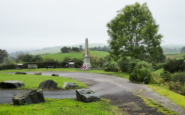
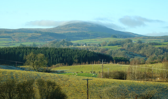
Killochy Moor is a vast expanse of downs and moorland located in Kirkcudbrightshire, a historic county in southwestern Scotland. Spanning over several square miles, this picturesque landscape is renowned for its rugged beauty and diverse ecology.

The moorland of Killochy Moor is characterized by its rolling hills, heather-clad expanses, and scattered patches of woodland. The terrain is predominantly made up of peat and rich mineral soils, providing a fertile ground for a variety of plant species to thrive. Visitors to the moor can experience the stunning vistas and tranquility of the open countryside, with unspoiled views stretching as far as the eye can see.

The moorland supports a wide array of wildlife, including numerous bird species such as curlews, lapwings, and skylarks, which nest and forage in the open fields. The diverse vegetation also attracts a range of butterflies and insects, making it a haven for nature enthusiasts and photographers.

Killochy Moor is a popular destination for outdoor activities, such as hiking, birdwatching, and nature walks. The area is crisscrossed by a network of walking trails, allowing visitors to explore the moor and discover its hidden gems. With its peaceful atmosphere and breathtaking scenery, it is a place where one can truly reconnect with nature and escape the hustle and bustle of everyday life.

Preservation efforts are in place to protect the unique ecosystem of Killochy Moor, ensuring that future generations can continue to enjoy its natural beauty and biodiversity.

If you have any feedback on the listing, please let us know in the comments section below.

Killochy Moor Images

Images are sourced within 2km of 55.072828/-4.1100713 or Grid Reference NX6577. Thanks to Geograph Open Source API. All images are credited.

War memorial above Balmaclellan Balmaclellan's war memorial is on the north side of the A712 above the small settlement which is out of view.
War memorial above Balmaclellan
Balmaclellan's war memorial is on the north side of the A712 above the small settlement which is out of view.
New Galloway Episcopalian Church Located on the main route into the village from Ken Bridge.
New Galloway Episcopalian Church
Located on the main route into the village from Ken Bridge.
Balmaclellan Church Many of these churches in small rural communities have monthly Sunday services. Balmaclellan’s turn is the first Sunday of each month.
Balmaclellan Church
Many of these churches in small rural communities have monthly Sunday services. Balmaclellan’s turn is the first Sunday of each month.
Balmaclellan Graveyard The gravestones show that this is a very old religious site with burials recorded in the early 18th century.
Balmaclellan Graveyard
The gravestones show that this is a very old religious site with burials recorded in the early 18th century.
Balmaclellan Graveyard view There can’t be many churches that enjoy such a wonderful view of the local countryside. Mulloch Hill is shown on the skyline.
Balmaclellan Graveyard view
There can’t be many churches that enjoy such a wonderful view of the local countryside. Mulloch Hill is shown on the skyline.
Old milestone When railways were constructed across the hills of Kirkcudbright and Wigtonshire the stations were often several miles from the nearest large settlement.   The station for New Galloway was 5 miles to the south along the west bank of Loch Ken and on to Mossdale.    Milestones of this shape are found on several of the roads leading to stations.  From New Galloway it is 5 miles to the station.   This stone is in the village centre near The Smithy Tea Room.
Old milestone
When railways were constructed across the hills of Kirkcudbright and Wigtonshire the stations were often several miles from the nearest large settlement. The station for New Galloway was 5 miles to the south along the west bank of Loch Ken and on to Mossdale. Milestones of this shape are found on several of the roads leading to stations. From New Galloway it is 5 miles to the station. This stone is in the village centre near The Smithy Tea Room.
Old milestone This milestone in the centre of New Galloway on the A712 indicates 24 miles from Dumfries.   It is another 18 miles to Newton Stewart.
Old milestone
This milestone in the centre of New Galloway on the A712 indicates 24 miles from Dumfries. It is another 18 miles to Newton Stewart.
Old milestone The crossroads in New Galloway, with a road north following the Water of Ken for 3 or 4 miles to Earlstoun Loch.   Crocketford is to the east on the way to Dumfries.
Old milestone
The crossroads in New Galloway, with a road north following the Water of Ken for 3 or 4 miles to Earlstoun Loch. Crocketford is to the east on the way to Dumfries.
Parking area beside the A713 near New Galloway
Balmaclellan Monument View of the monument and hills in distance
Balmaclellan Monument
View of the monument and hills in distance
New Galloway View south up the main street showing the rendered fronts of the buildings of this lovely Galloway village.
New Galloway
View south up the main street showing the rendered fronts of the buildings of this lovely Galloway village.
The Cross Keys Hotel, New Galloway View North down the Main Street of this picturesque Galloway village showing the Cross Keys Hotel which dates from the 18th Century
The Cross Keys Hotel, New Galloway
View North down the Main Street of this picturesque Galloway village showing the Cross Keys Hotel which dates from the 18th Century
Ken Bridge and Ken Bridge Hotel Looking east over the Water of Ken, which flows into Loch Ken, to the right of the photo, about 3km away.
Ken Bridge and Ken Bridge Hotel
Looking east over the Water of Ken, which flows into Loch Ken, to the right of the photo, about 3km away.
Farmland near New Galloway The town is just beyond the wooded hill. Looking south west.
Farmland near New Galloway
The town is just beyond the wooded hill. Looking south west.
The Ken Bridge Hotel, near New Galloway
Ironmacannie The old watermill was renovated by some old friends in the 1990s. Although I think it is now holiday cottages, all of the original gearing is preserved and displayed inside
Ironmacannie
The old watermill was renovated by some old friends in the 1990s. Although I think it is now holiday cottages, all of the original gearing is preserved and displayed inside
Town Hall, New Galloway The plaque above the doorway shows a shield supported by, on the left, a black man, and on the right, a cow. I don't know the history of this. The cow is now painted as a belted galloway, but I don't know whether this was always the case.
Town Hall, New Galloway
The plaque above the doorway shows a shield supported by, on the left, a black man, and on the right, a cow. I don't know the history of this. The cow is now painted as a belted galloway, but I don't know whether this was always the case.
Milestone by the A713 Marked D with a 3 below for the three miles to St John's Town of Dalry.
Milestone by the A713
Marked D with a 3 below for the three miles to St John's Town of Dalry.
Show me another place!

Killochy Moor is located at Grid Ref: NX6577 (Lat: 55.072828, Lng: -4.1100713)

Unitary Authority: Dumfries and Galloway

Police Authority: Dumfries and Galloway

What 3 Words

///manifests.cupcake.script. Near Castle Douglas, Dumfries & Galloway

Related Wikis

Ken Bridge

The Ken Bridge is a road bridge about 0.8 kilometres (0.5 mi) north east of New Galloway in Dumfries and Galloway, Scotland, which carries the A712 road...

Balmaclellan

Balmaclellan (Scottish Gaelic: Baile Mac-a-ghille-dhiolan, meaning town of the MacLellans) is a small hillside village of stone houses with slate roofs...
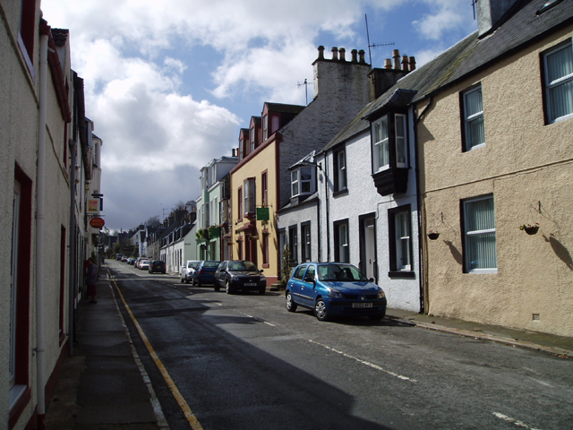
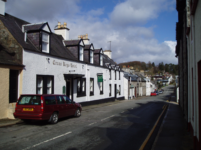
New Galloway

New Galloway (Scottish Gaelic: Gall-Ghàidhealaibh Nuadh) is a town in the historical county of Kirkcudbrightshire in Dumfries and Galloway. It lies on...

New Galloway Town Hall

The New Galloway Town Hall is a municipal building in Dumfries and Galloway, Scotland, situated on the town's high street. A tolbooth has existed on the...

Kenmure Castle

Kenmure Castle is a fortified house or castle in The Glenkens, 1 mile (1.6 km) south of the town of New Galloway in Kirkcudbrightshire, Galloway, south...

Kells, Dumfries and Galloway

Kells parish, in the Stewartry of Kirkcudbright in Scotland, is located 14 miles (NWbN) from Castle-Douglas, and 19 miles (NbW) from Kirkcudbright. It...
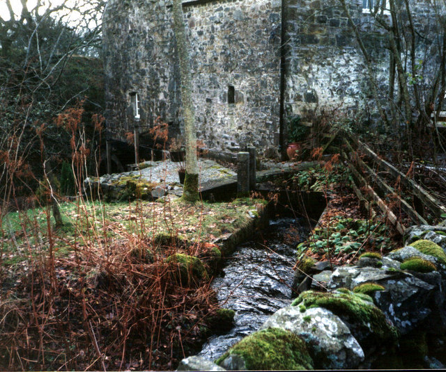
Ironmacannie Mill

Ironmacannie Mill is a historic watermill near Balmaclellan in Dumfries and Galloway, Scotland. Built in the 18th and 19th centuries, on the site of an...

Water of Ken

The Water of Ken is a river in the historical county of Kirkcudbrightshire in Galloway, south-west Scotland. It rises on Blacklorg Hill, north-east of...

Nearby Amenities

Located within 500m of 55.072828,-4.1100713
Grey Hill
Ele: 110
Natural: peak
Lat/Long: 55.0697066/-4.1075558
Drumchesnie
Ele: 105
Natural: peak
Lat/Long: 55.070098/-4.1053208
Power: tower
Lat/Long: 55.0714189/-4.116644
Power: tower
Lat/Long: 55.0693594/-4.1148527
Barharrie
Natural: peak
Lat/Long: 55.0737478/-4.1039722
White Hill
Natural: peak
Lat/Long: 55.0721316/-4.1130054
Power: pole
Lat/Long: 55.0763068/-4.1148518
The data included in this document is from www.openstreetmap.org. The data is made available under ODbL.

Have you been to Killochy Moor?

Leave your review of Killochy Moor below (or comments, questions and feedback).