Cocks Park

Downs, Moorland in Devon South Hams

England

Cocks Park

Harvested field near Kingston Red trailers can be seen over the hedge in the d-adjacent field - see <a href="https://www.geograph.org.uk/photo/6829431">SX6348 : Tractors near Kingston</a> for one of them.
Harvested field near Kingston Credit: Derek Harper

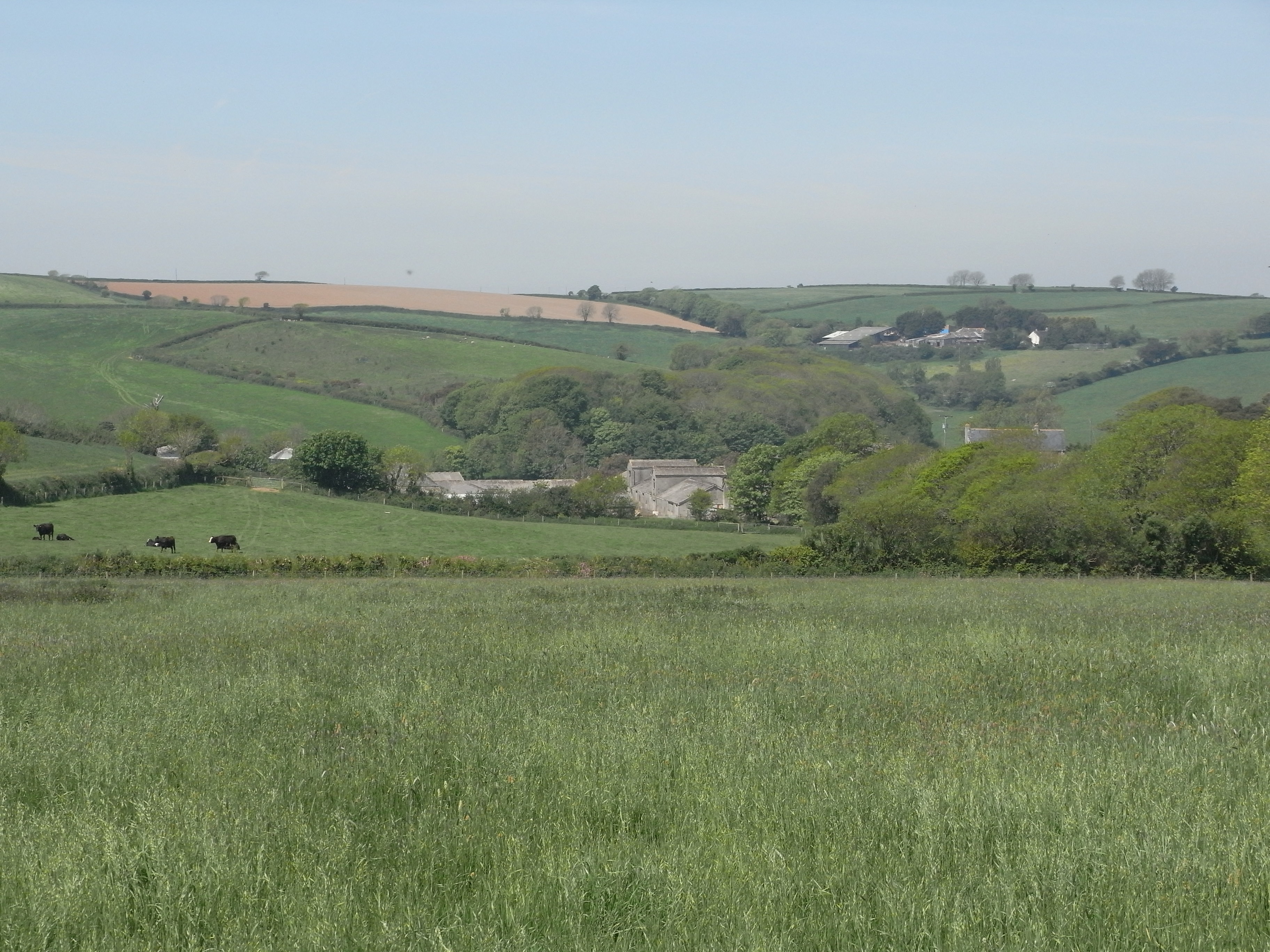
Cocks Park is a large and picturesque area located in Devon, England. Situated on the edge of Dartmoor National Park, the park is known for its stunning views of the surrounding countryside and its diverse range of flora and fauna. The landscape of Cocks Park consists of rolling hills, lush green meadows, and rugged moorland, making it a popular destination for nature lovers and outdoor enthusiasts.

The park is home to a variety of wildlife, including deer, birds of prey, and rare species of wildflowers. Visitors can explore the park on foot or by bike, taking in the breathtaking scenery and enjoying the peaceful atmosphere. There are also several walking trails and picnic areas scattered throughout the park, providing opportunities for visitors to relax and unwind in the great outdoors.

Cocks Park is a designated Area of Outstanding Natural Beauty, and efforts are made to preserve and protect the natural environment of the park. The park is open to the public year-round, and admission is free, making it an accessible and enjoyable destination for visitors of all ages.

If you have any feedback on the listing, please let us know in the comments section below.
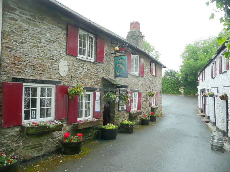
Cocks Park Images

Images are sourced within 2km of 50.319616/-3.909499 or Grid Reference SX6448. Thanks to Geograph Open Source API. All images are credited.

Harvested field near Kingston Red trailers can be seen over the hedge in the d-adjacent field - see <a href="https://www.geograph.org.uk/photo/6829431">SX6348 : Tractors near Kingston</a> for one of them.
Harvested field near Kingston
Red trailers can be seen over the hedge in the d-adjacent field - see SX6348 : Tractors near Kingston for one of them.
Footpath, Furzedown Wood Kingston footpath 3 winds between bluebells.
Footpath, Furzedown Wood
Kingston footpath 3 winds between bluebells.
Bluebells, Furzedown Wood Kingston footpath 3 drops through the bluebell wood.
Bluebells, Furzedown Wood
Kingston footpath 3 drops through the bluebell wood.
Bluebells, Furzedown Wood From the path shown in <a href="https://www.geograph.org.uk/photo/6829692">SX6247 : Footpath, Furzedown Wood</a>.
Bluebells, Furzedown Wood
From the path shown in SX6247 : Footpath, Furzedown Wood.
Footpath, Furzedown Wood Kingston footpath 3 reaches the southern edge of the wood after a climb.
Footpath, Furzedown Wood
Kingston footpath 3 reaches the southern edge of the wood after a climb.
Footpath, Furzedown Wood Kingston footpath 3 curves downhill through bluebells.
Footpath, Furzedown Wood
Kingston footpath 3 curves downhill through bluebells.
Bridleway, Wiscombe Kingston Bridleway 2, looking right from <a href="https://www.geograph.org.uk/photo/6830810">SX6446 : Trees, Wiscombe</a>.
Bridleway, Wiscombe
Kingston Bridleway 2, looking right from SX6446 : Trees, Wiscombe.
Wiscombe From the bridleway up the valley.
Wiscombe
From the bridleway up the valley.
Trees, Wiscombe Taken a little farther up the valley from <a href="https://www.geograph.org.uk/photo/6998430">SX6446 : Wiscombe</a>.
Trees, Wiscombe
Taken a little farther up the valley from SX6446 : Wiscombe.
Outfall from pond near Okenbury The waterfall links the two middle of the four ponds near Okenbury.
Outfall from pond near Okenbury
The waterfall links the two middle of the four ponds near Okenbury.
Tower, Okenbury A ruin and walls remaining from the manor house. See also <a href="https://www.geograph.org.uk/photo/6830915">SX6447 : Okenbury</a> and <span class="nowrap"><a title="https://historicengland.org.uk/listing/the-list/list-entry/1108108" rel="nofollow ugc noopener" href="https://historicengland.org.uk/listing/the-list/list-entry/1108108">Link</a><img style="margin-left:2px;" alt="External link" title="External link - shift click to open in new window" src="https://s1.geograph.org.uk/img/external.png" width="10" height="10"/></span> .
Tower, Okenbury
A ruin and walls remaining from the manor house. See also SX6447 : Okenbury and LinkExternal link .
Stile near Kingston Kingston footpath 9 leaves the lane at Higher Gabberwell House via this stile; see also <a href="https://www.geograph.org.uk/photo/6825469">SX6448 : Footpath near Kingston</a>.
Stile near Kingston
Kingston footpath 9 leaves the lane at Higher Gabberwell House via this stile; see also SX6448 : Footpath near Kingston.
St Mary's Well <span class="nowrap"><a title="https://historicengland.org.uk/listing/the-list/list-entry/1392219?section=official-list-entry" rel="nofollow ugc noopener" href="https://historicengland.org.uk/listing/the-list/list-entry/1392219?section=official-list-entry">Link</a><img style="margin-left:2px;" alt="External link" title="External link - shift click to open in new window" src="https://s1.geograph.org.uk/img/external.png" width="10" height="10"/></span>
St Mary's Well
Turning for Tuffland Farm
On the B3392 at Seven Stones Cross
The Dolphin A sign at the end of the road says "please drive slowly through the pub" and it is only when you reach it that you appreciate the relevance. See also <a title="https://www.geograph.org.uk/search.php?i=20981327" href="https://www.geograph.org.uk/search.php?i=20981327">Link</a> and, for the architecture, <span class="nowrap"><a title="http://www.britishlistedbuildings.co.uk/en-99629-the-dolphin-inn-kingston" rel="nofollow ugc noopener" href="http://www.britishlistedbuildings.co.uk/en-99629-the-dolphin-inn-kingston">Link</a><img style="margin-left:2px;" alt="External link" title="External link - shift click to open in new window" src="https://s1.geograph.org.uk/img/external.png" width="10" height="10"/></span> . On the immediate left is Park Cottage <span class="nowrap"><a title="http://www.britishlistedbuildings.co.uk/en-99630-park-cottage-kingston" rel="nofollow ugc noopener" href="http://www.britishlistedbuildings.co.uk/en-99630-park-cottage-kingston">Link</a><img style="margin-left:2px;" alt="External link" title="External link - shift click to open in new window" src="https://s1.geograph.org.uk/img/external.png" width="10" height="10"/></span> .
The Dolphin
A sign at the end of the road says "please drive slowly through the pub" and it is only when you reach it that you appreciate the relevance. See also Link and, for the architecture, LinkExternal link . On the immediate left is Park Cottage LinkExternal link .
The Dolphin, Kingston Showing the hotel accommodation across the narrow street from the pub, and the pub sign.
The Dolphin, Kingston
Showing the hotel accommodation across the narrow street from the pub, and the pub sign.
Churchyard Cross, Kingston Above the steps down from the Church of St James the Less, the granite cross has "some mediaeval elements, but mainly restructured in 1902 at
Edward VII Coronation" <span class="nowrap"><a title="http://www.britishlistedbuildings.co.uk/en-99627-churchyard-cross-kingston" rel="nofollow ugc noopener" href="http://www.britishlistedbuildings.co.uk/en-99627-churchyard-cross-kingston">Link</a><img style="margin-left:2px;" alt="External link" title="External link - shift click to open in new window" src="https://s1.geograph.org.uk/img/external.png" width="10" height="10"/></span> .
Churchyard Cross, Kingston
Above the steps down from the Church of St James the Less, the granite cross has "some mediaeval elements, but mainly restructured in 1902 at Edward VII Coronation" LinkExternal link .
Show me another place!

Cocks Park is located at Grid Ref: SX6448 (Lat: 50.319616, Lng: -3.909499)

Administrative County: Devon

District: South Hams

Police Authority: Devon and Cornwall

What 3 Words

///rules.ended.boggles. Near Modbury, Devon

Nearby Locations

Cocks Park Wastor Park

Related Wikis

Kingston, Devon

Kingston is civil parish and small scattered village in the South Hams, Devon, England. It is three miles south west of Modbury and about a mile from the...

Ringmore

Ringmore is a village and civil parish in the South Hams district, on the coast of Devon, England. The population taken at the 2011 census was 208. �...

Whympston

Whympston in the parish of Modbury in Devon, England, was a historic manor that belonged to the Fortescue family. == Descent == === Fortescue === As the...

River Erme

The Erme is a river in south Devon, England. From its source on Dartmoor it flows in a generally southerly direction past some of the best-preserved archaeological...

Nearby Amenities

Located within 500m of 50.319616,-3.909499
Four Cross
Place: locality
Source: OS OpenData StreetView
Lat/Long: 50.3182633/-3.9136341
Lower Torr
Place: hamlet
Source: OS OpenData StreetView
Lat/Long: 50.3218522/-3.9146287
Generator Method: photovoltaic
Generator Output Electricity: yes
Generator Source: solar
Generator Type: solar_photovoltaic_panel
Location: roof
Power: generator
Lat/Long: 50.3168335/-3.9128508
The data included in this document is from www.openstreetmap.org. The data is made available under ODbL.

Have you been to Cocks Park?

Leave your review of Cocks Park below (or comments, questions and feedback).