Holdstone Down

Downs, Moorland in Devon North Devon

England

Holdstone Down

Great Hangman The South West Coast Path passes the cairn at Great Hangman, 318m above sea level.
Great Hangman Credit: Grant Sherman

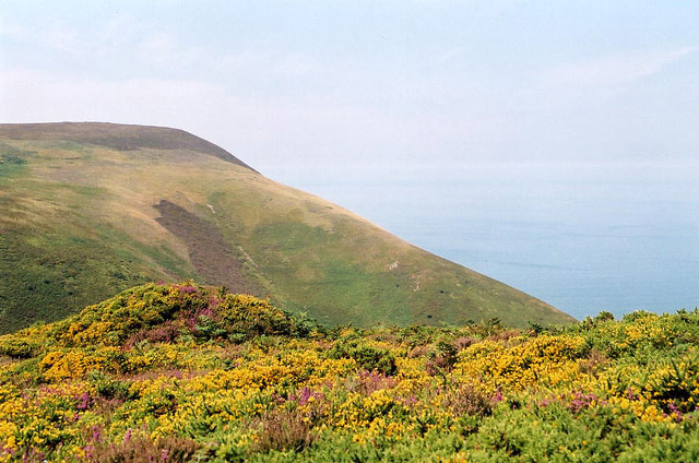
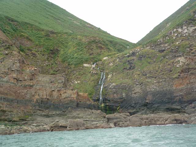
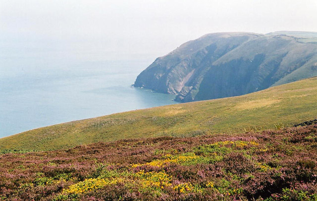
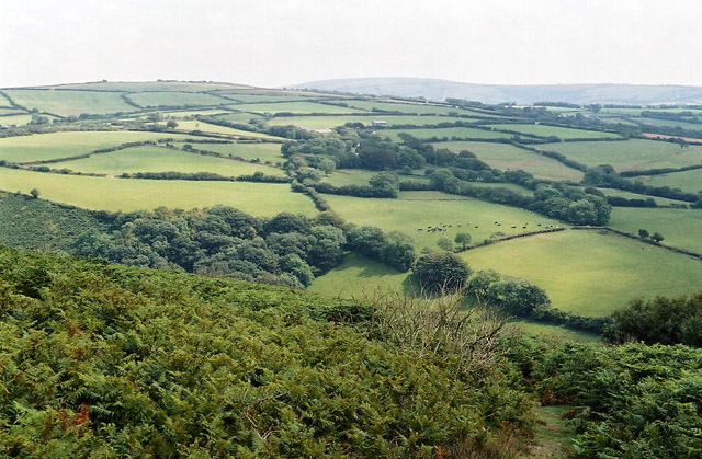
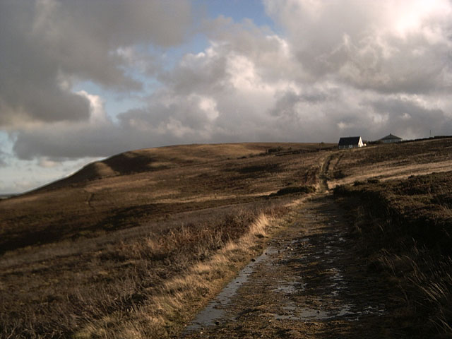
Holdstone Down is a prominent hill located in Devon, England, part of the Exmoor National Park. It is a popular destination for hikers and nature enthusiasts, offering stunning panoramic views of the surrounding countryside and coastline. The hill rises to an elevation of 1,100 feet and is characterized by rugged moorland terrain, with rocky outcrops and heather-covered slopes.

Holdstone Down is home to a variety of wildlife, including birds of prey such as buzzards and kestrels, as well as grazing sheep and ponies. The area is also rich in archaeological sites, with ancient stone circles and burial mounds dotting the landscape.

Visitors to Holdstone Down can enjoy a network of footpaths and bridleways that crisscross the hill, providing opportunities for both leisurely strolls and more challenging hikes. On a clear day, the summit offers breathtaking views across the Bristol Channel to Wales, making it a popular spot for picnics and photography.

Overall, Holdstone Down is a picturesque and peaceful destination that showcases the natural beauty of the Devon countryside.

If you have any feedback on the listing, please let us know in the comments section below.

Holdstone Down Images

Images are sourced within 2km of 51.213219/-3.9782862 or Grid Reference SS6147. Thanks to Geograph Open Source API. All images are credited.

Great Hangman The South West Coast Path passes the cairn at Great Hangman, 318m above sea level.
Great Hangman
The South West Coast Path passes the cairn at Great Hangman, 318m above sea level.
Combe Martin: Holdstone Down Looking west to Girt Down and the Great Hangman; seen from the South West Coast Path
Combe Martin: Holdstone Down
Looking west to Girt Down and the Great Hangman; seen from the South West Coast Path
Sherrycombe Waterfall It is believed that German U-boats used to get fresh water here during WWII. (Taken from the old Queen of Cornwall, which has been replaced by the Ilfracombe Princess).
Sherrycombe Waterfall
It is believed that German U-boats used to get fresh water here during WWII. (Taken from the old Queen of Cornwall, which has been replaced by the Ilfracombe Princess).
Combe Martin: overlooking Elwill Bay, Trentishoe On Holdstone Down. Seen from the South West Coast Path, looking roughly north east
Combe Martin: overlooking Elwill Bay, Trentishoe
On Holdstone Down. Seen from the South West Coast Path, looking roughly north east
Combe Martin: west to Great Hangman On Holdstone Down. Seen from the South West Coast Path, looking west
Combe Martin: west to Great Hangman
On Holdstone Down. Seen from the South West Coast Path, looking west
Trentishoe: Heale Down from Trentishoe Down On a path on National Trust land above Trentishoe Manor, looking south east. Parracombe is hidden behind Heale Down. The high ground on the skyline is Challacombe Common
Trentishoe: Heale Down from Trentishoe Down
On a path on National Trust land above Trentishoe Manor, looking south east. Parracombe is hidden behind Heale Down. The high ground on the skyline is Challacombe Common
Sherrycombe A lovely little combe. Between the 300m heights of Great Hangman and Holdstone Down, the South West Coastpath descends to 130m at Sherrycombe.
Sherrycombe
A lovely little combe. Between the 300m heights of Great Hangman and Holdstone Down, the South West Coastpath descends to 130m at Sherrycombe.
Trentishoe Down Viewed from the South West Coastpath on Holdstone Down.
Trentishoe Down
Viewed from the South West Coastpath on Holdstone Down.
Verwill Farm With Trentishoe Down in the background.
Verwill Farm
With Trentishoe Down in the background.
Farmland near Stony Cross With Holdstone Down just visible on the skyline.
Farmland near Stony Cross
With Holdstone Down just visible on the skyline.
View of Holdstone Down from Great Hangman With Highveer Point to the left. Taken on the South West Coastpath
View of Holdstone Down from Great Hangman
With Highveer Point to the left. Taken on the South West Coastpath
View of Holdstone Down from Girt Down Sherrycombe opens out before us. Taken on the South West Coastpath.
View of Holdstone Down from Girt Down
Sherrycombe opens out before us. Taken on the South West Coastpath.
Sherrycombe Taken on the South West Coastpath.
Sherrycombe
Taken on the South West Coastpath.
Footbridge, Sherrycombe Getting here is easy, but the journey back is all up hill. Taken on the South West Coastpath.
Footbridge, Sherrycombe
Getting here is easy, but the journey back is all up hill. Taken on the South West Coastpath.
To the waterfall... ... but not today. And anyway the best view of the waterfall is from the sea <a href="https://www.geograph.org.uk/gridref/SS6048">SS6048</a>
To the waterfall...
... but not today. And anyway the best view of the waterfall is from the sea SS6048
Sherrycombe Taken on the South West Coastpath
Sherrycombe
Taken on the South West Coastpath
View of Hangman from Holdstone Down Taken on the South West Coastpath
View of Hangman from Holdstone Down
Taken on the South West Coastpath
Holdstone Down Taken on the South West Coastpath
Holdstone Down
Taken on the South West Coastpath
Show me another place!

Holdstone Down is located at Grid Ref: SS6147 (Lat: 51.213219, Lng: -3.9782862)

Administrative County: Devon

District: North Devon

Police Authority: Devon and Cornwall

What 3 Words

///dabble.automate.feed. Near Combe Martin, Devon

Related Wikis

Exmoor Coastal Heaths

Exmoor Coastal Heaths (grid reference SS620480) is a 1758.3 hectare (4344.7 acre) biological Site of Special Scientific Interest in Devon and Somerset...

Trentishoe

Trentishoe is a village and civil parish in North Devon, England. The parish lies on the coast of the Bristol Channel. The village is 5 miles (8 km) east...
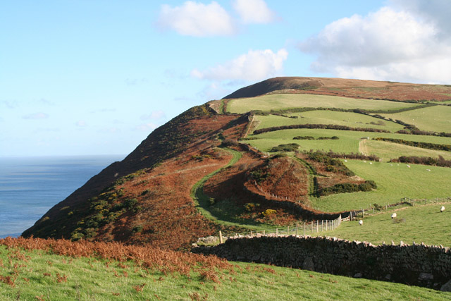
Hangman cliffs

Hangman cliffs, consisting of Great Hangman and Little Hangman, are near Combe Martin on the north coast of Devon, England, where Exmoor meets the sea...

Kentisbury

Kentisbury is a rural civil parish in North Devon, England, bordering the Exmoor National Park, consisting of three small hamlets, Patchole, Kentisbury...

Nearby Amenities

Located within 500m of 51.213219,-3.9782862
Holdstone Hill
Natural: peak
Lat/Long: 51.2118708/-3.9777375
Historic: ruins
Lat/Long: 51.2140882/-3.9761105
The data included in this document is from www.openstreetmap.org. The data is made available under ODbL.

Have you been to Holdstone Down?

Leave your review of Holdstone Down below (or comments, questions and feedback).